2020s Maps of Callaway County, Missouri
Explore 23 historic maps of Callaway County from the 2020s. These maps offer a rare glimpse into what life looked like during the 2020s — showing old roads, neighborhoods, homes, and landmarks that have changed or disappeared over time.
Whether you're researching your family's past, planning a metal detecting trip, or studying how Callaway County's landscape evolved across the 2020s, these high-resolution maps are a powerful tool for exploring the history of this region.
- Focus on a specific era: All maps on this page are from the 2020s, giving you a focused view of this time period.
- See what’s changed: Compare century-old streets, trails, and buildings to today's modern landscape using overlays and satellite layers.
- Research with precision: Use these maps for genealogy, historical research, land use analysis, or educational projects.
- View, download, or print: Maps are fully viewable online in high resolution, and can be downloaded or printed for your own records.
Start exploring Callaway County's history through authentic maps from the 2020s. This is your window into the past.
Callaway County, MO maps
(23)- 2021 Map of Loose Creek, 2021 Print
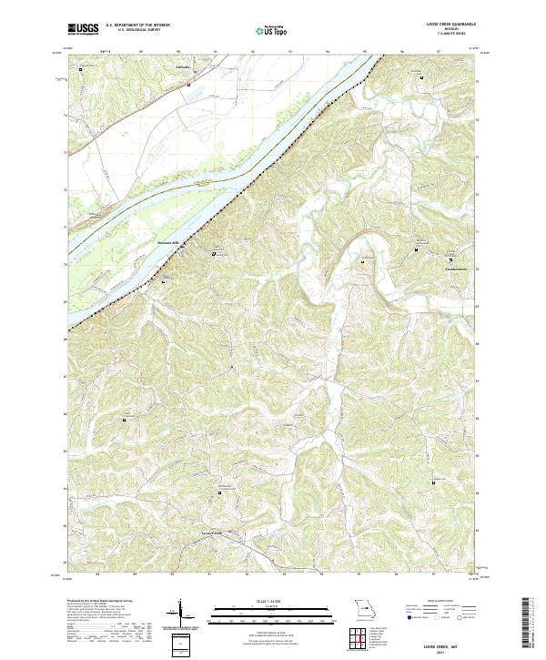 2021 Loose Creek2021 Print · USGSOsage County's river-driven landscape is captured here in the early twenty-first century, centered on the meeting of the Missouri and Osage rivers. Genealogists can trace family roots through numerous sites like Bonnots Mill, Frankenstein, and the Immaculate Conception Cem.
 - 2021 Map of Calwood, 2021 Print
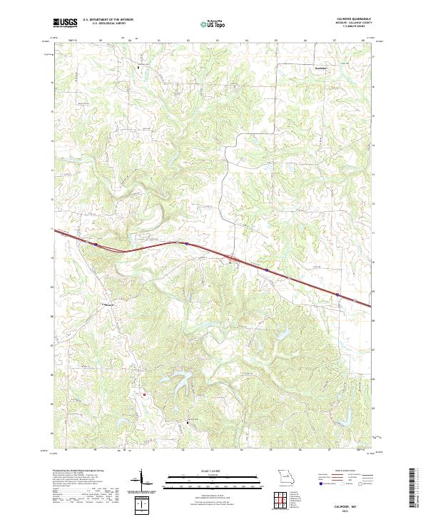 2021 Calwood2021 Print · USGSCallaway County's rural character and complex drainage are on full display in this recent survey. Local historians can trace family-named landmarks and resting places like Harrison Cem while following the many branches of Auxvasse Creek and Whetstone Cr.
 - 2021 Map of Fulton, 2021 Print
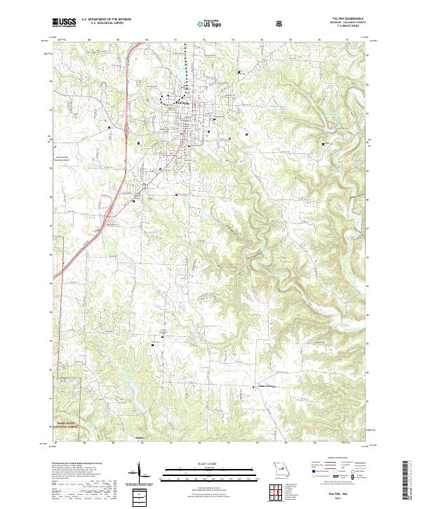 2021 Fulton2021 Print · USGSThe city of Fulton and its surrounding Missouri countryside are captured here in the early 21st century, showing a mix of collegiate life and rural tradition. Researchers can locate specific family landmarks like Muir Cem or explore the grounds of William Woods University and Westminster College.
 - 2021 Map of Mexico SE, 2021 Print
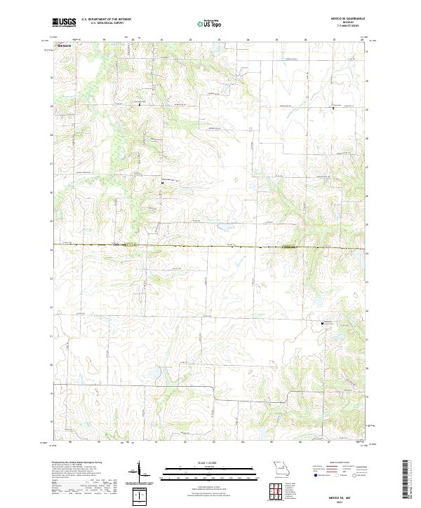 2021 Mexico SE2021 Print · USGSAudrain and Callaway Counties are captured here in the 2020s at the hydrological divide between the Salt and Loutre rivers. Family historians can locate New Hope Cem, Lockridge Cem, and Don Woods Lake among the section lines.
 - 2021 Map of Auxvasse, 2021 Print
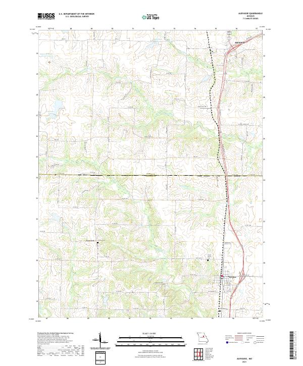 2021 Auxvasse2021 Print · USGSThe rural borderlands between Callaway and Audrain Counties are shown in detail as they appeared in 2021. Genealogists and local historians can trace family roots through several established burial grounds, including Concord Cem, Grand Prairie Cem, and Auxvasse Cem.
 - 2021 Map of Martinsburg, 2021 Print
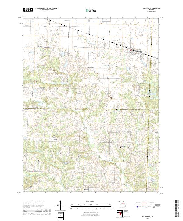 2021 Martinsburg2021 Print · USGSThe rural landscape of north-central Missouri is documented here at the meeting point of three counties. Local researchers can trace the drainages of the Loutre River or locate family history sites like Martinsburg Cem, Chatman Cem, and the small settlement of Shamrock.
 - 2021 Map of Morrison, 2021 Print
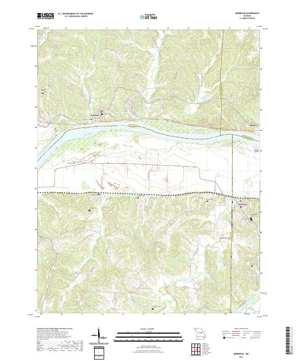 2021 Morrison2021 Print · USGSMorrison and the Missouri River bottoms appear in this modern survey of the Gasconade and Callaway county borders. Genealogists can trace numerous local burial sites like Assumption Catholic Cem and Ferguson Cem near the banks of Baileys Cr.
 - 2021 Map of Hallsville, 2021 Print
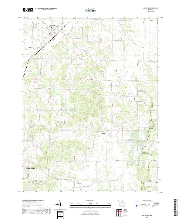 2021 Hallsville2021 Print · USGSThis central Missouri landscape near the Boone and Callaway county line showcases rural community life and the northern reaches of COLUMBIA. Researchers can trace old family roots and rural networks through landmarks like Stephens Cem, E JUDY SCHOOL RD, and the settlement of Youngers.
 - 2021 Map of Williamsburg, 2021 Print
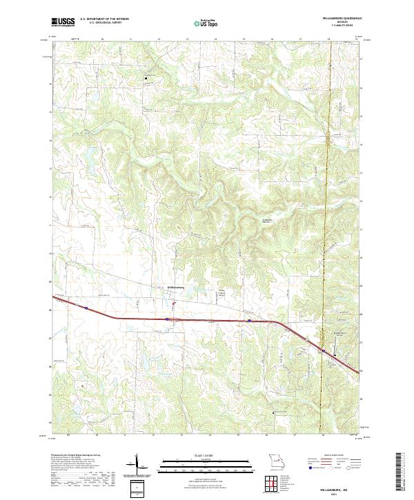 2021 Williamsburg2021 Print · USGSCallaway and Montgomery counties are captured in this modern survey of the Missouri countryside. Researchers can trace family history through sites like Augusta Cemetery or locate landmarks such as Flying V Ranch Airport and the Loutre River.
 - 2021 Map of Kingdom City, 2021 Print
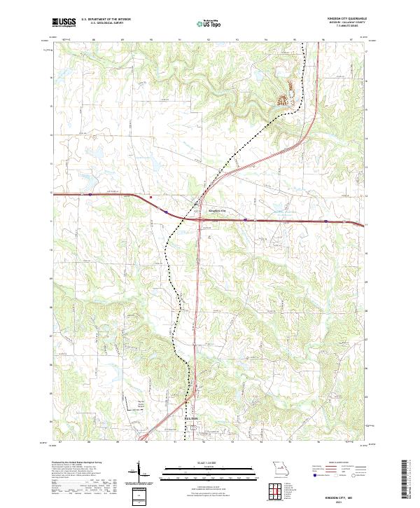 2021 Kingdom City2021 Print · USGSThe Callaway County landscape at the start of the 2020s shows the continued growth of Kingdom City and the northern expansion of Fulton. Genealogists and local historians can trace the creek-side boundaries of family lands along Richland Cr, Guthrie Lake, and the Sky-Go Farms Airport.
 - 2021 Map of Mokane East, 2021 Print
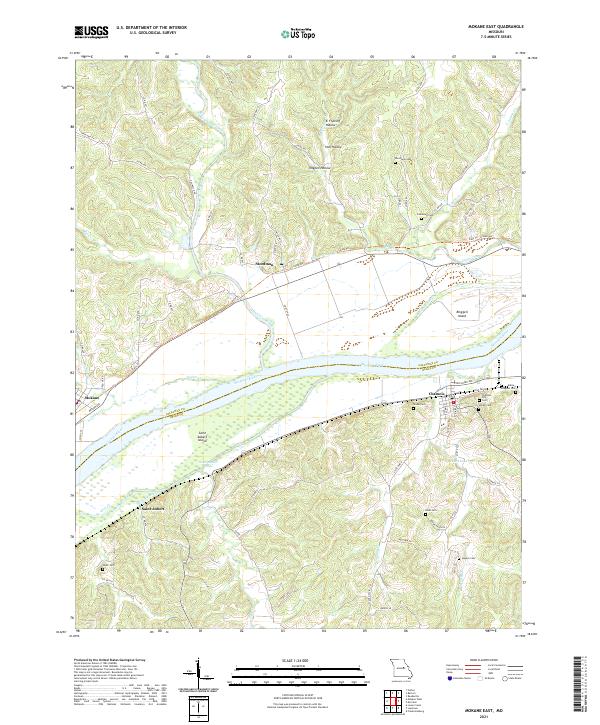 2021 Mokane East2021 Print · USGSMissouri River communities and island geography are documented here just after the turn of the decade. Genealogists can locate family sites like Riverview Cem and Bode Cem or trace the riverfronts of Chamois and Saint Aubert.
 - 2021 Map of Mokane West, 2021 Print
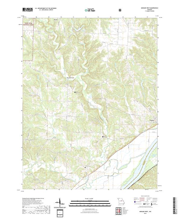 2021 Mokane West2021 Print · USGSCallaway County's rural landscape is captured here in the early twenty-first century, bounded by the river and national forest. Researchers can locate family sites near Mount Tabor Cem or trace the early paths around Browns Ford and Mokane.
 - 2021 Map of Reform, 2021 Print
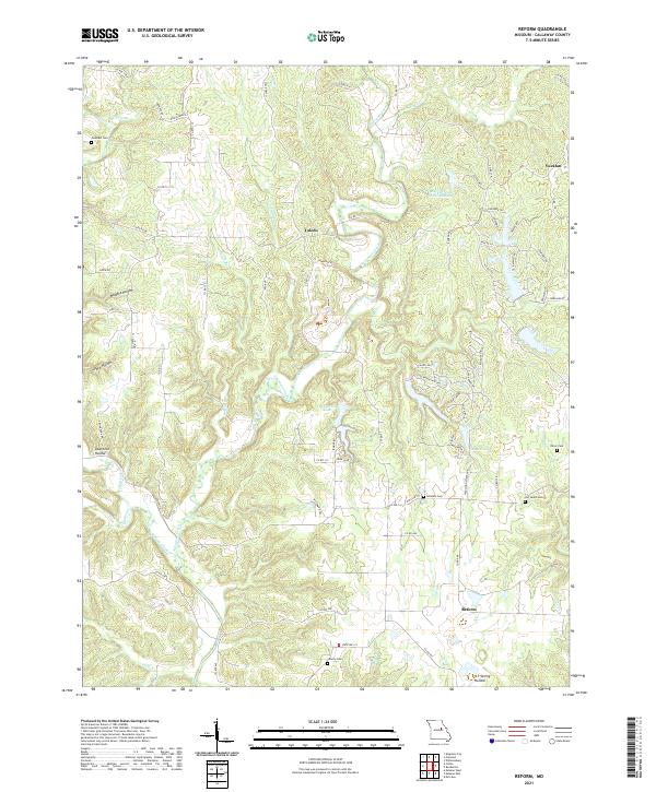 2021 Reform2021 Print · USGSCallaway County's rural character and winding creek valleys are captured in this recent survey. Local historians can trace family roots through several burial sites such as Old Salem Cem and Liberty Cem or locate the historic site of Toledo.
 - 2021 Map of Hatton, 2021 Print
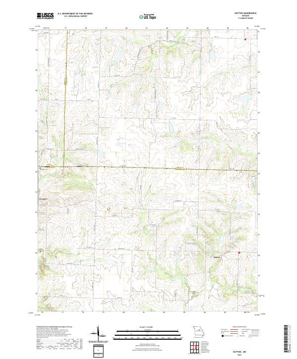 2021 Hatton2021 Print · USGSMid-Missouri's rural crossroads come alive in this detailed look at the borderlands of Boone, Audrain, and Callaway counties. Genealogists and local historians can trace the landscape around Youngers and Hatton, locating the Youngers Cem and winding creeks like Fourmile Br.
 - 2021 Map of Readsville, 2021 Print
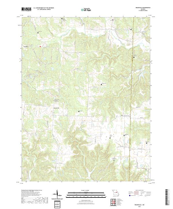 2021 Readsville2021 Print · USGSThe rural landscapes of Callaway County are documented here during the early twenty-first century, showing the enduring structure of its townships. Genealogists can locate numerous burial sites such as Mount Horeb Cem, Tate Cem, and Atterberry Cem among the hills.
 - 2021 Map of Jefferson City NW, 2021 Print
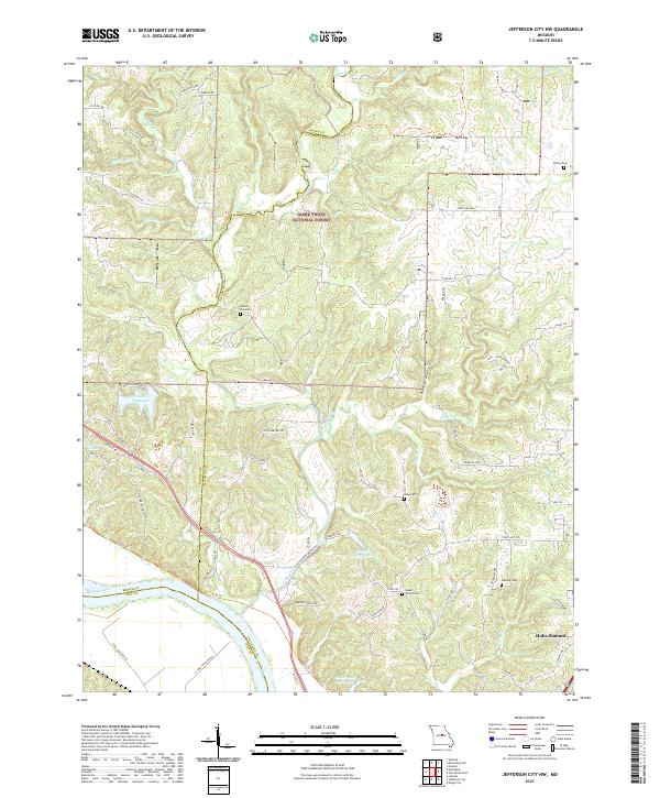 2021 Jefferson City NW2021 Print · USGSCallaway and Boone counties are seen here as they appeared recently, centered on the wooded breaks and creek valleys north of the Missouri River. Genealogists and hikers can trace the Katy Trl or locate family sites like Mount Zion Cem and Wallace Cem.
 - 2021 Map of Jefferson City, 2021 Print
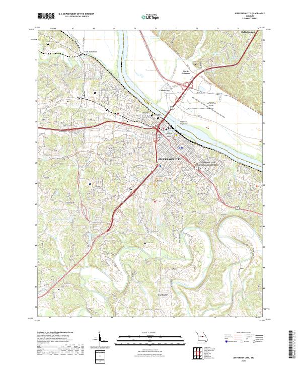 2021 Jefferson City2021 Print · USGSJefferson City and its surrounding Missouri River bluffs appear in high detail during the early 2020s. Genealogists and historians can trace institutional landmarks like Lincoln University or locate family burial sites at Harthill Cem and Lamkin Cem.
 - 2021 Map of Osage City, 2021 Print
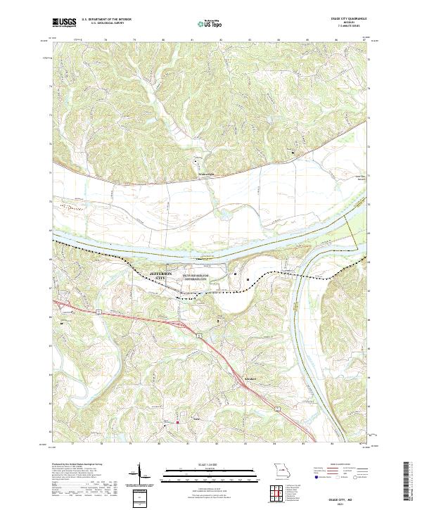 2021 Osage City2021 Print · USGSCentral Missouri's river heritage is on full display in the early 2020s where the Missouri River and Osage River converge near the state capital. Local researchers can trace family lands near Taos and Schubert or locate historic burial sites like Osage City Cem and Thorp Cem.
 - 2021 Map of New Bloomfield, 2021 Print
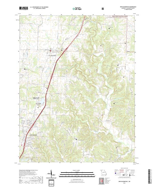 2021 New Bloomfield2021 Print · USGSCallaway County settlement and local history are documented here in the early twenty-first century, spanning from New Bloomfield to Holts Summit. Genealogists can locate numerous burial sites such as Old Providence Cem, King Cem, and Williams Cem.
 - 2021 Map of Millersburg, 2021 Print
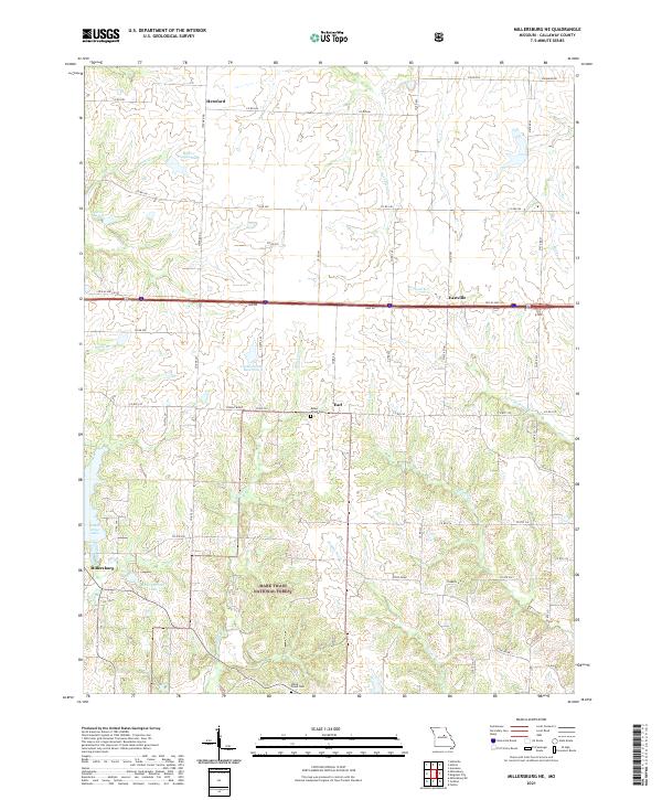
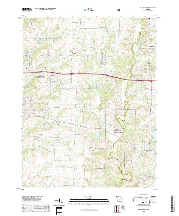 2021 Millersburg2021 Print · USGSModern Boone and Callaway counties meet at the edge of the national forest in this 2020s study. Researchers can trace local lineage through Prairie Grove Cem or locate rural landmarks like Cedar Creek Airport and Millersburg.
 - 2021 Map of Guthrie, 2021 Print
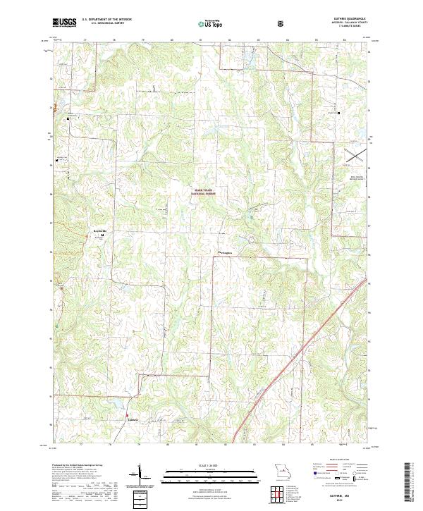 2021 Guthrie2021 Print · USGSCallaway County in the early twenty-first century reveals a landscape shaped by rural communities and forest conservation. Genealogists and local historians can trace family locations through several small burial grounds like Millers Creek Cem and Boydsville Cem.
 - 2021 Map of Millersburg NE, 2021 Print
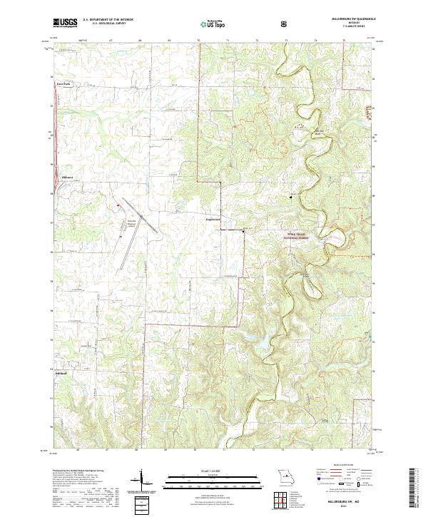
 2021 Millersburg NE2021 Print · USGSCallaway County’s rural landscape is captured here in the early twenty-first century, showing the forest and farmstead patterns of Central Missouri. Genealogists can locate family landmarks like Mount Olivet Cemetery and the settlements of Earl and Hereford.
 - 2021 Map of Millersburg SW, 2021 Print
 2021 Millersburg SW2021 Print · USGSBoone County's landscape in the early 2020s is defined by the Columbia Regional Airport and the forested reaches of the Mark Twain National Forest. Trace family history at Johnson Cem or explore the terrain near Devil's Backbone and Duley Mill Bridge.
End of results
Showing maps 1-23 of 23
Top cities of Callaway County
- Fulton historical maps
- Holts Summit historical maps
- Auxvasse historical maps
- New Bloomfield historical maps
- Lake Mykee Town historical maps
- Mokane historical maps
See more
Frequently asked questions
- What are the different types of historical maps available for Callaway County?
- What is the oldest map of Callaway County?
- Where can I purchase historical maps of Callaway County for my home or office?
- Where can I download high-res historical maps of Callaway County?
- Are there historical topographic maps available for Callaway County?
- Is there historical aerial imagery available for Callaway County?
- Where are historical maps of Callaway County sourced from?