Old Maps of Christian County, Missouri for Academic Research
Study the evolution of Christian County with 119 high-resolution historic maps. Whether you're teaching, researching, or modeling changes in land use, these maps provide essential visual documentation of urban, environmental, and geographic change.
- Analyze long-term change: Track patterns in development, transportation, and natural features.
- Ideal for environmental or urban studies: Support academic projects with primary historical map data.
- Use in the classroom or lab: Educators and researchers rely on these maps to bring historical context to life.
These maps are a powerful tool for teaching, research, and visualizing how Christian County has changed over the decades.
Christian County, MO maps
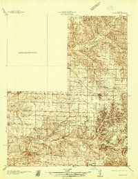
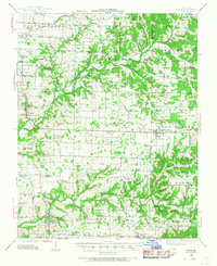
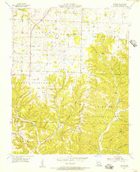
(119)- 1884 Map of Springfield
 1884 Springfield1884 Print · USGSSpringfield emerged as a critical railroad junction in Southwest Missouri during the 1880s. Local researchers can trace the early layouts of Springfield, Willard, and Republic as they developed along the St. Louis and San Francisco Railroad.
 - 1886 Map of Greenfield
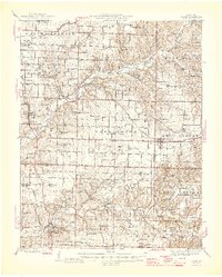
 1886 Greenfield1886 Print · USGSSouthwest Missouri was undergoing a rail-driven transformation in the 1880s, as new lines connected established county seats to outlying farm towns. Genealogists can trace family roots through numerous small settlements like Paris Springs, Dadeville, and the thriving rail hub at Ash Grove.4 unique versions available
 - 1886 Map of Springfield, 1896 Print
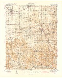
 1886 Springfield1896 Print · USGSSouthwest Missouri thrived as a regional rail hub in the 1880s, centering on the growth of Greene and Christian counties. Researchers can trace early rural settlements and rail stops like Springfield, Fair Grove, and Republic before the turn of the century.5 unique versions available
 - 1888 Map of Greenfield, 1898 Print
 1888 Greenfield1898 Print · USGSSouthwest Missouri thrived as a budding rail and agricultural hub in the 1880s. Local researchers can trace the early footprints of Greenfield and Mount Vernon, alongside smaller settlements like Paris Springs and Everton.
 - 1907 Map of Forsyth
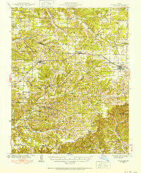
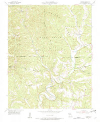
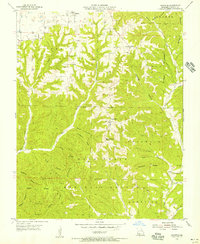
 1907 Forsyth1907 Print · USGSThe White River country of southwest Missouri is seen here in the early nineteen-hundreds, prior to the region's major dam projects. Genealogists can trace family homesteads near landmarks like Marble Cave, numerous riverside crossings such as Mabry Ferry, and local landmarks like Loafers Glory School.3 unique versions available
 - 1919 Map of Halltown
 1919 Halltown1919 Print · USGSThe Missouri Ozarks are captured here during a time of dense rural settlement across Lawrence and Greene counties. Genealogists can locate dozens of country schools and churches, from Buck Prairie School to Mt Olive Church and Wade Chapel Cemetery.3 unique versions available
 - 1937 Map of Bradleyville
 1937 Bradleyville1937 Print · USGSDouglas County in the late 1930s was a landscape of remote hollows and high ridges connected by a network of one-room schools and small post offices. Trace family roots at Huffman Cem or locate forgotten community hubs like Old Merritt and Lone Star Sch.
 - 1937 Map of Ozark
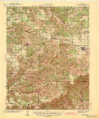
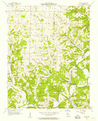
 1937 Ozark1937 Print · USGSChristian and Greene Counties are captured here in the mid-1930s, showing a landscape of river-valley farms and small railroad towns. Genealogists can trace family names through dozens of rural landmarks like Roller Cemetery, Riverside Inn, and the Whiteoak Church.
 - 1939 Map of Fordland
 1939 Fordland1939 Print · USGSThe Ozark plateau in the late 1930s is revealed as a dense network of ridge-top rail towns and valley settlements. Genealogists can trace family roots through numerous schools and churches like Cave Spring Sch, Taylor Cem, and the community of Elkhead.2 unique versions available
 - 1942 Map of Fordland
 1942 Fordland1942 Print · USGSThe rural Ozark highlands of Webster and Christian Counties are captured here in the late 1930s, centered on the railroad corridor through Fordland and Seymour. Researchers can trace dozens of early school sites and churches, from Union Chapel to the McHaffie Sch.2 unique versions available
 - 1942 Map of Aurora, 1961 Print
 1942 Aurora1961 Print · USGSThe northern Ozarks come to life in this mid-century survey of the rugged borderlands where three counties meet. Researchers can trace the path of the Missouri Pacific railroad through Aurora or locate family roots at rural landmarks like Charity Cem and Mountain Home Sch.2 unique versions available
 - 1943 Map of Ozark, 1968 Print
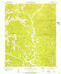
 1943 Ozark1968 Print · USGSThe James River valley south of Springfield comes alive in the 1940s, showing a landscape defined by small settlements and the St Louis - San Francisco line. Genealogists can trace family roots at Holland Cem or locate old school sites like Blue Star Sch and Plummer Sch.
 - 1943 Map of Bradleyville, 1968 Print
 1943 Bradleyville1968 Print · USGSThe Missouri Ozarks during the 1940s are documented here, showing the rural communities of Taney and Douglas counties. Genealogists can trace family homesteads near Bradleyville or locate remote landmarks like Huffman Cem and Whiteside Sch.2 unique versions available
 - 1945 Map of Harrison
 1945 Harrison1945 Print · USGSThe Ozark and Boston Mountains straddle the Missouri-Arkansas border during the mid-forties, showing a landscape of forest ridges and river valleys. Genealogists and historians can trace rail-connected towns like Monett and West Plains or early lake developments at Bull Shoals Res and Norfork Lake.
 - 1945 Map of Ozark
 1945 Ozark1945 Print · USGSSouth of Springfield in the mid-1940s, this area shows a landscape transitioning from rural farmsteads to modern aviation hubs. Genealogists can trace family names at Holland Cem, Riverside Inn, and numerous school sites like Pedelo Sch.2 unique versions available
 - 1945 Map of Bradleyville
 1945 Bradleyville1945 Print · USGSThe Missouri Ozarks are revealed in the mid-1940s, showing a landscape of small settlements and township life. Trace family roots through many rural schoolhouses like High Lonesome Sch and remote cemeteries like Old Merritt Cem.
 - 1945 Map of Aurora
 1945 Aurora1945 Print · USGSThe Ozark plateau around Aurora and Crane is captured here during the mid-forties, showing a landscape defined by rail junctions and rural school districts. Researchers can trace ancestral locations like Stubblefield Cem, the Clay Hill Ch, and old springs including Bean Factory Spr.2 unique versions available
 - 1949 Map of Harrison
 1949 Harrison1949 Print · USGSThe Ozark highlands of northern Arkansas and southern Missouri are shown just after the war, when the White River still followed its original course. Genealogists and historians can trace rail lines like the Missouri & Arkansas RR and locate rural hubs like Harrison, Eureka Springs, and Mountain Home.
 - 1954 Map of Harrison
 1954 Harrison1954 Print · USGSThe Ozarks and Boston Mountains meet during a period of massive river engineering in the mid-fifties. Researchers can trace the early shorelines of Bull Shoals Lake and Table Rock Reservoir or locate inland towns like Berryville and Harrison.
 - 1954 Map of Springfield
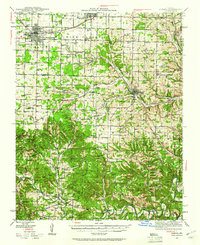
 1954 Springfield1954 Print · USGSThe Missouri Ozarks are captured here during the post-war era, showing the expansion of Springfield and the surrounding river valleys. Genealogists and historians can trace local landmarks like Mount Comfort Cemetery and the Fort Leonard Wood military grounds.6 unique versions available
 - 1955 Map of Garrison, 1956 Print
 1955 Garrison1956 Print · USGSThe border of Christian and Taney Counties is shown here in the mid-1950s, when remote ridges and deep hollows still defined local life. Researchers can find ancestral landmarks like Lone Star Ch, the Middleton Sch, and the winding banks of Swan Creek.3 unique versions available
 - 1955 Map of Selmore, 1956 Print
 1955 Selmore1956 Print · USGSChristian County's rural character is preserved here in the mid-fifties, showing the rugged intersection of farm life and the Mark Twain National Forest. Genealogists can locate family landmarks like Adams Cem, Cobb Cem, and the small settlement of Selmore.2 unique versions available
 - 1955 Map of Chadwick, 1956 Print
 1955 Chadwick1956 Print · USGSChristian County's Ozark highlands are captured here in the mid-fifties, showing a landscape defined by deep hollows and isolated upland farms. Researchers can locate family landmarks like Gardner Cem, the Fairview Ch, and the legendary Bald Knobbers Cave.2 unique versions available
 - 1955 Map of Day, 1956 Print
 1955 Day1956 Print · USGSThe Ozark hills along the Christian and Taney County line are shown here in the mid-fifties, dominated by the timbered ridges of the Mark Twain National Forest. Genealogists can trace rural family sites like Nash Cem and remote congregations including Oak Ridge Ch and Meadows Ch.4 unique versions available
 - 1955 Map of Hurley, 1957 Print
 1955 Hurley1957 Print · USGSStone and Christian Counties were characterized by small farming hamlets and river-valley crossings in the mid-fifties. Genealogists can trace family names at Wright Chapel Cem or locate old community centers like Possum Trot, Lanetown, and Union City.2 unique versions available
Showing maps 1-25 of 119
Top cities of Christian County
- Nixa historical maps
- Ozark historical maps
- Clever historical maps
- Sparta historical maps
- Billings historical maps
- Highlandville historical maps
See more
Frequently asked questions
- What are the different types of historical maps available for Christian County?
- What is the oldest map of Christian County?
- Where can I purchase historical maps of Christian County for my home or office?
- Where can I download high-res historical maps of Christian County?
- Are there historical topographic maps available for Christian County?
- Is there historical aerial imagery available for Christian County?
- Where are historical maps of Christian County sourced from?