Old Maps of Galt, Missouri for Hiking & Exploration
Hike through history with 16 historic maps of Galt. Explore old trails, ghost towns, and forgotten backroads — perfect for outdoor adventurers and local explorers.
- Rediscover forgotten places: Map out old mining camps, roads, and footpaths that no longer exist on modern maps.
- Layer with modern tools: Combine with LiDAR or satellite views to plan hikes through historical terrain.
- Made for exploration: Popular among hikers, overlanders, and local history lovers.
Use these maps to find adventure and explore the hidden past of Galt.
Galt, MO maps
(16)- 1946 Map of Galt, 1981 Print
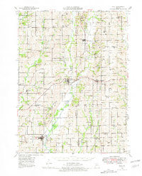 1946 Galt1981 Print · USGSMid-century Missouri agriculture and rail life are preserved here, showing the region at the height of its rural school and church network. Genealogists can locate specific family landmarks like Sandefur Cem or trace the early paths to Mud College Sch and Camp Ground Ch.
 - 1949 Map of Galt
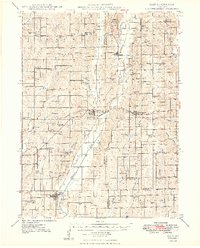 1949 Galt1949 Print · USGSMid-century Missouri farm life is captured here near the Grundy and Sullivan county lines as the rail network still linked small towns. Trace family roots through numerous local schools and churches like Mud College Sch, Starlight Ch, and Richardson Cem.2 unique versions available
 - 1954 Map of Centerville, 1967 Print
 1954 Centerville1967 Print · USGSThe Iowa-Missouri borderlands at mid-century reveal a landscape shaped by river valleys and the height of the regional rail network. Genealogists and historians can trace the paths of the Wabash railroad and locate old townsites like Mystic, Moulton, and Greentop.3 unique versions available
 - 1957 Map of Centerville
 1957 Centerville1957 Print · USGSThe Iowa-Missouri borderlands in the mid-fifties reveal a landscape of river-valley agriculture and vital rail corridors. Genealogists and historians can trace family-named landmarks and small-town growth in Centerville, Kirksville, and along the Wabash railroad line.
 - 1958 Map of Centerville
 1958 Centerville1958 Print · USGSThe Iowa-Missouri borderlands come into focus during the mid-fifties, showing a landscape defined by river valleys and intersecting rail lines. Genealogists and local historians can trace family roots through dozens of rural hubs like Bloomfield, Unionville, and Corydon.
 - 1981 Map of Trenton
 1981 Trenton1981 Print · USGSNorthern Missouri in the early eighties remains a landscape defined by its river valleys and intersecting rail lines. Genealogists and local historians can trace the development of riverside towns like Trenton and Princeton or locate smaller rural junctions such as Humphreys and Brimson.
 - 1984 Map of Laredo
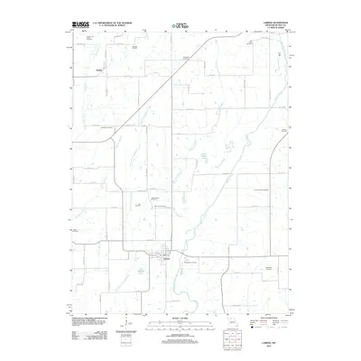
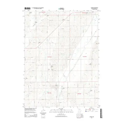
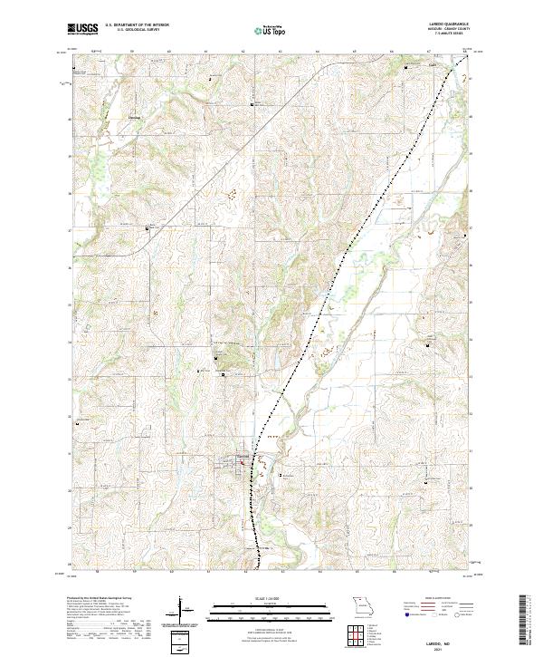
 1984 Laredo1984 Print · USGSGrundy County's rural townships are shown here in the mid-1980s, revealing the agricultural landscape and small-town footprints of the era. Researchers can trace the street grids of Laredo and Galt or locate homesteads near Medicine Creek and Dunlap.
 - 1984 Map of Galt, 1985 Print
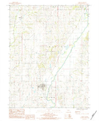
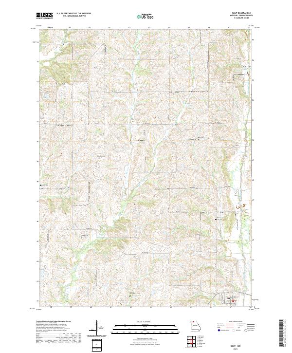
 1984 Galt1985 Print · USGSNorthern Missouri farmland in the early eighties centers on the village of Galt and its surrounding townships. Researchers can trace rural cemeteries labeled Cem and the intricate drainage of Medicine Creek and East Honey Creek.
 - 2012 Map of Laredo, 2012 Print
 2012 Laredo2012 Print · USGSCovers Galt, including Laredo, Dunlap, and other nearby areas
 - 2012 Map of Galt, 2012 Print
 2012 Galt2012 Print · USGSCovers Galt, including Grundy County, United States, and other nearby areas
 - 2014 Map of Galt, 2014 Print
 2014 Galt2014 Print · USGSCovers Galt, including Grundy County, United States, and other nearby areas
 - 2014 Map of Laredo, 2014 Print
 2014 Laredo2014 Print · USGSCovers Galt, including Laredo, Dunlap, and other nearby areas
 - 2017 Map of Galt, 2017 Print
 2017 Galt2017 Print · USGSCovers Galt, including Grundy County, United States, and other nearby areas
 - 2017 Map of Laredo, 2017 Print
 2017 Laredo2017 Print · USGSCovers Galt, including Laredo, Dunlap, and other nearby areas
 - 2021 Map of Laredo, 2021 Print
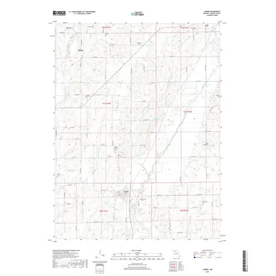
 2021 Laredo2021 Print · USGSGrundy County farmland and quiet crossroads are captured in the early 2020s, showing a landscape defined by the waters of Medicine Creek. Genealogists can trace deep local roots through numerous burial sites like Joseph Wright Cem, Richardson Cem, and Newlan Cem.
 - 2021 Map of Galt, 2021 Print
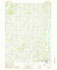
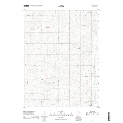
 2021 Galt2021 Print · USGSGrundy County settlement patterns are preserved here in the early twenty-first century, centered on the community of Galt. Researchers can trace local lineage through several rural burial sites, including McAfee Cem, Mount Zion Cem, and Berry Cem.
End of results
Showing maps 1-16 of 16
Top cities near Galt
- Trenton historical maps
- Spickard historical maps
- Browning historical maps
- Laredo historical maps
- Purdin historical maps
- Chula historical maps
See more
Frequently asked questions
- What are the different types of historical maps available for Galt?
- What is the oldest map of Galt?
- Where can I purchase historical maps of Galt for my home or office?
- Where can I download high-res historical maps of Galt?
- Are there historical topographic maps available for Galt?
- Is there historical aerial imagery available for Galt?
- Where are historical maps of Galt sourced from?