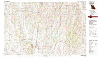
1981 Map of Trenton
USGS Topo · Published 1981About this map
The Grand River and its major tributaries, including the Thompson River and Weldon River, carve a dendritic drainage pattern across this northern Missouri landscape. This 1981 compilation, based on surveys dating back to the late 1940s, reveals a rural region defined by its river-valley settlements and a significant rail infrastructure. Major shipping corridors like the Burlington Northern and Norfolk and Western railroads connect regional hubs such as Trenton and Princeton to the wider Midwest. Beyond the primary towns, smaller communities like Mill Grove and Ravanna serve as local centers amidst the agricultural terrain. Protected lands, including the Wayne Helton Memorial State Wildlife Area and Lake Paho State Wildlife Area, provide a clear contrast to the surrounding section-line grid that dominates the geography of Grundy, Mercer, and Sullivan counties.
Find a feature on this map
64 named features on this map. Tap any name to fly to it.
Don’t see what you’re looking for? This feature index may not catch every label — zoom into the map to look around manually.
Map Details
Editions of this 1981 Trenton Map
This is the sole edition of this map. No revisions or reprints were ever made.
Other maps of this area

1912 · Green City
USGS Topo · 1:62,500

1914 · Green City
USGS Topo · 1:62,500

1921 · Chillicothe
USGS Topo · 1:62,500

1922 · Gallatin
USGS Topo · 1:62,500

1923 · Chillicothe
USGS Topo · 1:62,500

1924 · Winston
USGS Topo · 1:62,500

1924 · Chula
USGS Topo · 1:62,500

1925 · Pattonsburg
USGS Topo · 1:62,500

1925 · Gilman
USGS Topo · 1:62,500

1939 · Centerville
USGS Topo · 1:62,500