1900s (20th Century) Maps of Jefferson County, Missouri
Explore 72 historic maps of Jefferson County from the 1900s (20th Century). These maps offer a rare glimpse into what life looked like during the 1900s — showing old roads, neighborhoods, homes, and landmarks that have changed or disappeared over time.
Whether you're researching your family's past, planning a metal detecting trip, or studying how Jefferson County's landscape evolved across the 1900s, these high-resolution maps are a powerful tool for exploring the history of this region.
- Focus on a specific era: All maps on this page are from the 1900s, giving you a focused view of this time period.
- See what’s changed: Compare century-old streets, trails, and buildings to today's modern landscape using overlays and satellite layers.
- Research with precision: Use these maps for genealogy, historical research, land use analysis, or educational projects.
- View, download, or print: Maps are fully viewable online in high resolution, and can be downloaded or printed for your own records.
Start exploring Jefferson County's history through authentic maps from the 1900s. This is your window into the past.
Jefferson County, MO maps
(72)- 1901 Map of De Soto
 1901 De Soto1901 Print · USGSJefferson and Franklin Counties at the turn of the century show a landscape defined by industrial milling and river fords. Genealogists can trace early homesteads near Hillsboro or industrial sites like Vulcan Mine and Byrnes Mill.5 unique versions available
 - 1903 Map of O'Fallon
 1903 O'Fallon1903 Print · USGSSt. Charles County at the turn of the century is a labyrinth of river islands and rail lines at the confluence of the Missouri and Mississippi. Researchers can trace old river landings like Cap Au Gris Landing and family-named settlements from Moscow Mills to New Melle.5 unique versions available
 - 1912 Map of Kimmswick
 1912 Kimmswick1912 Print · USGSThe Illinois bottomlands along the Mississippi River are shown here in the early twentieth century, just as the railroad was solidifying the region's economy. Genealogists and local researchers can trace the locations of Harrisonville, the Blue Church, and historic schools like Miles Prairie School.2 unique versions available
 - 1915 Map of Renault
 1915 Renault1915 Print · USGSThe Illinois river bluffs and the American Bottom appear here in the early twentieth century as a landscape of thriving rail-side villages and rural schools. You can trace early family sites like Stuptown Church, the historic Ruma Convent, and landings at Prairie du Rocher.4 unique versions available
 - 1915 Map of Crystal City
 1915 Crystal City1915 Print · USGSThe Missouri-Illinois riverfront comes alive in this early 1900s survey of the industrial corridor between Crystal City and VALLES MINES. Researchers can trace the path of the St Louis and San Francisco railroad and locate old community centers like Rush Tower or the Telegraph School.4 unique versions available
 - 1916 Map of Kimmswick
 1916 Kimmswick1916 Print · USGSThe Mississippi River valley comes alive in this early twentieth-century survey of the Missouri-Illinois borderlands. Genealogists and historians can trace defunct schoolhouses like Fawn Ridge School, river landings such as Harrisonville Landing, and the path of the St Louis Iron Mountain and Southern RR.6 unique versions available
 - 1930 Map of De Soto NE
 1930 De Soto NE1930 Print · USGSJefferson County settlement and rural education are captured in the early 1930s as the railroad and river networks shaped the valley. Genealogists can locate family landmarks like Peter Moore Sch and Buckie Sch near the Victoria and De Soto corridors.
 - 1930 Map of Pacific SE
 1930 Pacific SE1930 Print · USGSJefferson County rural life in the early 1930s is captured here through its network of country schoolhouses and river valleys. Researchers can trace historic routes like Le May Ferry Road and find old settlements such as Belews and Goldman.2 unique versions available
 - 1931 Map of Manchester SE
 1931 Manchester SE1931 Print · USGSSt. Louis County and Jefferson County were still largely defined by the river and rail lines during the early 1930s. Researchers can trace the early layout of Times Beach or locate family-history landmarks like the Rankin Cem and Oak Ridge Sch.
 - 1931 Map of De Soto SE
 1931 De Soto SE1931 Print · USGSJefferson County was still a landscape of remote hill-country schools and river-valley railroads in the early thirties. Genealogists can trace family names and local landmarks like Mothershead Sch, the Joachim Cem, and the rail stop at Vineland.2 unique versions available
 - 1931 Map of Pacific NE
 1931 Pacific NE1931 Print · USGSJefferson County was a land of river bends and rural schools in the early thirties. Local historians can trace the foundations of communities at Byrnes Mill and House Springs, or locate old schoolhouse sites like Whiteoak Sch and Cedar Sch.2 unique versions available
 - 1933 Map of Kirkwood
 1933 Kirkwood1933 Print · USGSSt. Louis County is captured here during a period of rapid suburban and institutional expansion in the early thirties. Genealogists and local researchers can trace the footprint of Oakhill Cemetery, Meacham Park, and the grounds of Hartman College.
 - 1937 Map of Pacific
 1937 Pacific1937 Print · USGSIn the late 1930s, the Meramec and Big River valleys formed a landscape of rail junctions and rural infirmaries. You can trace the rail lines at Pacific, locate the C C C Camp, or find local schools like McNamee Sch and La Barque Sch.4 unique versions available
 - 1937 Map of Fletcher
 1937 Fletcher1937 Print · USGSJefferson and Washington counties in the 1930s were defined by the deep loops of the river and scattered rural settlements. Researchers can trace the location of family-named landmarks like McCain Cem, the community at Fletcher, and local schools such as Mammoth Sch.2 unique versions available
 - 1937 Map of Tiff, 1962 Print
 1937 Tiff1962 Print · USGSThe Missouri Ozarks are captured here in the late 1930s, showing a landscape of small mining outposts and river-valley settlements. Genealogists and historians can trace the foundations of Tiff, locate the Thunderbolt C C C Camp, and find rural landmarks like Cruise Mill.
 - 1938 Map of Cedar Hill
 1938 Cedar Hill1938 Print · USGSJefferson County before the Second World War was a network of river-bottom mills and ridge-top schools connected by winding country roads. Genealogists can trace family footprints at Morse Mill, the MCCULLOCH FORD crossing, and rural schools like Bethlehem Sch.2 unique versions available
 - 1938 Map of Fletcher
 1938 Fletcher1938 Print · USGSThe Big River loops through Jefferson County in the late 1930s, showing a landscape of small river towns and family farmsteads. Genealogists can trace local roots at McCain Cem, Maness Sch, and the settlements of Fletcher and Frumet.
 - 1939 Map of Tiff
 1939 Tiff1939 Print · USGSWashington County at the end of the Depression era shows a landscape of river-valley settlements and rural industry. Family researchers can locate the Cannon Mines, Cruise Mill, and early burial grounds like Masonic Cem and Pinson Cem.2 unique versions available
 - 1940 Map of Cedar Hill
 1940 Cedar Hill1940 Print · USGSJefferson County was a landscape of small river towns and hilltop schoolhouses just before the 1940s. Genealogists and local historians can trace family roots through landmarks like St Martins Ch, Morse Mill, and the many rural schools including Bethlehem Sch.
 - 1940 Map of Kirkwood
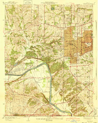 1940 Kirkwood1940 Print · USGSSt. Louis County shows its rapid suburban and institutional growth before the mid-century boom. Genealogists and historians can trace the rail-centered development of Kirkwood and find vanished landmarks like Windsor Springs and Hartman College.3 unique versions available
 - 1940 Map of Renault, 1955 Print
 1940 Renault1955 Print · USGSThe Illinois-Missouri borderlands come to life in the 1940s, highlighting the river-driven economy and rural community structure of the Mississippi valley. Genealogists can trace family footprints through dozens of local landmarks, from the Ruma Convent to historic schoolhouses like Yankeetown School and Foster School.2 unique versions available
 - 1945 Map of Manchester, 1955 Print
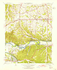 1945 Manchester1955 Print · USGSWestern St. Louis County is shown at a pivotal moment in the 1940s as suburban growth began to meet rural river life. Genealogists and historians can trace old homesteads and landmarks like Times Beach, Sherman P O, and the Sulphur Springs Sch.
 - 1946 Map of Richwoods, 1957 Print
 1946 Richwoods1957 Print · USGSThe Missouri Ozarks are captured here at the end of the Second World War, showing the rural communities of Washington County. Genealogists can locate family-named landmarks and institutions like Old Mines, Souls Chapel, and the Ebo Sch schoolhouse.3 unique versions available
 - 1947 Map of Manchester
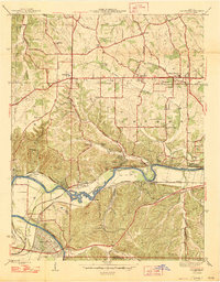 1947 Manchester1947 Print · USGSSt. Louis County is captured here just after the war, showing the distinct identities of communities along the historic Manchester Road. Genealogists and historians can locate family landmarks like the Ranken Cem, several local schoolhouses, and the original street grid of Times Beach.2 unique versions available
 - 1947 Map of St. Clair, 1950 Print
 1947 St. Clair1950 Print · USGSFranklin County at the dawn of the fifties shows a landscape shaped by the winding Meramec River and a busy network of major railroads. Genealogists and local historians can locate early landmarks like Purina Farm, the Virginia Mines (Abandoned), and the Brush Creek Cem.3 unique versions available
Showing maps 1-25 of 72
Frequently asked questions
- What are the different types of historical maps available for Jefferson County?
- What is the oldest map of Jefferson County?
- Where can I purchase historical maps of Jefferson County for my home or office?
- Where can I download high-res historical maps of Jefferson County?
- Are there historical topographic maps available for Jefferson County?
- Is there historical aerial imagery available for Jefferson County?
- Where are historical maps of Jefferson County sourced from?