Old Maps of Johnson County, Missouri for Hiking & Exploration
Hike through history with 139 historic maps of Johnson County. Explore old trails, ghost towns, and forgotten backroads — perfect for outdoor adventurers and local explorers.
- Rediscover forgotten places: Map out old mining camps, roads, and footpaths that no longer exist on modern maps.
- Layer with modern tools: Combine with LiDAR or satellite views to plan hikes through historical terrain.
- Made for exploration: Popular among hikers, overlanders, and local history lovers.
Use these maps to find adventure and explore the hidden past of Johnson County.
Johnson County, MO maps
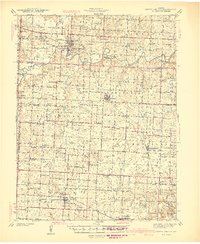
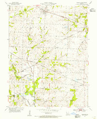
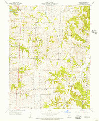
(139)- 1885 Map of Warrensburg, 1954 Print
 1885 Warrensburg1954 Print · USGSJohnson County and the surrounding Missouri prairie are captured here during the 1880s as the railroad era transformed the region. Researchers can trace the early footprints of settlements like Warrensburg, identify historic mines at Carbon Hill, and locate old landmarks like Iron Spring and Normal school.
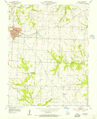
 - 1887 Map of Harrisonville
 1887 Harrisonville1887 Print · USGSMissouri's western borderlands are seen here during the rail boom of the late nineteenth century. Genealogists and historians can trace the early development of Harrisonville and Lees Summit, alongside smaller settlements like Lone Jack, Peculiar, and Garden City.
 - 1887 Map of Sedalia
 1887 Sedalia1887 Print · USGSIn the late nineteenth century, the rail corridors of central Missouri radiated from the bustling hub of Sedalia. Researchers can trace the development of early settlements like Georgetown and Houstonia along the Missouri Pacific Railroad.
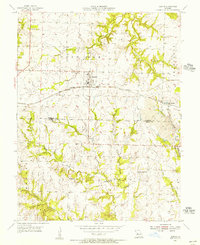
 - 1887 Map of Warrensburg
 1887 Warrensburg1887 Print · USGSMissouri's central plains are captured here in the mid-1880s, documenting the vital rail corridor through Warrensburg and Knob Noster. Genealogists can trace early homesteads near Carbon Hill, Chilhowee, or the Iron Spring during a period of rapid agricultural growth.
 - 1892 Map of Harrisonville, 1902 Print
 1892 Harrisonville1902 Print · USGSWestern Missouri comes into focus during the late nineteenth-century rail boom as new townships and post offices began to dot the prairie. Trace the development of early rail hubs like Harrisonville and Pleasant Hill or locate old community centers such as Chapel Hill and Daugherty (Eight Mile P. O.).2 unique versions available
 - 1894 Map of Harrisonville
 1894 Harrisonville1894 Print · USGSCass and Jackson counties come to life in the 1890s as a burgeoning rail network links remote prairie outposts. Genealogists can trace early homesteads and mail stops like Daugherty (Eight Mile P. O.), Peculiar, and Lone Jack.
 - 1894 Map of Sedalia
 1894 Sedalia1894 Print · USGSCentral Missouri's rail-and-river network is frozen in time during the late 19th century, centered on the growing hub of Sedalia. Researchers can trace the path of the Sedalia Warsaw And Southwestern RR and find vanished points like Dumpville and Mc Allister Springs.5 unique versions available
 - 1894 Map of Warrensburg
 1894 Warrensburg1894 Print · USGSJohnson County was a burgeoning rail and coal hub in the 1890s, anchored by the growth of Warrensburg. Researchers can trace old family sites and transport routes through vanished mining points like Carbon Hill and rural stops such as Cornelia and Iron Spring.5 unique versions available
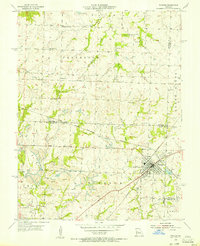
 - 1917 Map of Knobnoster
 1917 Knobnoster1917 Print · USGSSettlement and education are deeply rooted in this early twentieth-century survey of Johnson County, Missouri. Genealogists can trace family school districts like Hepsidam School and Union Prairie School or locate early rail stops at Knobnoster and Montserrat.3 unique versions available
 - 1939 Map of Sweet Springs
 1939 Sweet Springs1939 Print · USGSThe rural borderlands of Saline and Pettis Counties are captured here at the end of the 1930s as the rail and highway systems began to modernize the landscape. Genealogists can locate numerous country schoolhouses and churches like Sunny Dell Sch, Oak Grove Cem, and Houstonia.
 - 1940 Map of Sweet Springs
 1940 Sweet Springs1940 Print · USGSWestern Missouri in the late thirties is revealed here as a landscape of interconnected river valleys and tightly knit rural communities. Genealogists and historians can trace family roots through numerous country schools and landmarks like High Hill Cem, Bleak Mound, and the Missouri Pacific rail line.
 - 1941 Map of Sweet Springs
 1941 Sweet Springs1941 Print · USGSCentral Missouri farmland at the end of the Depression is defined here by the winding Blackwater River and the critical Missouri Pacific rail line. Genealogists and local historians can locate dozens of country schools and churches, such as Holy Cross Sch, Dunksburg, and the High Hill Cem.2 unique versions available
 - 1945 Map of Sweet Springs
 1945 Sweet Springs1945 Print · USGSCentral Missouri farmland at the end of the 1930s is revealed here, spanning the intersection of four counties. Genealogists can trace family roots through numerous rural landmarks like Holy Cross Ch, Weber Sch, and the isolated High Hill Cem.2 unique versions available
 - 1947 Map of Jefferson City, 1949 Print
 1947 Jefferson City1949 Print · USGSCentral Missouri and the northern Ozarks come into focus in this late 1940s survey of the river-and-rail landscape. Genealogists and historians can trace the growth of Jefferson City and Sedalia or locate family roots near Bagnell Dam and the Lake of the Ozarks.
 - 1947 Map of Lawrence, 1954 Print
 1947 Lawrence1954 Print · USGSEastern Kansas and western Missouri thrive in the late 1940s, showing a landscape defined by major river valleys and a dense railway network. Genealogists can trace family settlements from Lawrence to Greenwood and locate landmarks like Olathe Navy and Lake Lotawana.
 - 1950 Map of Lawrence
 1950 Lawrence1950 Print · USGSMid-century Kansas and Missouri come alive in this map of the river-valley corridors just as the interstate era was beginning. Researchers can trace the legacy of major rail lines like the Union Pacific RR and locate ancestral roots in towns from Lawrence to Harrisonville.
 - 1954 Map of Jefferson City
 1954 Jefferson City1954 Print · USGSCentral Missouri in the early postwar years showcases a landscape defined by the winding Lake of the Ozarks and the state capital at Jefferson City. Researchers can trace the mid-century rail networks of the Missouri Pacific RR and locate rural communities like Tuscumbia, St Elizabeth, and St Anthony.2 unique versions available
 - 1954 Map of Centerview, 1955 Print
 1954 Centerview1955 Print · USGSCenterview and the surrounding rural townships are captured here in the mid-1950s as a landscape of small schools and family farms. Local historians can trace the sites of Houts Chapel, Perile Springs, and several rural schools including the Glendale Sch.2 unique versions available
 - 1954 Map of East Lynne, 1955 Print
 1954 East Lynne1955 Print · USGSEastern Cass County is shown here in the mid-1950s, a time when three major railroads still defined the local economy and geography. Researchers can trace rural life through landmarks like Staley Mound Cem, Smith Sch, and the depot at Gunn City (Station).
 - 1954 Map of Quick City, 1955 Print
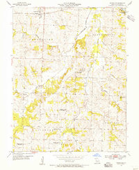
 1954 Quick City1955 Print · USGSMid-century Johnson County comes into focus as a landscape of small schools and family cemeteries along the ST LOUIS SAN FRANCISCO rail line. Genealogists can trace rural roots at Quick City or locate ancestral sites at Grant Cem and Forest Sch.
 - 1954 Map of Kingsville, 1955 Print
 1954 Kingsville1955 Print · USGSRailroad development in western Johnson County reached its peak in the mid-fifties, centering on the junction of five different lines. Genealogists and rail historians can trace local family landmarks like Rose Hill Cem, Stout Sch, and the small settlement of Latour.2 unique versions available
 - 1954 Map of Holden, 1955 Print
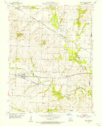
 1954 Holden1955 Print · USGSMid-century Johnson County is defined by its rail connectivity and dispersed farming communities. Family historians can trace the foundations of Holden and Magnolia, or locate rural sites like Fairview Cem and the Pleasant Shade Sch (Abandoned).
 - 1955 Map of Leeton, 1956 Print
 1955 Leeton1956 Print · USGSThe Leeton area at the height of the 1950s reveals a landscape defined by crossing railroads and active rural industry. Family researchers can locate numerous burial sites and schools like Sardis Cem, Hickory Grove Ch, and Pleasant View Sch.2 unique versions available
 - 1955 Map of Windsor, 1956 Print
 1955 Windsor1956 Print · USGSThe rail junctions and coal mines of Henry County are captured here in the mid-1950s as industry shaped the West Central Missouri landscape. Genealogists and local historians can trace the foundations of Windsor through landmarks like Laurel Oak Cem, the Windsor Fairgrounds, and the rural Sunny Side Sch.2 unique versions available
 - 1955 Map of Cornelia, 1956 Print
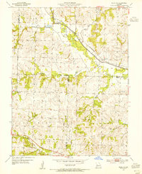
 1955 Cornelia1956 Print · USGSJohnson County is captured here in the mid-1950s, showing a rural landscape of crossroads settlements and family farmsteads. Researchers can trace the locations of defunct country schools and churches like Valley Sch and Bethel Ch, or locate ancestral plots at Adams Memorial Cem.3 unique versions available
Showing maps 1-25 of 139
Top cities of Johnson County
- Warrensburg historical maps
- Knob Noster historical maps
- Holden historical maps
- Leeton historical maps
- Chilhowee historical maps
- Kingsville historical maps
See more
Frequently asked questions
- What are the different types of historical maps available for Johnson County?
- What is the oldest map of Johnson County?
- Where can I purchase historical maps of Johnson County for my home or office?
- Where can I download high-res historical maps of Johnson County?
- Are there historical topographic maps available for Johnson County?
- Is there historical aerial imagery available for Johnson County?
- Where are historical maps of Johnson County sourced from?