1970s Maps of Ripley County, Missouri
Explore 6 historic maps of Ripley County from the 1970s. These maps offer a rare glimpse into what life looked like during the 1970s — showing old roads, neighborhoods, homes, and landmarks that have changed or disappeared over time.
Whether you're researching your family's past, planning a metal detecting trip, or studying how Ripley County's landscape evolved across the 1970s, these high-resolution maps are a powerful tool for exploring the history of this region.
- Focus on a specific era: All maps on this page are from the 1970s, giving you a focused view of this time period.
- See what’s changed: Compare century-old streets, trails, and buildings to today's modern landscape using overlays and satellite layers.
- Research with precision: Use these maps for genealogy, historical research, land use analysis, or educational projects.
- View, download, or print: Maps are fully viewable online in high resolution, and can be downloaded or printed for your own records.
Start exploring Ripley County's history through authentic maps from the 1970s. This is your window into the past.
Ripley County, MO maps
(6)- 1979 Map of Briar, 1980 Print
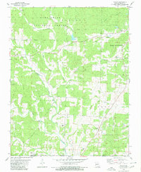
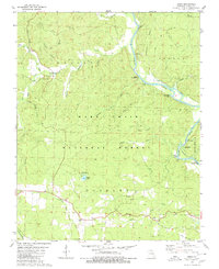 1979 Briar1980 Print · USGSRipley County in the late seventies showcases a landscape dominated by the winding Current River and the deep hollows of the Mark Twain National Forest. Genealogists and local historians can trace family locations through Bennett Cem, Chestnut Cem, and the small settlement of Briar.
 - 1979 Map of Oxly, 1980 Print
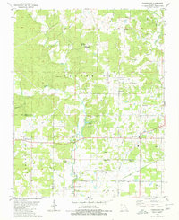
 1979 Oxly1980 Print · USGSRipley County is captured in the late seventies as the rural landscape straddled the Missouri and Arkansas border. Genealogists and historians can trace family burial sites like Stillwell Cem or locate the Oxly Lookout Tower and Bethel Bridge along the Little Black River.
 - 1979 Map of Flatwoods, 1980 Print
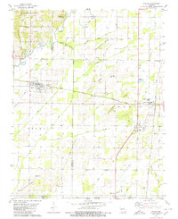
 1979 Flatwoods1980 Print · USGSRipley County, Missouri, is captured here in the late seventies, showing a landscape defined by the winding Little Black River and small rural hubs. Researchers can locate remote family burials and country churches like Woolard Cem, Pilgrims Rest Ch, and the historic Military Road.2 unique versions available
 - 1979 Map of Naylor, 1980 Print
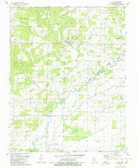
 1979 Naylor1980 Print · USGSRipley and Butler counties in the late seventies show a landscape defined by the Little Black River and the Missouri Pacific railroad. Genealogists and historians can trace numerous rural burial sites and congregations, including Masonic Cem, Corinth General Ch, and the settlement of Neelyville.
 - 1979 Map of Poynor, 1980 Print
 1979 Poynor1980 Print · USGSIn the Ozark foothills during the late 1970s, this area of the Missouri-Arkansas border features small crossroads settlements and timberland. Researchers can trace family sites at Old Ponder Cem and Patterson Cem or locate local landmarks like the County Fairground.
 - 1979 Map of Fairdealing, 1980 Print
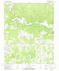
 1979 Fairdealing1980 Print · USGSThe border of Ripley and Butler Counties comes into focus during the late seventies, showing the rural communities between the Little Black River and Cane Creek. Genealogists can locate family landmarks like Military Cem, Hillview Sch, and New Harmony Ch.2 unique versions available
End of results
Showing maps 1-6 of 6
Top cities of Ripley County
Frequently asked questions
- What are the different types of historical maps available for Ripley County?
- What is the oldest map of Ripley County?
- Where can I purchase historical maps of Ripley County for my home or office?
- Where can I download high-res historical maps of Ripley County?
- Are there historical topographic maps available for Ripley County?
- Is there historical aerial imagery available for Ripley County?
- Where are historical maps of Ripley County sourced from?