1980s Maps of Ripley County, Missouri
Explore 7 historic maps of Ripley County from the 1980s. These maps offer a rare glimpse into what life looked like during the 1980s — showing old roads, neighborhoods, homes, and landmarks that have changed or disappeared over time.
Whether you're researching your family's past, planning a metal detecting trip, or studying how Ripley County's landscape evolved across the 1980s, these high-resolution maps are a powerful tool for exploring the history of this region.
- Focus on a specific era: All maps on this page are from the 1980s, giving you a focused view of this time period.
- See what’s changed: Compare century-old streets, trails, and buildings to today's modern landscape using overlays and satellite layers.
- Research with precision: Use these maps for genealogy, historical research, land use analysis, or educational projects.
- View, download, or print: Maps are fully viewable online in high resolution, and can be downloaded or printed for your own records.
Start exploring Ripley County's history through authentic maps from the 1980s. This is your window into the past.
Ripley County, MO maps
(7)- 1980 Map of Hogan Hollow
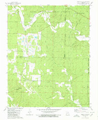 1980 Hogan Hollow1980 Print · USGSThe Ozark backcountry of the late seventies is centered on the settlement of Budapest and the timbered ridges of the Mark Twain National Forest. Genealogists can locate family burial sites at Scott Cem and Collins Cem or trace old tracks leading to the Grandin Lookout Tower.2 unique versions available
 - 1980 Map of Doniphan North
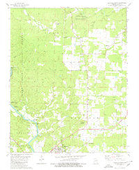 1980 Doniphan North1980 Print · USGSRipley County in the early eighties shows a landscape defined by state and national forests and the winding Current River. Researchers can locate many family landmarks, from Brooks Cem and Lone Star Sch to the Rancho Rio Landing Strip.
 - 1980 Map of Doniphan South
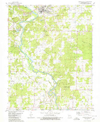 1980 Doniphan South1980 Print · USGSRipley County is captured here at the start of the 1980s, where the winding Current River meets the Arkansas border. Researchers can locate family landmarks such as Pope Chapel Cem, Gartman Cem, and the rural community of Current View.
 - 1983 Map of Cherokee Village
 1983 Cherokee Village1983 Print · USGSThe Ozark foothills and river valleys of Northeast Arkansas are captured in the early eighties as modern planned communities began to reshape the landscape. Genealogists and historians can trace family-named ridges and schools across Evening Shade, Melbourne, and the rail junction at Hoxie.
 - 1983 Map of Poplar Bluff
 1983 Poplar Bluff1983 Print · USGSSoutheast Missouri in the early 1980s reveals a landscape defined by the Ozark foothills and the complex drainage systems of the Bootheel. Researchers can trace the rail corridors of the Missouri Pacific RR through Poplar Bluff or locate rural sites like Wilhelmina Church and Lone Hill Lookout.
 - 1984 Map of West Plains
 1984 West Plains1984 Print · USGSThe Missouri Ozarks are mapped here in the mid-1980s, centered on the regional hub of West Plains and the river corridors of the Eleven Point River. Trace the old rail lines and timber towns of Willow Springs, Mountain View, and Birch Tree through the Mark Twain National Forest.2 unique versions available
 - 1984 Map of Paragould
 1984 Paragould1984 Print · USGSNortheast Arkansas and the Missouri Bootheel appear here in the mid-1980s as a landscape of ridge-top towns and engineered delta drainage. Genealogists and historians can locate rural landmarks like Oak Grove Church, trace the St Louis San Francisco RR, or explore the limits of Crowleys Ridge State Park.2 unique versions available
End of results
Showing maps 1-7 of 7
Top cities of Ripley County
Frequently asked questions
- What are the different types of historical maps available for Ripley County?
- What is the oldest map of Ripley County?
- Where can I purchase historical maps of Ripley County for my home or office?
- Where can I download high-res historical maps of Ripley County?
- Are there historical topographic maps available for Ripley County?
- Is there historical aerial imagery available for Ripley County?
- Where are historical maps of Ripley County sourced from?