1990s Maps of Ripley County, Missouri
Explore 9 historic maps of Ripley County from the 1990s. These maps offer a rare glimpse into what life looked like during the 1990s — showing old roads, neighborhoods, homes, and landmarks that have changed or disappeared over time.
Whether you're researching your family's past, planning a metal detecting trip, or studying how Ripley County's landscape evolved across the 1990s, these high-resolution maps are a powerful tool for exploring the history of this region.
- Focus on a specific era: All maps on this page are from the 1990s, giving you a focused view of this time period.
- See what’s changed: Compare century-old streets, trails, and buildings to today's modern landscape using overlays and satellite layers.
- Research with precision: Use these maps for genealogy, historical research, land use analysis, or educational projects.
- View, download, or print: Maps are fully viewable online in high resolution, and can be downloaded or printed for your own records.
Start exploring Ripley County's history through authentic maps from the 1990s. This is your window into the past.
Ripley County, MO maps
(9)- 1997 Map of Briar, 1999 Print
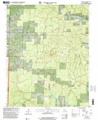
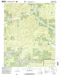 1997 Briar1999 Print · USGSThe Current River corridor in the late nineties reveals a landscape of deep timber and riverside camps. Researchers can trace family roots through Bennett Cemetery and Wilson Church or locate landmarks like Hogs Ankle and Briar.
 - 1997 Map of Handy, 1999 Print
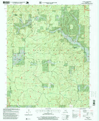 1997 Handy1999 Print · USGSThe Missouri Ozarks during the late 1990s reveal a landscape of deep hollows and forest settlements at the edge of the Irish Wilderness. Genealogists and hikers can locate Bristol Cemetery, Handy Church, and segments of the Ozark Trail.
 - 1997 Map of Doniphan North, 1999 Print
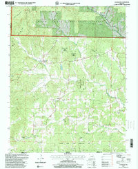
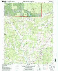
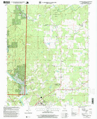 1997 Doniphan North1999 Print · USGSRipley County in the late 1990s was a landscape where the Current River met the deep woods of the Mark Twain National Forest. Local historians can trace family locations near the Mc Gee-Payne Cemetery, the old Fairview School, or the Doniphan Lookout.
 - 1997 Map of Grandin, 2000 Print
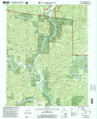
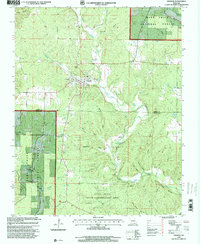 1997 Grandin2000 Print · USGSGrandin and the surrounding Ozark foothills are captured here in the late nineties, showing a landscape defined by protected forests and conservation areas. Researchers can locate community anchors like St Anne Church, Roan Cem, and the riverside grounds of Camp Semo.
 - 1997 Map of Bardley, 2000 Print
 1997 Bardley2000 Print · USGSThe southern Missouri Ozarks come to life in the late nineties, showing a landscape defined by forest management and small rural communities. Genealogists and researchers can trace family landmarks like Pine School, Bardley Church, and the remote outpost of Bennett.
 - 1997 Map of Billmore, 2000 Print
 1997 Billmore2000 Print · USGSThe Ozark plateau in the late nineties is defined here by the winding Eleven Point River and its protected forest lands. Researchers can locate remote community landmarks like Liberty Church, Billmore, and the Mt Carmel Cemetery.
 - 1997 Map of Gatewood, 2000 Print
 1997 Gatewood2000 Print · USGSRipley County is defined by its deep hollows and protected timberlands in the late 1990s. Researchers can trace rural lineage through landmarks like Gatewood, Tucker Church, and Johnson Chapel along the West Fork Fourche Creek.
 - 1997 Map of Grandin SW, 2000 Print
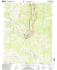
 1997 Grandin SW2000 Print · USGSThe Missouri Ozarks are captured here during the late 1990s as the river corridor transitioned into a federally protected scenic waterway. Genealogists can trace family roots at Ponder Cemetery or Good Hope Church along the Current River.
 - 1997 Map of Poynor, 2000 Print
 1997 Poynor2000 Print · USGSRipley County, Missouri, sits at the edge of the Ozarks in the late nineties, where the forest gives way to river bottoms. Genealogists can trace family names through dozens of rural sites, including Patterson Cemetery, Union Grove Cemetery, and the Poynor Church.
End of results
Showing maps 1-9 of 9
Top cities of Ripley County
Frequently asked questions
- What are the different types of historical maps available for Ripley County?
- What is the oldest map of Ripley County?
- Where can I purchase historical maps of Ripley County for my home or office?
- Where can I download high-res historical maps of Ripley County?
- Are there historical topographic maps available for Ripley County?
- Is there historical aerial imagery available for Ripley County?
- Where are historical maps of Ripley County sourced from?