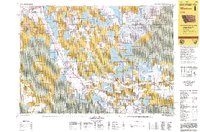
1990s Maps of Madison County, Montana
Explore 54 historic maps of Madison County from the 1990s. These maps offer a rare glimpse into what life looked like during the 1990s — showing old roads, neighborhoods, homes, and landmarks that have changed or disappeared over time.
Whether you're researching your family's past, planning a metal detecting trip, or studying how Madison County's landscape evolved across the 1990s, these high-resolution maps are a powerful tool for exploring the history of this region.
- Focus on a specific era: All maps on this page are from the 1990s, giving you a focused view of this time period.
- See what’s changed: Compare century-old streets, trails, and buildings to today's modern landscape using overlays and satellite layers.
- Research with precision: Use these maps for genealogy, historical research, land use analysis, or educational projects.
- View, download, or print: Maps are fully viewable online in high resolution, and can be downloaded or printed for your own records.
Start exploring Madison County's history through authentic maps from the 1990s. This is your window into the past.
Madison County, MT maps
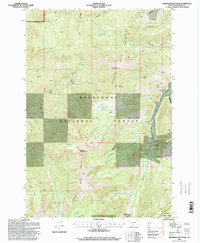
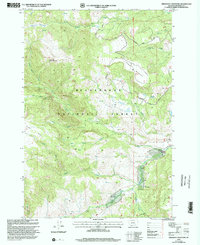
(54)- 1992 Map of Bozeman
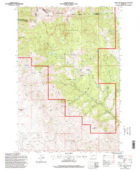
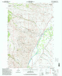
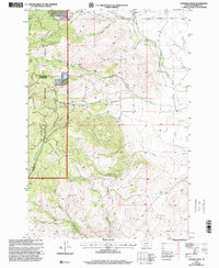
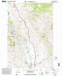
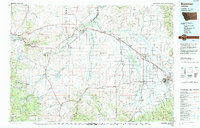 1992 Bozeman1992 Print · USGSThe Gallatin and Madison valleys are captured here in the early nineties, centered on the growth of the Montana State University area. Researchers can trace the legacy of mining in the Tobacco Root Mountains or locate landmarks like the Madison Buffalo Jump State Monument and Church Hill Church.
 - 1992 Map of Lima, 1993 Print
 1992 Lima1993 Print · USGSThe high Divide country of Beaverhead County comes into focus in the early nineties, centered on the rail-and-ranching corridor through the Tendoy Mountains. Genealogists and historians can trace the Union Pacific line through Lima, Dell, and Monida, or locate the Silver Queen Mine and Kidd along the historic valley routes.
 - 1993 Map of Hebgen Lake
 1993 Hebgen Lake1993 Print · USGSThe high mountain passes and vast river basins of the Montana-Idaho border come into focus in the early nineties. Genealogists and historians can trace the remote settlement of Lakeview and the development of West Yellowstone near the Red Rock Lakes National Wildlife Refuge.2 unique versions available
 - 1996 Map of Mount Humbug, 1998 Print
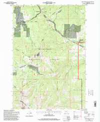
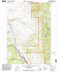
 1996 Mount Humbug1998 Print · USGSThe Silver Bow and Madison county line crosses the Continental Divide during the mid-1990s, revealing a landscape shaped by mining and water management. Trace local history through the mining sites near Moose Town and landmarks like Mount Humbug and Gold Hill.
 - 1996 Map of Manhead Mountain, 1998 Print
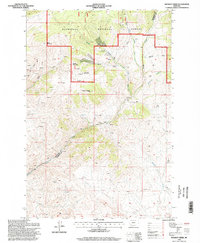
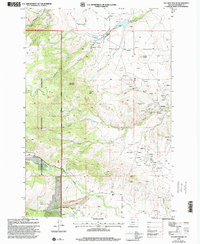
 1996 Manhead Mountain1998 Print · USGSMadison County, Montana, is shown here in the late twentieth century, centered on the high peaks and mining history of the Tobacco Roots. Researchers can trace mineral sites near Mammoth and explore landmarks like Manhead Mountain and Curly Lake.
 - 1996 Map of Whitehall, 1998 Print
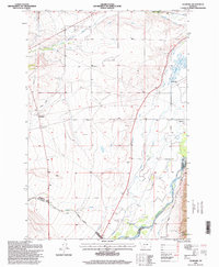
 1996 Whitehall1998 Print · USGSWhitehall and the Jefferson River valley are captured here in the mid-1990s, showcasing a landscape shaped by mining and irrigation. Genealogists and historians can locate family plots at Whitehall Cemetery or trace mining claims at the Mayflower Mine and Gold Hill.
 - 1996 Map of Vendome, 1998 Print
 1996 Vendome1998 Print · USGSThe Jefferson River valley in the mid-1990s reveals a landscape of ranching and complex irrigation. Genealogists and local historians can trace the irrigation networks of Parrot Ditch or locate the Fish Creek Cem and settlements like Piedmont and Vendome.
 - 1996 Map of Jefferson Island, 1998 Print
 1996 Jefferson Island1998 Print · USGSThe Jefferson River valley in the late nineties is captured here as it winds through the London Hills. Researchers can trace the legacy of mining at the Mayflower Mine or locate early settlement markers at Dogtown and the South Boulder Cemetery.
 - 1996 Map of Table Mountain, 1998 Print
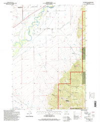
 1996 Table Mountain1998 Print · USGSThe Highland Mountains of Madison County are mapped here in the late twentieth century, showing a landscape defined by mining history and forest management. Researchers can locate the Big Bonanza Mine, trace the remote Hell Canyon Ranger Cabin, or find family-named points like Dougherty Butte.
 - 1996 Map of Wickiup Creek, 1998 Print
 1996 Wickiup Creek1998 Print · USGSThe high Montana backcountry along the Silver Bow and Madison county line appears in the mid-1990s as a landscape of active and historic mining. Mineral seekers can trace dozens of prospects and mines near Negro Mountain and Soap Gulch.
 - 1996 Map of Waterloo, 1998 Print
 1996 Waterloo1998 Print · USGSThe Waterloo area of Madison County appears here in the 1990s, where the river valley meets the forest edge. Researchers can trace irrigation networks like Parrot Ditch and mining sites such as Strawn Mine or Silver Bow Ranch.
 - 1996 Map of Pony, 1998 Print
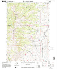
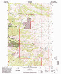 1996 Pony1998 Print · USGSMadison County mining history comes alive in this mid-nineties survey of the Tobacco Root Mountains near the settlement of Pony. Genealogists and researchers can trace local landmarks like the Cemetery, the Indiana University Geology Field Station, and numerous historic workings including the Strawberry Mine.
 - 1996 Map of Silver Star, 1998 Print
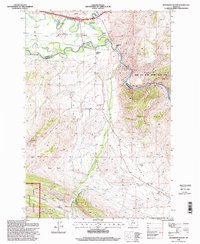
 1996 Silver Star1998 Print · USGSSilver Star and the Jefferson River valley are shown in the late twentieth century, when high-altitude mining still shaped the Madison County landscape. Metal detectorists and local historians can trace numerous workings like the Keystone and Stella mines or locate the old Cemetery and Ironrod Bridge.
 - 1996 Map of Pipestone Pass, 1998 Print
 1996 Pipestone Pass1998 Print · USGSThe high country of the Continental Divide in the late twentieth century reveals a transition from mining to recreation. Researchers can trace historic industrial footprints at Donald, various prospect pits, and the Highland Lookout atop the mountains.
 - 1997 Map of Swamp Creek, 2001 Print
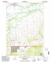
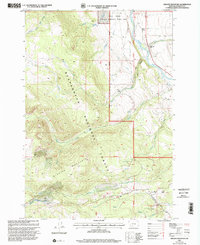
 1997 Swamp Creek2001 Print · USGSThe Montana high country of the late nineties is documented here, showing the intersection of wild forest and managed range. Trace topographic details near the Notch Guard Station, the high peaks of the Snowcrest Range, and the waters of Swamp Creek.
 - 1997 Map of Warm Springs Creek, 2001 Print
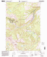
 1997 Warm Springs Creek2001 Print · USGSThe Madison County high country is shown here in the late 1990s as a vital ranching and forest management landscape. Researchers can find old outposts like the Warm Springs Cow Camp and Vigilante Guard Sta, or trace family interests at the Hudson Ranch.
 - 1997 Map of Leonard Creek, 2001 Print
 1997 Leonard Creek2001 Print · USGSThe high Tobacco Root Mountains were still a site of active forest management and historical mining interest in the late 1990s. Trace the paths of early prospectors through sites like the Mine Shaft near Aurora Creek or the remote Prospect on the western slopes.
 - 1997 Map of Bad Luck Creek, 2001 Print
 1997 Bad Luck Creek2001 Print · USGSMadison County's high river valleys are captured here in the late nineties, showing the convergence of working ranches and national forest lands. Local historians can locate the Lyon Guard Station, the remote Shelton Ranch, and various recreational sites along the Madison River.
 - 1997 Map of Stonehouse Mountain, 2001 Print
 1997 Stonehouse Mountain2001 Print · USGSThe high Snowcrest Range in the late nineties serves as a intersection for wilderness trails and high-country watersheds. Researchers can trace the boundary of Madison Co Beaverhead Co or locate remote sites like the Divide Creek Guard Station and Honeymoon Park.
 - 1997 Map of Maltbys Mound, 2001 Print
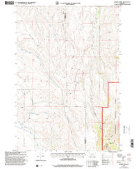
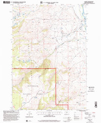
 1997 Maltbys Mound2001 Print · USGSMadison County's mining heart is on full display in the 1990s as it interfaces with the national forest boundary. Genealogists and industrial historians can trace the locations of the Revenue Mine, the timber works at Hagler Sawmill, and the settlement at Sterling.
 - 1997 Map of Melrose, 2002 Print
 1997 Melrose2002 Print · USGSThe high country surrounding Melrose in the late nineties was a landscape shaped by river irrigation and hard-rock mining. Genealogists and researchers can trace local landmarks like the Melrose Cem and historic workings at the Old Glory Mine or Maiden Rock Mine.
 - 1997 Map of Granite Mountain, 2002 Print
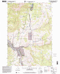
 1997 Granite Mountain2002 Print · USGSMadison County in the late nineties is documented here as a landscape of managed wilderness and high-country ranching. Genealogists and historians can trace legacy holdings like Wolf Creek Ranch and Kelly Ranch alongside mining Prospects and the peak of Granite Mountain.
 - 1997 Map of Potosi Peak, 2002 Print
 1997 Potosi Peak2002 Print · USGSThe Tobacco Root Mountains in the late nineties remain a hub of mining history and high-country hydrology within the Beaverhead National Forest. Researchers can locate specialized sites like the Beuth Mine, the remote New Deal Mine, and the Potosi Hot Springs.
 - 1997 Map of Varney, 2002 Print
 1997 Varney2002 Print · USGSThe Madison River valley and Gravelly Range come alive in the late 1990s as this survey documents ranching outposts and high-country waters. Researchers can locate family landmarks like Kent Ranch and Woodward Place alongside the Ennis National Fish Hatchery.
 - 1997 Map of Freezeout Mountain, 2002 Print
 1997 Freezeout Mountain2002 Print · USGSThe Madison River valley and high forest plateaus of Madison County are shown here in the late twentieth century, when seasonal ranching still shaped the landscape. Genealogists and historians can trace traditional land use via named sites like Partridge Cow Camp, Shakelford Cow Camp, and the road to Freezeout Mountain.
Showing maps 1-25 of 54
Top cities of Madison County
- Ennis historical maps
- Sheridan historical maps
- Twin Bridges historical maps
- Virginia City historical maps
- Harrison historical maps
Frequently asked questions
- What are the different types of historical maps available for Madison County?
- What is the oldest map of Madison County?
- Where can I purchase historical maps of Madison County for my home or office?
- Where can I download high-res historical maps of Madison County?
- Are there historical topographic maps available for Madison County?
- Is there historical aerial imagery available for Madison County?
- Where are historical maps of Madison County sourced from?