Old Maps of Condon, Montana for Academic Research
Study the evolution of Condon with 13 high-resolution historic maps. Whether you're teaching, researching, or modeling changes in land use, these maps provide essential visual documentation of urban, environmental, and geographic change.
- Analyze long-term change: Track patterns in development, transportation, and natural features.
- Ideal for environmental or urban studies: Support academic projects with primary historical map data.
- Use in the classroom or lab: Educators and researchers rely on these maps to bring historical context to life.
These maps are a powerful tool for teaching, research, and visualizing how Condon has changed over the decades.
Condon, MT maps
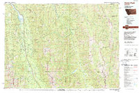
(13)- 1955 Map of Choteau, 1978 Print
 1955 Choteau1978 Print · USGSWestern Montana during the mid-fifties is captured here as a land of rugged high-country wilderness and vital eastern plains irrigation. Genealogists and historians can locate remote outposts like Condon, the communal Miller Colony, and the rail stops of the Chicago Milwaukee St Paul and Pacific.
 - 1957 Map of Choteau
 1957 Choteau1957 Print · USGSMontana's mountain front meets the eastern plains in the mid-fifties, showing the transition from forested wilderness to irrigated ranch land. Genealogists and historians can trace the rail lines of the Great Northern and find settlements like Choteau, Augusta, and Seeley Lake.
 - 1958 Map of Choteau
 1958 Choteau1958 Print · USGSMontana's front range meets the high wilderness in the late fifties, where the Great Northern railway connects ranching towns to the eastern plains. Researchers can trace the development of irrigation at Bynum Reservoir or locate remote camps like the Big Prairie District Ranger Station and Helmville.2 unique versions available
 - 1962 Map of Choteau
 1962 Choteau1962 Print · USGSThe Rocky Mountain Front meets the western plains in the early 1960s, showing a landscape defined by the Continental Divide. Genealogists and researchers can trace the tracks of the Great Northern and find settlements like Choteau, Augusta, and Bynum.
 - 1965 Map of Condon, 1968 Print
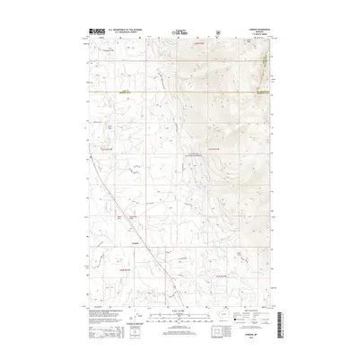
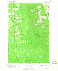 1965 Condon1968 Print · USGSThe mountain valley of Condon is captured here in the mid-1960s, showing a remote community dependent on forest service infrastructure. Genealogists and historians can locate the Condon PO, the Ranger Sta, and high-elevation fire lookouts like Cooney Lookout Tower.3 unique versions available
 - 1976 Map of Choteau
 1976 Choteau1976 Print · USGSThe Montana Rocky Mountain Front meets the plains in the 1970s, showcasing the high-altitude wilderness and the irrigation-fed ranching country. Trace the Great Northern Railway through Choteau or locate rural landmarks like the Farmington Cemetery and Gibson Reservoir.
 - 1988 Map of Swan Peak, 1989 Print
 1988 Swan Peak1989 Print · USGSSettlement in the Swan River Valley and the Bob Marshall Wilderness are captured in this late 1980s survey. Researchers can locate remote backcountry sites like the Spotted Bear Airport, the village of Condon, and the Swan Lake shoreline.
 - 1994 Map of Condon, 1996 Print
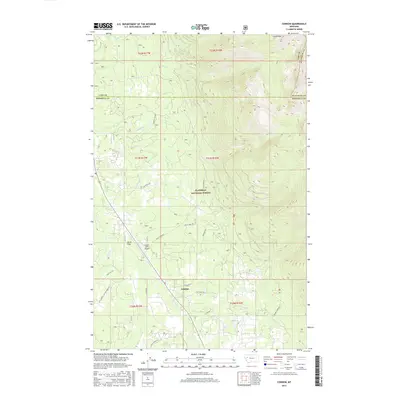
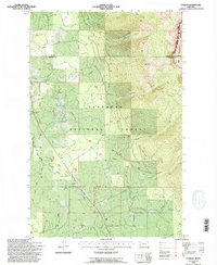 1994 Condon1996 Print · USGSIn the mid-1990s, the mountain valley around Condon remained a critical outpost for forestry and wilderness management. Researchers can locate specific infrastructure like the Condon PO, the Condon Forest Service Station, and the Cooney Lookout.
 - 2011 Map of Condon, 2011 Print
 2011 Condon2011 Print · USGSCovers Condon, including Missoula County, Flathead County, and other nearby areas
 - 2014 Map of Condon, 2014 Print
 2014 Condon2014 Print · USGSCovers Condon, including Missoula County, Flathead County, and other nearby areas
 - 2017 Map of Condon, 2017 Print
 2017 Condon2017 Print · USGSCovers Condon, including Missoula County, Flathead County, and other nearby areas
 - 2020 Map of Condon, 2020 Print
 2020 Condon2020 Print · USGSCovers Condon, including Missoula County, Flathead County, and other nearby areas
 - 2024 Map of Condon, 2024 Print
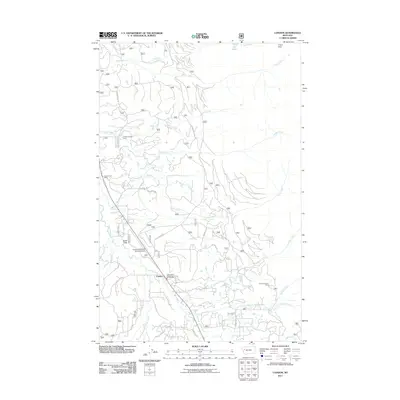
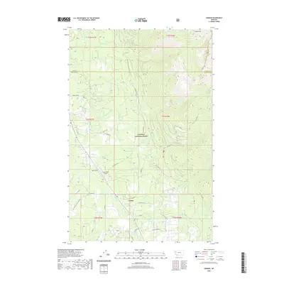
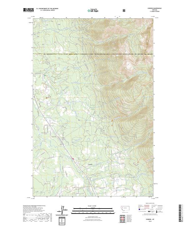 2024 Condon2024 Print · USGSThe Swan River valley near Condon comes into focus in this recent survey of the Montana backcountry. Researchers can trace land development on Smith Flats and identify backcountry routes like the Smith-Little Salmon Trl or the area near the Condon USFS Airport.
End of results
Showing maps 1-13 of 13
Frequently asked questions
- What are the different types of historical maps available for Condon?
- What is the oldest map of Condon?
- Where can I purchase historical maps of Condon for my home or office?
- Where can I download high-res historical maps of Condon?
- Are there historical topographic maps available for Condon?
- Is there historical aerial imagery available for Condon?
- Where are historical maps of Condon sourced from?