Old Maps of Chase County, Nebraska for Metal Detecting
Plan your next treasure hunt with 155 historic maps of Chase County. Find old homesites, ghost towns, trails, and gathering spots that may be lost to time — perfect for identifying promising metal detecting locations.
- Locate forgotten sites: Uncover places like long-lost settlements, abandoned rail lines, or gathering spots.
- Plan better hunts: Use map overlays combined with LiDAR or satellite views to narrow in on historically rich areas.
- Made for detectorists: Thousands of hobbyists use these maps to discover relics, coins, and hidden history.
Use these historic maps to boost your research and find new opportunities beneath the surface of Chase County.
Chase County, NE maps
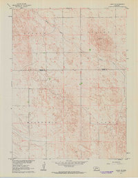
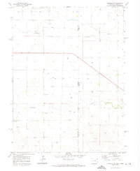
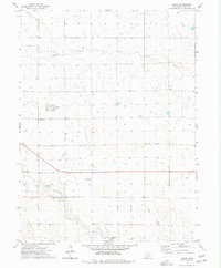
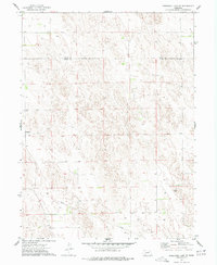
(155)- 1954 Map of Sterling
 1954 Sterling1954 Print · USGSNortheastern Colorado and the Nebraska borderlands are defined by the river-and-rail corridors of the mid-twentieth century. Researchers can trace the development of agricultural hubs from Sterling and Fort Morgan to smaller rail stops along the Union Pacific and Burlington Northern lines.3 unique versions available
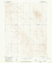
 - 1954 Map of McCook, 1966 Print
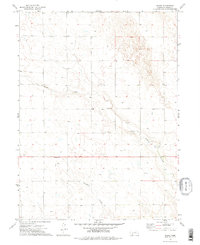
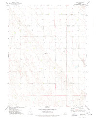
 1954 McCook1966 Print · USGSSouthwest Nebraska in the mid-fifties reveals a landscape shaped by major water projects and the Chicago Burlington and Quincy RR. Trace ancestral roots and defunct rail stops in McCook, Wauneta, and along the shores of Swanson Lake.2 unique versions available
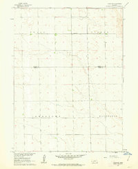
 - 1957 Map of McCook
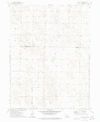
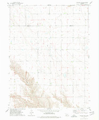
 1957 McCook1957 Print · USGSSouthwestern Nebraska in the mid-fifties is captured here during a period of significant water development and rail-based commerce. Researchers can trace the path of the Chicago Burlington and Quincy through Indianola and Bartley, or locate rural settlements like Chase Village and Ough near the Sand Hills.
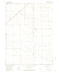
 - 1958 Map of McCook
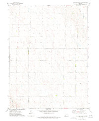
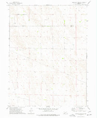
 1958 McCook1958 Print · USGSSouthwest Nebraska during the late fifties reveals a landscape of massive new reservoirs and established rail hubs like McCook. Genealogists can trace family footprints through rural centers like St Johns Church and the many grain elevators along the Union Pacific RR.2 unique versions available
 - 1958 Map of Sterling
 1958 Sterling1958 Print · USGSNortheastern Colorado thrived along the river and rail corridors during the late fifties. Genealogists and historians can trace family-named irrigation works like Davis Brothers Ditch and agricultural hubs from Peetz to Fort Morgan.
 - 1961 Map of Lamar NE, 1963 Print
 1961 Lamar NE1963 Print · USGSWestern Nebraska ranching country and the high plains are detailed here in the early sixties. Researchers can trace land holdings and fence lines between Stephenson and McCoy, or follow the winding course of Spring Creek through Lisbon Valley.
 - 1961 Map of Lamar, 1963 Print
 1961 Lamar1963 Print · USGSThe High Plains on the Perkins and Chase County line appear here in the early sixties, showing a landscape of remote ranching and prairie drainage. Researchers can trace the rural communities of Stephenson and McCoy or follow the path of Spring Creek.
 - 1961 Map of Lamar NW, 1963 Print
 1961 Lamar NW1963 Print · USGSThe high plains along the Perkins and Chase County line are captured here in the early sixties, showing a landscape defined by organized agricultural tracts. Genealogists and historians can locate Greenfield Ch and the distinct boundaries of Grace and Macedonia.2 unique versions available
 - 1962 Map of Amherst NE, 1964 Print
 1962 Amherst NE1964 Print · USGSHigh plains ranching and rail transport define this interstate borderland during the early sixties. Researchers can trace the Chicago Burlington and Quincy rail line and locate the Venango Cem near the Colorado Nebraska line.3 unique versions available
 - 1971 Map of Amherst SE, 1974 Print
 1971 Amherst SE1974 Print · USGSThe Colorado and Nebraska state line meets in the early 1970s, showing a high plains landscape shaped by ranching and resource extraction. Researchers can trace rural landmarks like Pleasant Valley Cem, Roadside Park, and the courses of Frenchman Creek and Wildhorse Creek.
 - 1971 Map of Alvin, 1974 Print
 1971 Alvin1974 Print · USGSThe Colorado-Nebraska borderlands in the early seventies reveal a sparse ranching and energy landscape. Genealogists and researchers can trace the small settlement of Alvin, find family roots at Hughes Cem, and locate early utility infrastructure like the Pumping Sta.3 unique versions available
 - 1971 Map of Alvin NE, 1974 Print
 1971 Alvin NE1974 Print · USGSThe tri-state borderland between Colorado and Nebraska comes alive in this early 1970s survey of the High Plains. Genealogists and land researchers can trace property boundaries across Colorado and Nebraska near a Gravel Pit and numerous wells.3 unique versions available
 - 1973 Map of Champion, 1977 Print
 1973 Champion1977 Print · USGSChase County, Nebraska, comes into focus in the mid-1970s as agricultural life centers around the waters of Frenchman Creek. Researchers can trace the local landscape through the Zion Cem, the village of Champion, and the Imperial Powerplant.
 - 1973 Map of Lamar, 1977 Print
 1973 Lamar1977 Print · USGSChase County, Nebraska, is documented in the 1970s as a high-plains landscape defined by ranching and vital water sources. Researchers can trace local burial sites at Green Lawn Cem or locate historical features like Arterburn Lake and the Top Flight Landing Strip.
 - 1973 Map of Chase, 1977 Print
 1973 Chase1977 Print · USGSAgricultural life in southwest Nebraska is documented here during the early seventies. Genealogists and researchers can locate School No 66, the Chase Cem, and the small settlement of Chase along the route of Highway 6.2 unique versions available
 - 1973 Map of Imperial NE, 1977 Print
 1973 Imperial NE1977 Print · USGSAgricultural land in southwestern Nebraska stretches across the border of Perkins Co and Chase Co during the early 1970s. Local researchers can trace the placement of vital water sources like the numerous Well sites across the sectioned terrain.
 - 1973 Map of Dittons Creek NE, 1977 Print
 1973 Dittons Creek NE1977 Print · USGSThe rural borderlands of Perkins, Chase, and Hayes counties are documented here in the early 1970s during a period of steady agricultural use. Researchers can locate the Attica Cem and trace the drainage of Blackwood Creek past various local Well sites.
 - 1973 Map of Enders, 1977 Print
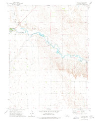
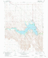 1973 Enders1977 Print · USGSChase County in the mid-1970s is centered on the waters of Enders Reservoir and the small railroad settlement of Enders. Local historians and researchers can trace the development of lakeside leisure at Church Grove Recreation Area or locate landmarks like the Enders Dam and the Burlington Northern line.
 - 1973 Map of Champion SW, 1977 Print
 1973 Champion SW1977 Print · USGSDundy County ranchlands and the high plains terrain are documented here as they appeared in the early seventies. Genealogists and local historians can locate Hiawatha Cem or trace the area around the landmark known as Old Baldy.
 - 1973 Map of Imperial, 1977 Print
 1973 Imperial1977 Print · USGSImperial and the surrounding Chase County plains are captured in the early 1970s, showing the community's growth as a prairie agricultural hub. Genealogists and local historians can trace the town grid, find the Mount Hope Cem, and see the early layout of the Imperial Municipal Airport.
 - 1973 Map of Dittons Creek NW, 1977 Print
 1973 Dittons Creek NW1977 Print · USGSChase and Perkins counties appear here in the early 1970s, showing a remote landscape of high plains agriculture and deep canyons. Researchers can locate Blanche Ch and trace the winding course of Stinking Water Creek toward Cliff Dwellers Canyon.
 - 1973 Map of Reservoir Lake SE, 1977 Print
 1973 Reservoir Lake SE1977 Print · USGSDundy and Chase Counties meet in this western Nebraska landscape during the early seventies, showing a world of isolated farmsteads and prairie infrastructure. Researchers can trace the settlement at Lamont, find numerous scattered Well sites, and locate the industrial footprint of a Gravel Pit.
 - 1973 Map of Ough, 1977 Print
 1973 Ough1977 Print · USGSDundy and Chase counties meet in this 1970s survey of the Nebraska High Plains during a period of steady agricultural production. Genealogists and local researchers can locate family sites at Ough Cem and Sleepy Hollow Cem, or trace the path of Muddy Cr.
 - 1973 Map of Wauneta SW, 1977 Print
 1973 Wauneta SW1977 Print · USGSThe high plains along the Chase Co and Dundy Co line are captured here in the early 1970s. Local historians can trace community roots at Mt Zion Ch and Mt Zion Cem or follow the path of Muddy Creek.
 - 1973 Map of Reservoir Lake SW, 1977 Print
 1973 Reservoir Lake SW1977 Print · USGSThe sand hills of the Nebraska panhandle are captured in the early seventies along the Chase Co and Dundy Co border. Researchers can trace the path of the regional Pipeline and locate numerous scattered wells across this sparsely populated landscape.
Showing maps 1-25 of 155
Top cities of Chase County
Frequently asked questions
- What are the different types of historical maps available for Chase County?
- What is the oldest map of Chase County?
- Where can I purchase historical maps of Chase County for my home or office?
- Where can I download high-res historical maps of Chase County?
- Are there historical topographic maps available for Chase County?
- Is there historical aerial imagery available for Chase County?
- Where are historical maps of Chase County sourced from?