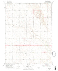
1973 Map of Chase
USGS Topo · Published 1977About this map
Chase sits at the heart of this 1970s landscape, serving as a focal point for a rural community defined by agricultural persistence and a network of ephemeral waterways. The geography is dominated by Sand Draw, which carves a path through the terrain alongside the smaller Davidson Branch. For those researching local heritage, the inclusion of School No 66 and Chase Cem provides essential spatial anchors for early-to-mid-century rural life in this corner of Nebraska. The presence of Roadside Park along Highway 6 suggests the area's role as a transit corridor for travelers crossing the plains. Numerous wells and sandpits are scattered across the sheet, reflecting the vital importance of groundwater and surface resources in a region where water management is central to the land's utility and settlement patterns.
Find a feature on this map
14 named features on this map. Tap any name to fly to it.
Don’t see what you’re looking for? This feature index may not catch every label — zoom into the map to look around manually.
Map Details
Editions of this 1973 Chase Map
2 editions found
Other maps of this area

1954 · McCook
USGS Topo · 1:250,000

1957 · McCook
USGS Topo · 1:250,000

1958 · McCook
USGS Topo · 1:250,000

1961 · Lamar NE
USGS Topo · 1:24,000

1961 · Lamar
USGS Topo · 1:24,000

1961 · Lamar NW
USGS Topo · 1:24,000

1973 · Champion
USGS Topo · 1:24,000
1973 · Lamar
USGS Topo · 1:24,000

1973 · Imperial
USGS Topo · 1:24,000
1973 · Imperial NW
USGS Topo · 1:24,000