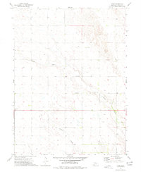
1973 Map of Chase
USGS Topo · Published 1977About this map
Chase and the small locality of Browning anchor this western Nebraska landscape during the early 1970s. The map illustrates a rural environment defined by the intermittent drainage of Sand Draw and Davidson Branch, where water management is critical as evidenced by the numerous marked Well locations and specialized operations like Sandpit. Genealogy and local history researchers will find important markers of 20th-century community life, including the School No 66 and the Chase Cem, which serve as the primary landmarks for this sparsely settled high plains area. The infrastructure of the time is further represented by a Roadside Park, reflecting the era's mid-century highway travel patterns through the Great Plains.
Find a feature on this map
11 named features on this map. Tap any name to fly to it.
Don’t see what you’re looking for? This feature index may not catch every label — zoom into the map to look around manually.
Map Details
Editions of this 1973 Chase Map
2 editions found
Other maps of this area

1954 · McCook
USGS Topo · 1:250,000

1957 · McCook
USGS Topo · 1:250,000

1958 · McCook
USGS Topo · 1:250,000

1961 · Lamar NE
USGS Topo · 1:24,000

1961 · Lamar
USGS Topo · 1:24,000

1961 · Lamar NW
USGS Topo · 1:24,000

1973 · Champion
USGS Topo · 1:24,000
1973 · Lamar
USGS Topo · 1:24,000
1973 · Chase
USGS Topo · 1:24,000

1973 · Imperial
USGS Topo · 1:24,000