Old Maps of Washington County, Nebraska for Academic Research
Study the evolution of Washington County with 89 high-resolution historic maps. Whether you're teaching, researching, or modeling changes in land use, these maps provide essential visual documentation of urban, environmental, and geographic change.
- Analyze long-term change: Track patterns in development, transportation, and natural features.
- Ideal for environmental or urban studies: Support academic projects with primary historical map data.
- Use in the classroom or lab: Educators and researchers rely on these maps to bring historical context to life.
These maps are a powerful tool for teaching, research, and visualizing how Washington County has changed over the decades.
Washington County, NE maps
(89)- 1893 Map of Omaha
 1893 Omaha1893 Print · USGSThe Missouri River valley at the close of the 19th century shows a landscape defined by industrial expansion and volatile waterways. Genealogists and historians can trace early street layouts in Omaha and Council Bluffs or locate old crossings near Florence and Crescent.
 - 1893 Map of Fremont, 1960 Print
 1893 Fremont1960 Print · USGSEastern Nebraska was a nexus of river navigation and rail expansion in the 1890s as the prairie gave way to organized township grids. Genealogists and historians can trace early settlements and transportation corridors through Fort Calhoun, the growth of Fremont, and the junctions of the Union Pacific R.R..
 - 1896 Map of Fremont
 1896 Fremont1896 Print · USGSThe rail-driven growth of eastern Nebraska is captured here in the late nineteenth century as steam power connected the prairie. Researchers can trace ancestral roots through dozens of established settlements like Fontanelle, Gretna, and Papillion, or follow the historic routes of the Union Pacific R.R. and the Elkhorn River.5 unique versions available
 - 1954 Map of Omaha, 1967 Print
 1954 Omaha1967 Print · USGSMid-century development radiates from the river bluffs into the agricultural heartland during this period of post-war growth. Genealogists and historians can trace rail-connected towns like Atlantic and Red Oak or locate the sprawling grounds of Offutt Air Force Base and Manawa Lake.3 unique versions available
 - 1955 Map of Fremont, 1966 Print
 1955 Fremont1966 Print · USGSEastern Nebraska and the Missouri River border are captured during the mid-fifties, just as the interstate system began to emerge. Researchers can trace the development of Omaha, locate the sprawling Offutt Air Force Base, or study the river-bound ecology of the De Soto National Wildlife Refuge.3 unique versions available
 - 1957 Map of Fremont
 1957 Fremont1957 Print · USGSEastern Nebraska and western Iowa thrive along the Platte and Missouri rivers during the mid-fifties. Genealogists can locate small rural schools like Fairview School and tracing the paths of the Union Pacific through towns like Albion and Humphrey.
 - 1957 Map of Omaha
 1957 Omaha1957 Print · USGSWestern Iowa and the Missouri River valley are seen here in the mid-fifties during the height of the rail-and-road era. Researchers can trace the sprawling rail lines of the Chicago And North Western or locate Cold War landmarks like Offutt Air Force Base.
 - 1957 Map of Loveland, 1958 Print
 1957 Loveland1958 Print · USGSThe Missouri River bottoms and bordering bluffs come alive in the late fifties as new highway infrastructure begins to reshape the landscape. Researchers can trace the legacy of river towns and rural education through sites like Loveland, Shipley Cem, and Ponca Sch.3 unique versions available
 - 1958 Map of Omaha
 1958 Omaha1958 Print · USGSOmaha and Council Bluffs stand at the center of this mid-fifties landscape, where the Missouri River splits the urban plains of Nebraska from the rolling hills of western Iowa. Genealogists can trace the rail lines of the Wabash RR and Illinois Central RR to rural settlements like Missouri Valley and Red Oak.2 unique versions available
 - 1958 Map of Fremont
 1958 Fremont1958 Print · USGSEastern Nebraska in the late fifties is captured here as a thriving corridor of river-valley commerce and rail transport. Researchers can trace the development of Omaha and Fremont or locate local landmarks like Midland College and Offutt Air Force Base.
 - 1966 Map of Nickerson, 1967 Print
 1966 Nickerson1967 Print · USGSThe Elkhorn River valley in the mid-1960s was a critical junction of rail and water, where the Chicago and North Western and Chicago Burlington and Quincy railroads meet. Genealogists can locate family landmarks like Hartung Cem, Immanuel Ch, and several rural schools.
 - 1966 Map of Nickerson NW, 1967 Print
 1966 Nickerson NW1967 Print · USGSThe rural borderlands of Dodge, Burt, and Washington counties are captured here in the mid-1960s, showing a landscape of established family farms. Genealogists can trace localized history through numerous country burial sites like Argo Cem and Logan Cem, alongside early district schools such as School No 68.
 - 1968 Map of Fremont East, 1971 Print
 1968 Fremont East1971 Print · USGSThe rail and river networks of eastern Nebraska converged here in the late sixties, showing a period of significant civic and industrial growth. Researchers can trace family roots through numerous neighborhood landmarks like St Patricks Sch, Midland College, and Ruwe Park.3 unique versions available
 - 1968 Map of Kennard, 1971 Print
 1968 Kennard1971 Print · USGSEastern Nebraska farming communities and rail corridors are frozen in time here just before the 1970s. Local historians can trace the Chicago and North Western tracks and locate rural anchors like Sunny Side Sch and the German Cem.
 - 1968 Map of Arlington, 1971 Print
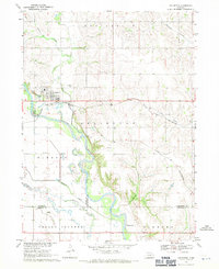 1968 Arlington1971 Print · USGSThe village of Arlington and the fertile Elkhorn River valley are captured here in the late sixties as the local rail and water networks shaped the region. Genealogists can locate family sites near Arlington Cem, School No 43, and along the banks of Rawhide Creek.2 unique versions available
 - 1968 Map of Fort Calhoun, 1971 Print
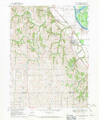 1968 Fort Calhoun1971 Print · USGSThe Missouri River bluffs at Fort Calhoun are captured in the late sixties, showing a landscape of rural schools and riverbottom conservation. Genealogists and local historians can locate the Pioneer Memorial Cem, Wranck Sch, and the Bil-Lo Landing Strip.2 unique versions available
 - 1969 Map of Orum, 1972 Print
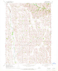 1969 Orum1972 Print · USGSEastern Nebraska farm country is documented here in the late sixties, showcasing the rural life of Herman and Fontanelle. Researchers can trace old family lands near Orum, Spiker, and numerous country school sites like Rose Hill Sch.
 - 1970 Map of Missouri Valley, 1972 Print
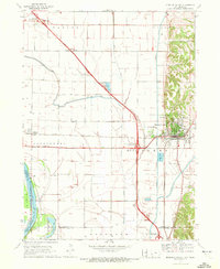 1970 Missouri Valley1972 Print · USGSMissouri Valley and the surrounding Harrison County bottomlands are captured here during a period of significant infrastructure development in the 1970s. Researchers can trace the local landscape from the winding Willow Creek to the hilltop Mt Carmel Cem.
 - 1970 Map of Herman, 1972 Print
 1970 Herman1972 Print · USGSIn the early seventies, the farming country near Herman was defined by its railroad grain connections and a sophisticated network of drainage ditches. Researchers can trace family history at the Herman Cem or explore the rail siding at Ranch Spur.
 - 1970 Map of Mondamin, 1972 Print
 1970 Mondamin1972 Print · USGSThe Missouri River floodplain of western Iowa is captured here in the early seventies, showing a landscape of managed drainage and rail transit. Genealogists and researchers can trace the roads around Mondamin, find the Noyes Cem, and explore the marshes of Round Lake.
 - 1970 Map of Modale, 1972 Print
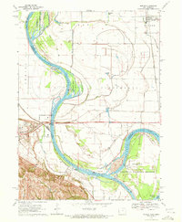 1970 Modale1972 Print · USGSThe Missouri River floodplain on the Iowa-Nebraska border comes alive in this early 1970s survey. Researchers can trace river changes at De Soto Lake and locate local landmarks like the Fort Calhoun Powerplant and Blair Cem.2 unique versions available
 - 1970 Map of Nickerson NE, 1972 Print
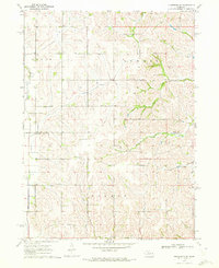 1970 Nickerson NE1972 Print · USGSEastern Nebraska agricultural life is captured here just after the mid-century, showing the rural landscape of the Burt Co and Washington Co border. Genealogists can locate family landmarks like New England Cem and the Alder Grove Ch.
 - 1970 Map of Blair, 1972 Print
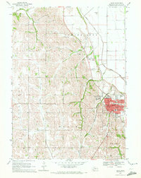 1970 Blair1972 Print · USGSBlair and the surrounding Missouri River uplands are captured here in the early 1970s, showing the town's expansion and its regional institutions. Researchers can trace local lineage through Dana College, the Cuming City Cemetery, and neighborhood schools like South School.2 unique versions available
 - 1980 Map of Harlan
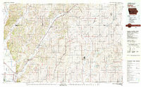 1980 Harlan1980 Print · USGSWestern Iowa and the Nebraska borderlands are shown in the early eighties as a vital corridor of rail and river commerce. Genealogists and local historians can trace family roots through old rural crossroads like Beebeetown and Westphalia, or locate landmarks like Rose Hill Cem.
 - 1982 Map of Fremont
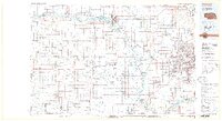 1982 Fremont1982 Print · USGSEastern Nebraska in the early eighties exhibits a landscape of industrious rail towns and river-fed agriculture. Genealogists and historians can trace the development of Fremont, locate the National Cem, and find landmarks like the Todd Valley.2 unique versions available
Showing maps 1-25 of 89
Top cities of Washington County
- Blair historical maps
- Arlington historical maps
- Fort Calhoun historical maps
- Kennard historical maps
- Herman historical maps
- Washington historical maps
Frequently asked questions
- What are the different types of historical maps available for Washington County?
- What is the oldest map of Washington County?
- Where can I purchase historical maps of Washington County for my home or office?
- Where can I download high-res historical maps of Washington County?
- Are there historical topographic maps available for Washington County?
- Is there historical aerial imagery available for Washington County?
- Where are historical maps of Washington County sourced from?