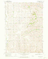
1970 Map of Nickerson NE
USGS Topo · Published 1972About this map
New England Cem and Alder Grove Ch sit amidst the agricultural uplands of Eastern Nebraska, marking the social and spiritual centers of this rural landscape during the late 1960s. The terrain is defined by a dense network of drainage systems, including the southward-flowing Bell Creek and the winding New York Creek, which carve through the townships of Craig, Summit, and Herman. This 1970 field-checked survey highlights the precise boundary line between Burt Co and Washington Co, revealing how property and political lines followed the township and range system. The map captures a moment of established rural life, where fine red dashed lines indicate the field and fence patterns that shaped the Nebraska plains before modern large-scale agricultural consolidation changed the visual character of the countryside.
Find a feature on this map
12 named features on this map. Tap any name to fly to it.
Don’t see what you’re looking for? This feature index may not catch every label — zoom into the map to look around manually.
Map Details
Editions of this 1970 Nickerson NE Map
This is the sole edition of this map. No revisions or reprints were ever made.
Other maps of this area

1955 · Fremont
USGS Topo · 1:250,000

1957 · Fremont
USGS Topo · 1:250,000

1958 · Fremont
USGS Topo · 1:250,000

1966 · Oakland
USGS Topo · 1:24,000

1966 · Nickerson
USGS Topo · 1:24,000

1966 · Nickerson NW
USGS Topo · 1:24,000
1969 · Orum
USGS Topo · 1:24,000

1970 · Oakland SE
USGS Topo · 1:24,000

1970 · Herman
USGS Topo · 1:24,000
1970 · Tekamah
USGS Topo · 1:24,000