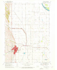
1970 Map of Tekamah
USGS Topo · Published 1972About this map
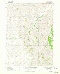
The Chicago and North Western railroad corridor anchors the city of Tekamah, serving as a vital transportation spine for this Burt County seat. The town center is densely marked with civic landmarks, including the Courthouse, City Hall, and a local Nursing Home, reflecting a mid-century period of established community infrastructure. To the east, the landscape transitions into a complex hydraulic network designed to manage the fertile bottomlands between the Missouri River and the Little Sioux River. This engineering is evident in the numerous man-made channels like the Arizona Diversion Ditch and Riverside Ditch, which redirect the natural flow of Silver Creek and Mud Creek. The small settlement of Arizona and its corresponding Arizona Cemetery stand as quiet reminders of earlier rural clusters along these reclaimed plains, while the Tekamah Municipal Airport signals the region's mid-20th-century modernization.
Find a feature on this map
35 named features on this map. Tap any name to fly to it.
Don’t see what you’re looking for? This feature index may not catch every label — zoom into the map to look around manually.
Map Details
Editions of this 1970 Tekamah Map
2 editions found
Other maps of this area

1955 · Fremont
USGS Topo · 1:250,000

1957 · Fremont
USGS Topo · 1:250,000

1958 · Fremont
USGS Topo · 1:250,000

1970 · Oakland SE
USGS Topo · 1:24,000

1970 · Little Sioux
USGS Topo · 1:24,000
1970 · Tekamah NW
USGS Topo · 1:24,000
1970 · Blencoe
USGS Topo · 1:24,000
1970 · Bertha
USGS Topo · 1:24,000

1970 · Herman
USGS Topo · 1:24,000

1970 · Mondamin
USGS Topo · 1:24,000