1950s Maps of Clark County, Nevada
Explore 56 historic maps of Clark County from the 1950s. These maps offer a rare glimpse into what life looked like during the 1950s — showing old roads, neighborhoods, homes, and landmarks that have changed or disappeared over time.
Whether you're researching your family's past, planning a metal detecting trip, or studying how Clark County's landscape evolved across the 1950s, these high-resolution maps are a powerful tool for exploring the history of this region.
- Focus on a specific era: All maps on this page are from the 1950s, giving you a focused view of this time period.
- See what’s changed: Compare century-old streets, trails, and buildings to today's modern landscape using overlays and satellite layers.
- Research with precision: Use these maps for genealogy, historical research, land use analysis, or educational projects.
- View, download, or print: Maps are fully viewable online in high resolution, and can be downloaded or printed for your own records.
Start exploring Clark County's history through authentic maps from the 1950s. This is your window into the past.
Clark County, NV maps
(56)- 1950 Map of Davis Dam, 1955 Print
 1950 Davis Dam1955 Print · USGSThe Colorado River corridor was undergoing a massive transformation in the early fifties as the newly completed Davis Dam began reshaping the tri-state border. Researchers can trace vanished river landings and frontier outposts such as the Hardyville Site, Mohave City, and the Fort Mohave Ruins.2 unique versions available
 - 1952 Map of Davis Dam
 1952 Davis Dam1952 Print · USGSThe Colorado River valley emerges in a period of significant change during the early fifties, as modern infrastructure meets pioneer history. Genealogists and historians can trace family-named locations such as Hardyville Ranch alongside significant landmarks like Fort Mohave (Ruins) and Bullhead City.2 unique versions available
 - 1952 Map of Corn Creek Springs, 1953 Print
 1952 Corn Creek Springs1953 Print · USGSThe northern Las Vegas Valley is captured here in the early 1950s, highlighting the vital water sources and ranching outposts of the Mojave desert. Trace the path of the Dismantled Railroad and locate historic sites like Tule Springs Ranch and Corn Creek Springs.3 unique versions available
 - 1952 Map of Gass Peak, 1953 Print
 1952 Gass Peak1953 Print · USGSIn the early fifties, the high desert north of Las Vegas was becoming a critical zone for national defense and conservation. You can trace the expansion of Nellis Air Force Base alongside historic water sources like Mormon Wells and the June Bug Mine.4 unique versions available
 - 1952 Map of Blue Diamond, 1953 Print
 1952 Blue Diamond1953 Print · USGSBlue Diamond and the surrounding Nevada desert appear here in the early fifties during a period of active quarrying and ranching. Genealogists and historians can trace family-named outposts like Bar Nothing Ranch or Oliver Ranch and locate early industry at the Blue Diamond Mine.5 unique versions available
 - 1952 Map of Dry Lake, 1953 Print
 1952 Dry Lake1953 Print · USGSRailroad and highway travel through the southern Nevada desert dominated the landscape in the early fifties. Local historians can trace the infrastructure of the Union Pacific line and small settlements like Crystal, Arrolime, and Dry Lake.2 unique versions available
 - 1952 Map of Henderson, 1956 Print
 1952 Henderson1956 Print · USGSHenderson and the shores of Lake Mead are shown here in the early fifties during an era of significant industrial expansion. Researchers can trace the layout of worker housing at Victory Village and Carver Park or locate the sprawling Magnesium Plant and Three Kids Mine.2 unique versions available
 - 1952 Map of Las Vegas, 1956 Print
 1952 Las Vegas1956 Print · USGSLas Vegas and its early suburbs are captured here in the early fifties during a period of rapid post-war aviation and industrial expansion. Researchers can trace family-named sites like Warm Springs Ranch and vanished landmarks like the Las Vegas Race Track or Mc Carran Field.
 - 1952 Map of Mercury, 1958 Print
 1952 Mercury1958 Print · USGSThe Nevada desert in the early fifties shows the high-security infrastructure of the atomic age. Historians can trace the original layout of Mercury and follow the path of the Mercury Highway as it climbs through Checkpoint Pass.2 unique versions available
 - 1952 Map of Frenchman Lake, 1958 Print
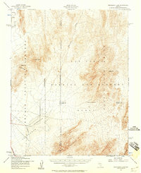 1952 Frenchman Lake1958 Print · USGSThe high Nevada desert at the dawn of the atomic age is captured here during a pivotal moment of military expansion. Trace the early road network of the Nevada Proving Grounds and locate landmarks like French Peak and Yucca Flat.3 unique versions available
 - 1953 Map of Muddy Peak, 1954 Print
 1953 Muddy Peak1954 Print · USGSThe northern Mojave Desert comes into focus in the early 1950s, highlighting the mining activity and natural landmarks of Clark County. Researchers can locate the American Borax Co Mines, the Colorock Quarry, and historical routes like the Arrowhead Trail.3 unique versions available
 - 1953 Map of Overton Beach, 1955 Print
 1953 Overton Beach1955 Print · USGSThe northern reaches of the reservoir appear in the mid-1950s as the rising waters reshaped the Clark County desert. Researchers can trace the submerged sites of St. Thomas and Kaolin or locate mining landmarks like the Nevada Silica Sand Mine and Florence Mine.4 unique versions available
 - 1953 Map of Iceberg Canyon, 1955 Print
 1953 Iceberg Canyon1955 Print · USGSThe northern reaches of the Colorado River and Lake Mead appear here in the early fifties, documenting a landscape of remote mines and deep desert canyons. Genealogists and historians can trace old routes like the Scanlon Dugway or locate the Union Mine and Lakeshore Mine.3 unique versions available
 - 1953 Map of Gold Butte, 1955 Print
 1953 Gold Butte1955 Print · USGSThe Clark County desert comes alive in the early fifties, showing the remote mining camps and peaks between the Virgin Mountains and the Arizona border. Researchers can trace the haul roads to the Gold Butte Mine, Tramp Mine, and the unique geological sinkhole at Devils Throat.3 unique versions available
 - 1953 Map of Hoover Dam, 1955 Print
 1953 Hoover Dam1955 Print · USGSThe Clark County desert and the Colorado River border appear here in the early fifties during the height of the post-war recreation era. Researchers can trace the original shoreline access via Bonelli Landing Road and locate remote desert workings like the Old Pope Mine.3 unique versions available
 - 1953 Map of Virgin Basin, 1955 Print
 1953 Virgin Basin1955 Print · USGSThe rising waters of Lake Mead are the focus of this mid-fifties study of the Nevada-Arizona borderlands. Researchers can trace the submerged river geography and find land-based markers like the Lakeside Mine, Bonelli Landing, and the Ferry Road.3 unique versions available
 - 1954 Map of Las Vegas
 1954 Las Vegas1954 Print · USGSLas Vegas and the Mojave Desert are shown in the early fifties as the region's military and recreational footprint expanded. Genealogists and historians can trace the early layout of North Las Vegas, the sites of Indian Springs Air Force Base, and long-established towns like Bunkerville.5 unique versions available
 - 1954 Map of Kingman, 1964 Print
 1954 Kingman1964 Print · USGSThe High Desert borderlands come to life in the mid-fifties, showing the intersection of mining legacies and massive river projects. Researchers can trace old rail stops like Roach Station, mining sites such as Chloride, and river landmarks like Searchlight Ferry.4 unique versions available
 - 1955 Map of Kingman
 1955 Kingman1955 Print · USGSThe Mojave Desert and Colorado River corridor come alive in the mid-fifties, showing a landscape of mining camps and rail junctions. Trace the river to the Searchlight Ferry or locate old desert mining sites like Goldroad and the Great Monster Mine.
 - 1955 Map of Roach Lake, 1957 Print
 1955 Roach Lake1957 Print · USGSThe Mojave Desert at the Nevada-California line appears here in the mid-fifties, dominated by mining claims and railroad outposts. Researchers can trace the paths of the Union Pacific and Old Traction Road to find the Christmas Mine and the settlement of Roach.4 unique versions available
 - 1956 Map of Ivanpah, 1957 Print
 1956 Ivanpah1957 Print · USGSThe Mojave Desert at the California-Nevada line reveals a network of high-altitude mines and railroad outposts in the mid-1950s. Trace the history of extraction at the Morning Star Mine or locate the old stop at Vanderbilt along the Union Pacific line.3 unique versions available
 - 1956 Map of Clark Mountain, 1957 Print
 1956 Clark Mountain1957 Print · USGSThe high Mojave desert at the California-Nevada border reveals a landscape shaped by mining and early freighting in the mid-1950s. Trace the paths of prospectors through the Clark Mountain Range to the Colosseum Mine, Greens Mill, and the Old Traction Road.3 unique versions available
 - 1956 Map of Shenandoah Peak, 1957 Print
 1956 Shenandoah Peak1957 Print · USGSThe Nevada-California borderlands were defined by remote mining camps and boundary surveys during the mid-fifties. Researchers can trace the extensive legacy of the SPRING MOUNTAINS mineral belt through sites like the Potosi Mine, the VON SCHMIDT LINE, and the Ripley (Site).3 unique versions available
 - 1956 Map of Horse Thief Springs, 1957 Print
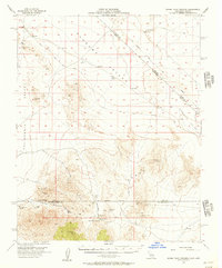 1956 Horse Thief Springs1957 Print · USGSIn the mid-fifties, the rugged desert border between California and Nevada remained a frontier for mineral prospectors and travelers. You can trace the Old Traction Road past numerous mining sites like the Silver Rule Mine and Jupiter Mine.3 unique versions available
 - 1956 Map of Homer Mtn, 1958 Print
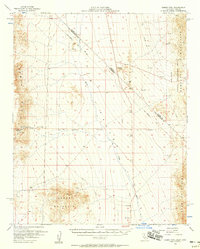 1956 Homer Mtn1958 Print · USGSSan Bernardino County and the Nevada borderland are captured here in the mid-1950s, detailing a landscape of historic desert crossings and early boundary lines. Researchers can trace the Old Government Road past Fort Piute (Ruins) or locate the Juniper Mine and Petroglyphs.4 unique versions available
Showing maps 1-25 of 56
Top cities of Clark County
- Las Vegas historical maps
- Henderson historical maps
- North Las Vegas historical maps
- Enterprise historical maps
- Spring Valley historical maps
- Sunrise Manor historical maps
See more
Frequently asked questions
- What are the different types of historical maps available for Clark County?
- What is the oldest map of Clark County?
- Where can I purchase historical maps of Clark County for my home or office?
- Where can I download high-res historical maps of Clark County?
- Are there historical topographic maps available for Clark County?
- Is there historical aerial imagery available for Clark County?
- Where are historical maps of Clark County sourced from?