1960s Maps of Clark County, Nevada
Explore 20 historic maps of Clark County from the 1960s. These maps offer a rare glimpse into what life looked like during the 1960s — showing old roads, neighborhoods, homes, and landmarks that have changed or disappeared over time.
Whether you're researching your family's past, planning a metal detecting trip, or studying how Clark County's landscape evolved across the 1960s, these high-resolution maps are a powerful tool for exploring the history of this region.
- Focus on a specific era: All maps on this page are from the 1960s, giving you a focused view of this time period.
- See what’s changed: Compare century-old streets, trails, and buildings to today's modern landscape using overlays and satellite layers.
- Research with precision: Use these maps for genealogy, historical research, land use analysis, or educational projects.
- View, download, or print: Maps are fully viewable online in high resolution, and can be downloaded or printed for your own records.
Start exploring Clark County's history through authentic maps from the 1960s. This is your window into the past.
Clark County, NV maps
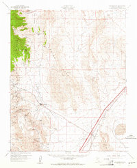
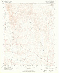
(20)- 1960 Map of Kingman
 1960 Kingman1960 Print · USGSThe high desert landscape of the Arizona-Nevada border comes alive in the mid-twentieth century, showcasing the rise of recreation alongside deep-rooted mining history. Genealogists and historians can trace the roots of towns like Kingman and Oatman, or locate remote sites like the Lucky Dutchman Mine and Santa Claus.3 unique versions available
 - 1960 Map of Goodsprings, 1961 Print
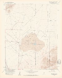
 1960 Goodsprings1961 Print · USGSIn the arid desert of southern Nevada during the early sixties, the mining district around Goodsprings remains a prominent fixture of the landscape. Researchers can trace dozens of specific claims like the Yellow Pine Mine and Bluejay Mine, or locate the isolated settlement of Jean near the Union Pacific tracks.2 unique versions available
 - 1960 Map of McCullough Mtn, 1961 Print
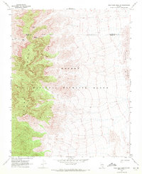
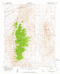 1960 McCullough Mtn1961 Print · USGSSouthern Nevada’s high desert landscape comes into focus during the early sixties, centered on the high peaks of the McCullough Range. Researchers can trace early water rights and desert transport routes through features like McClanahan Spring, the Silver Bell Mine, and the rail stop at Borax.2 unique versions available
 - 1960 Map of Hayford Peak, 1961 Print
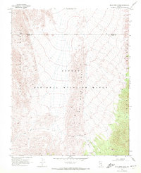
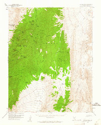 1960 Hayford Peak1961 Print · USGSThe high desert of Clark County was a landscape of remote mountain camps and vital springs in the early 1960s. Researchers can trace the isolated locations of Hidden Forest Cabin and Pine Nut Camp or locate water sources like Mormon Well.2 unique versions available
 - 1960 Map of Sloan, 1961 Print
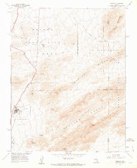
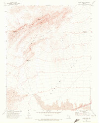
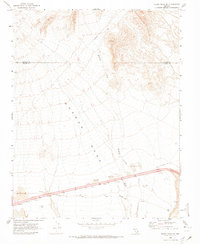
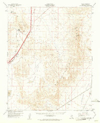 1960 Sloan1961 Print · USGSThe Clark County desert comes into focus in the early 1960s as a corridor of rail industry and mountain terrain. Trace the Union Pacific line through Sloan and Erie, or locate industrial landmarks like the Quarries and the Bard (Site).3 unique versions available
 - 1960 Map of Frenchman Flat, 1962 Print
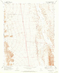
 1960 Frenchman Flat1962 Print · USGSThe Nevada desert at the dawn of the 1960s serves as a critical backdrop for Cold War history and atomic research. Researchers can trace the layout of early nuclear testing infrastructure, from the Blast Center and Sugar Bunker to the remote Cane Spring.3 unique versions available
 - 1961 Map of Mercury, 1962 Print
 1961 Mercury1962 Print · USGSThe base camp at Mercury and the Nevada Test Site appear here during the height of the early 1960s. Researchers can trace military infrastructure from Checkpoint Pass to the Eagle Roost Radio Tower and the Ranger Mountains.3 unique versions available
 - 1962 Map of Las Vegas
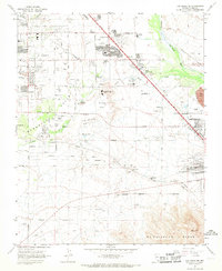
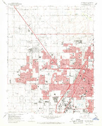
 1962 Las Vegas1962 Print · USGSSouthern Nevada is captured here during a period of significant military and industrial growth in the early sixties. Researchers can trace the development of Las Vegas alongside the Magnesium Plant in Henderson and the expansive Nellis Air Force Base.
 - 1967 Map of Las Vegas SE, 1968 Print
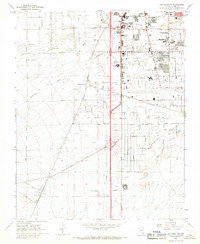
 1967 Las Vegas SE1968 Print · USGSThe southeastern Las Vegas valley in the late sixties shows a landscape transitioning from desert springs to industrial and suburban hubs. Trace early Clark County landmarks like Whitney Mesa, St Viator Sch, and the sprawling Henderson industrial works.5 unique versions available
 - 1967 Map of Las Vegas SW, 1968 Print
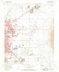
 1967 Las Vegas SW1968 Print · USGSThe southern Las Vegas valley in the mid-1960s was a desert landscape undergoing a dramatic industrial and recreational transformation. Local historians can trace early landmarks like the Stardust International Raceway and the Union Pacific Railroad stops at Arden and Bracken.5 unique versions available
 - 1967 Map of Las Vegas NW, 1968 Print
 1967 Las Vegas NW1968 Print · USGSMid-century Nevada comes alive in this survey of the desert metropolis during its rapid post-war expansion. Local historians can trace the foundations of modern neighborhoods through dozens of schools like Culley Sch and landmarks such as the North Las Vegas Air Terminal.6 unique versions available
 - 1967 Map of Las Vegas NE, 1968 Print
 1967 Las Vegas NE1968 Print · USGSGreater Las Vegas undergoes rapid suburban expansion in the late sixties, with residential grids reaching toward the desert foothills. Researchers can trace the mid-century city layout through Sunrise Acres, the Frenchman Mine, and dozens of local schools.6 unique versions available
 - 1969 Map of Farrier, 1972 Print
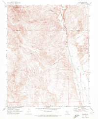 1969 Farrier1972 Print · USGSThe desert corridor along the Union Pacific railroad comes into focus in the late sixties, showcasing the remote landscape of southern Nevada. Researchers can trace the drainage of Meadow Valley Wash past the settlement of Farrier and locate numerous early mining Prospects.
 - 1969 Map of Rox SE, 1972 Print
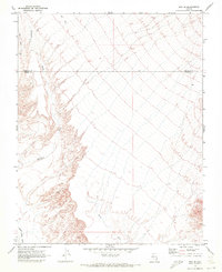 1969 Rox SE1972 Print · USGSThe high desert along the border of Clark and Lincoln counties comes into focus in this late 1960s study. Explorers and researchers can trace the paths of Meadow Valley Wash, a single Jeep Trail, and a remote Drill Hole in this arid landscape.2 unique versions available
 - 1969 Map of Wildcat Wash SE, 1972 Print
 1969 Wildcat Wash SE1972 Print · USGSThe high desert border of Clark and Lincoln counties comes into focus in the late sixties. Researchers can trace remote Jeep Trails and desert landmarks like Table Mountain, Dead Man Hill, and a lone mineral Prospect.2 unique versions available
 - 1969 Map of Moapa Peak, 1972 Print
 1969 Moapa Peak1972 Print · USGSThe high desert of southern Nevada comes into focus in the late sixties, where the Mormon Mountains meet the vast Mormon Mesa. Researchers can trace the path of an old Jeep Trail past isolated Ruins and the Sheep Canyon Reservoir.2 unique versions available
 - 1969 Map of Mule Deer Ridge SE, 1972 Print
 1969 Mule Deer Ridge SE1972 Print · USGSThe high Nevada desert at the close of the 1960s reveals a landscape of isolated springs and mountain trails. Researchers can locate remote water sources like Grapevine Spring and Cherry Spring, or trace the faint path of a Jeep Trail past unnamed ruins.2 unique versions available
 - 1969 Map of Mule Deer Ridge, 1972 Print
 1969 Mule Deer Ridge1972 Print · USGSSouthern Nevada's high basins and mountain spines are documented here in the late sixties, where the wildlife range meets the county line. Explore the primitive Dead Horse Trail and find cattle-era landmarks like a corral and scattered ruins.2 unique versions available
 - 1969 Map of Wildcat Wash SW, 1973 Print
 1969 Wildcat Wash SW1973 Print · USGSThe high Nevada desert at the cusp of the 1970s is captured here, showing the intersection of Lincoln and Clark counties. Local historians can trace early tracks like Sawmill Road or locate remote water points and industrial markers like Dry Well and Starvation Flat.2 unique versions available
 - 1969 Map of Moapa Peak SE, 1973 Print
 1969 Moapa Peak SE1973 Print · USGSSouthern Nevada in the late sixties shows a landscape of ancient paths and modern transit. Map collectors can trace the Old Spanish Trail across Mormon Mesa or locate early rural markers like Dean and Bush.2 unique versions available
End of results
Showing maps 1-20 of 20
Top cities of Clark County
- Las Vegas historical maps
- Henderson historical maps
- North Las Vegas historical maps
- Enterprise historical maps
- Spring Valley historical maps
- Sunrise Manor historical maps
See more
Frequently asked questions
- What are the different types of historical maps available for Clark County?
- What is the oldest map of Clark County?
- Where can I purchase historical maps of Clark County for my home or office?
- Where can I download high-res historical maps of Clark County?
- Are there historical topographic maps available for Clark County?
- Is there historical aerial imagery available for Clark County?
- Where are historical maps of Clark County sourced from?