1950s Maps of Nye County, Nevada
Explore 68 historic maps of Nye County from the 1950s. These maps offer a rare glimpse into what life looked like during the 1950s — showing old roads, neighborhoods, homes, and landmarks that have changed or disappeared over time.
Whether you're researching your family's past, planning a metal detecting trip, or studying how Nye County's landscape evolved across the 1950s, these high-resolution maps are a powerful tool for exploring the history of this region.
- Focus on a specific era: All maps on this page are from the 1950s, giving you a focused view of this time period.
- See what’s changed: Compare century-old streets, trails, and buildings to today's modern landscape using overlays and satellite layers.
- Research with precision: Use these maps for genealogy, historical research, land use analysis, or educational projects.
- View, download, or print: Maps are fully viewable online in high resolution, and can be downloaded or printed for your own records.
Start exploring Nye County's history through authentic maps from the 1950s. This is your window into the past.
Nye County, NV maps
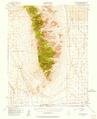
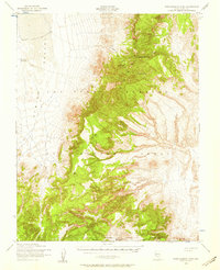
(68)- 1950 Map of Paradise Peak
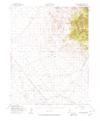
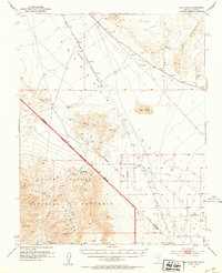
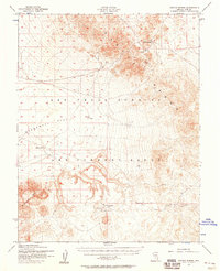
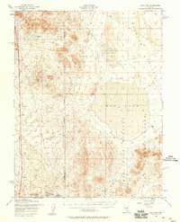
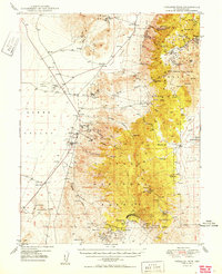 1950 Paradise Peak1950 Print · USGSMid-century mining operations dominate this Nye County landscape as industrial magnesite and tungsten extraction centers around Brucite. Local historians can trace the foundations of Downeyville or the active Illinois Mine and Paradise Mine.
 - 1950 Map of Ione
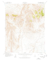
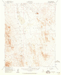
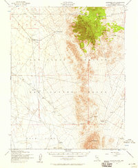
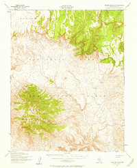
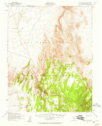
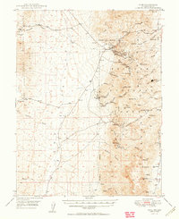 1950 Ione1950 Print · USGSThe Toiyabe Range in the early post-war years reveals a landscape of high-altitude mining claims and remote Nevada ranches. Genealogists and historians can trace the foundations of Ione and Berlin, or locate the Kohinoor Mine and Milton Ranch.2 unique versions available
 - 1951 Map of Green Springs, 1952 Print
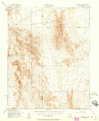
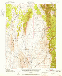 1951 Green Springs1952 Print · USGSWhite Pine County mining and ranching are recorded here in the early fifties. Local historians can trace old silver operations like the Ne Plus Ultra Mine or locate sites such as Shermantown and the Bull Creek Ranch.4 unique versions available
 - 1952 Map of Chloride Cliff
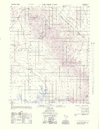 1952 Chloride Cliff1952 Print · USGSIn the early 1950s, the California-Nevada borderlands near the Grapevine Mountains still bore the marks of a fading mining era. Researchers can trace historic industrial sites like the Keane Wonder Mill, the remote Chloride City, and the Jean Lemoigne Grave.4 unique versions available
 - 1952 Map of Stinking Spring
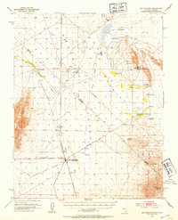
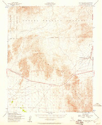
 1952 Stinking Spring1952 Print · USGSNye County ranching and mining gave way to Cold War military operations during the early fifties. Researchers can trace the layout of the Las Vegas Bombing and Gunnery Range alongside older sites like Longstreets Ranch and the Golden Arrow Mining Area.3 unique versions available
 - 1952 Map of Topopah Spring
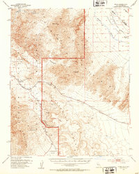
 1952 Topopah Spring1952 Print · USGSNye County’s high desert is captured here in the early fifties, showing the land as it was utilized for military operations. Researchers can trace early infrastructure across the Las Vegas Bombing and Gunnery Range and locate Topopah Spring.4 unique versions available
 - 1952 Map of Ash Meadows, 1953 Print
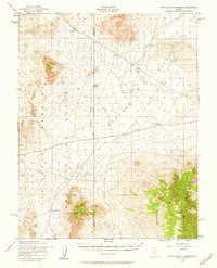
 1952 Ash Meadows1953 Print · USGSThe Nevada-California borderlands come alive in the early fifties, showing a desert landscape of remote ranches and defunct railroads. Trace the routes of the dismantled Death Valley Railroad and find long-gone sites like Hog Ranch and Franklin Well.4 unique versions available
 - 1952 Map of Ryan, 1953 Print
 1952 Ryan1953 Print · USGSThe California-Nevada borderlands are captured here in the early fifties, showcasing the intricate mining and rail infrastructure of the Death Valley region. Researchers can locate the settlement of Ryan, the industrial remains of the Inyo Mine, and the route of the Tonopah and Tidewater Railroad.5 unique versions available
 - 1952 Map of Big Dune, 1953 Print
 1952 Big Dune1953 Print · USGSThe Amargosa Desert in the early fifties shows a landscape of transitioning infrastructure and old mining camps. Genealogists and desert historians can trace the Tonopah and Tidewater Railroad corridor and locate former sites like Ashton and Lees Camp.3 unique versions available
 - 1952 Map of Mellan, 1958 Print
 1952 Mellan1958 Print · USGSNye County was becoming a hub for military aviation and desert operations during the early fifties. Researchers can trace the layout of the Las Vegas Bombing and Gunnery Range and find remote sites like Mellan, Wilsons Camp, and the Mining Area.3 unique versions available
 - 1952 Map of Tippipah Spring, 1958 Print
 1952 Tippipah Spring1958 Print · USGSThe high desert of Nye County is shown here during the early years of atomic testing and military operations. Researchers can trace the early infrastructure of the Nevada Proving Ground and Mercury Highway alongside natural landmarks like Tippipah Spring.3 unique versions available
 - 1952 Map of Kawich Peak, 1958 Print
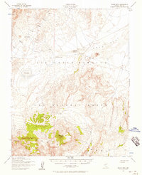
 1952 Kawich Peak1958 Print · USGSIn the early 1950s, this pocket of the Nevada interior balanced high-desert ranching with the growing needs of the military. Genealogists and historians can trace old homesteads like Breen Ranch or the operations at Silverbow and the Mining Area.3 unique versions available
 - 1952 Map of Cactus Spring, 1958 Print
 1952 Cactus Spring1958 Print · USGSNye County's high desert reveals its dual identity as a mining frontier and military range during the early fifties. Researchers can trace remote sites like Gold Crater (Site) and the Urania Mine among the peaks of the Cactus Range.3 unique versions available
 - 1952 Map of Quartzite Mtn, 1958 Print
 1952 Quartzite Mtn1958 Print · USGSNevada's high desert underwent a massive transformation during the Cold War as old ranching and mining lands were converted for military use. Researchers can trace the remnants of the Gold Reed (Site) alongside active Mining Area labels and various targets within the Las Vegas Bombing and Gunnery Range.4 unique versions available
 - 1952 Map of Papoose Lake, 1958 Print
 1952 Papoose Lake1958 Print · USGSThe Nevada desert in the early fifties shows a stark intersection of military testing grounds and high-desert wilderness. Trace early cold-war history across the Nevada Proving Grounds and the Las Vegas Bombing and Gunnery Range, or locate the isolated Kelly Mine.2 unique versions available
 - 1952 Map of White Blotch Springs, 1958 Print
 1952 White Blotch Springs1958 Print · USGSHigh desert military operations define this part of Nevada in the early fifties, where restricted zones meet the basin floor. You can trace the boundaries of the Bombing Range near White Blotch Springs and across the Penoyer Valley.3 unique versions available
 - 1952 Map of Reveille Peak, 1958 Print
 1952 Reveille Peak1958 Print · USGSNye County's high desert reveals its isolated ranching and military character in the early fifties. Genealogists and desert historians can trace the Cedar Pipeline Ranch, the Las Vegas Bombing and Gunnery Range, and the site of an early Landing Field (Aban'd).3 unique versions available
 - 1952 Map of Specter Range, 1958 Print
 1952 Specter Range1958 Print · USGSThe Nevada desert in the early fifties shows a landscape of military expansion and early atomic testing infrastructure. Researchers can trace the layout of Camp Desert Rock, the path of the Mercury Highway, and the remains of an Old Railroad Grade.3 unique versions available
 - 1952 Map of Timber Mountain, 1958 Print
 1952 Timber Mountain1958 Print · USGSNye County, Nevada, is shown in the early fifties as a restricted military zone within the Las Vegas Bombing and Gunnery Range. Researchers can trace the rugged desert geography of Pahute Mesa and identify isolated markers like a designated Target.3 unique versions available
 - 1952 Map of Wheelbarrow Peak, 1958 Print
 1952 Wheelbarrow Peak1958 Print · USGSNye County was becoming a focal point for military testing in the early fifties as the Cold War intensified. Researchers can trace the boundaries of the Las Vegas Bombing and Gunnery Range and locate isolated desert landmarks like Wheelbarrow Peak and Johnnies Water.3 unique versions available
 - 1952 Map of Mud Lake, 1958 Print
 1952 Mud Lake1958 Print · USGSNye County's high-desert landscape in the early fifties shows a region shifting from mining roots to military operations. Researchers can trace the Dismantled Railroad, locate the Silver King Mine, and identify Targets within the Mud Lake basin.2 unique versions available
 - 1952 Map of Silent Canyon, 1958 Print
 1952 Silent Canyon1958 Print · USGSNye County was a critical military landscape in the early fifties, serving as a vast testing ground. Researchers can trace the sparse infrastructure of the Las Vegas Bombing and Gunnery Range, including Gold Flat Well No 1 and a remote Landing Strip.3 unique versions available
 - 1952 Map of Black Mtn, 1958 Print
 1952 Black Mtn1958 Print · USGSNye County's high desert was a site of significant military activity during the early fifties, as shown on this survey of the Pahute Mesa. Researchers can locate critical water sources like Salisbury Well and prominent landmarks including Black Mtn and Mt Helen.2 unique versions available
 - 1952 Map of Goldfield, 1958 Print
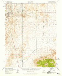 1952 Goldfield1958 Print · USGSGoldfield and its high-desert mining landscape are documented here during the early fifties as the region transitioned toward military use. Researchers can trace the remnants of a mining empire through the Columbia Mill, Florence Hill, and the local Cemetery.4 unique versions available
 - 1952 Map of Mercury, 1958 Print
 1952 Mercury1958 Print · USGSThe Nevada desert in the early fifties shows the high-security infrastructure of the atomic age. Historians can trace the original layout of Mercury and follow the path of the Mercury Highway as it climbs through Checkpoint Pass.2 unique versions available
Showing maps 1-25 of 68
Top cities of Nye County
- Pahrump historical maps
- Tonopah historical maps
- Amargosa Valley historical maps
- Beatty historical maps
- Scotty's Junction historical maps
- Reveille historical maps
Frequently asked questions
- What are the different types of historical maps available for Nye County?
- What is the oldest map of Nye County?
- Where can I purchase historical maps of Nye County for my home or office?
- Where can I download high-res historical maps of Nye County?
- Are there historical topographic maps available for Nye County?
- Is there historical aerial imagery available for Nye County?
- Where are historical maps of Nye County sourced from?