1900s (20th Century) Maps of Nye County, Nevada
Explore 547 historic maps of Nye County from the 1900s (20th Century). These maps offer a rare glimpse into what life looked like during the 1900s — showing old roads, neighborhoods, homes, and landmarks that have changed or disappeared over time.
Whether you're researching your family's past, planning a metal detecting trip, or studying how Nye County's landscape evolved across the 1900s, these high-resolution maps are a powerful tool for exploring the history of this region.
- Focus on a specific era: All maps on this page are from the 1900s, giving you a focused view of this time period.
- See what’s changed: Compare century-old streets, trails, and buildings to today's modern landscape using overlays and satellite layers.
- Research with precision: Use these maps for genealogy, historical research, land use analysis, or educational projects.
- View, download, or print: Maps are fully viewable online in high resolution, and can be downloaded or printed for your own records.
Start exploring Nye County's history through authentic maps from the 1900s. This is your window into the past.
Nye County, NV maps
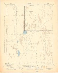
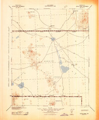
(547)- 1907 Map of Tonopah, 1955 Print
 1907 Tonopah1955 Print · USGSCentral Nevada's mining heartland comes alive in this survey of the high desert and mountain ranges at the peak of the silver and gold booms. Researchers can trace the early rail networks of the Goldfield RR and locate sites like Round Mountain, the Orizaba Mine, and Darrough's Hot Springs.
 - 1907 Map of Las Vegas, 1956 Print
 1907 Las Vegas1956 Print · USGSSouthern Nevada is shown at a pivotal moment in the early 1900s as the rail network began to transform the desert landscape. Genealogists and historians can locate early homesteads and landmarks like Las Vegas Ranch, Mormon Well, and the Stirling Mine.
 - 1908 Map of Kawich
 1908 Kawich1908 Print · USGSNye County's high-desert mining frontier is documented here just after the turn of the century as camps and rail lines began to stitch together the valleys. You can trace early logistics and family landholdings at Longstreets Ranch, the isolated Gold Reed Kawich PO, and the Bullfrog Goldfield RR junction.3 unique versions available
 - 1908 Map of Lida
 1908 Lida1908 Print · USGSEsmeralda County enters its mining peak at the start of the twentieth century as rail lines and boomtowns transform the high desert. Researchers can trace the exact layout of the Tonopah and Goldfield RR, find remote camps like Diamondfield, and locate the Rattlesnake Mine.
 - 1908 Map of Furnace Creek
 1908 Furnace Creek1908 Print · USGSThe California-Nevada borderlands hummed with mining activity in the early twentieth century as new rail lines reached into the desert. Genealogists and historians can trace pioneer outposts like Rhyolite, industrial sites like the Keane Wonder Mine, and the springs of Ash Meadows.
 - 1908 Map of Las Vegas
 1908 Las Vegas1908 Print · USGSSouthern Nevada was a frontier of rail and ranching in the years before major desert expansion. Trace the early footprints of Las Vegas and its surrounding outposts like Arden, Bracken, and the Stirling Mine.4 unique versions available
 - 1908 Map of Tonopah
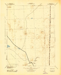
 1908 Tonopah1908 Print · USGSCentral Nevada's mining boom is frozen in time in this early century survey of the Tonopah and Manhattan districts. Trace the old Tonopah and Goldfield RR lines to vanished camps like Berlin and active sites such as the Nevada Mine.3 unique versions available
 - 1908 Map of Ballarat
 1908 Ballarat1908 Print · USGSInyo County was a frontier of mining and survival in the early 1900s, where water and ore dictated the settlement patterns. Researchers can locate remote camps like Skidoo and Harrisburg, or trace the vital network of desert water at Stovepipe Wells and Warm Sulphur Spring.
 - 1908 Map of Carson Sink, 1954 Print
 1908 Carson Sink1954 Print · USGSChurchill County at the opening of the century reveals a landscape of desert mining camps and nascent river irrigation. Genealogists and historians can trace the early streets of Fallon, the remote Nevada Hills Mine, and the location of Dixie.3 unique versions available
 - 1909 Map of Hawthorne, 1955 Print
 1909 Hawthorne1955 Print · USGSWestern Nevada and the California borderlands are captured here during the height of the early mining era. Genealogists and historians can trace rail-depot life and remote outposts from Hawthorne to Belleville, including vanished sites like Oro City and Buckley Camp.
 - 1910 Map of Furnace Creek
 1910 Furnace Creek1910 Print · USGSThe Nevada and California borderlands thrive during a historic mining boom in this early twentieth-century survey. Researchers can trace the rise of desert settlements like Rhyolite and Gold Center or locate industrial sites such as the Keane Wonder Mine and Borax Mill.5 unique versions available
 - 1910 Map of Carson Sink
 1910 Carson Sink1910 Print · USGSWestern Nevada at the end of the first decade of the century shows a landscape defined by desert mining camps and the burgeoning Carson-Truckee irrigation projects. Genealogists and historians can trace the early streets of Fallon or locate remote camps like Rawhide and the Nevada Wonder Mine.5 unique versions available
 - 1910 Map of Ivanpah, 1957 Print
 1910 Ivanpah1957 Print · USGSThe Mojave high desert at the start of the twentieth century was a landscape of remote mining camps and vital railroad junctions. Trace the early industrial footprint of Vanderbilt, the Copper World Mine, and the rail stops at Nipton and Kelso.
 - 1911 Map of Hawthorne
 1911 Hawthorne1911 Print · USGSEarly Nevada mining and rail history come alive in this survey of the Walker Lake region during the era of steam and silver. Researchers can trace the routes of the Southern Pacific System and locate the sites of Lucky Boy, Marietta, and Belleville.4 unique versions available
 - 1912 Map of Ivanpah
 1912 Ivanpah1912 Print · USGSThe Mojave high desert at the border of California and Nevada was a bustling corridor of mining and transcontinental rail at the start of the century. Genealogists and historians can trace defunct settlements and industrial sites like the abandoned copper smelter, Good Springs, and the Old Traction Road.5 unique versions available
 - 1913 Map of Lida
 1913 Lida1913 Print · USGSThe Nevada and California borderlands appear here at the peak of the gold rush era, centered on the bustling streets of Goldfield. Genealogists and historians can trace the early rail networks of the Bullfrog Goldfield RR and locate camps like Gen Thomas Camp or the remote Palmetto Mine.5 unique versions available
 - 1913 Map of Ballarat
 1913 Ballarat1913 Print · USGSThe high desert of Inyo County is documented here during a period of intense mining and early water development. Genealogists and desert historians can trace the foundations of Ballarat, the Southern Pacific RR line, and active sites like Skidoo or the Cerro Gordo Mines.7 unique versions available
 - 1915 Map of Hawthorne, 1951 Print
 1915 Hawthorne1951 Print · USGSWestern Nevada at the turn of the century shows a landscape dominated by mining outposts and the reaching arms of the Southern Pacific System. Genealogists can trace early residents to sites like Candelaria, Sodaville, and Mina or locate vanished camps such as Buckley Camp.
 - 1926 Map of Roberts Mountains, 1955 Print
 1926 Roberts Mountains1955 Print · USGSCentral Nevada in the mid-1920s is a landscape of remote mountain ranges and isolated valley ranching. Genealogists and historians can trace family-named locations like Hall Creek Ranch, Sadler Sch, and the Keystone Mine across the high desert.
 - 1929 Map of Roberts Mountains
 1929 Roberts Mountains1929 Print · USGSCentral Nevada in the late 1920s reveals a vast ranching and mining landscape organized around vital water sources. Researchers can trace early family outposts like Roberts Creek Ranch and Grubbs Ranch or locate remote schools such as Simpson Park Sch.4 unique versions available
 - 1942 Map of Emigrant Valley
 1942 Emigrant Valley1942 Print · USGSThe Nevada desert underwent a major wartime transformation in the early 1940s as vast tracts were designated for defense. Researchers can trace the early Military Reservation Boundary and locate isolated landmarks like the mine at Groom and the peak of Bald Mountain.
 - 1942 Map of Tolicha Peak
 1942 Tolicha Peak1942 Print · USGSNye County ranching and early military expansion meet in the early 1940s. Researchers can locate remote desert outposts like Springdale and Howell Ranch or trace the early boundary of the Tonopah Bombing and Gunnery Range.
 - 1942 Map of Indian Spring
 1942 Indian Spring1942 Print · USGSSouthern Nevada's desert landscape is captured here in the early forties as military interests began to redefine the territory. Researchers can trace the early layout of Indian Spring and find remote water sources like Quartz Spring and Mesquite Spring.
 - 1942 Map of Ivanpah
 1942 Ivanpah1942 Print · USGSThe Mojave Desert frontier comes into focus during the early war years, showing a landscape shaped by mining and rail. You can trace the path of the Union Pacific through remote stops like Nipton, Goodsprings, and the junction at Barnwell.
 - 1942 Map of Cactus Range
 1942 Cactus Range1942 Print · USGSNye County was undergoing a major military transformation during the early forties as ranching and mining land was repurposed for defense. Researchers can find old desert outposts like Golden Arrow and Trappmans Camp alongside vital water sources such as Antelope Springs and Cactus Spring.
Showing maps 1-25 of 547
Top cities of Nye County
- Pahrump historical maps
- Tonopah historical maps
- Amargosa Valley historical maps
- Beatty historical maps
- Scotty's Junction historical maps
- Reveille historical maps
Frequently asked questions
- What are the different types of historical maps available for Nye County?
- What is the oldest map of Nye County?
- Where can I purchase historical maps of Nye County for my home or office?
- Where can I download high-res historical maps of Nye County?
- Are there historical topographic maps available for Nye County?
- Is there historical aerial imagery available for Nye County?
- Where are historical maps of Nye County sourced from?