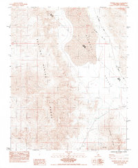
1980s Maps of Nye County, Nevada
Explore 207 historic maps of Nye County from the 1980s. These maps offer a rare glimpse into what life looked like during the 1980s — showing old roads, neighborhoods, homes, and landmarks that have changed or disappeared over time.
Whether you're researching your family's past, planning a metal detecting trip, or studying how Nye County's landscape evolved across the 1980s, these high-resolution maps are a powerful tool for exploring the history of this region.
- Focus on a specific era: All maps on this page are from the 1980s, giving you a focused view of this time period.
- See what’s changed: Compare century-old streets, trails, and buildings to today's modern landscape using overlays and satellite layers.
- Research with precision: Use these maps for genealogy, historical research, land use analysis, or educational projects.
- View, download, or print: Maps are fully viewable online in high resolution, and can be downloaded or printed for your own records.
Start exploring Nye County's history through authentic maps from the 1980s. This is your window into the past.
Nye County, NV maps
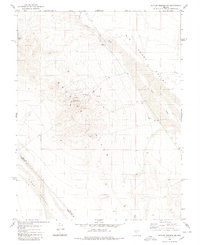
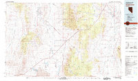
(207)- 1980 Map of Arc Dome
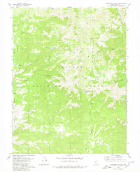
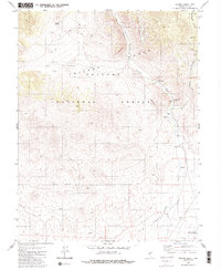
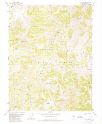 1980 Arc Dome1980 Print · USGSThe Toiyabe Range high country is captured here in the late 1970s, showcasing a wilderness of deep canyons and prominent summits. Researchers can trace the Pack Trail network past the Upper Corral, the Reese River headwaters, and several remote Prospects.3 unique versions available
 - 1980 Map of Cole Spring
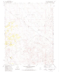
 1980 Cole Spring1980 Print · USGSEsmeralda and Nye counties meet at the high-desert spring and rugged mountain ridges documented here in the early eighties. Researchers can locate remote mineral prospects, a quarry, and the vital water source at Cole Spring along the edge of the Cirac Valley.2 unique versions available
 - 1980 Map of Cloverdale Ranch
 1980 Cloverdale Ranch1980 Print · USGSNye County ranching and mining interests come into focus in this late twentieth-century survey of the high-desert borderlands. Researchers can trace the layout of the Cloverdale Ranch and locate historical mining sites like the Orizaba Mine and Prospect.
 - 1980 Map of Outlaw Springs SE
 1980 Outlaw Springs SE1980 Print · USGSThe Nevada desert landscape at the border of Nye and Esmeralda counties is revealed in this 1980 survey of the mining districts east of Cirac Valley. Researchers can trace old prospecting sites like USMM Big Smoky, locate unnamed Ruins, and follow a network of Jeep Trails through the hills.
 - 1980 Map of Outlaw Springs NE
 1980 Outlaw Springs NE1980 Print · USGSThe high desert of Nye and Esmeralda counties is captured here in the 1980s, showcasing a landscape defined by mineral exploration and arid basins. Researchers can trace the network of Jeep Trails connecting remote Mines, Prospects, and exploratory Drill Holes throughout the Royston Hills.
 - 1980 Map of Mount Annie
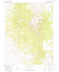
 1980 Mount Annie1980 Print · USGSThe high desert of Mineral and Nye Counties is shown here in the 1980s, highlighting the geothermal features and remote basins of the Nevada interior. Researchers can trace land use through isolated Prospects, water sources like Hot Well, and landmarks including Mount Annie.
 - 1980 Map of Black Spring NW
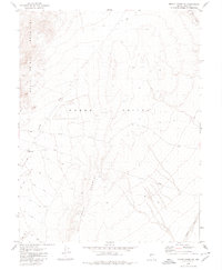
 1980 Black Spring NW1980 Print · USGSIone Valley and the Shoshone Mountains are captured in the late 1970s, revealing the remote geography of Nye County. Researchers can trace high-desert watercourses like Ione Wash and Cottonwood Creek or explore the rugged trails leading into Toiyabe National Forest.
 - 1980 Map of Secret Basin
 1980 Secret Basin1980 Print · USGSThe Toiyabe Range in the late twentieth century reveals a landscape of high-elevation basins and essential water sources. Genealogists and researchers can trace old routes and mining Prospects near Secret Basin, Mississippi Springs, and Rainier Mountain.
 - 1980 Map of Farrington Canyon
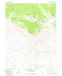
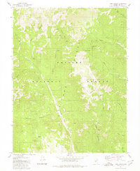
 1980 Farrington Canyon1980 Print · USGSNye County ranching and mountain landscapes are captured here during the late 1970s. Researchers can locate the Farrington Ranch and trace vital water sources like Barney Meadows Spring and Cloverdale Creek.
 - 1980 Map of Black Spring
 1980 Black Spring1980 Print · USGSThe high desert of Nye and Mineral Counties is revealed in the late seventies as a land of expansive basins and hidden springs. Researchers can trace the paths of Ione Wash or locate remote sites like Black Spring and a lonely Prospect near the Royston Hills.
 - 1980 Map of Mount Ardivey
 1980 Mount Ardivey1980 Print · USGSNye County's high-elevation mining district and forest boundary are captured here in the late seventies and early eighties. Researchers can trace the remnants of old camps at Golden (Ruins) and locate mineral workings such as the Golden King Mine and various Prospects.
 - 1980 Map of Mount Annie NE
 1980 Mount Annie NE1980 Print · USGSNye County in the late seventies and early eighties shows a landscape of high desert exploration and rugged transit. Researchers can trace the path of a Pipeline across Gabbs Valley or locate mineral interests at Prospect sites.
 - 1980 Map of Peavine Ranch
 1980 Peavine Ranch1980 Print · USGSNye County ranching and forest land come into focus during the late seventies as the high peaks give way to the valley floor. Trace the locations of Peavine Ranch and its corrals, old prospects, and vital water sources like Mustang Spring.2 unique versions available
 - 1980 Map of Toms Canyon
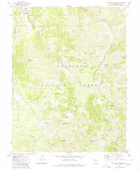
 1980 Toms Canyon1980 Print · USGSNye County's high-elevation backcountry is captured here during the late 1970s, showcasing the intricate drainage systems of the Toiyabe Range. Researchers can trace old routes like the Pack Trail to historic sites such as the Wall Canyon Mine and Keough Spring.2 unique versions available
 - 1980 Map of Bakeoven Creek
 1980 Bakeoven Creek1980 Print · USGSNye County in the 1980s reveals a high-desert landscape defined by the Toiyabe Range and the Yomba Indian Res. Researchers can trace remote routes and isolated structures including the Stone Cabin, Potosi Cabin, and seasonal drainages like Bakeoven Creek.
 - 1980 Map of Granny Goose Well
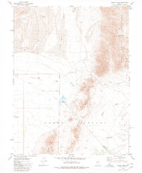
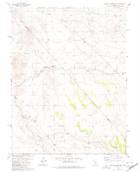 1980 Granny Goose Well1980 Print · USGSStewart Valley and the Nye-Mineral county line appear here as they were in the late 1970s. Researchers can locate the historical Antone Station (Site), trace remote water sources like Granny Goose Well, and find old desert workings near Indian Well.
 - 1980 Map of Duckwater, 1981 Print
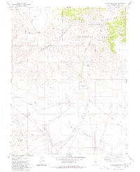
 1980 Duckwater1981 Print · USGSNye County and White Pine County are shown here in the early eighties as a landscape of isolated valleys and high mountain ranges. Genealogists and researchers can trace remote settlements like Duckwater, locate the Gold Point Mine, or find the unique Meteorite Crater.2 unique versions available
 - 1982 Map of Wilson Creek Range
 1982 Wilson Creek Range1982 Print · USGSLincoln County mining districts and high-desert basins are captured here in the early eighties as the region balanced mineral production with early conservation. Researchers can trace historic industrial sites like the Atlanta Mine and Bristol Silver Mine or locate remote landmarks such as The Hermitage.
 - 1984 Map of Point of Rocks
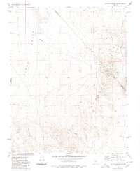
 1984 Point of Rocks1984 Print · USGSSouthern Nevada in the mid-eighties was a landscape defined by military research and the high desert of the Nevada Test Site. Genealogists and researchers can locate specific infrastructure like Army Well No 1, the State Historical Mon #165, and numerous Prospects throughout the Specter Range.2 unique versions available
 - 1984 Map of Skeleton Hills
 1984 Skeleton Hills1984 Print · USGSNye County's arid interior is captured here in the early eighties as mining and utility expansion left their mark on the Amargosa Desert. Researchers can trace the old Railroad Grade and locate numerous Prospects tucked into the Skeleton Hills.2 unique versions available
 - 1984 Map of Sixmile Spring
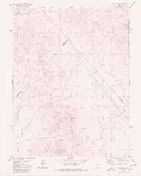
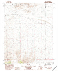
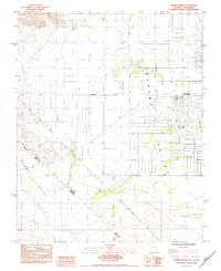 1984 Sixmile Spring1984 Print · USGSPahrump and the surrounding high desert are shown here in the mid-eighties as residential development began to reshape the valley. Genealogists and historians can trace the early street grid and find markers like the Von Schmidt Line and Sixmile Spring.
 - 1984 Map of Niavi Wash
 1984 Niavi Wash1984 Print · USGSThe northern edge of the Spring Mountains meets the desert floor in the early eighties, just as it crosses the Clark and Nye County line. Researchers can locate the boundary of the Nevada Test Site and trace infrastructure like Highway 95 and several scattered Borrow Pits.
 - 1984 Map of Pahrump NE
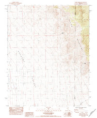
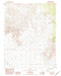 1984 Pahrump NE1984 Print · USGSThe high desert canyons of the Spring Mountains are captured in the mid-1980s, documenting a landscape of steep drainages and primitive roads. Trace the paths of Lee Canyon, Carpenter Canyon, and the utility corridor for the Wooden Power Transmission Line.
 - 1984 Map of Horse Springs
 1984 Horse Springs1984 Print · USGSThe high desert border between Nye and Clark Counties comes into focus in this early 1980s record of the basin-and-range landscape. Researchers can trace the winding Wheeler Pass Road and locate critical water sources like Santa Cruz Spring and Horse Springs.
 - 1984 Map of Stewart Valley
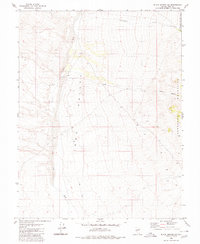
 1984 Stewart Valley1984 Print · USGSThe California-Nevada borderlands are mapped here in the early eighties as a rugged corridor of mining and early surveying. Trace historical boundaries along the Von Schmidt Line (1873) or locate desert work sites like the Shaw Mine and Gravel Pit.
Showing maps 1-25 of 207
Top cities of Nye County
- Pahrump historical maps
- Tonopah historical maps
- Amargosa Valley historical maps
- Beatty historical maps
- Scotty's Junction historical maps
- Reveille historical maps
Frequently asked questions
- What are the different types of historical maps available for Nye County?
- What is the oldest map of Nye County?
- Where can I purchase historical maps of Nye County for my home or office?
- Where can I download high-res historical maps of Nye County?
- Are there historical topographic maps available for Nye County?
- Is there historical aerial imagery available for Nye County?
- Where are historical maps of Nye County sourced from?