1960s Maps of Nye County, Nevada
Explore 141 historic maps of Nye County from the 1960s. These maps offer a rare glimpse into what life looked like during the 1960s — showing old roads, neighborhoods, homes, and landmarks that have changed or disappeared over time.
Whether you're researching your family's past, planning a metal detecting trip, or studying how Nye County's landscape evolved across the 1960s, these high-resolution maps are a powerful tool for exploring the history of this region.
- Focus on a specific era: All maps on this page are from the 1960s, giving you a focused view of this time period.
- See what’s changed: Compare century-old streets, trails, and buildings to today's modern landscape using overlays and satellite layers.
- Research with precision: Use these maps for genealogy, historical research, land use analysis, or educational projects.
- View, download, or print: Maps are fully viewable online in high resolution, and can be downloaded or printed for your own records.
Start exploring Nye County's history through authentic maps from the 1960s. This is your window into the past.
Nye County, NV maps
(141)- 1960 Map of Reno
 1960 Reno1960 Print · USGSThe high desert of western Nevada comes alive in this mid-century survey of the Reno-Tahoe region. Genealogists and historians can trace rail lines like the Southern Pacific RR and locate remote outposts such as Olinghouse, Nixon, and the Olinghouse Mine.2 unique versions available
 - 1960 Map of Lund
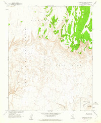
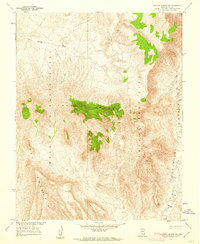
 1960 Lund1960 Print · USGSEastern Nevada and the Utah borderlands are mapped here during the mid-twentieth century, showing a landscape of high peaks and isolated ranching outposts. Researchers can locate remote mining sites like the Tungsten Queen Mine and early settlements including Lund and Shoshone.
 - 1960 Map of Kingman
 1960 Kingman1960 Print · USGSThe high desert landscape of the Arizona-Nevada border comes alive in the mid-twentieth century, showcasing the rise of recreation alongside deep-rooted mining history. Genealogists and historians can trace the roots of towns like Kingman and Oatman, or locate remote sites like the Lucky Dutchman Mine and Santa Claus.3 unique versions available
 - 1960 Map of Tonopah, 1961 Print
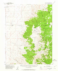
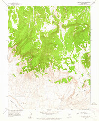
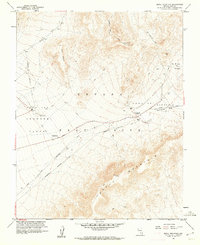
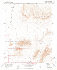
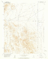
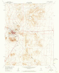 1960 Tonopah1961 Print · USGSThe high-desert mining hub of Tonopah is captured here in the early 1960s at the intersection of Nye and Esmeralda counties. Researchers can trace historic mineral claims and local landmarks like Mizpah Hill, Boston Tonopah, and Henderson Park.4 unique versions available
 - 1960 Map of Yucca Flat, 1961 Print
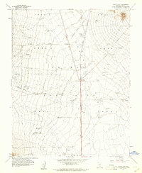 1960 Yucca Flat1961 Print · USGSYucca Flat and the surrounding desert were at the height of the atomic age during this 1960 survey by the Atomic Energy Commission. Researchers can trace the layout of the Nevada Test Site, locating technical landmarks like the BJ Wye, a Launching Pad, and several Blast Centers.3 unique versions available
 - 1960 Map of Tippipah Spring, 1961 Print
 1960 Tippipah Spring1961 Print · USGSNye County's high desert was a hub of nuclear research in the early sixties, as shown by the Atomic Energy Commission's footprint. Trace military and geological history across Syncline Ridge and the Nevada Test Site, locating the Observation Station and Tippipah Spring.3 unique versions available
 - 1960 Map of Dianas Punch Bowl, 1962 Print
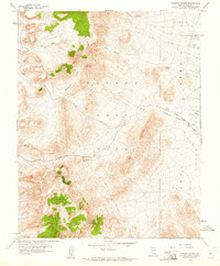
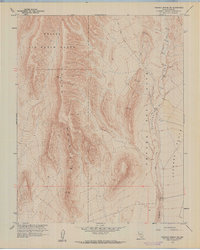
 1960 Dianas Punch Bowl1962 Print · USGSCentral Nevada's high basin and range country is documented here during the early sixties, showing a landscape of remote cattle operations and geothermal features. Researchers can find old homesteads and water rights including Potts Ranch, Dianas Punch Bowl, and the Willow Creek Ranch.3 unique versions available
 - 1960 Map of Oak Spring, 1962 Print
 1960 Oak Spring1962 Print · USGSNye County was at the heart of the atomic age in the early sixties, as this specialized survey shows the integration of military testing zones into the desert landscape. Researchers can locate specific test sites like Teapot Crater, the Climax Mine, and Smoky (Blast Center).3 unique versions available
 - 1960 Map of Wildcat Peak, 1962 Print
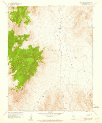
 1960 Wildcat Peak1962 Print · USGSIn the early 1960s, the high desert of the Nye and Lander county line was a landscape defined by remote ranching and mining. Researchers can trace the water sources and trails that sustained life here, from the Bronco Mine and Indian Ranch to the prehistoric Toquima Cave.2 unique versions available
 - 1960 Map of Plutonium Valley, 1962 Print
 1960 Plutonium Valley1962 Print · USGSNye County's desert floor became a focal point of the atomic age during this era of intensive nuclear testing. Researchers can pinpoint the exact locations of several Blast Centers, a Bunker, and the Radioactive Waste Dump within Plutonium Valley.3 unique versions available
 - 1960 Map of Frenchman Flat, 1962 Print
 1960 Frenchman Flat1962 Print · USGSThe Nevada desert at the dawn of the 1960s serves as a critical backdrop for Cold War history and atomic research. Researchers can trace the layout of early nuclear testing infrastructure, from the Blast Center and Sugar Bunker to the remote Cane Spring.3 unique versions available
 - 1961 Map of Death Valley
 1961 Death Valley1961 Print · USGSDeath Valley and the Nevada borderlands are shown in the early sixties as a landscape of military testing and historic mining. Genealogists and researchers can locate remote settlements like Rhyolite, active operations at Darwin Mines, and cold-war sites such as the Nevada Proving Grounds.
 - 1961 Map of Ammonia Tanks, 1962 Print
 1961 Ammonia Tanks1962 Print · USGSNye County, Nevada, is shown in the early sixties as the Nevada Test Site expanded across the high desert plateaus. Researchers can trace remote jeep trails and locate isolated landmarks like Ammonia Tanks, Landmark Rock, and Pahute Mesa.2 unique versions available
 - 1961 Map of Topopah Spring SW, 1962 Print
 1961 Topopah Spring SW1962 Print · USGSThe Nevada desert at the height of the Cold War reveals a landscape dedicated to military and atomic research. Researchers can trace the boundaries of the Nevada Test Site and Nellis Air Force Range across Yucca Mountain.6 unique versions available
 - 1961 Map of Scrugham Peak, 1962 Print
 1961 Scrugham Peak1962 Print · USGSThe desert highlands of Nye County are captured here in the early 1960s, a time of significant Cold War operations. Military and scientific researchers can trace the boundaries of Area 18 and the restricted Nevada Test Site near Scrugham Peak.
 - 1961 Map of Mine Mountain, 1962 Print
 1961 Mine Mountain1962 Print · USGSThe Nevada high desert at the height of the Cold War is captured here during the expansion of the Nevada Test Site. Researchers can trace remote infrastructure across Mid Valley to specific locations like Mine Mountain Junction and Jackass Divide.3 unique versions available
 - 1961 Map of Skull Mountain, 1962 Print
 1961 Skull Mountain1962 Print · USGSThe Nevada desert in the early sixties reveals a landscape transformed by atomic research and federal oversight. Researchers can trace the layout of the Nevada Test Site and find the location of the old Wahmonie (Site) near Cane Spring.4 unique versions available
 - 1961 Map of Yucca Lake, 1962 Print
 1961 Yucca Lake1962 Print · USGSNye County's atomic landscape comes into focus during the early 1960s, showing the intersection of desert terrain and nuclear testing infrastructure. Researchers can trace specialized Cold War sites like News Nob, the Smoky Junior Radio Tower, and the dry Yucca Lake bed.2 unique versions available
 - 1961 Map of Topopah Spring NW, 1962 Print
 1961 Topopah Spring NW1962 Print · USGSNye County was a center of high-security military and nuclear research during the early sixties. Researchers can trace the restricted boundaries of the Nevada Test Site and the rugged peaks of Yucca Mountain and the Galico Hills.3 unique versions available
 - 1961 Map of Tonopah, 1962 Print
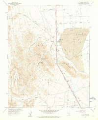
 1961 Tonopah1962 Print · USGSThe silver-rich hub of Tonopah is captured here in the early 1960s, showing the town surrounded by a labyrinth of mining claims and rugged desert peaks. Genealogists and historians can locate specific sites like the Belle of Tonopah Mine, the old settlement at Rays, and landmarks such as Henderson Park.2 unique versions available
 - 1961 Map of Striped Hills, 1962 Print
 1961 Striped Hills1962 Print · USGSThe Nevada desert in the early sixties was a landscape of high-stakes science and isolation within the Nevada Test Site. You can trace the path of Cane Spring Road and locate remote installations like a Weather Station and Tunnel.4 unique versions available
 - 1961 Map of Buckboard Mesa, 1962 Print
 1961 Buckboard Mesa1962 Print · USGSThe Nevada desert in the early sixties reveals a landscape of atomic research and ancient history within the Nevada Test Site. Trace early human sites like Indian Petroglyphs alongside mid-century landmarks including Tippipah Spring and an Abandoned Airstrip.4 unique versions available
 - 1961 Map of Camp Desert Rock, 1962 Print
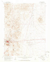
 1961 Camp Desert Rock1962 Print · USGSNye County was at the center of American nuclear testing during the early sixties, as shown on this detailed topographic survey. Researchers can trace the perimeter of Area 5 and locate facilities like Camp Desert Rock, the Heliport, and the Mercury Highway.3 unique versions available
 - 1961 Map of Rainier Mesa, 1962 Print
 1961 Rainier Mesa1962 Print · USGSNye County was at the forefront of atomic research in the early sixties, as shown by these military testing zones. Researchers can trace the layout of Nevada Test Site Area 12 and find specialized sites like the Radioactive Waste Dump and Campsite No 3.2 unique versions available
 - 1961 Map of Jangle Ridge, 1962 Print
 1961 Jangle Ridge1962 Print · USGSNye County's high desert was a site of intense Cold War activity during the early sixties, split between military testing grounds and wildlife preserves. Researchers can trace restricted sectors like Area 10 and Area 9 alongside landmarks like Jangle Ridge and Banded Mtn.3 unique versions available
Showing maps 1-25 of 141
Top cities of Nye County
- Pahrump historical maps
- Tonopah historical maps
- Amargosa Valley historical maps
- Beatty historical maps
- Scotty's Junction historical maps
- Reveille historical maps
Frequently asked questions
- What are the different types of historical maps available for Nye County?
- What is the oldest map of Nye County?
- Where can I purchase historical maps of Nye County for my home or office?
- Where can I download high-res historical maps of Nye County?
- Are there historical topographic maps available for Nye County?
- Is there historical aerial imagery available for Nye County?
- Where are historical maps of Nye County sourced from?