1960s Maps of Catron County, New Mexico
Explore 81 historic maps of Catron County from the 1960s. These maps offer a rare glimpse into what life looked like during the 1960s — showing old roads, neighborhoods, homes, and landmarks that have changed or disappeared over time.
Whether you're researching your family's past, planning a metal detecting trip, or studying how Catron County's landscape evolved across the 1960s, these high-resolution maps are a powerful tool for exploring the history of this region.
- Focus on a specific era: All maps on this page are from the 1960s, giving you a focused view of this time period.
- See what’s changed: Compare century-old streets, trails, and buildings to today's modern landscape using overlays and satellite layers.
- Research with precision: Use these maps for genealogy, historical research, land use analysis, or educational projects.
- View, download, or print: Maps are fully viewable online in high resolution, and can be downloaded or printed for your own records.
Start exploring Catron County's history through authentic maps from the 1960s. This is your window into the past.
Catron County, NM maps
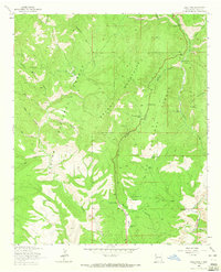
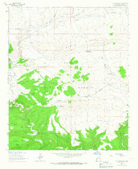
(81)- 1961 Map of Blue, 1963 Print
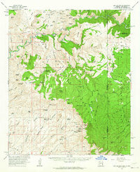
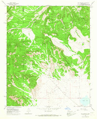
 1961 Blue1963 Print · USGSThe high Mogollon Rim and the Arizona-New Mexico state line meet in the early 1960s, showing a remote mountain landscape. Researchers can trace historic forest outposts and ranch sites like Blue Ranger Sta, Carlton Vista, and the settlement of Blue.2 unique versions available
 - 1962 Map of Socorro
 1962 Socorro1962 Print · USGSCentral New Mexico comes alive in the early sixties as the rail-and-river corridor of the Rio Grande connects historic pueblos and ranching towns. Local historians can trace the route of the Atchison Topeka and Santa Fe through Belen or locate the Torrance Mine near Mountainair.
 - 1962 Map of Clifton
 1962 Clifton1962 Print · USGSThe copper-rich Arizona-New Mexico borderlands come into focus in the early sixties, centered on the mining complexes of Morenci and Clifton. Researchers can trace the Southern Pacific rail lines and locate remote outposts like Honeymoon and the Double Circle Ranch.
 - 1962 Map of Saint Johns
 1962 Saint Johns1962 Print · USGSEastern Arizona and the New Mexico borderlands come alive in the early sixties, showing a landscape of high-plateau ranching and early national monuments. Trace the path of the Atchison Topeka and Santa Fe or locate old water sources like Salado Springs and Lyman Reservoir.
 - 1962 Map of Big Lue Mts, 1964 Print
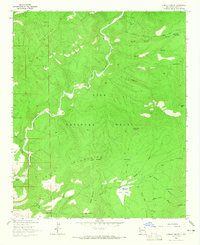
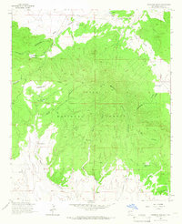
 1962 Big Lue Mts1964 Print · USGSThe Arizona and New Mexico borderlands come to life in this early 1960s survey of the high mesas and deep river canyons. Genealogists and researchers can trace isolated homesteads like Martinez Ranch and historic landmarks like the Cliff Dwelling or Black Jack Cave.2 unique versions available
 - 1963 Map of Bearwallow Mountain, 1965 Print
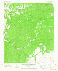
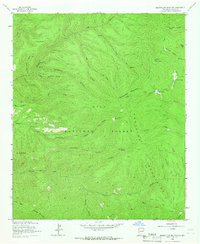 1963 Bearwallow Mountain1965 Print · USGSThe high Mogollon Mountains are captured here in the early 1960s, a period when this forest landscape was reachable only by pack trails and jeep tracks. Genealogists and historians can locate isolated outposts like the Old Waterman Place and the Lookout Tower on Bearwallow Mountain.2 unique versions available
 - 1963 Map of Negrito Mountain, 1965 Print
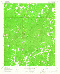
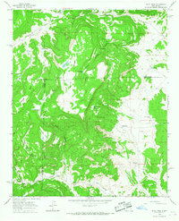
 1963 Negrito Mountain1965 Print · USGSIn the high backcountry of the 1960s, this area of New Mexico was defined by remote forest outposts and rugged cattle ranching. Researchers can trace historic trails and sites like the Willow Creek Guard Station, N Bar Ranch, and the Lookout Tower.
 - 1963 Map of Sign Camp Mountain, 1965 Print
 1963 Sign Camp Mountain1965 Print · USGSCatron County ranching and forest lands are detailed in this early 1960s survey of the high Gila backcountry. Researchers can locate remote landmarks like the Kiehne Ranch, the Rainy Mesa Airstrip, and numerous stock tanks along the Mogollon Divide.2 unique versions available
 - 1963 Map of Saliz Pass, 1965 Print
 1963 Saliz Pass1965 Print · USGSCatron County ranching and forest lands are detailed here during the early sixties. Researchers can trace historic family-named locations such as Martinez Ranch and Serna Ranch, or locate features like the Saliz No 2 mine and Kelly Camp.2 unique versions available
 - 1963 Map of O Block Canyon, 1965 Print
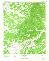
 1963 O Block Canyon1965 Print · USGSCatron County, New Mexico, is shown in the early 1960s as a remote mountain landscape where the San Francisco River carves through the forest. Researchers can trace the legacy of back-country ranching at the K Kelly Ranch and explore high-altitude landmarks like Apache Peak and Devils Park.2 unique versions available
 - 1963 Map of Mogollon, 1965 Print
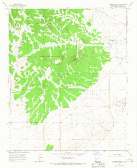
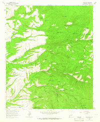 1963 Mogollon1965 Print · USGSMogollon was a focal point of New Mexico mining in the early sixties, surrounded by dozens of named claims and deep canyons. Genealogists and historians can trace the local mining economy through sites like the Fannie Mine, Maud S Mine, and the Mogollon Cem.2 unique versions available
 - 1963 Map of Alma, 1966 Print
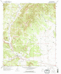
 1963 Alma1966 Print · USGSAlma and the surrounding ranchlands of Catron County appear here in the early 1960s, showing the intersection of forest service lands and private holdings. Local researchers can trace family landmarks like the L H Ranch and B McKeen Ranch or locate the Cem near the San Francisco River.2 unique versions available
 - 1963 Map of Loco Mountain, 1966 Print
 1963 Loco Mountain1966 Print · USGSMid-century ranching and forest management in Catron County are etched into this landscape of high mesas and deep canyons. Researchers can trace remote water improvements like Dipping Vat Tank and find historical sites such as Ruins along the Middle Fork Gila River.2 unique versions available
 - 1963 Map of Pitchfork Canyon, 1966 Print
 1963 Pitchfork Canyon1966 Print · USGSCatron County's high backcountry is captured here in the mid-1960s, showing a landscape defined by the Continental Divide. Researchers can trace old mountain routes like Seven HL Road to landmarks such as Slater Cabin and Elk Mountain.2 unique versions available
 - 1963 Map of Telephone Canyon, 1966 Print
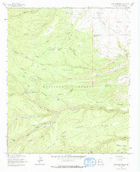
 1963 Telephone Canyon1966 Print · USGSCatron County ranching and forest life are captured here in the mid-1960s. Researchers can locate remote outposts like Brennan Ranch, trace high-elevation markers along the Continental Divide, and find the unique Sheepherders Baseball Park.2 unique versions available
 - 1963 Map of Cal Ship Mesa, 1967 Print
 1963 Cal Ship Mesa1967 Print · USGSCatron County ranching and forest lands are captured in the early sixties, showing a landscape defined by high mesas and seasonal water sources. Trace remote landmarks and livestock improvements including Double Tanks Wells, Skeleton Spring, and the high reaches of Cal Ship Mesa.
 - 1963 Map of Anderson Peak, 1967 Print
 1963 Anderson Peak1967 Print · USGSCatron County ranching country is documented here in the early sixties, showing a landscape defined by water and wide-open range. Researchers can trace historic land use through named features like Boaz Well, Rock House Well, and Anderson Peak.
 - 1963 Map of Datil, 1967 Print
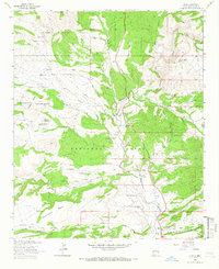
 1963 Datil1967 Print · USGSIn the early 1960s, the ranching country around Datil remained a landscape of scattered wells and mountain peaks. Genealogists and historians can trace family locations and ranch boundaries at Jeffers Place, the Drag A Ranch, and the Datil Cem.2 unique versions available
 - 1964 Map of Third Canyon, 1967 Print
 1964 Third Canyon1967 Print · USGSHigh-country ranching in Catron County defines this mid-century survey of the New Mexico interior. Researchers can trace the layout of the McPhaul Ranch, locate the remote Landing Strip, and find vital water sources like Lobo Well and Trinchera Lake.2 unique versions available
 - 1964 Map of Wiley Mesa, 1967 Print
 1964 Wiley Mesa1967 Print · USGSSocorro County and the surrounding high mesas are captured in the mid-1960s, showing a landscape defined by ranching and water management. Researchers can trace remote sites like Manning Cabin, family-named landmarks like Barela Well, and features like Wiley Lake.
 - 1964 Map of Dog Springs, 1967 Print
 1964 Dog Springs1967 Print · USGSThe high mesas and deep canyons of Socorro County are documented here in the mid-1960s, showing a working landscape of ranching and forest boundary lines. Genealogists and local historians can locate remote landmarks such as John Henry Windmill, Dog Springs, and North Lake.
 - 1964 Map of Bonine Canyon, 1967 Print
 1964 Bonine Canyon1967 Print · USGSCatron County, New Mexico ranching life is preserved here in the mid-1960s, showing a landscape shaped by isolated wells and desert canyons. Genealogists and historians can trace the vital water sources and early camps of the era, from Summers Ranch to the Schoolhouse Windmill.
 - 1964 Map of Pasture Canyon, 1967 Print
 1964 Pasture Canyon1967 Print · USGSCatron County ranching life is preserved here in the mid-1960s, showing the remote outposts of the Cibola National Forest. Researchers can trace old family sites like the McCord Place and water infrastructure such as Buds Windmill or Ox Spring.2 unique versions available
 - 1964 Map of Madre Mountain, 1967 Print
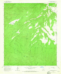
 1964 Madre Mountain1967 Print · USGSThe high timber and grazing lands of Catron County are captured here in the mid-1960s, showing a remote landscape of the Cibola National Forest. Researchers can trace the ranching footprint through landmarks like the Double Circle Ranch, Webster Cabin, and the high-elevation Davenport Lookout Tower.2 unique versions available
 - 1964 Map of Wild Horse Canyon, 1967 Print
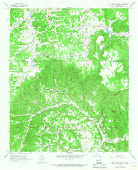 1964 Wild Horse Canyon1967 Print · USGSCatron County ranchlands are documented here in the mid-1960s, showing a rugged landscape where water was the primary concern for local survival. Researchers can trace historic homesteads like Woods Ranch and map out vital water sources such as Techado Spring and the Highway Windmill.
Showing maps 1-25 of 81
Top cities of Catron County
Frequently asked questions
- What are the different types of historical maps available for Catron County?
- What is the oldest map of Catron County?
- Where can I purchase historical maps of Catron County for my home or office?
- Where can I download high-res historical maps of Catron County?
- Are there historical topographic maps available for Catron County?
- Is there historical aerial imagery available for Catron County?
- Where are historical maps of Catron County sourced from?