1980s Maps of Catron County, New Mexico
Explore 47 historic maps of Catron County from the 1980s. These maps offer a rare glimpse into what life looked like during the 1980s — showing old roads, neighborhoods, homes, and landmarks that have changed or disappeared over time.
Whether you're researching your family's past, planning a metal detecting trip, or studying how Catron County's landscape evolved across the 1980s, these high-resolution maps are a powerful tool for exploring the history of this region.
- Focus on a specific era: All maps on this page are from the 1980s, giving you a focused view of this time period.
- See what’s changed: Compare century-old streets, trails, and buildings to today's modern landscape using overlays and satellite layers.
- Research with precision: Use these maps for genealogy, historical research, land use analysis, or educational projects.
- View, download, or print: Maps are fully viewable online in high resolution, and can be downloaded or printed for your own records.
Start exploring Catron County's history through authentic maps from the 1980s. This is your window into the past.
Catron County, NM maps
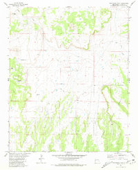
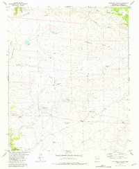
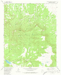
(47)- 1981 Map of Cox Peak
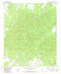
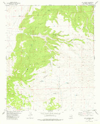
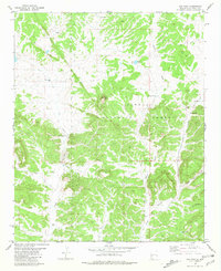 1981 Cox Peak1981 Print · USGSCatron County, New Mexico, is shown here in the early 1980s as a landscape of forest management and high-country ranching. Researchers can trace vital water sources and family-named infrastructure such as Mc Clusky Well, Raino Windmill, and the namesake Cox Peak.
 - 1981 Map of Fullerton
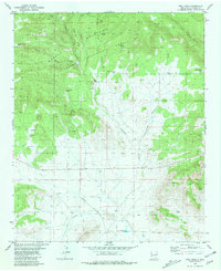
 1981 Fullerton1981 Print · USGSHigh desert ranching and remote settlement in Catron County appear during the early 1980s. Trace old water sources like Birmingham Well and Sanchez Well near the settlement of Fullerton or explore the terrain around Bat Cave.
 - 1981 Map of Mangas Mountain
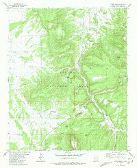
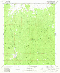 1981 Mangas Mountain1981 Print · USGSIn the high country of Catron County during the early eighties, the Continental Divide crosses a landscape shaped by the Apache National Forest. Researchers can trace old routes and water sources like the Mangas Work Center, Valle Tio Vinces Spring, and Sawmill Pond.
 - 1981 Map of Luera Mountains NW
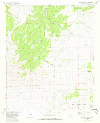
 1981 Luera Mountains NW1981 Print · USGSCatron County ranch land in the early eighties is defined by the high elevations of the Luera Mountains and essential water infrastructure. Genealogists and land historians can trace the distribution of range resources like Navajo Well, Chamiza Well, and First Well.
 - 1981 Map of Taylor Peak
 1981 Taylor Peak1981 Print · USGSThe high Gila backcountry in the early 1980s was a landscape of remote mines and vital water tanks. Trace old mining operations at the Strip Mine or prospects near Boiler Peak, and follow the watershed from Alexander Cienaga to Taylor Creek.
 - 1981 Map of Ponderosa Tank
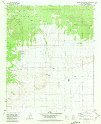
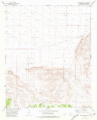
 1981 Ponderosa Tank1981 Print · USGSCatron County, New Mexico, as it appeared in the early eighties shows a high-desert landscape defined by ranching life and national forest boundaries. Researchers can locate remote family-named sites like Sanchez and essential water sources such as Agua Fria Creek and Ponderosa Tank.
 - 1981 Map of Bell Peak
 1981 Bell Peak1981 Print · USGSHigh-altitude ranching and forest lands in Catron County are captured here in the early 1980s. Researchers can trace remote water sources like Patterson Lake and Loco Tank or follow the path of the historic Bursum Road through the mountains.
 - 1981 Map of Largo Mesa
 1981 Largo Mesa1981 Print · USGSHigh mesa country in Catron County during the early 1980s reveals a remote landscape of canyons and national forest land. Researchers can trace historic water sources and rugged landmarks like Castle Rock, Agua Fria Spring, and Chavez Lake.
 - 1981 Map of Pelona Mountain
 1981 Pelona Mountain1981 Print · USGSCatron County, New Mexico, is shown here in the early eighties at the height of high-desert ranching and water management. Researchers can trace the winding Continental Divide and locate remote landmarks like Pelona Mountain, Pelona Well, and the Fullerton Trail.
 - 1981 Map of Mojonera Canyon
 1981 Mojonera Canyon1981 Print · USGSCatron County ranchlands and forest boundaries are captured here in the early eighties. Researchers can trace the Continental Divide past isolated landmarks like a lone Grave and family-named water sources such as the Henry Ford Tank.
 - 1981 Map of Horse Mountain West
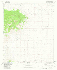
 1981 Horse Mountain West1981 Print · USGSCatron County, New Mexico, appears in the early eighties as a landscape of remote ranching outposts and high-country forest. Genealogists can locate the distinct settlements of Old Horse Springs and New Horse Springs, along with family-named sites like Armijo Well and Sanchez Spring.
 - 1981 Map of Gallo Mountains East
 1981 Gallo Mountains East1981 Print · USGSCatron County, New Mexico, is documented here in the early 1980s as a high-country frontier of the Apache National Forest. Researchers can trace the ranching and forest history of the Gallo Mountains through remote landmarks like Davis Windmill, Gallo Lake, and Bull Camp Spring.
 - 1981 Map of Luera Mountains East
 1981 Luera Mountains East1981 Print · USGSCatron County, New Mexico, appears as a high mountain ranching landscape in this early eighties survey. Researchers can trace land use through isolated landmarks like Luera Ranch, the Landing Strip, and named drainages like Patrocino Canyon.
 - 1981 Map of Gallo Mountains West
 1981 Gallo Mountains West1981 Print · USGSThe high timber and range of the New Mexico backcountry are recorded here during the early eighties. Researchers can trace remote ranching infrastructure and landmarks like Hardcastle, the Lookout on Fox Mountain, and the Jewett Gap corridor.
 - 1981 Map of Paddys Hole
 1981 Paddys Hole1981 Print · USGSHigh desert ranching and forest lands in Catron County are captured here in the early eighties. Researchers can trace the Continental Divide as it winds past landmarks like Paddys Hole, Lonesome Well, and Bear Mountain.
 - 1981 Map of Wallace Mesa
 1981 Wallace Mesa1981 Print · USGSCatron County ranching and forest lands are captured in the early eighties as the Continental Divide winds through the high mesas. Researchers can locate the settlement of Collinsville, the isolated Greens Gap Cem, and vital water sources like Nance Windmill.
 - 1981 Map of Collins Park
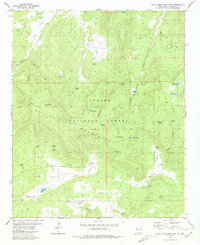
 1981 Collins Park1981 Print · USGSThe Tularosa Mountains and Gila National Forest come into focus in this early 1980s survey of the high Continental Divide. Researchers can trace remote livestock infrastructure and mountain tracks, from the Collins Park Well to the winding Bursum Road.
 - 1981 Map of Rail Canyon
 1981 Rail Canyon1981 Print · USGSCatron County ranching country is mapped during the early 1980s, centered on the high ridges of the Continental Divide. Researchers can trace old stock-water systems and canyon trails through Rail Canyon, Batton Pond, and Indian House Canyon.
 - 1981 Map of Shaw Mountain
 1981 Shaw Mountain1981 Print · USGSCatron County, New Mexico, is captured here in the early 1980s as a high-altitude ranching landscape. Researchers can trace isolated family-named water sources like Thurgood Well and Concilio Well, or locate a solitary Grave near the mountainside.
 - 1981 Map of C-N Lake
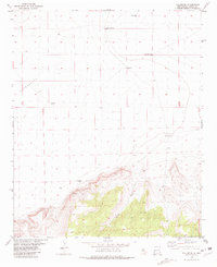
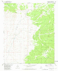
 1981 C-N Lake1981 Print · USGSCatron County, New Mexico, is shown in the early eighties at the intersection of traditional ranching and cutting-edge science. You can trace the path of the Radio Telescope Track (VLA) or locate historic water sites like the West Pasture Windmill and C-N Lake.
 - 1981 Map of Rael Spring
 1981 Rael Spring1981 Print · USGSCatron County ranching and forest lands are captured here in the early eighties as the network of mountain roads and water tanks supported the local timber and livestock economy. Researchers can trace the path of Bursum Road past family-named landmarks like Frank Well and Mayberry Well.
 - 1981 Map of Salvation Peak
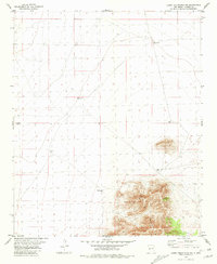
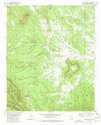
 1981 Salvation Peak1981 Print · USGSThe high country of Catron County is captured here as it appeared in the mid-twentieth century, centered on the Continental Divide. Researchers can trace remote ranching infrastructure and landmarks like Graveyard Well, Salvation Peak, and the Landing Strip.
 - 1981 Map of Escondido Mountain
 1981 Escondido Mountain1981 Print · USGSCatron County during the early 1980s reveals a high-country landscape of forest management and vital water sources. Trace historical movement through the timber via Pack Trail routes and find family-named landmarks like Leyba Spring and Baca Mesa.
 - 1981 Map of Jones Canyon
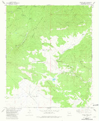
 1981 Jones Canyon1981 Print · USGSCatron County, New Mexico, is documented here in the early eighties as a landscape of remote ranching outposts and high-altitude forest. Researchers can trace the hydrology of the Apache National Forest through local landmarks like Mangas Spring, Jones Lake, and Martin Windmill.
 - 1981 Map of Wahoo Peak
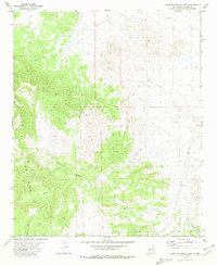
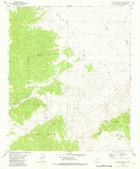
 1981 Wahoo Peak1981 Print · USGSCatron County’s high desert reaches are documented here in the early eighties, showing the remote canyonlands of the Gila National Forest. Trace the water-scarce terrain through cattle tanks and springs like Adobe Spring, White Saddle Well, and Wahoo Tank.
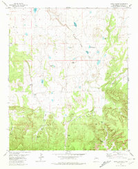
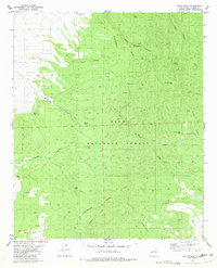
Showing maps 1-25 of 47
Top cities of Catron County
Frequently asked questions
- What are the different types of historical maps available for Catron County?
- What is the oldest map of Catron County?
- Where can I purchase historical maps of Catron County for my home or office?
- Where can I download high-res historical maps of Catron County?
- Are there historical topographic maps available for Catron County?
- Is there historical aerial imagery available for Catron County?
- Where are historical maps of Catron County sourced from?