1970s Maps of Catron County, New Mexico
Explore 20 historic maps of Catron County from the 1970s. These maps offer a rare glimpse into what life looked like during the 1970s — showing old roads, neighborhoods, homes, and landmarks that have changed or disappeared over time.
Whether you're researching your family's past, planning a metal detecting trip, or studying how Catron County's landscape evolved across the 1970s, these high-resolution maps are a powerful tool for exploring the history of this region.
- Focus on a specific era: All maps on this page are from the 1970s, giving you a focused view of this time period.
- See what’s changed: Compare century-old streets, trails, and buildings to today's modern landscape using overlays and satellite layers.
- Research with precision: Use these maps for genealogy, historical research, land use analysis, or educational projects.
- View, download, or print: Maps are fully viewable online in high resolution, and can be downloaded or printed for your own records.
Start exploring Catron County's history through authentic maps from the 1970s. This is your window into the past.
Catron County, NM maps
(20)- 1971 Map of Mesa Parada, 1973 Print
 1971 Mesa Parada1973 Print · USGSThe high desert plateau along the Arizona-New Mexico border is captured here in the early seventies, detailing a landscape defined by ranching and water. Researchers can trace remote water improvements like Little Electric Well and Gallegos Springs near the prominent Mesa Parada.
 - 1971 Map of The Rincon, 1973 Print
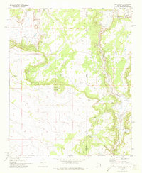
 1971 The Rincon1973 Print · USGSThe high desert border between Arizona and New Mexico comes into focus during the early 1970s, showing a landscape defined by ranching and water access. Genealogists and historians can trace family-named sites like Tom Phelps Well and Goldwater Well along the edge of Cottonwood Canyon.
 - 1972 Map of Zuni Salt Lake, 1976 Print
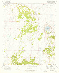 1972 Zuni Salt Lake1976 Print · USGSCatron County, New Mexico, is shown in the early seventies as a remote landscape centered on the unique volcanic hydrology of the salt basin. Researchers can locate infrastructure of the local salt industry and isolated ranching landmarks like Zuni Salt Lake, Davila Well, and the cemetery.
 - 1972 Map of Lake Armijo, 1976 Print
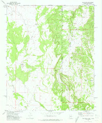
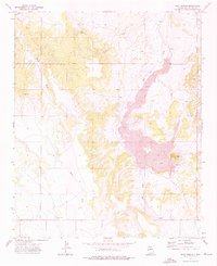
 1972 Lake Armijo1976 Print · USGSCatron County, New Mexico, appears here in the early seventies as a vast expanse of ranchland and high-desert terrain. Researchers can identify isolated landmarks and water sources like the Salt Evaporator, Eagle Peak, and Lake Armijo.
 - 1972 Map of Twentytwo Spring, 1976 Print
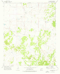
 1972 Twentytwo Spring1976 Print · USGSWestern New Mexico rangeland is captured here in the early 1970s, showcasing the intricate system of water management in a high-desert environment. Researchers can trace remote ranching infrastructure such as the Roundtree Windmills, Twentytwo Spring, and Indian Tank.
 - 1972 Map of Red Hill, 1976 Print
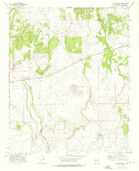
 1972 Red Hill1976 Print · USGSCatron County ranching country is captured in the early seventies, centered around the settlement at Red Hill. Researchers can trace family homesteads and vital water sources like Davies Place, Mardelito Place, and Gatlin Lake.
 - 1972 Map of Tejana Mesa, 1976 Print
 1972 Tejana Mesa1976 Print · USGSCatron County ranching lands are captured here in the early 1970s, showing a vast landscape of mesas and canyons. Genealogists and local historians can trace legacy holdings like the Chavez Ranch and Mesa Ranch alongside markers like the Old Tejana Well.
 - 1972 Map of Cerro Prieto, 1976 Print
 1972 Cerro Prieto1976 Print · USGSCatron County ranching country is captured here in the early seventies, showing a land of isolated homesteads and essential desert water sources. Researchers can trace family landmarks and cattle-country history at the Hubbell Ranch, Montaño Ranch, and the Apodaca Windmill.
 - 1972 Map of Fence Lake SW, 1976 Print
 1972 Fence Lake SW1976 Print · USGSWestern New Mexico ranching and water rights come into focus in the early 1970s along the border of Valencia and Catron counties. Researchers can trace historic water sources and property markers from Old Santa Rita Springs to the Cox Ranch and the small Cem near Nicolas Spring.
 - 1972 Map of Blaines Lake, 1976 Print
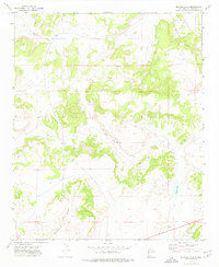 1972 Blaines Lake1976 Print · USGSCatron County, New Mexico, appears here in the early seventies, showcasing a high-desert landscape defined by the expansive Cimarron Mesa. Local historians and researchers can trace the drainage of Agua Fria Creek and locate isolated features like Cajon Well.
 - 1972 Map of Moreno Hill, 1976 Print
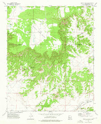
 1972 Moreno Hill1976 Print · USGSHigh desert ranching and resource extraction define this area of western New Mexico in the early seventies. Researchers can trace land use through features like Morelos Cem, the Pueblo Windmill, and numerous cattle tanks including Heffner Tank.
 - 1972 Map of Cow Springs, 1976 Print
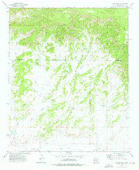
 1972 Cow Springs1976 Print · USGSCatron County ranching country is mapped here in the early 1970s, showing a high-desert landscape defined by vital water draws. Genealogists and local historians can locate family holdings like Gould Ranch and Brockman Ranch alongside essential landmarks such as the Vicente Baca Windmill.
 - 1972 Map of Goat Spring, 1976 Print
 1972 Goat Spring1976 Print · USGSCatron County in the early seventies shows a landscape shaped by volcanic activity and the search for water. Researchers can trace the basalt flows of the LAVA beds and locate remote landmarks like Goat Spring, Red Cone Hill, and Salvation Well.
 - 1972 Map of Armstrong Canyon, 1976 Print
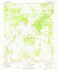
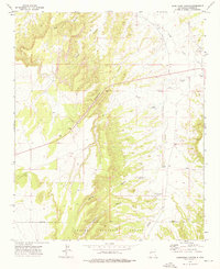 1972 Armstrong Canyon1976 Print · USGSCatron County ranch lands and high-desert canyons are documented here in the early seventies, showing a landscape shaped by water and flight. You can locate family-named landmarks like the Allison Windmill or trace the remote path of the Jeep Trail near the Quemado Airfield.
 - 1972 Map of Salazar Canyon, 1976 Print
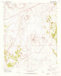
 1972 Salazar Canyon1976 Print · USGSCatron County, New Mexico, is shown here in the early 1970s as a landscape defined by ranching infrastructure and remote desert draws. Researchers can trace historic sites and vital water improvements like Piedres Lumbre (Site), Goodling Ranch, and Rock House Wells.
 - 1978 Map of Carrisito Spring
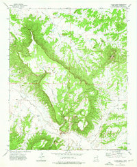
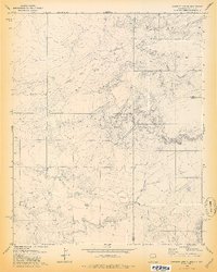 1978 Carrisito Spring1978 Print · USGSThe Arizona-New Mexico state line runs through this remote high-desert region during the late 1970s. Local researchers can trace the drainage patterns of Little Blanco Canyon and locate isolated ranching landmarks like Carrisito Spring and various corrals.2 unique versions available
 - 1978 Map of Acoma Pueblo, 1979 Print
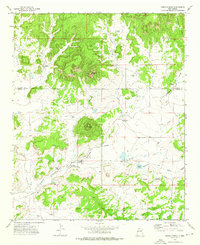
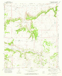
 1978 Acoma Pueblo1979 Print · USGSCibola and Valencia counties are captured here in the late seventies, showing a landscape of ancient pueblos and modern transit corridors. Genealogists and historians can trace the paths of U.S. 66 and the Atchison Topeka and Santa Fe RR past Acoma Pueblo and Suwanee.
 - 1979 Map of Magdalena
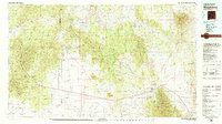 1979 Magdalena1979 Print · USGSSocorro County in the late seventies is shown here as a high-desert landscape of mountain ranges and remote settlements. Genealogists and historians can trace the reach of the Atchison Topeka and Santa Fe Railway and locate sites like Kelly and Guthrieville.
 - 1979 Map of Truth or Consequences
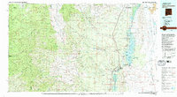 1979 Truth or Consequences1979 Print · USGSSierra County in the late seventies is a landscape of massive reservoirs and remote mining districts. Researchers can trace the Rio Grande corridor from Truth or Consequences past historic outposts like Winston, Chloride, and the Republic Mine.2 unique versions available
 - 1979 Map of San Mateo Mountains
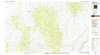 1979 San Mateo Mountains1979 Print · USGSCentral New Mexico’s high desert and mountain ranges are captured here in the late seventies, showing the remote ranching and mining country of Socorro County. Researchers can locate historic sites like Fort Craig (Ruins), the Continental Divide, and isolated settlements like Dusty and Monticello.2 unique versions available
End of results
Showing maps 1-20 of 20
Top cities of Catron County
Frequently asked questions
- What are the different types of historical maps available for Catron County?
- What is the oldest map of Catron County?
- Where can I purchase historical maps of Catron County for my home or office?
- Where can I download high-res historical maps of Catron County?
- Are there historical topographic maps available for Catron County?
- Is there historical aerial imagery available for Catron County?
- Where are historical maps of Catron County sourced from?