Old Maps of Curry County, New Mexico for Hiking & Exploration
Hike through history with 189 historic maps of Curry County. Explore old trails, ghost towns, and forgotten backroads — perfect for outdoor adventurers and local explorers.
- Rediscover forgotten places: Map out old mining camps, roads, and footpaths that no longer exist on modern maps.
- Layer with modern tools: Combine with LiDAR or satellite views to plan hikes through historical terrain.
- Made for exploration: Popular among hikers, overlanders, and local history lovers.
Use these maps to find adventure and explore the hidden past of Curry County.
Curry County, NM maps
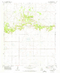
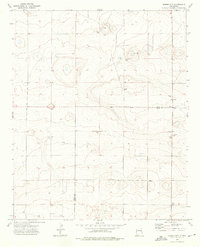
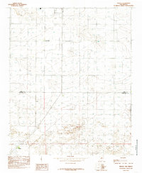
(189)- 1954 Map of Clovis, 1966 Print
 1954 Clovis1966 Print · USGSThe High Plains of the Texas-New Mexico borderland come alive in this mid-century survey as the region's agricultural and rail networks reached their peak. Trace family roots and local history through features like Cannon AFB, the massive Sand Hills, and busy rail towns such as Friona and Littlefield.4 unique versions available
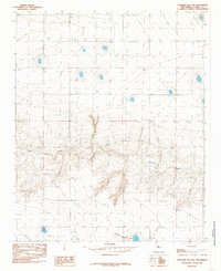
 - 1957 Map of Portair, 1958 Print
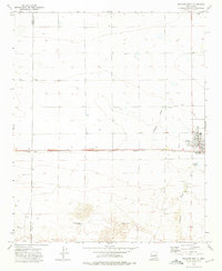
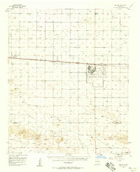 1957 Portair1958 Print · USGSEastern New Mexico's high plains are captured here in the late fifties, centered on the strategic expansion of Cannon Air Force Base. Researchers can trace the rail-side growth of St Vrain, Grier, and Portair along the Atchison Topeka and Santa Fe line.2 unique versions available
 - 1957 Map of Melrose, 1958 Print
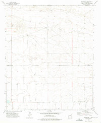
 1957 Melrose1958 Print · USGSEastern New Mexico ranching and rail life are captured here in the late fifties, centered on the activity of the plains. Genealogists and historians can locate family landmarks like Hart Ranch, the North Cem, and the central siding at Melrose along the Atchison Topeka and Santa Fe line.
 - 1957 Map of Clovis, 1958 Print
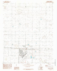
 1957 Clovis1958 Print · USGSThe High Plains railroad hub of Clovis is captured here in the mid-fifties at the peak of its rail-era importance. Genealogists and researchers can trace the growth of the border towns of Texico and Farwell or locate landmarks like Lawn Haven Cem.3 unique versions available
 - 1957 Map of Pleasant Hill, 1958 Print
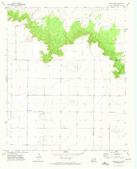
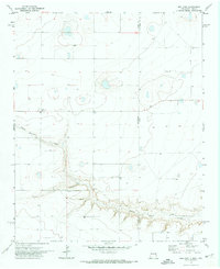
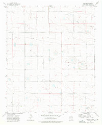
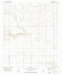
 1957 Pleasant Hill1958 Print · USGSCurry County, New Mexico, is captured in the late fifties as a landscape of rural crossroads and prairie draws along the Texas line. Researchers can locate the Pleasant Hill Cem, the settlement of Claud, and the New Mexico Game Refuge No 252.
 - 1957 Map of Hammond Ranch, 1958 Print
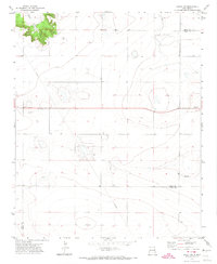
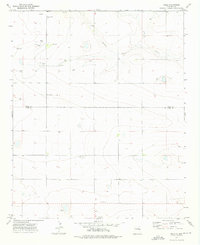
 1957 Hammond Ranch1958 Print · USGSCurry County ranching country comes into focus in the mid-1950s, highlighting a landscape of isolated homesteads and ephemeral draws. Genealogists and researchers can locate family sites like Hammond Ranch and the uniquely named Denton Ranch (The Buzzard Roost).
 - 1958 Map of Clovis
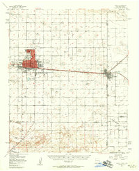
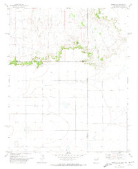
 1958 Clovis1958 Print · USGSThe High Plains of the New Mexico-Texas borderlands are captured here in the late fifties, during a period of significant military and agricultural expansion. Genealogists and historians can trace the rail-side growth of Clovis, the operations at Clovis Air Force Base, and the rural layout of communities like Muleshoe and Hereford.
 - 1971 Map of Day Canyon, 1974 Print
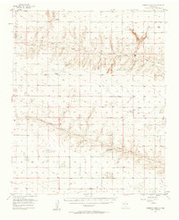
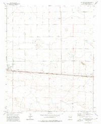
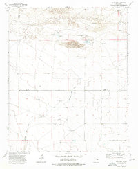
 1971 Day Canyon1974 Print · USGSThe high plains of the New Mexico borderlands come to life in this early 1970s survey. Researchers can trace the rugged drainages of Day Canyon and Rusk Canyon or locate land features like Buffalo Lake and Round Mountain.
 - 1971 Map of Wheatland, 1974 Print
 1971 Wheatland1974 Print · USGSThe high plains of the New Mexico borderlands meet the break of the caprock in the early seventies. Genealogists and local historians can locate the Wheatland Cem and trace the winding paths of Horseshoe Cave Canyon and Tipton Canyon.
 - 1971 Map of Broadview, 1974 Print
 1971 Broadview1974 Print · USGSBroadview and the surrounding Curry County plains are captured here in the early seventies during a period of steady ranching and agricultural life. Researchers can trace the drainage of Tierra Blanca Creek or locate local landmarks like the Gravel Pit and numerous Well sites.2 unique versions available
 - 1971 Map of Grady, 1974 Print
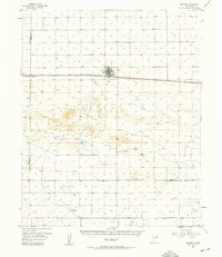
 1971 Grady1974 Print · USGSEastern New Mexico's high plains are documented here in the early seventies, centered on the village of Grady. Researchers can trace the local footprint of the town, from its central Park and Storage Bins to the nearby Cem and Substa.
 - 1971 Map of Bellview, 1974 Print
 1971 Bellview1974 Print · USGSThe high plains of the New Mexico and Texas border come into focus in the early 1970s, showcasing a landscape of isolated homesteads and deep-cut drainages. Researchers can trace the rural communities of Bellview and Hollene or follow the path of Tierra Blanca Creek.
 - 1971 Map of Grady SW, 1974 Print
 1971 Grady SW1974 Print · USGSThe High Plains of Eastern New Mexico are captured in the early 1970s as a landscape of ranching and utility infrastructure. Genealogists and researchers can locate the settlement of Watts, a lone Cemetery, and remote features like Landing Strips.2 unique versions available
 - 1971 Map of Endee Hill, 1974 Print
 1971 Endee Hill1974 Print · USGSThe New Mexico and Texas state line meets at this high plains escarpment during the early seventies. Genealogists and local historians can locate Mitchel Cem and trace livestock water sources from Arroyo Trujillo to Salt Well Canyon.
 - 1972 Map of Melrose East, 1975 Print
 1972 Melrose East1975 Print · USGSMelrose sits at a vital railroad junction on the New Mexico high plains in the early seventies. Genealogists and local historians can trace the town's footprint from the Memorial Cem to the Rodeo Ground and the busy Atchison Topeka and Santa Fe line.
 - 1973 Map of Weber City, 1975 Print
 1973 Weber City1975 Print · USGSThe High Plains of eastern New Mexico were a network of family-named water sources and ranching outposts in the 1970s. Trace local roots and land use near Weber City through features like Yeakley Cemetery, Capps Lake, and several historic wells.2 unique versions available
 - 1973 Map of Field SE, 1975 Print
 1973 Field SE1975 Print · USGSCurry County ranching lands are captured in the early 1970s, showing a landscape defined by water management and section lines. Genealogists and land researchers can pinpoint numerous water sources like Well and trace the path of Running Water Draw and Dead Horse Lake.
 - 1973 Map of Melrose West, 1975 Print
 1973 Melrose West1975 Print · USGSEastern New Mexico high plains life is captured here in the early seventies, centered on the railroad town of Melrose. Genealogists and historians can trace rail-side infrastructure and local landmarks like the North Cem, Cantara, and the Sand Dunes to the south.
 - 1973 Map of Tule Lake, 1975 Print
 1973 Tule Lake1975 Print · USGSEastern New Mexico ranching country comes into focus in the early seventies, showing a land defined by its vital water wells. Genealogists and researchers can trace local family land use through the Hart Ranch, Steele Ranch, and Tule Lake.2 unique versions available
 - 1973 Map of Field SW, 1976 Print
 1973 Field SW1976 Print · USGSThe high plains of eastern New Mexico meet in the early seventies at the junction of three counties. Genealogists and land researchers can trace property boundaries and livestock infrastructure like a Silo, remote Well sites, and the course of Alamosa Creek.2 unique versions available
 - 1973 Map of Field, 1976 Print
 1973 Field1976 Print · USGSThe high plains of the Quay and Curry county line come into focus during the early seventies. Genealogists and local historians can trace family-named sites like Grandmother Well or Cornet Well and locate the isolated Field Cem near Field.
 - 1973 Map of Melrose SE, 1976 Print
 1973 Melrose SE1976 Print · USGSEastern New Mexico ranching lands are captured in the early 1970s along the border of Curry and Roosevelt counties. Genealogists and historians can trace family-named landmarks like Spencer Ranch, Smart Ranch, and the route of Sun Dale Valley Rd.2 unique versions available
 - 1985 Map of Portair
 1985 Portair1985 Print · USGSCurry County's high plains are captured here in the mid-1980s, centered on the military and agricultural hub west of Clovis. Researchers can trace the facility layout of Cannon Air Force Base and locate the smaller settlements of Portair and Ranchvale.
 - 1985 Map of Midway
 1985 Midway1985 Print · USGSThe high plains of the New Mexico borderlands come into focus during the mid-eighties, revealing a landscape of scattered ranching outposts and rural townships. Trace local landmarks like Center School and the settlements of Midway and Cameo.
 - 1985 Map of Pleasant Hill NW
 1985 Pleasant Hill NW1985 Print · USGSCurry County in the early 1980s was defined by its wide, open drainage systems and emerging utility infrastructure. Researchers can trace the winding course of Frio Draw and locate specific groundwater resources marked as Well and the Trans Line Wooden H-Frame.
Showing maps 1-25 of 189
Top cities of Curry County
Frequently asked questions
- What are the different types of historical maps available for Curry County?
- What is the oldest map of Curry County?
- Where can I purchase historical maps of Curry County for my home or office?
- Where can I download high-res historical maps of Curry County?
- Are there historical topographic maps available for Curry County?
- Is there historical aerial imagery available for Curry County?
- Where are historical maps of Curry County sourced from?