1950s Maps of Hidalgo County, New Mexico
Explore 15 historic maps of Hidalgo County from the 1950s. These maps offer a rare glimpse into what life looked like during the 1950s — showing old roads, neighborhoods, homes, and landmarks that have changed or disappeared over time.
Whether you're researching your family's past, planning a metal detecting trip, or studying how Hidalgo County's landscape evolved across the 1950s, these high-resolution maps are a powerful tool for exploring the history of this region.
- Focus on a specific era: All maps on this page are from the 1950s, giving you a focused view of this time period.
- See what’s changed: Compare century-old streets, trails, and buildings to today's modern landscape using overlays and satellite layers.
- Research with precision: Use these maps for genealogy, historical research, land use analysis, or educational projects.
- View, download, or print: Maps are fully viewable online in high resolution, and can be downloaded or printed for your own records.
Start exploring Hidalgo County's history through authentic maps from the 1950s. This is your window into the past.
Hidalgo County, NM maps
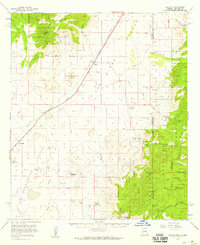
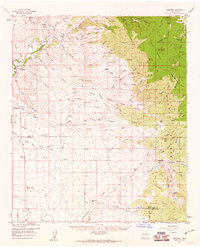
(15)- 1950 Map of San Simon
 1950 San Simon1950 Print · USGSThe high desert borderlands of Arizona and New Mexico are captured here at mid-century, following the line of the Southern Pacific railroad. Researchers can locate remote cattle operations and early landmarks like the Braidfoot Ranch, the Old Stage Station (Ruins), and the lonely Giddings Grave.2 unique versions available
 - 1950 Map of Vanar, 1958 Print
 1950 Vanar1958 Print · USGSThe high desert borderlands near the Arizona and New Mexico line come to life in this mid-century survey of the San Simon Valley. Genealogists and historians can trace the remote Southern Pacific rail stops, old mining sites like Mineral Mtn Mine, and ranching landmarks such as Cienega Ranch.3 unique versions available
 - 1951 Map of Vanar
 1951 Vanar1951 Print · USGSThe Arizona-New Mexico borderlands in the early fifties reveal a landscape of remote ranching and early mining at the edge of the Coronado National Forest. Genealogists and historians can trace the Southern Pacific rail line through Vanar or locate the Cienega Ranch and its associated cemetery.2 unique versions available
 - 1951 Map of San Simon
 1951 San Simon1951 Print · USGSCrossing the Arizona-New Mexico border in the 1950s, this survey shows a high-desert landscape defined by the railroad and mountain passes. Trace the legacy of early travel and mining at the Old Stage Station (Ruins), Giddings Grave, and the Volcano Mine.
 - 1954 Map of Silver City, 1967 Print
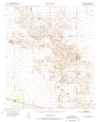
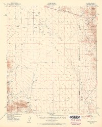
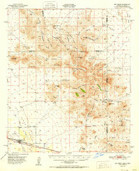
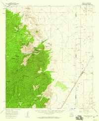
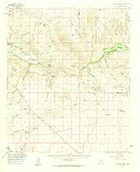
 1954 Silver City1967 Print · USGSSoutheast Arizona and southwest New Mexico meet in this mid-century survey of the high desert and mountain mining districts. Local researchers can trace the rail lines through Lordsburg, the silver operations at Ash Peak Mines, and the limits of Fort Bayard Military Reservation.4 unique versions available
 - 1955 Map of Douglas
 1955 Douglas1955 Print · USGSThe Arizona and New Mexico borderlands come into focus in the mid-1950s, highlighting the mining and ranching hubs of the Desert Southwest. Genealogists and historians can trace the foundations of Bisbee, the operations at Hachita Mine, and rural landmarks like the Double Adobe School.2 unique versions available
 - 1958 Map of Silver City
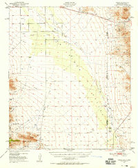
 1958 Silver City1958 Print · USGSSouthwestern New Mexico and eastern Arizona appear here in the mid-1950s, a period of intensive mining and rail activity. Trace the routes of the Southern Pacific RR through Lordsburg or locate historic operations at the Chino Mine and Santa Rita.
 - 1958 Map of Apache, 1959 Print
 1958 Apache1959 Print · USGSThe high desert borderlands of Cochise County are captured in the late 1950s as they transition from frontier outposts to a modern energy corridor. Genealogists and historians can locate the Geronimo Surrender Site, the Apache Cemetery, and remote family holdings like Fairchild Ranch.3 unique versions available
 - 1958 Map of Guadalupe Canyon, 1959 Print
 1958 Guadalupe Canyon1959 Print · USGSThe Arizona-New Mexico-Mexico borderlands come alive in the late fifties, showing a remote landscape of high-desert ranching and frontier trails. Genealogists and historians can locate family landmarks like the Cottonwood Creek Cemetery, McDonald Ranch, and the isolated Silverton Mine.3 unique versions available
 - 1958 Map of Portal, 1959 Print
 1958 Portal1959 Print · USGSThe Arizona-New Mexico borderlands come alive in the late 1950s, showing a rugged landscape of high peaks and desert rail stops. Genealogists and historians can trace the foundations of Paradise, locate the Paradise Cemetery, or follow the Southern Pacific line through Rodeo.4 unique versions available
 - 1959 Map of Steeple Rock, 1960 Print
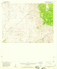
 1959 Steeple Rock1960 Print · USGSMining and ranching activity define this high-desert region on the Grant and Hidalgo county line in the late fifties. Genealogists and historians can trace family-named sites like the Thygerson Ranch, Carlisle Mine, and the Anderson Ranch.2 unique versions available
 - 1959 Map of Redrock, 1960 Print
 1959 Redrock1960 Print · USGSSouthwestern New Mexico at the end of the fifties reveals a landscape of high-desert ranching and deep-canyon mining. Genealogists and historians can trace family holdings like Van Meter Ranch and Jim Cureton Ranch alongside the Alhambra Mine and Graves.3 unique versions available
 - 1959 Map of Canador Peak, 1960 Print
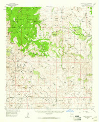
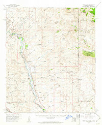
 1959 Canador Peak1960 Print · USGSThe Gila River valley and its surrounding high-desert mesas come alive in the late fifties, showcasing a landscape of isolated ranching and early mining. Genealogists and historians can trace the Southern Pacific Railroad or locate local landmarks like Virden and the Consolation Mine.3 unique versions available
 - 1959 Map of York Valley, 1961 Print
 1959 York Valley1961 Print · USGSThe Gila River valley in the late fifties was a remote corridor of rail transport and ranching along the Arizona-New Mexico line. Genealogists and historians can trace the family names behind Willis Ranch and Smith Ranch or locate the site of the old Tollhouse and Petroglyphs.3 unique versions available
 - 1959 Map of Douglas, 1968 Print
 1959 Douglas1968 Print · USGSSoutheast Arizona and southwest New Mexico meet at the border in the late fifties, showcasing a high-desert landscape defined by industrial copper mining and ranching. Genealogists and historians can trace the foundations of Bisbee, locate the Lavender Pit, and follow the Southern Pacific line through Douglas.4 unique versions available
End of results
Showing maps 1-15 of 15
Top cities of Hidalgo County
Frequently asked questions
- What are the different types of historical maps available for Hidalgo County?
- What is the oldest map of Hidalgo County?
- Where can I purchase historical maps of Hidalgo County for my home or office?
- Where can I download high-res historical maps of Hidalgo County?
- Are there historical topographic maps available for Hidalgo County?
- Is there historical aerial imagery available for Hidalgo County?
- Where are historical maps of Hidalgo County sourced from?