1960s Maps of Hidalgo County, New Mexico
Explore 22 historic maps of Hidalgo County from the 1960s. These maps offer a rare glimpse into what life looked like during the 1960s — showing old roads, neighborhoods, homes, and landmarks that have changed or disappeared over time.
Whether you're researching your family's past, planning a metal detecting trip, or studying how Hidalgo County's landscape evolved across the 1960s, these high-resolution maps are a powerful tool for exploring the history of this region.
- Focus on a specific era: All maps on this page are from the 1960s, giving you a focused view of this time period.
- See what’s changed: Compare century-old streets, trails, and buildings to today's modern landscape using overlays and satellite layers.
- Research with precision: Use these maps for genealogy, historical research, land use analysis, or educational projects.
- View, download, or print: Maps are fully viewable online in high resolution, and can be downloaded or printed for your own records.
Start exploring Hidalgo County's history through authentic maps from the 1960s. This is your window into the past.
Hidalgo County, NM maps
(22)- 1960 Map of Duncan, 1961 Print
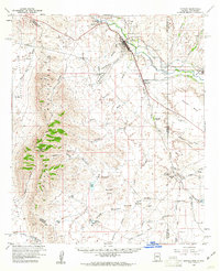 1960 Duncan1961 Print · USGSThe Gila River valley along the Arizona-New Mexico border is captured here in the early 1960s as a thriving corridor of rail and irrigation. Researchers can trace the Southern Pacific line through Duncan and Franklin, or locate family sites like Cox Ranch and Rainville Ranch.4 unique versions available
 - 1961 Map of Douglas
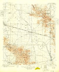
 1961 Douglas1961 Print · USGSThe Arizona-Mexico borderlands come into focus at mid-century, detailing the vital mining and ranching hubs of Cochise County and southwest New Mexico. Genealogists and historians can trace the Southern Pacific Railroad through Bisbee and Douglas, or locate early sites like the Old Hachita Mine and Rucker School.
 - 1962 Map of Silver City
 1962 Silver City1962 Print · USGSThe high desert borderlands of New Mexico and Arizona come alive in this early sixties survey. Genealogists and historians can trace the mining economy through the Chino Mine, follow the rail routes of the Southern Pacific, or locate settlements like Virden and Bayard.
 - 1962 Map of San Simon, 1971 Print
 1962 San Simon1971 Print · USGSThe Arizona-New Mexico borderlands come alive in this survey of the San Simon Valley and the Peloncillo Mountains as they appeared before the Great War. Genealogists and historians can trace the foundations of Old Fort Bowie, the SOUTHERN PACIFIC line, and family landmarks like Riggs Home Ranch.
 - 1962 Map of Lisbon, 1978 Print
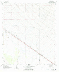 1962 Lisbon1978 Print · USGSHidalgo County in the early sixties is shown here as a critical transportation corridor through the high desert. Researchers can trace the path of the Butterfield Trail and the Southern Pacific line, passing by Lisbon and Mesquite Windmill.2 unique versions available
 - 1963 Map of Lordsburg, 1965 Print
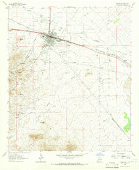 1963 Lordsburg1965 Print · USGSLordsburg and its surrounding mining districts are recorded here in the early sixties as the regional rail and road network matured. Genealogists and historians can trace old wagon routes like the Butterfield Trail or locate family sites near the Henry Clay Mine and Mountain View Cem.3 unique versions available
 - 1963 Map of Gold Hill, 1965 Print
 1963 Gold Hill1965 Print · USGSHidalgo and Grant Counties are documented here in the early 1960s, showing a rugged landscape defined by mountain ranching and hard-rock mining. Researchers can trace historic mineral claims like the Golden Cross Mine and locate family landmarks such as Cline Ranch and Gold Hill Cemetery.2 unique versions available
 - 1963 Map of Culberson Ranch, 1965 Print
 1963 Culberson Ranch1965 Print · USGSHidalgo County ranching life in the early 1960s was defined by desert water management and remote homesteads. Researchers can locate named landmarks like Culberson Ranch, find industrial groundwater sources such as Big Well, and trace deep-cut features like Hoodoo Canyon.2 unique versions available
 - 1964 Map of Douglas
 1964 Douglas1964 Print · USGSThe Arizona-New Mexico borderlands in the early sixties reveal a landscape of deep-rooted copper mining and high-desert ranching. Genealogists and researchers can trace the legacy of settlements like Pirtleville, the industrial site of the Copper Smelter, and remnants of the Cochise Mines.
 - 1964 Map of Muir Ranch, 1966 Print
 1964 Muir Ranch1966 Print · USGSThe high desert of Hidalgo and Grant counties is shown here in the mid-1960s, defined by its ranching economy and rail history. Trace family-named landmarks and infrastructure such as Muir Ranch, the Old Railroad Grade, and Homestead Hill.2 unique versions available
 - 1964 Map of South Pyramid Peak, 1966 Print
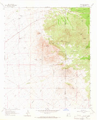
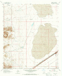
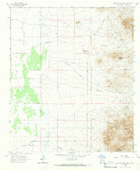
 1964 South Pyramid Peak1966 Print · USGSThe Pyramid Mountains of Hidalgo County are shown here in the mid-1960s, capturing a remote landscape defined by the winding Continental Divide. Researchers can trace the essential water network of the era through sites like Rattler Well, China Pond, and Piedra Wells.2 unique versions available
 - 1964 Map of Pyramid Peak, 1966 Print
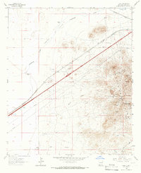
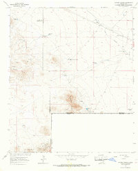
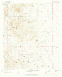 1964 Pyramid Peak1966 Print · USGSThe Pyramid Mountains of southwestern New Mexico are documented here in the mid-1960s, showing a landscape defined by ranching and high-desert hydrology. Researchers can trace the water sources and land-use markers of the era through sites like Jose Placencia Canyon, Cedar Mountain, and McWirter Canyon.
 - 1964 Map of Table Top Mountain, 1966 Print
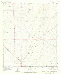
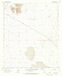
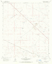
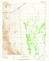
 1964 Table Top Mountain1966 Print · USGSHidalgo County ranching and early aviation are visible in this mid-1960s survey of the New Mexico desert. Researchers can locate family operations like Wamel Ranch and infrastructure including the Cotton Gin and Cotton City Landing Area.2 unique versions available
 - 1964 Map of Coyote Peak, 1966 Print
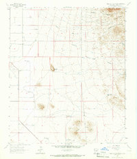
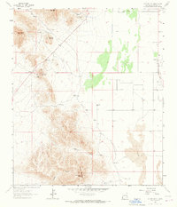
 1964 Coyote Peak1966 Print · USGSThe arid borderlands of New Mexico are captured in the mid-1960s, showing a landscape defined by the CONTINENTAL DIVIDE and ranching. Trace early water infrastructure like Baker Wells and New Coyote Tank near the Bertoglio-Merrill Ranch.2 unique versions available
 - 1964 Map of Summit, 1966 Print
 1964 Summit1966 Print · USGSHidalgo County's high desert landscape comes into focus during the mid-1960s, a period when the Southern Pacific still anchored the small community of Summit. Researchers can trace the essential water infrastructure of the era, from the High Lonesome Windmill to the Three Mills Tank.
 - 1964 Map of Mondel, 1966 Print
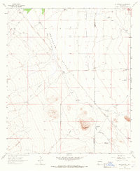
 1964 Mondel1966 Print · USGSHidalgo County's arid basin and range topography is captured here in the mid-1960s, showing a landscape shaped by historic transit and ranching. Researchers can trace the legendary Butterfield Trail and locate family-named sites like Robinson Windmill and the settlement of Mondel.
 - 1964 Map of Gary, 1966 Print
 1964 Gary1966 Print · USGSThe high desert of Hidalgo County comes alive in the mid-1960s, showing the intersection of the historic Butterfield Trail and the Southern Pacific railroad. Genealogists and historians can trace mining activity at the Anita Mine or locate family-named landmarks like the Wright Windmill.2 unique versions available
 - 1964 Map of Ninemile Hill, 1966 Print
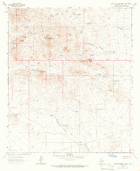
 1964 Ninemile Hill1966 Print · USGSHidalgo County ranching and rail infrastructure are captured here in the mid-1960s as the high-desert landscape modernizes. Researchers can trace historic water sources and ranch holdings like the Box M Ranch, Malpais Windmill, and the Southern Pacific rail line.2 unique versions available
 - 1964 Map of Cotton City, 1967 Print
 1964 Cotton City1967 Print · USGSCotton City and the surrounding high-desert ranching country are shown in the early sixties as a hub of mining and cattle operations. Researchers can trace family outposts like Weatherby Ranch and locate historical diggings including the Montgomery Mine and Vesley Mine.2 unique versions available
 - 1965 Map of Swallow Fork Peak, 1966 Print
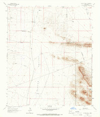
 1965 Swallow Fork Peak1966 Print · USGSHidalgo County's high-desert terrain is captured here in the mid-1960s, showing a landscape of ranching water holes and remote mining prospects. Researchers can trace historical land use through landmarks like the Silver Bell Mine, CCC Tank, and Lightning Dock Mountain.2 unique versions available
 - 1965 Map of Steins, 1966 Print
 1965 Steins1966 Print · USGSHidalgo County's high-desert mining and ranching landscapes are captured here during the mid-sixties, as the railroad and Interstate 10 corridor took shape. Local historians can trace old mining claims at the North Star Mine or locate the rural Valley View Ch and Cem near the mountains.2 unique versions available
 - 1965 Map of Victorio Ranch, 1967 Print
 1965 Victorio Ranch1967 Print · USGSThe high desert borderlands south of Deming appear here in the mid-sixties, where the New Mexico and Mexico line meets at the Sierra Rica. Trace the history of remote ranching and mining through the Victorio Cem, the Old Railroad Grade, and the International Mine.2 unique versions available
End of results
Showing maps 1-22 of 22
Top cities of Hidalgo County
Frequently asked questions
- What are the different types of historical maps available for Hidalgo County?
- What is the oldest map of Hidalgo County?
- Where can I purchase historical maps of Hidalgo County for my home or office?
- Where can I download high-res historical maps of Hidalgo County?
- Are there historical topographic maps available for Hidalgo County?
- Is there historical aerial imagery available for Hidalgo County?
- Where are historical maps of Hidalgo County sourced from?