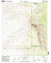
1990s Maps of Hidalgo County, New Mexico
Explore 26 historic maps of Hidalgo County from the 1990s. These maps offer a rare glimpse into what life looked like during the 1990s — showing old roads, neighborhoods, homes, and landmarks that have changed or disappeared over time.
Whether you're researching your family's past, planning a metal detecting trip, or studying how Hidalgo County's landscape evolved across the 1990s, these high-resolution maps are a powerful tool for exploring the history of this region.
- Focus on a specific era: All maps on this page are from the 1990s, giving you a focused view of this time period.
- See what’s changed: Compare century-old streets, trails, and buildings to today's modern landscape using overlays and satellite layers.
- Research with precision: Use these maps for genealogy, historical research, land use analysis, or educational projects.
- View, download, or print: Maps are fully viewable online in high resolution, and can be downloaded or printed for your own records.
Start exploring Hidalgo County's history through authentic maps from the 1990s. This is your window into the past.
Hidalgo County, NM maps
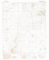
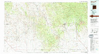
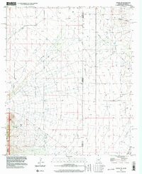
(26)- 1990 Map of Willow Draw, 1991 Print
 1990 Willow Draw1991 Print · USGSHidalgo and Grant Counties meet in this arid basin during the late twentieth century, where water management shaped the desert landscape. Trace the network of cattle tanks and seasonal washes like Willow Draw, Harper Tank, and the rugged Knight Canyon.
 - 1990 Map of Eagle Eye Peak, 1991 Print
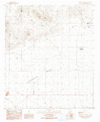
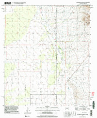
 1990 Eagle Eye Peak1991 Print · USGSThe high ridges of the Gila National Forest come to life in this 1990 survey of the Grant and Hidalgo county line. Researchers can trace the legacy of southwestern mining and ranching through landmarks like the Malone Mines, the Open Pit Mine, and family-named features like Thompson Canyon.
 - 1990 Map of Walker Canyon, 1991 Print
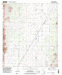
 1990 Walker Canyon1991 Print · USGSThe high desert borderlands of Grant and Hidalgo Counties appear in the early 1990s as a landscape of isolated canyons and mesas. Geologists and local historians can trace mining activity at the Open Pit Mine or locate vital water sources like Walker Tank and Mud Springs Draw.
 - 1990 Map of Steeple Rock, 1991 Print
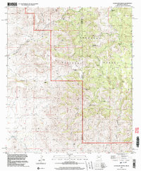
 1990 Steeple Rock1991 Print · USGSNear the Hidalgo county line in the early 1990s, this area of the Summit Mountains was a center of intensive mineral exploration. Genealogists and historians can trace the legacy of the mining era through the Carlisle Mine, the Graves cemetery, and family-named sites like the Hext Place.
 - 1990 Map of Nichols Canyon, 1991 Print
 1990 Nichols Canyon1991 Print · USGSThe Gila River basin in southwestern New Mexico was home to scattered mining operations and ranching outposts during the late twentieth century. Genealogists and historians can trace local industry and infrastructure through features like the Black Bob Mine, Anderson Windmill, and a small Cem.
 - 1990 Map of Rock Tank Draw, 1991 Print
 1990 Rock Tank Draw1991 Print · USGSHidalgo County's arid high-desert landscape is captured here in the late twentieth century as ranching and infrastructure intersected. Researchers can trace land use through local landmarks like Cottonwood Windmill, Rock Tank, and the Summit Hills.
 - 1990 Map of Canador Peak, 1991 Print
 1990 Canador Peak1991 Print · USGSHidalgo County ranching and river life are preserved here in the late twentieth century, before modern changes altered the valley. Trace irrigation works near Virden, find the isolated Mine Shafts by Riley Peaks, or locate the Landing Strip on the valley floor.
 - 1990 Map of Caprock Mountain, 1991 Print
 1990 Caprock Mountain1991 Print · USGSHidalgo County in the late twentieth century remained a center for desert mineral exploration and transit. Researchers can locate specific industrial sites such as the Constellation Mine and Poe Mine or trace the vast Lordsburg Mesa terrain.
 - 1994 Map of Douglas
 1994 Douglas1994 Print · USGSThe copper mining heart of Cochise County and the international border are captured here in the mid-nineties. Researchers can trace the massive Lavender Pit at Bisbee or locate rural landmarks like Paul Spur and the San Bernardino National Wildlife Refuge.2 unique versions available
 - 1994 Map of Willcox
 1994 Willcox1994 Print · USGSSoutheast Arizona in the mid-nineties shows a landscape defined by expansive desert basins and rugged sky islands. Genealogists and historians can trace the rail corridor of the Southern Pacific through Willcox, Bowie, and the Kansas Settlement.2 unique versions available
 - 1994 Map of Silver City
 1994 Silver City1994 Print · USGSThe mining heart of Grant County is revealed in the mid-1990s as the massive industrial footprints of the copper industry shaped the landscape. Genealogists and historians can trace the rail lines of the Atchison Topeka and Santa Fe RR or locate landmarks like Fort Bayard State Medical Center and White Signal.
 - 1994 Map of Safford
 1994 Safford1994 Print · USGSSoutheastern Arizona and the New Mexico borderlands come into focus in the mid-1990s, highlighting the irrigation-fed life of the Gila Valley. Genealogists and researchers can trace local landmarks like Eastern Arizona College, the Southern Pacific RR, and settlements from Artesia to Virden.2 unique versions available
 - 1994 Map of Chiricahua Peak
 1994 Chiricahua Peak1994 Print · USGSSoutheast Arizona in the mid-nineties shows a land of high sky islands and broad cattle valleys transitioning into New Mexico. Trace the legacy of old mining camps and railroad stops from Pearce and Gleeson to the canyons of the Chiricahua Mountains.2 unique versions available
 - 1996 Map of Skull Canyon, 2002 Print
 1996 Skull Canyon2002 Print · USGSThe Arizona and New Mexico borderlands in the mid-nineties are defined here by high-desert drainage and historical transport routes. Researchers can trace the Old Railroad Grade and locate vital backcountry water sources like Kimble Tank and Natural Tanks.
 - 1996 Map of Vanar, 2003 Print
 1996 Vanar2003 Print · USGSThe Arizona-New Mexico state line at the end of the century shows a landscape defined by utility corridors and desert mining. Genealogists and industrial historians can trace an Old Railroad Grade, find scattered Mine Shafts near Steins Mountain, and locate the old Pumping Station.
 - 1996 Map of Portal NE, 2003 Print
 1996 Portal NE2003 Print · USGSThe Arizona and New Mexico borderlands come into focus in the mid-1990s, showcasing the high-desert transition from the Peloncillo Mountains to the valley. Researchers can locate the Landing Strip near the state line or trace the old Mine Shaft and GLO Station 5 survey markers.
 - 1996 Map of San Simon Cienega, 2003 Print
 1996 San Simon Cienega2003 Print · USGSThe high desert border between Arizona and New Mexico is captured here in the mid-1990s, centering on the vital waters of the San Simon Cienega. Researchers can trace remote ranching life at Cienega Ranch and locate the small cemetery and landing strip nearby.
 - 1996 Map of Rodeo, 2003 Print
 1996 Rodeo2003 Print · USGSThe high desert border between Arizona and New Mexico is captured here in the mid-1990s, centered on the community of Rodeo. Researchers can trace the path of the Old Railroad Grade and locate local landmarks like the Cem and Sanford Tanks.
 - 1997 Map of Guadalupe Spring, 2003 Print
 1997 Guadalupe Spring2003 Print · USGSThe high desert borderlands of New Mexico and Arizona are captured here in the late twentieth century, showing a remote landscape of deep canyons and peaks. Researchers can locate the isolated Cem and several historic water sources like Pickhandle Tank and Guadalupe Spring.
 - 1997 Map of Mount Baldy, 2003 Print
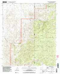
 1997 Mount Baldy2003 Print · USGSHidalgo County, New Mexico, was a land of high peaks and vital water tanks in the late nineties. Modern researchers can trace the movement through the Coronado National Forest and locate specific landmarks like Maverick Spring, Miller Tank, and Mount Baldy.
 - 1997 Map of Skeleton Canyon, 2003 Print
 1997 Skeleton Canyon2003 Print · USGSThe Peloncillo Mountains along the Arizona-New Mexico border appear here in the late twentieth century, showing a remote landscape shaped by water and ranching history. Researchers can trace historic water sources and rugged drainages like Skeleton Canyon, Woodchoppers Spring, and Geronimo Tank.
 - 1998 Map of Doubtful Canyon, 2003 Print
 1998 Doubtful Canyon2003 Print · USGSThe high desert borderlands of Arizona and New Mexico appear here as they were in the late nineties, defined by the historic Butterfield Trail. Researchers can locate specialized mining sites like the Volcano Mine or Flora Mine and trace water sources like Ward Spring.
 - 1998 Map of Black Point, 2003 Print
 1998 Black Point2003 Print · USGSThe New Mexico Bootheel in the late twentieth century remains a landscape of cattle ranching and high-elevation peaks. Researchers can trace the ranching infrastructure around Cloverdale, including family-named landmarks like Cordy Cowan Tank and the local Cem.
 - 1998 Map of Clanton Draw, 2003 Print
 1998 Clanton Draw2003 Print · USGSHidalgo County ranch lands and the edge of the Coronado National Forest are captured here at the close of the century. Researchers can trace the essential water infrastructure of this arid landscape through named catchments like Irishman Tank, Maddock Tank, and Patterson Tank.
 - 1999 Map of Eagle Eye Peak, 2002 Print
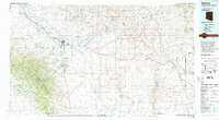
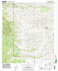
 1999 Eagle Eye Peak2002 Print · USGSThe high desert ranching and mining lands of Grant and Hidalgo counties are captured here in the late 1990s. Genealogists and historians can locate legacy homesteads like Ray Ranch or trace early mineral exploration at Mabie Mine and Knight Peak.
Showing maps 1-25 of 26
Top cities of Hidalgo County
Frequently asked questions
- What are the different types of historical maps available for Hidalgo County?
- What is the oldest map of Hidalgo County?
- Where can I purchase historical maps of Hidalgo County for my home or office?
- Where can I download high-res historical maps of Hidalgo County?
- Are there historical topographic maps available for Hidalgo County?
- Is there historical aerial imagery available for Hidalgo County?
- Where are historical maps of Hidalgo County sourced from?