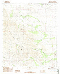
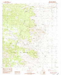
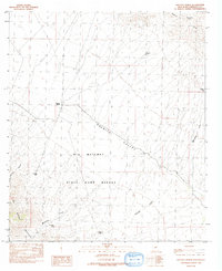
1980s Maps of Hidalgo County, New Mexico
Explore 54 historic maps of Hidalgo County from the 1980s. These maps offer a rare glimpse into what life looked like during the 1980s — showing old roads, neighborhoods, homes, and landmarks that have changed or disappeared over time.
Whether you're researching your family's past, planning a metal detecting trip, or studying how Hidalgo County's landscape evolved across the 1980s, these high-resolution maps are a powerful tool for exploring the history of this region.
- Focus on a specific era: All maps on this page are from the 1980s, giving you a focused view of this time period.
- See what’s changed: Compare century-old streets, trails, and buildings to today's modern landscape using overlays and satellite layers.
- Research with precision: Use these maps for genealogy, historical research, land use analysis, or educational projects.
- View, download, or print: Maps are fully viewable online in high resolution, and can be downloaded or printed for your own records.
Start exploring Hidalgo County's history through authentic maps from the 1980s. This is your window into the past.
Hidalgo County, NM maps
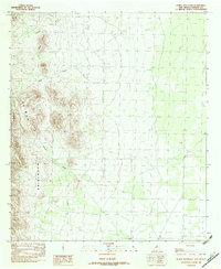
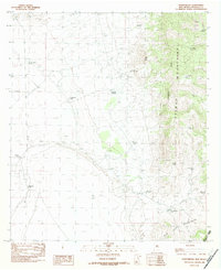
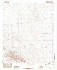
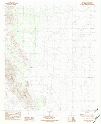
(54)- 1981 Map of Lordsburg
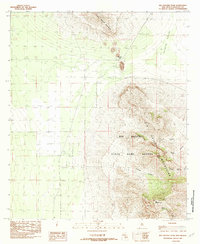
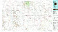 1981 Lordsburg1981 Print · USGSHidalgo County in the early eighties remains a landscape defined by the copper-and-rail economy and the long stretch of the Continental Divide. Genealogists and historians can trace the paths of the Southern Pacific and small settlements like Cotton City or find remote workings such as the Golden Cross Mine.
 - 1982 Map of Playas Lake North
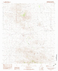
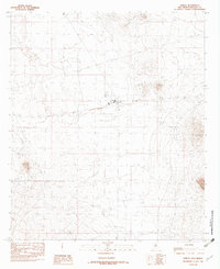
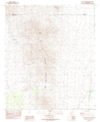
 1982 Playas Lake North1982 Print · USGSHidalgo County's industrial desert landscape is captured here in the early eighties as the town of Playas took shape. Researchers can trace the development of this company town, from its Phelps Dodge Industrial R.R. connection to the Trailer Park and Hellport.
 - 1982 Map of Playas Lake South
 1982 Playas Lake South1982 Print · USGSHidalgo County industry and desert geography meet in the early 1980s as mining and refining operations expanded near the dry basin. Researchers can locate the massive Smelter complex and trace water management features from Whitmire Spring to Playas Lake.
 - 1982 Map of Walnut Wells NE
 1982 Walnut Wells NE1982 Print · USGSThe high slopes of the Animas Mountains and their desert drainages are captured here in the early 1980s. Researchers can trace the courses of Cottonwood Creek, Gillespie Creek, and Millsite Creek across this rugged ranching country.
 - 1982 Map of Horse Mountain
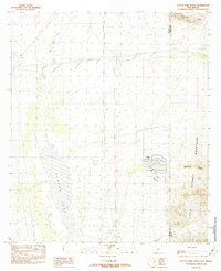
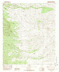
 1982 Horse Mountain1982 Print · USGSThe northern Animas Mountains and desert flats of Hidalgo County are shown here as they were surveyed in the late seventies. Trace the arid drainages of Cowboy Creek and Tullous Creek past landmarks like Horse Mountain and Fireplace.
 - 1982 Map of Antelope Pass
 1982 Antelope Pass1982 Print · USGSThe high desert of Hidalgo County in the early eighties reveals a landscape of transit and mining history. Trace the Old Railroad Grade near Pratt or locate family-named landmarks like Martin Draw and Nipple Hill.
 - 1982 Map of Animas Peak NE
 1982 Animas Peak NE1982 Print · USGSThe high desert of Hidalgo County appears here in the early eighties as a network of vital ranching water sources and mountain drainages. Researchers can trace the rugged topography of the Animas Mountains and locate historic sites like Double Adobes or Middle Wells.
 - 1982 Map of Doyle Peak
 1982 Doyle Peak1982 Print · USGSThe high desert of Hidalgo County in the early eighties is defined here by the steep elevations of the Apache Hills and the Hachita Valley. Researchers can trace the isolated landscape around Doyle Peak, Quartzite Ridge, and cattle tanks like Chapo Tank.
 - 1982 Map of Big Hatchet Peak
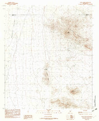
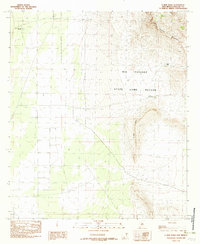
 1982 Big Hatchet Peak1982 Print · USGSHidalgo County's high desert peaks and game lands were documented in the late seventies just before this survey was edited. Researchers and outdoorsmen can locate specific water sources like Sheep Tank and trace the deep recesses of Ram Gorge or Mescal Canyon.
 - 1982 Map of Animas
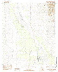
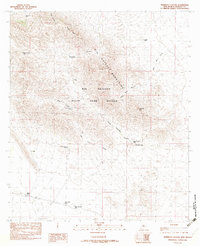
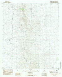
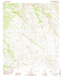
 1982 Animas1982 Print · USGSHidalgo County's high-desert ranching country is documented here in the early 1980s, centered on the settlement of Animas. Researchers can trace the path of the Old R R, locate the local Cem, and navigate landmarks like Limestone Hill.
 - 1982 Map of Sheridan Canyon
 1982 Sheridan Canyon1982 Print · USGSThe Big Hatchet Mountains in Hidalgo County were managed for conservation and wildlife in the early 1980s. Local history researchers can trace water sources like Hell To Get To Tank and old sites in Mine Canyon and along Bugle Ridge.
 - 1982 Map of Center Peak
 1982 Center Peak1982 Print · USGSThe high Animas Mountains and the winding Continental Divide are captured here in the early eighties. Researchers and ranching historians can trace vital water sources and land divisions like Cowboy Rim, Rock Guard Tank, and Lower Walnut Tank.
 - 1982 Map of Fitzpatricks
 1982 Fitzpatricks1982 Print · USGSHidalgo County ranch lands are captured here in the early eighties, where the Continental Divide crosses the high desert. Researchers can trace the water infrastructure of the era through sites like Fitzpatricks, Schoolhouse Tank, and Birch Spring.
 - 1982 Map of Pierce Peak
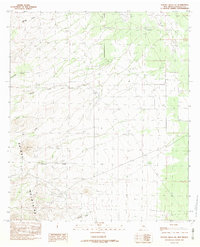
 1982 Pierce Peak1982 Print · USGSThe rugged Alamo Hueco Mountains and the Big Hatchet State Game Refuge define this corner of Hidalgo County in the early eighties. Local researchers can trace historic water sources like The Thicket Spring, Cottonwood Spring, and landmarks such as Pierce Peak.
 - 1982 Map of Mount Baldy
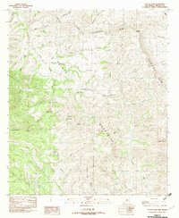
 1982 Mount Baldy1982 Print · USGSHidalgo County's high desert peaks and canyons are captured in detail here during the early eighties. Researchers and hikers can locate specific water sources like Maverick Spring and Slover Tank, or trace the rugged geography of Post Office Canyon and Mount Baldy.
 - 1982 Map of Black Point
 1982 Black Point1982 Print · USGSThe high desert of Hidalgo County comes into focus in the early eighties, showing the ranching infrastructure of the Guadalupe Mountains. Researchers can trace old water sources and ranch sites like Cloverdale Spring and Windy Miller Tank.
 - 1982 Map of Hatchet Ranch
 1982 Hatchet Ranch1982 Print · USGSHidalgo County ranching life in the early 1980s was centered on the vital water sources of the high desert. Researchers can trace the layout of the Hatchet Ranch and the network of stock tanks like Elkins Tank and Thompson Tank scattered throughout the State Game Refuge.
 - 1982 Map of Clanton Draw
 1982 Clanton Draw1982 Print · USGSHidalgo County's high desert landscape comes into focus in the early 1980s, detailing a region shaped by ranching and forest management. Researchers can locate remote cattle infrastructure and landmarks like Skeleton Canyon, Patterson Tank, and Deer Flat.2 unique versions available
 - 1982 Map of Gillespie Mountain
 1982 Gillespie Mountain1982 Print · USGSHidalgo County's high desert peaks and mineral prospects are documented here during the early eighties. Researchers and hikers can trace the Continental Divide as it passes Gillespie Mountain and locate early industrial activity at the Open Pit Mines.
 - 1982 Map of Whitmire Pass
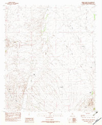
 1982 Whitmire Pass1982 Print · USGSIn the early 1980s, the high desert of Hidalgo County remained a remote expanse defined by the Continental Divide. Researchers can trace old resource exploration sites such as Prospects and the difficult route through Whitmire Pass.
 - 1982 Map of Beacon Hill
 1982 Beacon Hill1982 Print · USGSHidalgo County in the early eighties shows a high-desert landscape defined by the Animas Mountains and the Continental Divide. Researchers can trace the path of an Old Railroad Grade and locate localized features like a Trailer Park or Beacon Hill.
 - 1982 Map of Hachita Peak
 1982 Hachita Peak1982 Print · USGSThe Little Hatchet Mountains in the early 1980s reveal a landscape shaped by mining and high-desert passes. Researchers can trace historical resource extraction at a Mine Shaft and Prospects or locate the remote Cottonwood Spring.
 - 1982 Map of Hilo Peak
 1982 Hilo Peak1982 Print · USGSHidalgo County is captured in the early eighties, showcasing a high-desert terrain dominated by the Animas Mountains. Researchers can trace old stock routes through Granite Pass or locate remote water features like Little Brushy Tank and South Tank.
 - 1982 Map of U Bar Ridge
 1982 U Bar Ridge1982 Print · USGSThe high desert of Hidalgo County in the early eighties is a study in conservation and remote terrain. Genealogists and researchers can trace access routes via 4WD tracks to isolated landmarks like Las Cienegas Spring and the U Bar Ridge overlook.
 - 1982 Map of San Luis Pass
 1982 San Luis Pass1982 Print · USGSHidalgo County's remote borderlands are captured here in the early eighties, where the Continental Divide separates high mountain ranges. Researchers can trace historic access points like San Luis Pass and locate ranching landmarks such as Big Geronimo Tank and Smith Tank.
Showing maps 1-25 of 54
Top cities of Hidalgo County
Frequently asked questions
- What are the different types of historical maps available for Hidalgo County?
- What is the oldest map of Hidalgo County?
- Where can I purchase historical maps of Hidalgo County for my home or office?
- Where can I download high-res historical maps of Hidalgo County?
- Are there historical topographic maps available for Hidalgo County?
- Is there historical aerial imagery available for Hidalgo County?
- Where are historical maps of Hidalgo County sourced from?