1960s Maps of Rio Arriba County, New Mexico
Explore 56 historic maps of Rio Arriba County from the 1960s. These maps offer a rare glimpse into what life looked like during the 1960s — showing old roads, neighborhoods, homes, and landmarks that have changed or disappeared over time.
Whether you're researching your family's past, planning a metal detecting trip, or studying how Rio Arriba County's landscape evolved across the 1960s, these high-resolution maps are a powerful tool for exploring the history of this region.
- Focus on a specific era: All maps on this page are from the 1960s, giving you a focused view of this time period.
- See what’s changed: Compare century-old streets, trails, and buildings to today's modern landscape using overlays and satellite layers.
- Research with precision: Use these maps for genealogy, historical research, land use analysis, or educational projects.
- View, download, or print: Maps are fully viewable online in high resolution, and can be downloaded or printed for your own records.
Start exploring Rio Arriba County's history through authentic maps from the 1960s. This is your window into the past.
Rio Arriba County, NM maps
(56)- 1960 Map of Taos Junction, 1963 Print
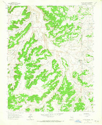
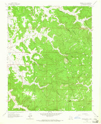
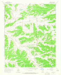
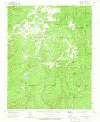
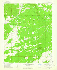 1960 Taos Junction1963 Print · USGSHigh-altitude New Mexico terrain at the dawn of the sixties shows a landscape defined by ranching life and mountain transit. Researchers can trace the Old Railroad Grade and locate long-standing landmarks like Taos Junction and Cerro Azul.3 unique versions available
 - 1961 Map of Durango
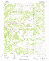
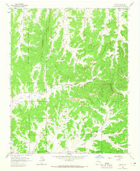
 1961 Durango1961 Print · USGSThe high San Juan country in the early sixties is shown here as a network of historic mining towns and early reservoir projects. Genealogists and researchers can trace the Denver & Rio Grande Western RR as it connects Durango, Silverton, and Arboles.
 - 1961 Map of Servilleta Plaza, 1963 Print
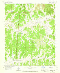
 1961 Servilleta Plaza1963 Print · USGSNorthern New Mexico's high-country terrain is captured here in the early sixties, centered on the settlement of Servilleta Plaza. Genealogists and historians can trace the Old Railroad Grade near Route 285 and locate landmarks like Cerro Mojino.2 unique versions available
 - 1962 Map of Aztec
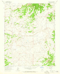
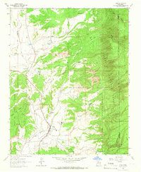
 1962 Aztec1962 Print · USGSNorthwestern New Mexico in the early sixties showcases a landscape defined by the arrival of the Navajo Reservoir and the high-altitude timber of the Carson National Forest. Trace the path of the Denver & Rio Grande Western RR or locate historic settlements like Tierra Amarilla and Gobernador.
 - 1962 Map of Albuquerque
 1962 Albuquerque1962 Print · USGSAlbuquerque and the surrounding high desert are captured here in the early 1960s during a period of intense mineral and military growth. Genealogists and historians can locate early schools like the Pueblo Pintado School, major industrial sites like the Jackpile Mine, and the sprawling Kirtland Air Force Base.
 - 1963 Map of Durango
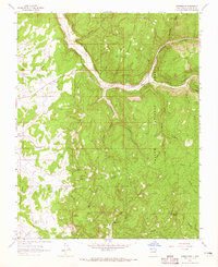
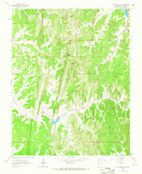
 1963 Durango1963 Print · USGSThe San Juan Mountains and San Luis Valley are captured here in the early 1950s as mining, rail, and tribal lands shaped the region. Researchers can trace the Denver & Rio Grande Western RR through high-country towns like Telluride and Silverton, or locate landmarks such as the Asiatic Mine.
 - 1963 Map of Lapis Point, 1965 Print
 1963 Lapis Point1965 Print · USGSThe Jicarilla Apache lands are captured here in the early sixties during a period of expanding energy infrastructure. Researchers can trace early gas development across Wild Horse Mesa and find localized landmarks like Eagles Nest and Lapis Point.
 - 1963 Map of Albuquerque, 1965 Print
 1963 Albuquerque1965 Print · USGSMid-century New Mexico unfolds across this map, showcasing the intersection of ancient pueblos, modern military bases, and historic mining districts. Trace family roots and local history through the Ortiz Mine, Seven Lakes Trading Post, and Alameda.3 unique versions available
 - 1963 Map of Schmitz Ranch, 1965 Print
 1963 Schmitz Ranch1965 Print · USGSThe Jicarilla Apache Indian Reservation in the mid-1960s reveals a landscape of high mesas and early energy exploration. Researchers can trace the ranching history and natural resource development at Schmitz Ranch, Ojito Camp, and along Wild Horse Mesa.
 - 1963 Map of Tayfoya Canyon, 1965 Print
 1963 Tayfoya Canyon1965 Print · USGSRio Arriba County’s rugged canyonlands are captured here in the early sixties as the San Juan Basin gas field expanded across the landscape. Researchers can trace remote ranch sites like Old Rock Ranch and industrial markers like the Lindrith Pumping Station.2 unique versions available
 - 1963 Map of Truchas Peak, 1965 Print
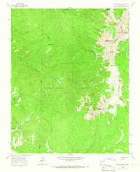 1963 Truchas Peak1965 Print · USGSThe Sangre de Cristo high country is surveyed here in the early sixties, showing the intersection of three counties among alpine peaks and glacial lakes. Hikers and historians can trace old routes to Brazas Cabin, Jose Vigil Lake, and the remote Horsethief Meadow.2 unique versions available
 - 1963 Map of Pecos Falls, 1965 Print
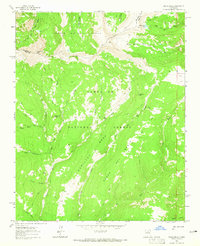 1963 Pecos Falls1965 Print · USGSThe high wilderness of Mora County is captured here in the early sixties, showing the convergence of major national forests. Backcountry travelers can trace the pack trails leading to Beatty Cabin, Pecos Falls, and the summit of Chimayosos Peak.2 unique versions available
 - 1963 Map of Fourmile Canyon, 1965 Print
 1963 Fourmile Canyon1965 Print · USGSUpper Rio Arriba County is shown in the early sixties as a center of ranching and early energy development. Genealogists and researchers can trace the roads to Gobernador Camp, the Gobernador Sch, and remote markers like Encierro Canyon.2 unique versions available
 - 1963 Map of Espinosa Ranch, 1965 Print
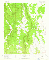
 1963 Espinosa Ranch1965 Print · USGSRio Arriba County in the early sixties was a landscape of deep canyons and mesas within the Carson National Forest. Researchers can trace the mid-century energy infrastructure and isolated outposts like Espinosa Ranch, Manuel Spring, and Mesteñas Peak.4 unique versions available
 - 1963 Map of Gobernador, 1965 Print
 1963 Gobernador1965 Print · USGSUpper Rio Arriba County appears in the early sixties as a ranching landscape transitioning into a gas-producing hub. Researchers can trace historic sites like Gobernador, locate the Cem, and find scattered water sources like Bubbling Spring and Trujillo Reservoir.3 unique versions available
 - 1963 Map of Gonzales Mesa, 1965 Print
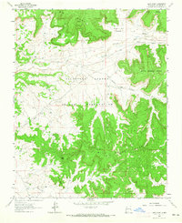
 1963 Gonzales Mesa1965 Print · USGSRio Arriba County’s high mesas and deep canyons are captured here in the early sixties as energy infrastructure began to crisscross the landscape. Researchers can trace the layout of the Jicarilla Apache Indian Reservation and locate remote outposts like Kaime Ranch or the Dogle Canyon Pumping Station.2 unique versions available
 - 1963 Map of Otero Store, 1965 Print
 1963 Otero Store1965 Print · USGSThe Jicarilla Apache lands of Rio Arriba County are shown here in the early sixties as a center for energy and ranching. Trace the isolated landmark of Otero Store and the network of Oil Wells tucked between Wild Horse Mesa and Navajo Valley.2 unique versions available
 - 1963 Map of Lindrith, 1965 Print
 1963 Lindrith1965 Print · USGSThe high canyon country of Rio Arriba County is shown here in the early sixties as the San Juan Basin gas field expanded. Researchers can trace the ranching and energy footprint across the Jicarilla Apache Indian Reservation and locate local landmarks like the Lindrith Cem and Ojito Camp.2 unique versions available
 - 1963 Map of Ojito, 1965 Print
 1963 Ojito1965 Print · USGSHigh desert ranching and tribal lands meet at the Continental Divide in the early 1960s. Researchers can locate remote family landmarks like Huffman Ranch, the settlement of Ojito, and a lonely hillside Cem.2 unique versions available
 - 1963 Map of Cement Lake, 1966 Print
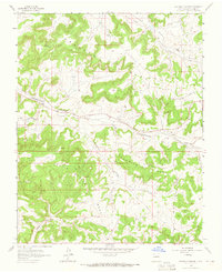
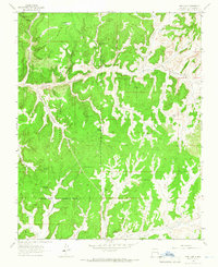
 1963 Cement Lake1966 Print · USGSRio Arriba County is shown here in the early sixties, highlighting a landscape of ridge-top lookouts and essential canyon water sources. Researchers can trace the heritage of the local timber industry and ranching via Pounds Mill, the Pounds Mill Guard Station, and Lower Burro Canyon Well.
 - 1963 Map of Cuba, 1966 Print
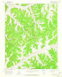
 1963 Cuba1966 Print · USGSThe high desert valley of north-central New Mexico is captured here in the early sixties, centered on the community of Cuba. Researchers can trace old family sites and rural infrastructure at La Placita, Santos Niños Church, and the Circle A Ranch.3 unique versions available
 - 1963 Map of Nacimiento Peak, 1966 Print
 1963 Nacimiento Peak1966 Print · USGSThe high meadows and alpine headwaters of Rio Arriba County are captured here in the early 1960s. Researchers can trace the network of mountain trails and clearings like American Park, Vega Redonda, and the banks of San Gregorio Reservoir.2 unique versions available
 - 1963 Map of John Mills Lake, 1966 Print
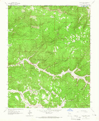
 1963 John Mills Lake1966 Print · USGSRio Arriba County in the early sixties was a land of high ridges and deep canyons managed for water and forestry. Researchers can trace the path of Pounds Mill Road to find John Mills Lake, the Lookout Tower, and the spillway system.
 - 1963 Map of Pine Lake, 1966 Print
 1963 Pine Lake1966 Print · USGSRio Arriba County’s high mesa country is captured here in the early 1960s as energy development began to mark the tribal landscape. Researchers can trace the Jicarilla Apache Indian Reservation Boundary and locate isolated water sources like Pine Lake, Bee Spring, and the headwaters of Tapicito Creek.3 unique versions available
 - 1963 Map of Bancos Mesa, 1966 Print
 1963 Bancos Mesa1966 Print · USGSThe high mesas of Rio Arriba County remain largely untouched in the early sixties, situated right where the New Mexico border meets Colorado. Researchers can trace the ranching history of the Carson National Forest through features like Velasquez Spring and the vast Bancos Mesa.3 unique versions available
Showing maps 1-25 of 56
Top cities of Rio Arriba County
Frequently asked questions
- What are the different types of historical maps available for Rio Arriba County?
- What is the oldest map of Rio Arriba County?
- Where can I purchase historical maps of Rio Arriba County for my home or office?
- Where can I download high-res historical maps of Rio Arriba County?
- Are there historical topographic maps available for Rio Arriba County?
- Is there historical aerial imagery available for Rio Arriba County?
- Where are historical maps of Rio Arriba County sourced from?