Old Maps of Magdalena, New Mexico for Metal Detecting
Plan your next treasure hunt with 33 historic maps of Magdalena. Find old homesites, ghost towns, trails, and gathering spots that may be lost to time — perfect for identifying promising metal detecting locations.
- Locate forgotten sites: Uncover places like long-lost settlements, abandoned rail lines, or gathering spots.
- Plan better hunts: Use map overlays combined with LiDAR or satellite views to narrow in on historically rich areas.
- Made for detectorists: Thousands of hobbyists use these maps to discover relics, coins, and hidden history.
Use these historic maps to boost your research and find new opportunities beneath the surface of Magdalena.
Magdalena, NM maps
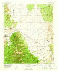
(33)- 1954 Map of Socorro, 1972 Print
 1954 Socorro1972 Print · USGSMid-century New Mexico comes into focus as the Rio Grande valley and the surrounding high desert undergo post-war growth. Genealogists and historians can trace old mountain settlements like Tajique and Punta de Agua or locate remote sites like the Torrance Mine.2 unique versions available
 - 1958 Map of Socorro
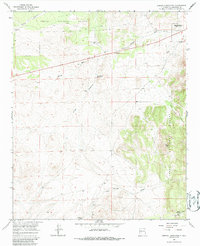
 1958 Socorro1958 Print · USGSNew Mexico's high desert during the late fifties reveals a landscape of massive land grants and remote mining outposts. Researchers can trace the path of the Atchison Topeka and Santa Fe railroad as it connects Socorro and Belen to industrial sites like the Manganese Mill.
 - 1959 Map of Magdalena, 1961 Print
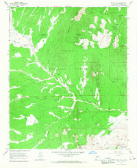
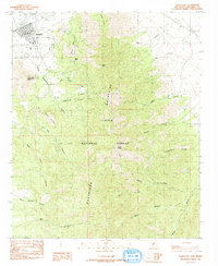
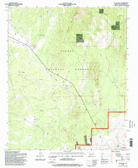
 1959 Magdalena1961 Print · USGSThe high desert of Socorro County comes alive in this late fifties survey of the Magdalena Mountains mining district. Researchers can trace historic industrial sites like the Hardscrabble Mine, locate family holdings such as B Kelly Ranch, or follow the path of the Atchison Topeka and Santa Fe railroad.2 unique versions available
 - 1962 Map of Socorro
 1962 Socorro1962 Print · USGSCentral New Mexico comes alive in the early sixties as the rail-and-river corridor of the Rio Grande connects historic pueblos and ranching towns. Local historians can trace the route of the Atchison Topeka and Santa Fe through Belen or locate the Torrance Mine near Mountainair.
 - 1963 Map of Arroyo Landavaso, 1967 Print
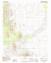
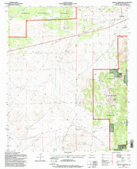
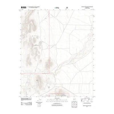
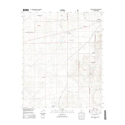
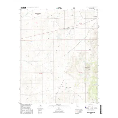
 1963 Arroyo Landavaso1967 Print · USGSMagdalena sat at the edge of the desert wilderness in the early sixties, where ranching life relied on a network of remote wells and reservoirs. Researchers can trace historic water sources like Boxcar Well and Landavaso Reservoir near the slopes of Cerro Pelon.2 unique versions available
 - 1964 Map of Silver Hill, 1967 Print
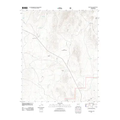
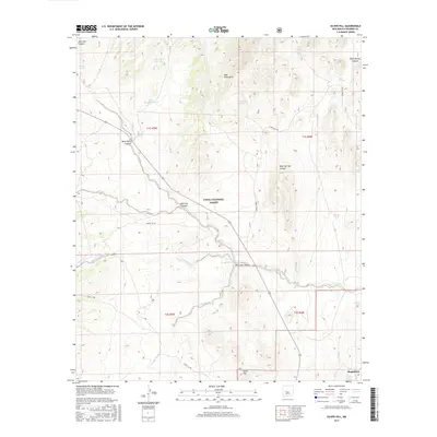
 1964 Silver Hill1967 Print · USGSSocorro County ranching life in the mid-sixties is centered here among the high desert canyons and mountains. Genealogists and local historians can trace legacy landholdings like Bear Springs Ranch and Pueblito Ranch alongside ancient Indian Ruins.2 unique versions available
 - 1979 Map of Magdalena
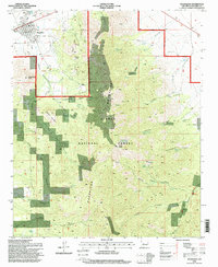
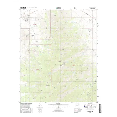
 1979 Magdalena1979 Print · USGSSocorro County in the late seventies is shown here as a high-desert landscape of mountain ranges and remote settlements. Genealogists and historians can trace the reach of the Atchison Topeka and Santa Fe Railway and locate sites like Kelly and Guthrieville.
 - 1985 Map of Granite Mountain
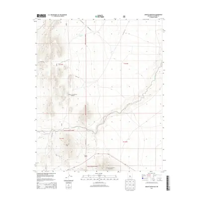
 1985 Granite Mountain1985 Print · USGSMagdalena and the surrounding high desert terrain are captured in the mid-1980s, showcasing the intersection of the mining frontier and protected forest lands. Researchers can trace the path of the Old RR Grade or locate historic Prospects near the slopes of Granite Mountain.
 - 1985 Map of Magdalena
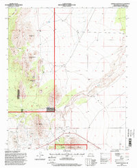
 1985 Magdalena1985 Print · USGSMagdalena and the surrounding high country are captured here in the mid-1980s, revealing a landscape shaped by both nature and industry. Researchers can trace the legacy of local mining and transit through the Old Railroad Grade, Tailings, and the small community of Chihuahua.
 - 1995 Map of Magdalena, 1998 Print
 1995 Magdalena1998 Print · USGSMagdalena and the mining settlement of Kelly are shown here in the 1990s as the high desert meets the Magdalena Mountains. Researchers can trace the legacy of resource extraction through numerous mines and prospects scattered near Kelly Gulch and Elephant Mountain.2 unique versions available
 - 1995 Map of Granite Mountain, 1998 Print
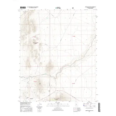
 1995 Granite Mountain1998 Print · USGSSocorro County's high desert terrain is captured here in the mid-1990s, revealing a landscape of national forest land and mineral exploration. Genealogists and historians can trace the remote Cem and isolated Prospects near Granite Mountain.
 - 1995 Map of Silver Hill, 1998 Print
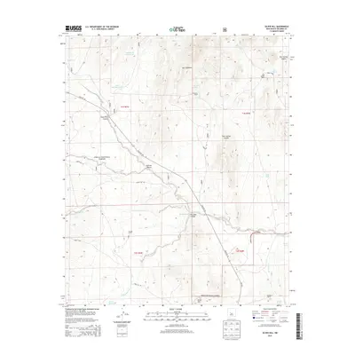
 1995 Silver Hill1998 Print · USGSRanching outposts and high desert terrain characterize this Socorro County landscape in the 1990s. Researchers can locate remote operations like Threemile Ranch, established water sources such as Bear Spring, and livestock features like the Allen Well Corral.
 - 1995 Map of Arroyo Landavaso, 1998 Print
 1995 Arroyo Landavaso1998 Print · USGSSocorro County ranching and forest lands are captured here in the mid-1990s, highlighting a landscape shaped by water scarcity. Genealogists and researchers can trace local landmarks like Woodbury Ranch, the edge of Magdalena, and dozens of named water sources from Texas Well to Landavaso Reservoir.
 - 2011 Map of Magdalena, 2011 Print
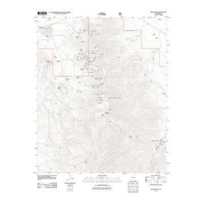 2011 Magdalena2011 Print · USGSCovers Magdalena, including Kelly, Socorro County, and other nearby areas
 - 2011 Map of Arroyo Landavaso, 2011 Print
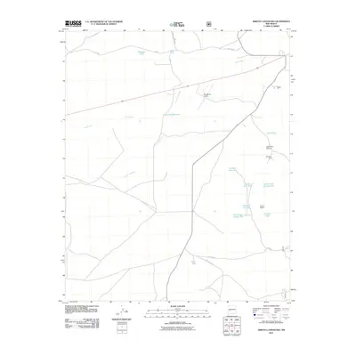 2011 Arroyo Landavaso2011 Print · USGSCovers Magdalena, including Socorro County, United States, and other nearby areas
 - 2011 Map of Granite Mountain, 2011 Print
 2011 Granite Mountain2011 Print · USGSCovers Magdalena, including Socorro County, United States, and other nearby areas
 - 2011 Map of Silver Hill, 2011 Print
 2011 Silver Hill2011 Print · USGSCovers Magdalena, including Socorro County, United States, and other nearby areas
 - 2013 Map of Magdalena, 2013 Print
 2013 Magdalena2013 Print · USGSCovers Magdalena, including Kelly, Socorro County, and other nearby areas
 - 2013 Map of Silver Hill, 2013 Print
 2013 Silver Hill2013 Print · USGSCovers Magdalena, including Socorro County, United States, and other nearby areas
 - 2013 Map of Arroyo Landavaso, 2013 Print
 2013 Arroyo Landavaso2013 Print · USGSCovers Magdalena, including Socorro County, United States, and other nearby areas
 - 2013 Map of Granite Mountain, 2013 Print
 2013 Granite Mountain2013 Print · USGSCovers Magdalena, including Socorro County, United States, and other nearby areas
 - 2017 Map of Silver Hill, 2017 Print
 2017 Silver Hill2017 Print · USGSCovers Magdalena, including Socorro County, United States, and other nearby areas
 - 2017 Map of Granite Mountain, 2017 Print
 2017 Granite Mountain2017 Print · USGSCovers Magdalena, including Socorro County, United States, and other nearby areas
 - 2017 Map of Arroyo Landavaso, 2017 Print
 2017 Arroyo Landavaso2017 Print · USGSCovers Magdalena, including Socorro County, United States, and other nearby areas
 - 2017 Map of Magdalena, 2017 Print
 2017 Magdalena2017 Print · USGSCovers Magdalena, including Kelly, Socorro County, and other nearby areas
Showing maps 1-25 of 33
Top cities near Magdalena
Frequently asked questions
- What are the different types of historical maps available for Magdalena?
- What is the oldest map of Magdalena?
- Where can I purchase historical maps of Magdalena for my home or office?
- Where can I download high-res historical maps of Magdalena?
- Are there historical topographic maps available for Magdalena?
- Is there historical aerial imagery available for Magdalena?
- Where are historical maps of Magdalena sourced from?