Old Maps of Lima, New York for Hiking & Exploration
Hike through history with 38 historic maps of Lima. Explore old trails, ghost towns, and forgotten backroads — perfect for outdoor adventurers and local explorers.
- Rediscover forgotten places: Map out old mining camps, roads, and footpaths that no longer exist on modern maps.
- Layer with modern tools: Combine with LiDAR or satellite views to plan hikes through historical terrain.
- Made for exploration: Popular among hikers, overlanders, and local history lovers.
Use these maps to find adventure and explore the hidden past of Lima.
Lima, NY maps
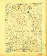
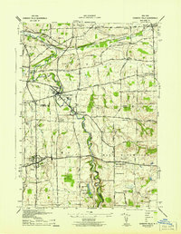
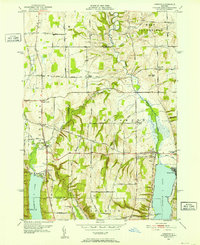
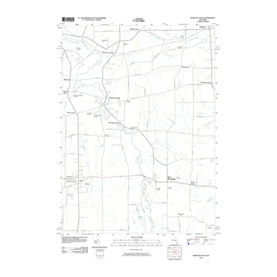
(38)- 1901 Map of Honeoye, 1954 Print
 1901 Honeoye1954 Print · USGSThe Finger Lakes region at the turn of the century was a bustling corridor of milling and rail transit. Genealogists and rail historians can trace the intricate routes of the Lehigh Valley and Erie RR between settlements like Honeoye Falls and Richmond Mills.
 - 1904 Map of Honeoye
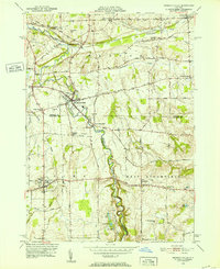
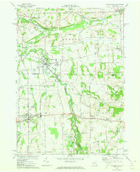
 1904 Honeoye1904 Print · USGSThe Finger Lakes region thrived at the start of the century as a vital rail and milling corridor. Researchers can trace the path of the Electric R. R. and locate family landmarks like Jakman Hill or the old milling sites at Richmond Mills.6 unique versions available
 - 1934 Map of Rush
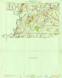 1934 Rush1934 Print · USGSThe Genesee River valley in the 1930s serves as a busy crossroads for major rail lines and rural hamlets. Researchers can trace family homesteads along Martin Road, locate the grounds of School No 6, or map the rail junctions at Golah and West Rush.2 unique versions available
 - 1934 Map of Honeoye Falls
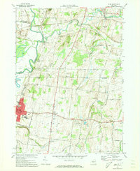
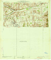 1934 Honeoye Falls1934 Print · USGSMonroe County and the surrounding valleys are shown here in the 1930s, centered on the village of Honeoye Falls. Local historians can trace early school districts and family plots at Quaker Cem, Graves Cem, and the old rail hub at Rochester Junction.
 - 1942 Map of Honeoye
 1942 Honeoye1942 Print · USGSThe Finger Lakes region comes to life in the early 1940s as lakeside settlements and hill-country farms define the local landscape. Genealogists and researchers can trace family landmarks like Short Cem, old school districts, and the path of the Lehigh Valley railroad through Hemlock.
 - 1942 Map of Honeoye Falls
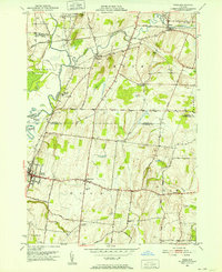
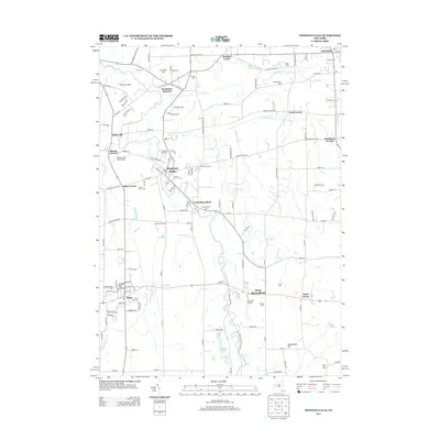
 1942 Honeoye Falls1942 Print · USGSWestern New York at the onset of the 1940s reveals a landscape of thriving rail hubs and rural crossroads villages. Genealogists can trace family names through landmarks like Quaker Cem or Graves Cem and locate historic rural schools such as School No 10.
 - 1942 Map of Livonia
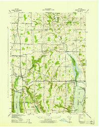
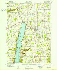
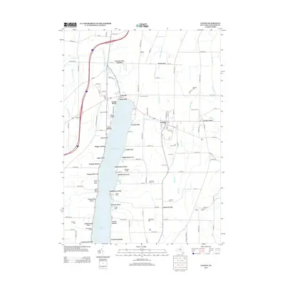
 1942 Livonia1942 Print · USGSConesus Lake's eastern shore and the surrounding uplands are captured here during the early war years. Genealogists and local historians can trace family locations through named sites like Alger Cem, School No 7, and the lakeside Excelsior Springs.
 - 1950 Map of Elmira
 1950 Elmira1950 Print · USGSThe Finger Lakes region thrived in the late 1940s as a hub of industry and transport. Trace family roots and vanished landmarks near Seneca Lake or explore the rail lines of the Erie RR and the sprawling Seneca Ordnance Depot.2 unique versions available
 - 1951 Map of Honeoye Falls, 1952 Print
 1951 Honeoye Falls1952 Print · USGSThe Genesee Valley region comes to life in the early 1950s, showing the intersection of the rail-and-river economy just south of Rochester. Genealogists can locate several historic burial grounds like Quaker Cem and St Pauls Cem or trace family roots through landmarks such as Tomlinson Corners.2 unique versions available
 - 1951 Map of Livonia, 1952 Print
 1951 Livonia1952 Print · USGSLakeside life and rail travel meet in the early fifties as the shores of Conesus Lake begin to fill with cottages and landings. Researchers can trace family sites near Livonia Center or locate rural landmarks like Mt Pleasant Cem and the Erie RR line.4 unique versions available
 - 1951 Map of Rush, 1952 Print
 1951 Rush1952 Print · USGSThe Genesee Valley in the early fifties shows a landscape shaped by three major railroads and the winding paths of Honeoye Creek. Genealogists can trace family names through landmarks like East Avon Cemetery, Gannett, and the State Industrial School.2 unique versions available
 - 1951 Map of Honeoye, 1952 Print
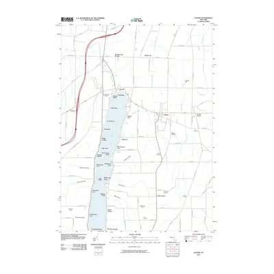
 1951 Honeoye1952 Print · USGSThe Finger Lakes region of Upstate New York is captured here in the early 1950s, showing the settled valleys between Ontario and Livingston Counties. Researchers can trace historic family landmarks and community sites like St Marys Cem, School No 5 Hewitt, and the Fairgrounds near Hemlock.3 unique versions available
 - 1958 Map of Elmira
 1958 Elmira1958 Print · USGSThe New York Finger Lakes during the late fifties reveal a complex landscape of glacial geology and industrial growth. Researchers can trace historic transport corridors like the Erie Canal and Erie RR, or locate institutional landmarks like Cornell University.2 unique versions available
 - 1962 Map of Elmira, 1969 Print
 1962 Elmira1969 Print · USGSThe Finger Lakes region and Southern Tier are captured here during a period of industrial maturity and highway expansion. Researchers can trace the path of the Erie Canal, the footprint of the Seneca Army Depot, and legacy rail lines through Elmira and Ithaca.4 unique versions available
 - 1965 Map of Elmira
 1965 Elmira1965 Print · USGSThe Finger Lakes and Southern Tier regions are captured in the mid-sixties, showcasing a landscape of deep glacial valleys and heavy rail infrastructure. Trace old railroad corridors like the Pennsylvania RR or visit landmarks like Letchworth State Park and the Seneca Army Depot.
 - 1971 Map of Honeoye Falls, 1973 Print
 1971 Honeoye Falls1973 Print · USGSThe Monroe and Livingston county borders are defined by the winding course of Honeoye Creek in the early 1970s. Researchers can trace the legacy of the Lehigh Valley tracks, find St Pauls Cem, and locate older settlements like Sibleyville.3 unique versions available
 - 1971 Map of Rush, 1973 Print
 1971 Rush1973 Print · USGSLivingston and Monroe counties come together in the 1970s at the confluence of the Genesee River and Honeoye Creek. Genealogists and local historians can trace family-named sites and vanished rail spurs near Golah, West Rush, and East Avon Cem.3 unique versions available
 - 1983 Map of Canandaigua, 1985 Print
 1983 Canandaigua1985 Print · USGSThe Finger Lakes and Genesee Valley appear in high detail in the early 1980s as the region's transport and academic centers reached a peak. Researchers can trace rail lines like the Lehigh Valley RR and find landmarks such as the Mount Morris Dam and Gannagaro State Historical Site.2 unique versions available
 - 2010 Map of Rush, 2010 Print
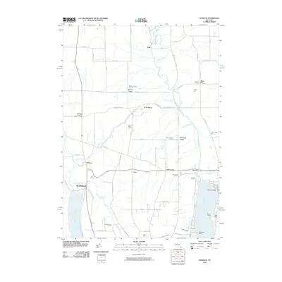
 2010 Rush2010 Print · USGSCovers Lima, including Mendon, Avon, and other nearby areas
 - 2010 Map of Honeoye, 2010 Print
 2010 Honeoye2010 Print · USGSCovers Lima, including Livonia, Richmond, and other nearby areas
 - 2010 Map of Honeoye Falls, 2010 Print
 2010 Honeoye Falls2010 Print · USGSCovers Lima, including Mendon, Rush, and other nearby areas
 - 2010 Map of Livonia, 2010 Print
 2010 Livonia2010 Print · USGSCovers Lima, including Geneseo, Livonia, and other nearby areas
 - 2013 Map of Rush, 2013 Print
 2013 Rush2013 Print · USGSCovers Lima, including Mendon, Avon, and other nearby areas
 - 2013 Map of Honeoye Falls, 2013 Print
 2013 Honeoye Falls2013 Print · USGSCovers Lima, including Mendon, Rush, and other nearby areas
 - 2013 Map of Livonia, 2013 Print
 2013 Livonia2013 Print · USGSCovers Lima, including Geneseo, Livonia, and other nearby areas
Showing maps 1-25 of 38
Top cities near Lima
- Rochester historical maps
- Perinton historical maps
- Henrietta historical maps
- Penfield historical maps
- Brighton historical maps
- Pittsford historical maps
See more
Top neighborhoods of Lima
Frequently asked questions
- What are the different types of historical maps available for Lima?
- What is the oldest map of Lima?
- Where can I purchase historical maps of Lima for my home or office?
- Where can I download high-res historical maps of Lima?
- Are there historical topographic maps available for Lima?
- Is there historical aerial imagery available for Lima?
- Where are historical maps of Lima sourced from?