1930s Maps of Cherokee County, North Carolina
Explore 33 historic maps of Cherokee County from the 1930s. These maps offer a rare glimpse into what life looked like during the 1930s — showing old roads, neighborhoods, homes, and landmarks that have changed or disappeared over time.
Whether you're researching your family's past, planning a metal detecting trip, or studying how Cherokee County's landscape evolved across the 1930s, these high-resolution maps are a powerful tool for exploring the history of this region.
- Focus on a specific era: All maps on this page are from the 1930s, giving you a focused view of this time period.
- See what’s changed: Compare century-old streets, trails, and buildings to today's modern landscape using overlays and satellite layers.
- Research with precision: Use these maps for genealogy, historical research, land use analysis, or educational projects.
- View, download, or print: Maps are fully viewable online in high resolution, and can be downloaded or printed for your own records.
Start exploring Cherokee County's history through authentic maps from the 1930s. This is your window into the past.
Cherokee County, NC maps
(33)- 1933 Map of Haw Knob
 1933 Haw Knob1933 Print · USGSThe Tennessee-North Carolina borderlands come alive in this early 1930s survey, showing the deep creek valleys and high peaks of the southern mountains. Researchers can find old community hubs like Tallassee Sch, Ballplay Ch, and the remote Hemlock Lookout.2 unique versions available
 - 1933 Map of Bald River Falls
 1933 Bald River Falls1933 Print · USGSMonroe County, Tennessee, is shown in the mid-1930s as a high-altitude mountain landscape where early forest management and rural education intersect. Researchers can locate the Waucheesi Lookout Tower and old school sites like Blackankle Sch and Waucheesi Sch among the winding creeks.
 - 1933 Map of Bushnell
 1933 Bushnell1933 Print · USGSSwain County high country in the late 1920s is defined by a remote landscape of steep ridges and small mountain schools. Researchers can trace the locations of Mill Creek Sch and School No 2 or identify family landmarks like Loudermilk Ridge and Welch Bald.
 - 1934 Map of Murphy
 1934 Murphy1934 Print · USGSCherokee County at the height of the mid-thirties TVA era reveals a landscape shaped by river junctions and dual rail lines. Genealogists and local historians can trace rural family life through landmarks like Rogers Chapel, Martin Creek Sch, and the industrial activity at the Talc Mine.
 - 1934 Map of Persimmon Creek
 1934 Persimmon Creek1934 Print · USGSCherokee County, North Carolina, appears here in the mid-1930s as a landscape of mountain ridges and narrow river valleys. Genealogists and historians can locate rural landmarks like Suit Cem, Harris Chapel, and the community of Postell.
 - 1934 Map of McDaniel Bald
 1934 McDaniel Bald1934 Print · USGSThe North Carolina and Tennessee borderlands appear here in the mid-1930s, showing a network of high-elevation gaps and remote mountain schools. Genealogists can locate family landmarks like Bryson Cem, Ebenezer, and schools including Owl Creek Sch and Davis Creek Sch.
 - 1934 Map of Unaka
 1934 Unaka1934 Print · USGSCherokee County at the height of the New Deal era reveals a mountain landscape defined by the winding Hiwassee River and remote forest settlements. Genealogists can locate family landmarks such as Buckberry Sch, Bethel Cem, and the depression-era CCC Camp No F 11.
 - 1934 Map of Murphy
 1934 Murphy1934 Print · USGSWestern North Carolina during the mid-thirties reveals a mountain landscape transitioning from resource extraction to managed forest. Researchers can trace family roots at Old Friendship Cem or locate industrial sites like Culberson Mine and Regal Sta.
 - 1934 Map of Tellico Plains
 1934 Tellico Plains1934 Print · USGSMonroe County mountain life is captured here in the mid-thirties, showing the rail and river economy of the Tellico River valley. Researchers can trace old mountain schools and family sites like Atkins Sch, Murphys Mill, and Leonards Chapel.
 - 1935 Map of Tellico
 1935 Tellico1935 Print · USGSMonroe County was a landscape of mountain ridges and remote outposts in the mid-1930s, anchored by the rail hub at Tellico Plains. Genealogists and researchers can trace family landmarks like Carpenter Cem, Oldman Mill, and the Rural Vale School.
 - 1935 Map of Peachtree
 1935 Peachtree1935 Print · USGSCherokee and Clay counties appear here in the mid-1930s, showing the mountain communities along the Hiwassee River. Genealogists and historians can locate the John C Campbell Folk Sch, Sally Nebo Ch, and the site of Andrews Dam.
 - 1935 Map of Ivylog
 1935 Ivylog1935 Print · USGSUnion County, Georgia, and the North Carolina borderlands are captured here in the mid-1930s before major dam projects reshaped the river valleys. Genealogists and local historians can trace family roots through numerous country landmarks like Ivylog Cem, Mt Zion Sch, and Davenport Mill.
 - 1935 Map of Mineral Bluff
 1935 Mineral Bluff1935 Print · USGSThe tri-state border region of Georgia, Tennessee, and North Carolina comes alive in the mid-1930s as industry and infrastructure reshape the mountain landscape. Genealogists can locate family landmarks like Paintertown Sch, Shady Grove Ch, and the homes near Mineral Bluff.
 - 1935 Map of Robbinsville
 1935 Robbinsville1935 Print · USGSRobbinsville and the surrounding Blue Ridge high country are documented here in the mid-thirties, showing the early footprint of the lake and national forest. Genealogists can trace family landmarks like the Snowbird Cherokee Indian Sch, West Buffalo Cem, and the Graham County R R.
 - 1935 Map of Topton
 1935 Topton1935 Print · USGSWestern North Carolina’s mountain timber and rail landscape is captured here in the mid-thirties as federal relief work takes root. Trace the winding Ritter Lumber RR alongside CCC Camp No F 13 and the remote settlement of Aquone.
 - 1935 Map of Marble
 1935 Marble1935 Print · USGSCherokee County enters a period of industrial growth in the mid-1930s as the Valley River becomes a corridor for rail and mining. Researchers can trace the heritage of Marble, locate the Talc Mine, and find family sites like Moss Cem or Oak Grove Sch.
 - 1935 Map of Wayah Bald
 1935 Wayah Bald1935 Print · USGSHigh in the Blue Ridge Mountains during the mid-1930s, this survey reveals the isolated homesteads and forest tracts of Macon County. Genealogists can locate family landmarks like Marshall Chapel, Oakdale Sch, and the remote Kyle PO or Flats PO.
 - 1935 Map of Andrews
 1935 Andrews1935 Print · USGSMid-1930s Cherokee County centers on the rail-driven town of Andrews as it sits between the Snowbird Mountains and Tusquitee Mountains. Genealogists and historians can trace local landmarks like Valleytown Cem, the Junaluska Sch, and the unique Valley River Tunnel.
 - 1935 Map of Culberson
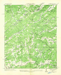 1935 Culberson1935 Print · USGSThe borderlands of North Carolina and Georgia come alive in this mid-1930s study of the mountain gaps and rail corridors. Genealogists and historians can trace family-named sites like Hawkins Mill, Bell Sch, and New Liberty Ch along the winding Hemptown Creek.
 - 1935 Map of Gumlog
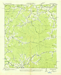 1935 Gumlog1935 Print · USGSUpper Georgia and North Carolina meet in this mid-1930s landscape, where mountain gaps and creek valleys dictate the layout of rural life. Researchers can trace the heritage of remote settlements like Gumlog and find local landmarks such as Ownby Mill and Zebulon Ch.
 - 1935 Map of Hayesville
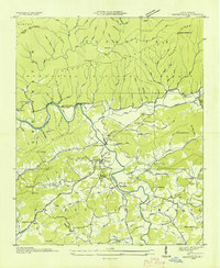 1935 Hayesville1935 Print · USGSClay County's river valleys and high ridges are captured in the mid-1930s during a period of transition for Western North Carolina. Genealogists and local historians can locate family landmarks like Meyers Chapel Cem, the Philadelphia Ch, and the old Fires Creek Sch.
 - 1936 Map of Isabella
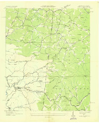 1936 Isabella1936 Print · USGSThe copper-mining industrial landscape of the Tennessee and North Carolina border is caught here in the mid-1930s. Genealogists and historians can trace company towns and local landmarks like the Isabella Mine, Stewardtown, and the Kimsey Sch.
 - 1936 Map of Hewitt
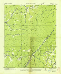 1936 Hewitt1936 Print · USGSGraham County's high ridges and river gorges are captured here in the mid-1930s, just as the regional infrastructure was being formalized by the Tennessee Valley Authority. Researchers can trace the early Appalachian Trail or locate family sites like Jenkins Cem, Rowlin Sch, and the Cheoah Mill.
 - 1936 Map of Ducktown
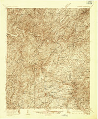 1936 Ducktown1936 Print · USGSThe Tennessee and North Carolina borderlands come to life in the mid-1930s as the Copper Basin mining boom reaches its peak. Researchers can locate vanished infrastructure like the Tennessee Copper Co RR and legendary sites including the Burra Burra Mine and Kimsey Junior College.
 - 1936 Map of Farner
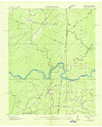 1936 Farner1936 Print · USGSThe Hiwassee River valley at the Tennessee-North Carolina border is captured here in the mid-1930s, showing a landscape shaped by rail and timber. Genealogists and hikers can locate Ironsburg Sch, the Ironsburg Lookout Tower, and the remote siding at Old Apalachia.
Showing maps 1-25 of 33
Top cities of Cherokee County
Frequently asked questions
- What are the different types of historical maps available for Cherokee County?
- What is the oldest map of Cherokee County?
- Where can I purchase historical maps of Cherokee County for my home or office?
- Where can I download high-res historical maps of Cherokee County?
- Are there historical topographic maps available for Cherokee County?
- Is there historical aerial imagery available for Cherokee County?
- Where are historical maps of Cherokee County sourced from?