1900s (20th Century) Maps of Columbus County, North Carolina
Explore 64 historic maps of Columbus County from the 1900s (20th Century). These maps offer a rare glimpse into what life looked like during the 1900s — showing old roads, neighborhoods, homes, and landmarks that have changed or disappeared over time.
Whether you're researching your family's past, planning a metal detecting trip, or studying how Columbus County's landscape evolved across the 1900s, these high-resolution maps are a powerful tool for exploring the history of this region.
- Focus on a specific era: All maps on this page are from the 1900s, giving you a focused view of this time period.
- See what’s changed: Compare century-old streets, trails, and buildings to today's modern landscape using overlays and satellite layers.
- Research with precision: Use these maps for genealogy, historical research, land use analysis, or educational projects.
- View, download, or print: Maps are fully viewable online in high resolution, and can be downloaded or printed for your own records.
Start exploring Columbus County's history through authentic maps from the 1900s. This is your window into the past.
Columbus County, NC maps
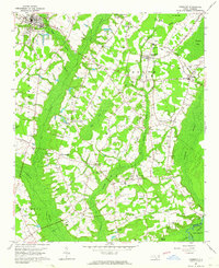
(64)- 1942 Map of Juniper Creek, 1962 Print
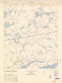
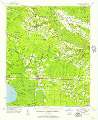
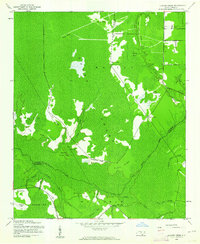 1942 Juniper Creek1962 Print · USGSThe North Carolina coastal plain in the early 1940s reveals a world of vast swamp forests and isolated ridge settlements. Researchers can locate the Waccamaw Institute and trace old family landmarks like Clewis Corner or Bennett Little Field.
 - 1943 Map of Pages Mill
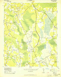
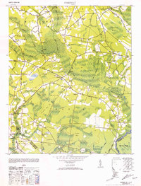
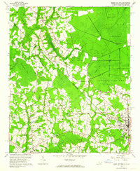
 1943 Pages Mill1943 Print · USGSThe Carolina borderlands come alive in the 1940s, showing a landscape shaped by the Lumber River and the Atlantic Coast Line railroad. Genealogists can trace family names through numerous rural landmarks like Oliver Cross Roads, Tabernacle Ch, and White Pond Ch & Sch.
 - 1943 Map of Pireway
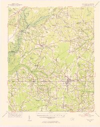
 1943 Pireway1943 Print · USGSCoastal Carolina and the borderlands near the Waccamaw River appear here during the wartime years, showing a landscape defined by expansive swamps and rural bay formations. Genealogists can trace family roots through the Dothans Sch, the Old Tram Road, and local landmarks like Dulah Mormon Church.
 - 1943 Map of Nakina
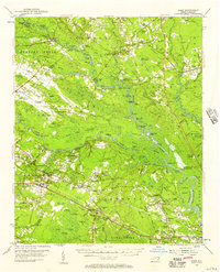
 1943 Nakina1943 Print · USGSSoutheast North Carolina is shown here in the 1940s, characterized by the vast wetlands of Big Bay and scattered rural homesteads. Genealogists and historians can trace family locations near Nakina, Mollie, and local landmarks like Sweet Home Ch.3 unique versions available
 - 1943 Map of Calabash
 1943 Calabash1943 Print · USGSThe coastal borderlands of North Carolina and South Carolina are captured here during the early forties, showing a landscape of dense swamps and timber bays. Genealogists can locate family landmarks like Philadelphia Wesley Church, Hickmans Crossroads, and the school at La Savannah Sch.
 - 1943 Map of Freeland, 1962 Print
 1943 Freeland1962 Print · USGSCoastal North Carolina during the mid-century is captured here as a landscape of dense swamps and winding river systems. Genealogists can locate family landmarks such as the Smith Cem, Soldier Bay Ch, and small settlements like Regan and Reeves.
 - 1943 Map of Honey Island, 1962 Print
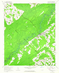
 1943 Honey Island1962 Print · USGSCoastal North Carolina's interior wetlands are captured here in the 1940s, showing the intersection of Brunswick and Columbus counties. Researchers can trace the Old Railroad Grade through the Green Swamp or locate the Waccamaw Institute and Riegel Lookout Tower.
 - 1943 Map of Lewis Swamp, 1962 Print
 1943 Lewis Swamp1962 Print · USGSCoastal North Carolina during the mid-forties reveals a landscape defined by the wetlands of the Green Swamp and local timber history. Researchers can locate family landmarks such as the Old Cumbee Place, identify rural congregations like Christian Hope Ch, and trace the paths of an Old Railroad Grade.
 - 1944 Map of Longs
 1944 Longs1944 Print · USGSCoastal South Carolina and North Carolina were defined by river ferries and swamp agriculture during the mid-forties. Genealogists can trace local family landmarks such as Butler Cem, Buck Creek Church, and the former Olyphic PO.
 - 1944 Map of Lewis Swamp
 1944 Lewis Swamp1944 Print · USGSCoastal North Carolina during the mid-forties reveals a landscape of dense swamps and scattered rural settlements like Batarora and Rabontown. Genealogists can locate family landmarks such as the Old Cumbee Place and Flowers Corner alongside local country churches.
 - 1949 Map of Duford
 1949 Duford1949 Print · USGSHorry County, South Carolina and Columbus County, North Carolina appear here in the late 1940s as a rural landscape of scattered farms and wetlands. Family historians can locate several local landmarks, including Floyds High Sch, Pee Dee Academy, and Blanton Cem.4 unique versions available
 - 1949 Map of Georgetown, 1953 Print
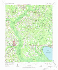
 1949 Georgetown1953 Print · USGSThe South Carolina coast and North Carolina borderlands appear here in the mid-century, prior to the major modern development of the Grand Strand. Genealogists and historians can trace the rail networks of the Seaboard Air Line Railroad and locate coastal landmarks from Fort Caswell to McClellanville.
 - 1953 Map of Longs
 1953 Longs1953 Print · USGSHorry County at the mid-century was a landscape of winding river swamps and quiet crossroads settlements along the North Carolina border. Genealogists and local historians can trace family locations through Butler Cem, Worthams Ferry, and the Olyphic PO.2 unique versions available
 - 1953 Map of Calabash
 1953 Calabash1953 Print · USGSThe coastal borderlands of North and South Carolina are frozen in time just after the war, showing the area as it transitioned into the mid-century. Researchers can trace the layout of early settlements like Calabash and Thomasboro or locate rural landmarks such as Philadelphia Wesley Church and the La Savannah Sch.2 unique versions available
 - 1953 Map of Pireway
 1953 Pireway1953 Print · USGSCoastal North Carolina near the South Carolina border was a landscape of intricate wetlands and small farmsteads in the early 1950s. Genealogists and local researchers can trace the locations of Dothans Sch, the Riverside Ch, and the remote community of Bughill.2 unique versions available
 - 1953 Map of Chadbourn, 1955 Print
 1953 Chadbourn1955 Print · USGSSoutheastern North Carolina's railroad and river economy comes alive in the 1950s, centered on the growing hubs of Chadbourn and Cerro Gordo. Researchers can trace old family names and rural landmarks from Belle View Cem to the landings along the Lumber River.2 unique versions available
 - 1953 Map of Florence, 1964 Print
 1953 Florence1964 Print · USGSThe Carolina borderlands in the mid-fifties were a landscape of vast river swamps and rising rail towns. Trace the legacy of the Seaboard Air Line through Florence or explore the wetlands surrounding Lake Waccamaw and the Green Swamp.3 unique versions available
 - 1954 Map of Florence
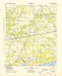
 1954 Florence1954 Print · USGSThe Carolinas borderlands come alive in the early fifties, showing the vital rail-and-river networks of the coastal plain. Genealogists can trace family footprints across the Green Swamp or through settlements like Red Springs, Chadbourn, and McColl.
 - 1954 Map of Acme, 1957 Print
 1954 Acme1957 Print · USGSCoastal North Carolina river life in the mid-fifties centered on the confluence of the Cape Fear and the Black River. Genealogists can trace family names at Still Bluff and Maultbys Point, or locate the historic Lincoln High Sch and Farmers Chapel.2 unique versions available
 - 1954 Map of Bolton, 1957 Print
 1954 Bolton1957 Print · USGSCoastal North Carolina's timber and rail corridor is captured here in the mid-fifties, spanning the rugged terrain between the Cape Fear River and Green Swamp. Researchers can trace old family sites and rural congregations at Weyman Chapel, New Hope Ch, and the settlement of Wananish.2 unique versions available
 - 1955 Map of Whiteville
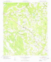
 1955 Whiteville1955 Print · USGSColumbus County and the town of Whiteville are shown here in the mid-fifties, dominated by timber-rich swamps and the railroads that serviced them. Researchers can trace the layout of Porterville, Wananish, and rural landmarks like Richardson Millpond.2 unique versions available
 - 1962 Map of Fair Bluff, 1964 Print
 1962 Fair Bluff1964 Print · USGSThe borderlands of the Carolinas come alive in the early sixties as the Lumber River and Atlantic Coast Line Railroad define the local economy. Researchers can trace rural lineages through Powell Cem, Turner Chapel, and the vanished tracks near Marietta.2 unique versions available
 - 1962 Map of Goretown, 1964 Print
 1962 Goretown1964 Print · USGSCoastal plain life in the early sixties centers on the rural communities of Loris and Goretown along the Carolina border. Researchers can trace family roots through numerous landmarks like Hardee Cem, Sweet Home Sch, and Ironhill Ch among the local swamplands.2 unique versions available
 - 1962 Map of Fairmont, 1964 Print
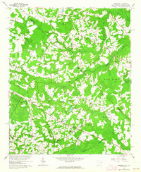
 1962 Fairmont1964 Print · USGSRobeson County in the early sixties is characterized by a landscape of productive fields and deep watercourses like Ashpole Swamp. Genealogists can trace family names through dozens of burial sites including Warwick Cem and Hardin Cem, or locate landmarks like Antioch Ch.
 - 1962 Map of Tabor City West, 1964 Print
 1962 Tabor City West1964 Print · USGSThe Carolina borderlands in the early sixties reveal a landscape of dense swamps and scattered homesteads between North and South Carolina. Genealogists and local historians can trace family sites like Strickland Cemetery and churches including Little Bethel near the Atlantic Coast Line rail corridor.2 unique versions available
Showing maps 1-25 of 64
Top cities of Columbus County
- Whiteville historical maps
- Tabor City historical maps
- Chadbourn historical maps
- Lake Waccamaw historical maps
- Fair Bluff historical maps
- Bolton historical maps
See more
Frequently asked questions
- What are the different types of historical maps available for Columbus County?
- What is the oldest map of Columbus County?
- Where can I purchase historical maps of Columbus County for my home or office?
- Where can I download high-res historical maps of Columbus County?
- Are there historical topographic maps available for Columbus County?
- Is there historical aerial imagery available for Columbus County?
- Where are historical maps of Columbus County sourced from?