1950s Maps of Columbus County, North Carolina
Explore 9 historic maps of Columbus County from the 1950s. These maps offer a rare glimpse into what life looked like during the 1950s — showing old roads, neighborhoods, homes, and landmarks that have changed or disappeared over time.
Whether you're researching your family's past, planning a metal detecting trip, or studying how Columbus County's landscape evolved across the 1950s, these high-resolution maps are a powerful tool for exploring the history of this region.
- Focus on a specific era: All maps on this page are from the 1950s, giving you a focused view of this time period.
- See what’s changed: Compare century-old streets, trails, and buildings to today's modern landscape using overlays and satellite layers.
- Research with precision: Use these maps for genealogy, historical research, land use analysis, or educational projects.
- View, download, or print: Maps are fully viewable online in high resolution, and can be downloaded or printed for your own records.
Start exploring Columbus County's history through authentic maps from the 1950s. This is your window into the past.
Columbus County, NC maps
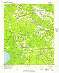
(9)- 1953 Map of Longs
 1953 Longs1953 Print · USGSHorry County at the mid-century was a landscape of winding river swamps and quiet crossroads settlements along the North Carolina border. Genealogists and local historians can trace family locations through Butler Cem, Worthams Ferry, and the Olyphic PO.2 unique versions available
 - 1953 Map of Calabash
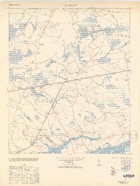 1953 Calabash1953 Print · USGSThe coastal borderlands of North and South Carolina are frozen in time just after the war, showing the area as it transitioned into the mid-century. Researchers can trace the layout of early settlements like Calabash and Thomasboro or locate rural landmarks such as Philadelphia Wesley Church and the La Savannah Sch.2 unique versions available
 - 1953 Map of Pireway
 1953 Pireway1953 Print · USGSCoastal North Carolina near the South Carolina border was a landscape of intricate wetlands and small farmsteads in the early 1950s. Genealogists and local researchers can trace the locations of Dothans Sch, the Riverside Ch, and the remote community of Bughill.2 unique versions available
 - 1953 Map of Chadbourn, 1955 Print
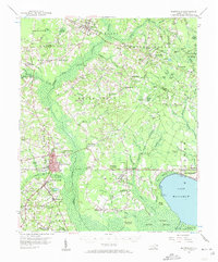
 1953 Chadbourn1955 Print · USGSSoutheastern North Carolina's railroad and river economy comes alive in the 1950s, centered on the growing hubs of Chadbourn and Cerro Gordo. Researchers can trace old family names and rural landmarks from Belle View Cem to the landings along the Lumber River.2 unique versions available
 - 1953 Map of Florence, 1964 Print
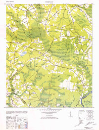
 1953 Florence1964 Print · USGSThe Carolina borderlands in the mid-fifties were a landscape of vast river swamps and rising rail towns. Trace the legacy of the Seaboard Air Line through Florence or explore the wetlands surrounding Lake Waccamaw and the Green Swamp.3 unique versions available
 - 1954 Map of Florence
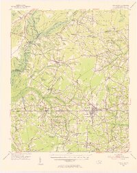
 1954 Florence1954 Print · USGSThe Carolinas borderlands come alive in the early fifties, showing the vital rail-and-river networks of the coastal plain. Genealogists can trace family footprints across the Green Swamp or through settlements like Red Springs, Chadbourn, and McColl.
 - 1954 Map of Acme, 1957 Print
 1954 Acme1957 Print · USGSCoastal North Carolina river life in the mid-fifties centered on the confluence of the Cape Fear and the Black River. Genealogists can trace family names at Still Bluff and Maultbys Point, or locate the historic Lincoln High Sch and Farmers Chapel.2 unique versions available
 - 1954 Map of Bolton, 1957 Print
 1954 Bolton1957 Print · USGSCoastal North Carolina's timber and rail corridor is captured here in the mid-fifties, spanning the rugged terrain between the Cape Fear River and Green Swamp. Researchers can trace old family sites and rural congregations at Weyman Chapel, New Hope Ch, and the settlement of Wananish.2 unique versions available
 - 1955 Map of Whiteville
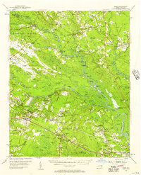
 1955 Whiteville1955 Print · USGSColumbus County and the town of Whiteville are shown here in the mid-fifties, dominated by timber-rich swamps and the railroads that serviced them. Researchers can trace the layout of Porterville, Wananish, and rural landmarks like Richardson Millpond.2 unique versions available
End of results
Showing maps 1-9 of 9
Top cities of Columbus County
- Whiteville historical maps
- Tabor City historical maps
- Chadbourn historical maps
- Lake Waccamaw historical maps
- Fair Bluff historical maps
- Bolton historical maps
See more
Frequently asked questions
- What are the different types of historical maps available for Columbus County?
- What is the oldest map of Columbus County?
- Where can I purchase historical maps of Columbus County for my home or office?
- Where can I download high-res historical maps of Columbus County?
- Are there historical topographic maps available for Columbus County?
- Is there historical aerial imagery available for Columbus County?
- Where are historical maps of Columbus County sourced from?