1970s Maps of Columbus County, North Carolina
Explore 3 historic maps of Columbus County from the 1970s. These maps offer a rare glimpse into what life looked like during the 1970s — showing old roads, neighborhoods, homes, and landmarks that have changed or disappeared over time.
Whether you're researching your family's past, planning a metal detecting trip, or studying how Columbus County's landscape evolved across the 1970s, these high-resolution maps are a powerful tool for exploring the history of this region.
- Focus on a specific era: All maps on this page are from the 1970s, giving you a focused view of this time period.
- See what’s changed: Compare century-old streets, trails, and buildings to today's modern landscape using overlays and satellite layers.
- Research with precision: Use these maps for genealogy, historical research, land use analysis, or educational projects.
- View, download, or print: Maps are fully viewable online in high resolution, and can be downloaded or printed for your own records.
Start exploring Columbus County's history through authentic maps from the 1970s. This is your window into the past.
Columbus County, NC maps
(3)- 1974 Map of Georgetown, 1978 Print
 1974 Georgetown1978 Print · USGSThe Carolina coast and Pee Dee region are shown here in the mid-seventies, just as the Grand Strand was maturing into a premier destination. Researchers can trace the inland rail corridors of the Seaboard Coast Line Railroad or explore the coastal reaches of the Cape Romain National Wildlife Refuge and Myrtle Beach State Park.2 unique versions available
 - 1976 Map of Fair Bluff, 1978 Print
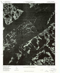 1976 Fair Bluff1978 Print · USGSThe Lumber River basin comes into sharp focus during the mid-seventies, showing the intersection of North and South Carolina. Researchers can trace the river's path past Fair Bluff or locate smaller outposts like Marietta and Causey.
 - 1976 Map of Fairmont, 1978 Print
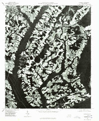 1976 Fairmont1978 Print · USGSCoastal plain agriculture and river-bound settlements define this Robeson County landscape in the mid-seventies. Genealogists and historians can trace the growth of Fairmont and locate rural family sites near Proctorville and Leggett Crossroads.
End of results
Showing maps 1-3 of 3
Top cities of Columbus County
- Whiteville historical maps
- Tabor City historical maps
- Chadbourn historical maps
- Lake Waccamaw historical maps
- Fair Bluff historical maps
- Bolton historical maps
See more
Frequently asked questions
- What are the different types of historical maps available for Columbus County?
- What is the oldest map of Columbus County?
- Where can I purchase historical maps of Columbus County for my home or office?
- Where can I download high-res historical maps of Columbus County?
- Are there historical topographic maps available for Columbus County?
- Is there historical aerial imagery available for Columbus County?
- Where are historical maps of Columbus County sourced from?