Old Maps of Topsail Beach, North Carolina for Metal Detecting
Plan your next treasure hunt with 36 historic maps of Topsail Beach. Find old homesites, ghost towns, trails, and gathering spots that may be lost to time — perfect for identifying promising metal detecting locations.
- Locate forgotten sites: Uncover places like long-lost settlements, abandoned rail lines, or gathering spots.
- Plan better hunts: Use map overlays combined with LiDAR or satellite views to narrow in on historically rich areas.
- Made for detectorists: Thousands of hobbyists use these maps to discover relics, coins, and hidden history.
Use these historic maps to boost your research and find new opportunities beneath the surface of Topsail Beach.
Topsail Beach, NC maps
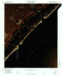
(36)- 1942 Map of Topsail
 1942 Topsail1942 Print · USGSThe Pender County coast was undergoing a military transformation in the early 1940s as infrastructure expanded around Camp Davis. Genealogists and historians can trace dozens of family-named water access points like Howard Landing and Edens Landing along the edge of Topsail Sound.
 - 1948 Map of Topsail
 1948 Topsail1948 Print · USGSThe Pender County coastline is shown here in the late 1940s, when the maritime economy was centered on small inlets and landings. Researchers can trace the military history of Camp Davis or locate family sites at Edens Landing and Hampstead.2 unique versions available
 - 1953 Map of Beaufort, 1965 Print
 1953 Beaufort1965 Print · USGSThe North Carolina coastline in the mid-fifties reveals an era of massive military expansion alongside traditional maritime life. Genealogists can trace family names and small settlements from Sealevel to Sneads Ferry or locate landmarks like Fort Macon.3 unique versions available
 - 1954 Map of Beaufort
 1954 Beaufort1954 Print · USGSCoastal North Carolina in the mid-fifties reveals a landscape of strategic military installations, sprawling wetlands, and thriving rail towns. Genealogists and historians can trace the foundations of Wilmington, the rural reaches of Duplin County, and shoreline landmarks like Cape Lookout and Carolina Beach.
 - 1970 Map of Hampstead, 1972 Print
 1970 Hampstead1972 Print · USGSCoastal Pender County at the start of the 1970s reveals a landscape of quiet sounds and growing shoreline communities. Genealogists and local historians can trace the foundations of Hampstead or locate family markers near Topsail Beach and Mallory.2 unique versions available
 - 1970 Map of Topsail, 1973 Print
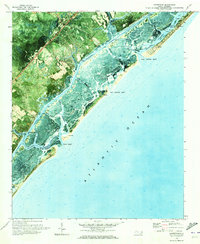
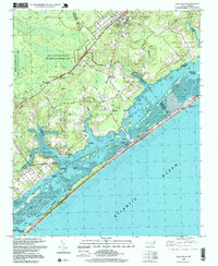
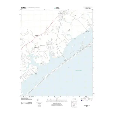
 1970 Topsail1973 Print · USGSCoastal Pender County is shown in the early seventies as the barrier island developments began to grow alongside ancient swamp tracts. Trace family history and land use through the numerous rural churches like Union Bethel Ch and the vast reaches of the Holly Shelter Swamp.
 - 1970 Map of Holly Ridge, 1973 Print
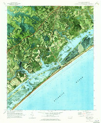 1970 Holly Ridge1973 Print · USGSCoastal Onslow and Pender counties come to life in this early 1970s orthophotomap showing the transition from forest to shore. Researchers can trace family landings like Morris Landing and Sears Landing or study the early layouts of Surf City and Topsail Beach.
 - 1972 Map of Beaufort, 1975 Print
 1972 Beaufort1975 Print · USGSThe North Carolina coast in the early seventies shows a landscape defined by massive military bases and coastal sounds. Trace rural family roots at Sarecta and Catherine Lake or explore the barrier islands of the Cape Lookout National Seashore.
 - 1980 Map of Topsail, 1985 Print
 1980 Topsail1985 Print · USGSThe North Carolina coast at the dawn of the eighties reveals a sharp divide between the massive Holly Shelter Swamp and burgeoning shoreward communities. Trace the early footprints of Topsail and Woodside as they expand toward the waters of Topsail Sound.2 unique versions available
 - 1980 Map of Holly Ridge, 1985 Print
 1980 Holly Ridge1985 Print · USGSThe Onslow County coast in the early eighties shows the rhythmic patterns of barrier island life and inland timbering. Genealogists and historians can locate old coastal sites like Morris Landing and Watts Landing along Topsail Sound.
 - 1980 Map of Hampstead, 1986 Print
 1980 Hampstead1986 Print · USGSThe Pender County coastline and barrier islands are seen here in the early eighties as residential development began to expand around Hampstead. Genealogists and historians can trace the inland settlements of Browntown and the coastal landing at Kings Landing.
 - 1984 Map of Wilmington, 1985 Print
 1984 Wilmington1985 Print · USGSThe Lower Cape Fear region is shown here in the mid-1980s as the coastal corridor between Wilmington and the barrier islands experienced significant development. Researchers can trace historic river landings, the winding Intracoastal Waterway, and established communities from Castle Hayne to Topsail Beach.
 - 1990 Map of Wilmington
 1990 Wilmington1990 Print · USGSThe North Carolina coast in the early nineties reveals a landscape defined by the convergence of the Cape Fear River and the Atlantic shore. Genealogists and historians can trace suburban growth and maritime infrastructure from the inland Kendall Chapel to coastal hubs like Wrightsville Beach and Carolina Beach.
 - 1997 Map of Holly Ridge, 1999 Print
 1997 Holly Ridge1999 Print · USGSCoastal North Carolina during the late nineties shows a landscape of barrier island growth and protected inland wetlands. Genealogists can trace family connections through numerous landings like Edens Landing and rural churches such as Stump Sound Ch.
 - 1997 Map of Topsail, 2000 Print
 1997 Topsail2000 Print · USGSThe Pender County coast and its expansive wetlands were undergoing subtle changes at the end of the century. Genealogists and historians can trace old community landmarks like Blakes Chapel, St Johns Ch, and the rural settlement of Woodside.
 - 1997 Map of Hampstead, 2000 Print
 1997 Hampstead2000 Print · USGSCoastal Pender County and its barrier islands come into sharp focus in the late nineties as the region's shoreline communities grew. Genealogists and researchers can trace local landmarks like St Johns Ch, Brown Town, and the docks at Kings Landing.
 - 2010 Map of Holly Ridge, 2010 Print
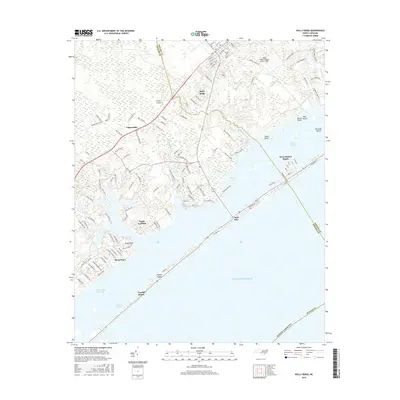
 2010 Holly Ridge2010 Print · USGSCovers Topsail Beach, including Surf City, Holly Ridge, and other nearby areas
 - 2010 Map of Topsail, 2010 Print
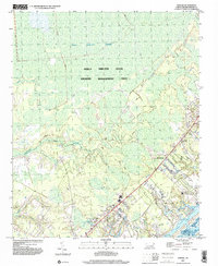
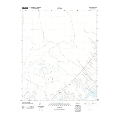 2010 Topsail2010 Print · USGSCovers Topsail Beach, including Topsail, Pender County, and other nearby areas
 - 2010 Map of Hampstead, 2010 Print
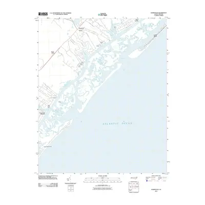 2010 Hampstead2010 Print · USGSCovers Topsail Beach, including Hampstead, Brown Town, and other nearby areas
 - 2011 Map of Hampstead OE E, 2011 Print
 2011 Hampstead OE E2011 Print · USGSCovers Topsail Beach, including Pender County, United States, and other nearby areas
 - 2013 Map of Hampstead OE E, 2013 Print
 2013 Hampstead OE E2013 Print · USGSCovers Topsail Beach, including Pender County, United States, and other nearby areas
 - 2013 Map of Holly Ridge, 2013 Print
 2013 Holly Ridge2013 Print · USGSCovers Topsail Beach, including Surf City, Holly Ridge, and other nearby areas
 - 2013 Map of Hampstead, 2013 Print
 2013 Hampstead2013 Print · USGSCovers Topsail Beach, including Hampstead, Brown Town, and other nearby areas
 - 2013 Map of Topsail, 2013 Print
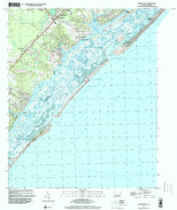
 2013 Topsail2013 Print · USGSCovers Topsail Beach, including Topsail, Pender County, and other nearby areas
 - 2016 Map of Holly Ridge, 2016 Print
 2016 Holly Ridge2016 Print · USGSCovers Topsail Beach, including Surf City, Holly Ridge, and other nearby areas
Showing maps 1-25 of 36
Top cities near Topsail Beach
- Wilmington historical maps
- Wrightsville Beach historical maps
- Surf City historical maps
- Holly Ridge historical maps
- North Topsail Beach historical maps
- Hampstead historical maps
Frequently asked questions
- What are the different types of historical maps available for Topsail Beach?
- What is the oldest map of Topsail Beach?
- Where can I purchase historical maps of Topsail Beach for my home or office?
- Where can I download high-res historical maps of Topsail Beach?
- Are there historical topographic maps available for Topsail Beach?
- Is there historical aerial imagery available for Topsail Beach?
- Where are historical maps of Topsail Beach sourced from?