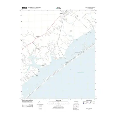
2010 Map of Holly Ridge
USGS Topo · Published 2010About this map
Holly Ridge and the surrounding coastal landscape of Pender County are defined by a complex network of tidal creeks and landings that characterize North Carolina's inner coastal waters. The map reveals a settlement pattern heavily influenced by the shoreline, with family-named locations such as Watts Landing, Macmillan Landing, and Bell Farm Landing indicating long-standing maritime and agricultural ties to the land. The proximity of the Sloop Point Post Office to the historic Sloop Point area highlights the civic infrastructure that served these scattered waterfront communities.
Find a feature on this map
56 named features on this map. Tap any name to fly to it.
Don’t see what you’re looking for? This feature index may not catch every label — zoom into the map to look around manually.
Map Details
Editions of this 2010 Holly Ridge Map
This is the sole edition of this map. No revisions or reprints were ever made.
Other maps of this area

1942 · Spicer Bay
USGS Topo · 1:62,500

1942 · Topsail
USGS Topo · 1:62,500

1948 · Maple Hill
USGS Topo · 1:62,500

1948 · Topsail
USGS Topo · 1:62,500

1948 · New River
USGS Topo · 1:62,500

1952 · Spicer Bay
USGS Topo · 1:24,000

1952 · Sneads Ferry
USGS Topo · 1:24,000

1953 · Beaufort
USGS Topo · 1:250,000

1954 · Beaufort
USGS Topo · 1:250,000

1970 · Hampstead
USGS Topo · 1:24,000