Old Maps of Benson County, North Dakota for Metal Detecting
Plan your next treasure hunt with 311 historic maps of Benson County. Find old homesites, ghost towns, trails, and gathering spots that may be lost to time — perfect for identifying promising metal detecting locations.
- Locate forgotten sites: Uncover places like long-lost settlements, abandoned rail lines, or gathering spots.
- Plan better hunts: Use map overlays combined with LiDAR or satellite views to narrow in on historically rich areas.
- Made for detectorists: Thousands of hobbyists use these maps to discover relics, coins, and hidden history.
Use these historic maps to boost your research and find new opportunities beneath the surface of Benson County.
Benson County, ND maps
(311)- 1928 Map of Tokio, 1954 Print
 1928 Tokio1954 Print · USGSThe Devils Lake Indian Reservation and the shores of Devils Lake are captured here in the late 1920s. Genealogists and local historians can trace the Great Northern rail line through Tokio or locate rural landmarks like Wood Lake Ch and Fort Totten P O.
 - 1930 Map of Hamar
 1930 Hamar1930 Print · USGSBenson County and the Sheyenne River valley are captured here in the late 1920s as the rail-and-river economy flourished. Genealogists can trace the rural communities around Warwick and Hamar, locating landmarks like the Jerusalem Ch and Lookout Mtn.
 - 1931 Map of Oberon
 1931 Oberon1931 Print · USGSThe North Dakota prairie unfolds in the late twenties as a network of rail-side towns and rural townships north of the Sheyenne River. Genealogists and historians can trace the exact locations of Grandfield Ch, St Gertrudes Ch, and several numbered country schools.2 unique versions available
 - 1931 Map of Tokio
 1931 Tokio1931 Print · USGSThe southern shores of Devils Lake come into focus in the late twenties, detailing the area around Fort Totten P O and the Devils Lake Indian Reservation. Genealogists can trace local landmarks like Devils Heart and numerous rural schoolhouses including School No 2 and School No 4.2 unique versions available
 - 1931 Map of Devils Lake
 1931 Devils Lake1931 Print · USGSThe North Dakota prairie and its complex lake systems are captured here in the late 1920s. Genealogists and historians can trace early rural life at Grand Harbor, the military grounds of CAMP GRAFTON, and numerous local sites like Consolidated School No 1.3 unique versions available
 - 1932 Map of Flora
 1932 Flora1932 Print · USGSBenson and Wells Counties are captured here between the wars, when the prairie was a network of small school districts and railroad sidings. Trace the early township life of the region through landmarks like Monterey Town Hall, Stony Lake, and the Maddock Cem.2 unique versions available
 - 1932 Map of Grahams Island
 1932 Grahams Island1932 Print · USGSDevils Lake and Grahams Island are seen here in the early 1930s as a complex network of prairie schools and railroads. Genealogists can locate family landmarks like St Paul Cem, Antiochia Ch, and the many numbered schools scattered across Normania and Coulee.
 - 1941 Map of Selz
 1941 Selz1941 Print · USGSPierce and Wells Counties are shown in the late thirties as a landscape of rural school districts and bustling rail towns. Genealogists can locate family landmarks such as the Sheyenne River Academy, St Anthony Cem, and dozens of numbered country schools.2 unique versions available
 - 1943 Map of Maddock, 1963 Print
 1943 Maddock1963 Print · USGSBenson and Wells counties are shown in detail during the 1940s, when the prairie was dotted with localized school districts and rural parishes. Genealogists can trace family footprints at North Viking Cem or find the sites of East Fram Sch No 4 and Heimdal.
 - 1945 Map of Maddock
 1945 Maddock1945 Print · USGSBenson and Wells counties in the mid-1940s are defined by a robust network of prairie towns and competing rail lines. Researchers can trace rural life through numerous landmark schools and churches, from Maddock and Heimdal to Klara Church and East Fram School No 4.
 - 1950 Map of Oberon SW
 1950 Oberon SW1950 Print · USGSMid-century Eddy County remains a landscape of traditional township borders and scattered prairie schoolhouses. Genealogists can locate Grandfield Ch and Town Hall, or trace the Northern Pacific tracks as they cross the Sheyenne River.2 unique versions available
 - 1950 Map of Wellsburg
 1950 Wellsburg1950 Print · USGSThe mid-century plains of Wells County are defined here by the winding Sheyenne River and the critical Great Northern rail corridor. Genealogists can locate several rural landmarks including Wellsburg, Odessa Sch No 1, and Butte De Morale.
 - 1950 Map of Sheyenne
 1950 Sheyenne1950 Print · USGSMid-century Eddy County comes into focus as a network of rural schools and rail-side settlements in the years following the war. Genealogists and historians can trace the foundations of Sheyenne and Divide, along with local landmarks like Holy Cross Cem and Rose Hill Sch.3 unique versions available
 - 1950 Map of Tokio SW
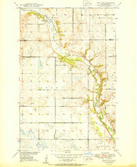 1950 Tokio SW1950 Print · USGSMid-century Eddy County is captured here as a landscape of prairie schoolhouses and river bends before modern consolidation. Family researchers can trace local landmarks like Bourett Cem, School No 4, and the winding Sheyenne River.
 - 1950 Map of Tokio, 1952 Print
 1950 Tokio1952 Print · USGSBenson County at the start of the 1950s was a landscape defined by the shifting waters of the Devils Lake basin and the lifeline of the railroad. Researchers can trace the mid-century footprints of Saint Michael and Tokio, or find local landmarks like Wood Lake Ch and Devils Heart Butte.
 - 1950 Map of Grahams Island, 1959 Print
 1950 Grahams Island1959 Print · USGSDevils Lake and its rugged shoreline dominate this mid-century survey of Benson and Ramsey counties. Local historians can trace the legacy of rural education and faith at School No 5, St Paul Cem, and the Old Military Reservation.2 unique versions available
 - 1950 Map of Devils Lake, 1959 Print
 1950 Devils Lake1959 Print · USGSDevils Lake and the surrounding North Dakota prairies are captured mid-century, showing a landscape shaped by rail lines and regional institutions. Genealogists can locate several schools and cemeteries, including the Grand Harbor Cem, Grove Sch, and the military grounds at Camp Grafton.2 unique versions available
 - 1950 Map of Oberon, 1960 Print
 1950 Oberon1960 Print · USGSBenson and Eddy Counties are captured here at mid-century, defined by a landscape of prairie schoolhouses and the winding Sheyenne River. Genealogists can trace the locations of family landmarks like Holy Cross Cem, St Jerome Ch, and the town of Oberon along the Northern Pacific rail line.
 - 1950 Map of Devils Lake Mountain, 1978 Print
 1950 Devils Lake Mountain1978 Print · USGSRamsey County and the surrounding prairies are captured here at mid-century as rural life centered around small township hubs. Genealogists can locate the Odessa Cem and early landmarks like School No 2 near the shores of East Devils Lake.
 - 1951 Map of Crow Hill
 1951 Crow Hill1951 Print · USGSBenson County was a landscape of small school districts and rural parishes in the early fifties. Genealogists and historians can trace the foundations of this community through landmarks like St Jerome Ch, Plainview Sch No 2, and the shores of Twin Lakes.2 unique versions available
 - 1951 Map of Oberon
 1951 Oberon1951 Print · USGSBenson County prairie life is centered on the railroad in the early fifties, where the tracks connect small rural hubs. Researchers can trace the Old Indian Reservation Boundary and locate family landmarks like Hillside Cem and Oberon.2 unique versions available
 - 1951 Map of Crary
 1951 Crary1951 Print · USGSRamsey County's prairie landscape was still a patchwork of small school districts and family farms in the mid-twentieth century. Trace local genealogy and rail history through the Great Northern tracks, Crary Cem, and rural landmarks like School No 1.
 - 1951 Map of Flora SE
 1951 Flora SE1951 Print · USGSThe Sheyenne River valley and the surrounding townships of Wells and Benson counties are recorded here in the early fifties. Genealogists and historians can locate rural landmarks such as Eden Ch, Augustana Ch, and multiple schoolhouses like School No 1.2 unique versions available
 - 1951 Map of Devils Lake Mountain
 1951 Devils Lake Mountain1951 Print · USGSThe rural landscapes of Ramsey and Nelson counties are captured here in the early fifties, showing the sparse prairie settlements of Odessa and Minco. Genealogists can trace family footprints near School No 2 and the Odessa Cem, while the Old Indian Reservation Boundary marks a significant historical line.
 - 1951 Map of Devils Lake
 1951 Devils Lake1951 Print · USGSDevils Lake in the early fifties shows a thriving regional center defined by its institutions and the rail lines of the Great Northern. Researchers can trace the footprints of the Odd Fellows Home, St Marys Academy, and several rural sites like School No 1.2 unique versions available
Showing maps 1-25 of 311
Top cities of Benson County
- Maddock historical maps
- Leeds historical maps
- Minnewaukan historical maps
- Esmond historical maps
- Hesper historical maps
- Oberon historical maps
See more
Frequently asked questions
- What are the different types of historical maps available for Benson County?
- What is the oldest map of Benson County?
- Where can I purchase historical maps of Benson County for my home or office?
- Where can I download high-res historical maps of Benson County?
- Are there historical topographic maps available for Benson County?
- Is there historical aerial imagery available for Benson County?
- Where are historical maps of Benson County sourced from?