Old Maps of Nelson County, North Dakota for Academic Research
Study the evolution of Nelson County with 198 high-resolution historic maps. Whether you're teaching, researching, or modeling changes in land use, these maps provide essential visual documentation of urban, environmental, and geographic change.
- Analyze long-term change: Track patterns in development, transportation, and natural features.
- Ideal for environmental or urban studies: Support academic projects with primary historical map data.
- Use in the classroom or lab: Educators and researchers rely on these maps to bring historical context to life.
These maps are a powerful tool for teaching, research, and visualizing how Nelson County has changed over the decades.
Nelson County, ND maps
(198)- 1930 Map of Pekin
 1930 Pekin1930 Print · USGSNelson County's prairie landscape was shaped by the railroad and glacial lakes during the late twenties. Genealogists can locate rural schoolhouses and rail hubs like Pekin and Tolna along the Great Northern tracks and the Sheyenne River.2 unique versions available
 - 1930 Map of Hamar
 1930 Hamar1930 Print · USGSBenson County and the Sheyenne River valley are captured here in the late 1920s as the rail-and-river economy flourished. Genealogists can trace the rural communities around Warwick and Hamar, locating landmarks like the Jerusalem Ch and Lookout Mtn.
 - 1939 Map of Niagara
 1939 Niagara1939 Print · USGSThe northern prairie along the Nelson and Grand Forks county line is shown here in the mid-1930s, defined by its glacial terrain and rail-fed towns. Trace the locations of early rural schools and congregations like Lunney Sch, Logan Ch, and Bethel Ch.2 unique versions available
 - 1942 Map of McVille
 1942 McVille1942 Print · USGSNorth Dakota's prairie townships were still defined by remote schoolhouses and country churches in the years before the war. You can trace the rural foundations of McVille or locate family roots at Hamlin Cem and Central Farmers Union Hall.2 unique versions available
 - 1950 Map of Devils Lake Mountain, 1978 Print
 1950 Devils Lake Mountain1978 Print · USGSRamsey County and the surrounding prairies are captured here at mid-century as rural life centered around small township hubs. Genealogists can locate the Odessa Cem and early landmarks like School No 2 near the shores of East Devils Lake.
 - 1951 Map of Pekin NE
 1951 Pekin NE1951 Print · USGSNelson County's prairie landscape is captured in the early fifties, showing a remote rural grid before modern consolidation. Genealogists and local historians can trace the exact locations of rural schoolhouses like School No 2 and the shoreline of Stump Lake.
 - 1951 Map of Devils Lake Mountain
 1951 Devils Lake Mountain1951 Print · USGSThe rural landscapes of Ramsey and Nelson counties are captured here in the early fifties, showing the sparse prairie settlements of Odessa and Minco. Genealogists can trace family footprints near School No 2 and the Odessa Cem, while the Old Indian Reservation Boundary marks a significant historical line.
 - 1951 Map of Pekin NW
 1951 Pekin NW1951 Print · USGSNelson County's prairie landscape was meticulously surveyed in the early fifties, documenting the complex shoreline of the lake basin. Local researchers can pinpoint rural landmarks like School No 2 and the original boundaries of the Stump Lake National Wildlife Refuge.
 - 1951 Map of Tolna, 1953 Print
 1951 Tolna1953 Print · USGSNelson County settlement and rail infrastructure are captured here in the early fifties as the Missouri River Basin project shaped the land. Genealogists and historians can trace local landmarks like St Marys Cem, School No 2, and the Great Northern line.
 - 1951 Map of Pekin, 1953 Print
 1951 Pekin1953 Print · USGSNelson County's agricultural and rail heartland is captured here in the early fifties, centered on the settlement of Pekin. Genealogists and researchers can trace the locations of rural schoolhouses like School No 2 and the route of the Great Northern railroad.
 - 1951 Map of Pekin, 1959 Print
 1951 Pekin1959 Print · USGSMid-century Nelson County is defined here by its glacial lakes and the winding Sheyenne River during a period of active water management. Genealogists and local historians can trace the rural school system and find landmarks like St Marys Cem, Tolna, and Pekin along the Great Northern tracks.
 - 1952 Map of Grand Forks, 1967 Print
 1952 Grand Forks1967 Print · USGSThe Red River Valley in the early fifties is shown here at the height of its rail-and-river agricultural economy. Researchers can locate small-town landmarks like the Pleasant View School, the Immanuel Lutheran Church, and trace the path of the Soo Line Railroad.3 unique versions available
 - 1952 Map of Thief River Falls, 1967 Print
 1952 Thief River Falls1967 Print · USGSThe Red River Valley's agricultural and conservation landscape is captured in the mid-1950s, detailing a web of rail lines and international border crossings. Researchers can trace family roots in towns like Thief River Falls, locate the State School for Blind, and survey landmarks like the Agassiz National Wildlife Refuge.2 unique versions available
 - 1952 Map of New Rockford, 1968 Print
 1952 New Rockford1968 Print · USGSThe North Dakota prairie during the mid-1950s was a landscape of rail-dependent farm towns and vast wildlife refuges. Genealogists and historians can trace the foundations of local communities at Fort Totten Indian Agenc, Concordia Lutheran Church, and the Bowdon Country Church and Cemetery.3 unique versions available
 - 1953 Map of Devils Lake, 1968 Print
 1953 Devils Lake1968 Print · USGSNorth Dakota's northern plains are captured here in the mid-fifties, showing a landscape of rail-fed grain elevators and prairie wetlands. Genealogists can locate family landmarks like Rose Hill School, Hurricane Lake Church, and the Turtle Mountain Indian Reservation.3 unique versions available
 - 1956 Map of New Rockford
 1956 New Rockford1956 Print · USGSMid-century central North Dakota is captured here as a landscape of prairie rail towns and vast wildlife refuges. Trace family roots at the Bowdon Country Church and Cemetery or locate the old St Michael Mission School and Fort Totten.
 - 1956 Map of Thief River Falls
 1956 Thief River Falls1956 Print · USGSThe Red River Valley in the mid-1950s is captured here as a sprawling network of rail corridors and wildlife refuges along the Canadian border. Trace the vanished transport routes of the Dismantled railroad and Abandoned railroad or locate local landmarks like the Herrick Elevator and State School for Blind.
 - 1956 Map of Devils Lake
 1956 Devils Lake1956 Print · USGSNorthern North Dakota is shown at a mid-century peak of rail-driven agriculture, where the Soo Line and Great Northern railroads cross the prairie. Trace the borders of the Turtle Mountain Indian Reservation and locate local landmarks like Rose Hill School or Camp Grafton.
 - 1956 Map of Grand Forks
 1956 Grand Forks1956 Print · USGSThe Red River Valley in the mid-fifties is captured here as a thriving corridor of grain elevators and rail-linked towns along the North Dakota and Minnesota border. Researchers can trace historic church sites like Immanuel Lutheran Church, vanished rail stops at Tilde Junction, and the boundaries of the White Earth Indian Reservation.
 - 1957 Map of Thief River Falls
 1957 Thief River Falls1957 Print · USGSThe Red River Valley in the mid-fifties is captured here as a thriving network of rail towns and conservation lands. Genealogists and historians can trace family roots through settlements like Grafton, Pembina, and Hallock, or locate landmarks such as the State School for Blind and the Great Northern RR corridor.
 - 1961 Map of Kloten NW, 1963 Print
 1961 Kloten NW1963 Print · USGSThe Sheyenne River valley and the heights of Pilot Mound define this North Dakota landscape in the early sixties. Genealogists can locate rural landmarks like Norway Ch and New Luther Valley Cem along the Nelson and Griggs county border.
 - 1961 Map of Johnson Lake, 1963 Print
 1961 Johnson Lake1963 Print · USGSPrairie potholes and the Johnson Lake National Wildlife Refuge define this rural Eddy County landscape in the early sixties. Genealogists can locate Gethsemane Ch, its nearby Cem, and the Community Hall among the farms of Colvin and Paradise.2 unique versions available
 - 1961 Map of Binford NE, 1963 Print
 1961 Binford NE1963 Print · USGSNelson and Griggs Counties are shown here in the early sixties, a time when the prairie was dotted with small parish churches and seasonal wetlands. Genealogists and local historians can locate Bethlehem Ch, Sheyenne Ch, and the waterside Red Willow Camp.
 - 1961 Map of McVille, 1963 Print
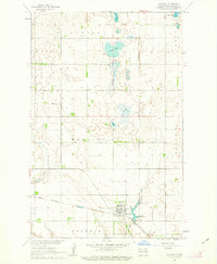 1961 McVille1963 Print · USGSMcVille and the surrounding Nelson County townships appear here in the early sixties as a center of prairie rail commerce. Genealogists and historians can trace local landmarks like Center Ch, Hamlin Cem, and the path of the Great Northern railroad.
 - 1961 Map of Binford NW, 1963 Print
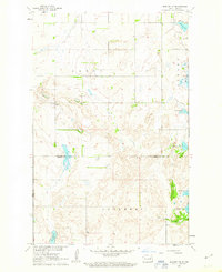 1961 Binford NW1963 Print · USGSThe glacial prairie of central North Dakota is captured here in the early sixties, showing the vital connection between water and rural settlement. Genealogists and local historians can locate early burial sites such as Bergen Ch Cem and trace the shorelines of Red Willow Lake and Ottofy Lake.
Showing maps 1-25 of 198
Top cities of Nelson County
- Lakota historical maps
- McVille historical maps
- Michigan City historical maps
- Aneta historical maps
- Tolna historical maps
- Petersburg historical maps
See more
Frequently asked questions
- What are the different types of historical maps available for Nelson County?
- What is the oldest map of Nelson County?
- Where can I purchase historical maps of Nelson County for my home or office?
- Where can I download high-res historical maps of Nelson County?
- Are there historical topographic maps available for Nelson County?
- Is there historical aerial imagery available for Nelson County?
- Where are historical maps of Nelson County sourced from?