Old Maps of Grano, North Dakota for Genealogy
Trace your family roots with 9 historic maps of Grano. These high-res maps reveal old neighborhoods, homesites, landmarks, and streets — helping you uncover where your ancestors lived and how the area evolved over time.
- Explore historic neighborhoods: Identify where your relatives may have lived in the 1800s or 1900s.
- Compare maps over time: Trace the changes in streets, buildings, and landmarks for multi-generational research.
- Perfect for genealogy & ancestry research: Used by family historians and researchers to map out lineage and migration.
These maps are an incredible resource for exploring your personal connection to Grano's past.
Grano, ND maps
(9)- 1949 Map of Grano
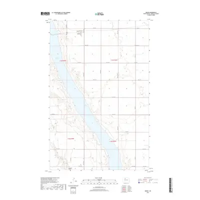
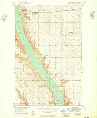 1949 Grano1949 Print · USGSRenville County life in the late forties is centered on the railroad town of Grano and the winding valley of Lake Darling. Genealogists and local historians can locate family landmarks such as Lockwood Sch, Sauer Sch, and the Grano Cem.
 - 1951 Map of Grano
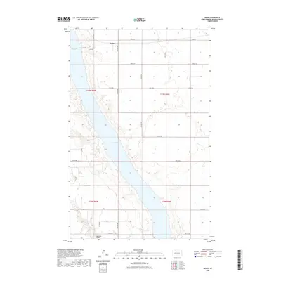
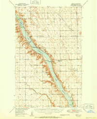 1951 Grano1951 Print · USGSRenville County is shown at mid-century as a grid of northern prairie townships shaped by the river valley and the rail. Genealogists can locate family landmarks like Gethsemane Ch, Grano Cem, and schools such as Sauer Sch or Clay Center Sch.
 - 1954 Map of Minot, 1964 Print
 1954 Minot1964 Print · USGSNorth Dakota's northern borderlands are captured here in the mid-fifties, showing a landscape defined by the winding Souris River and the rise of the Turtle Mountains. Genealogists can locate family-named sidings like Hurd Siding and Truro Siding alongside the vital Great Northern rail lines.3 unique versions available
 - 1958 Map of Minot
 1958 Minot1958 Print · USGSNorthern North Dakota is shown here during the mid-fifties, dominated by the rail-driven growth of Minot and the surrounding grain-farming prairie. Genealogists can trace family connections to border towns like Westhope or explore the vast reaches of the Turtle Mountains.
 - 2011 Map of Grano, 2011 Print
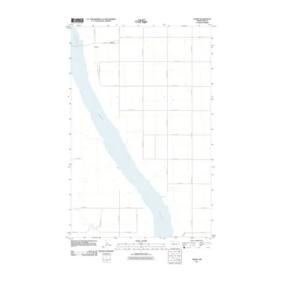 2011 Grano2011 Print · USGSCovers Grano, including Renville County, United States, and other nearby areas
 - 2014 Map of Grano, 2014 Print
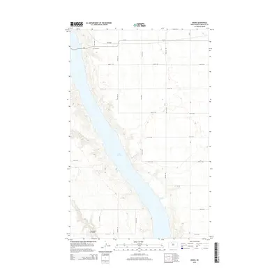 2014 Grano2014 Print · USGSCovers Grano, including Renville County, United States, and other nearby areas
 - 2017 Map of Grano, 2017 Print
 2017 Grano2017 Print · USGSCovers Grano, including Renville County, United States, and other nearby areas
 - 2020 Map of Grano, 2020 Print
 2020 Grano2020 Print · USGSCovers Grano, including Renville County, United States, and other nearby areas
 - 2024 Map of Grano, 2024 Print
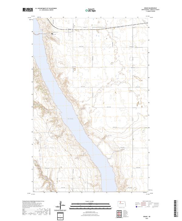 2024 Grano2024 Print · USGSRenville County's prairie and river valley are captured here in the early twenty-first century as agricultural life continues around the Souris River. Researchers can trace the layout of Grano, locate the Grano Cem on the valley bluffs, and see the extent of Lake Darling.
End of results
Showing maps 1-9 of 9
Top cities near Grano
Frequently asked questions
- What are the different types of historical maps available for Grano?
- What is the oldest map of Grano?
- Where can I purchase historical maps of Grano for my home or office?
- Where can I download high-res historical maps of Grano?
- Are there historical topographic maps available for Grano?
- Is there historical aerial imagery available for Grano?
- Where are historical maps of Grano sourced from?