1990s Maps of Slope County, North Dakota
Explore 30 historic maps of Slope County from the 1990s. These maps offer a rare glimpse into what life looked like during the 1990s — showing old roads, neighborhoods, homes, and landmarks that have changed or disappeared over time.
Whether you're researching your family's past, planning a metal detecting trip, or studying how Slope County's landscape evolved across the 1990s, these high-resolution maps are a powerful tool for exploring the history of this region.
- Focus on a specific era: All maps on this page are from the 1990s, giving you a focused view of this time period.
- See what’s changed: Compare century-old streets, trails, and buildings to today's modern landscape using overlays and satellite layers.
- Research with precision: Use these maps for genealogy, historical research, land use analysis, or educational projects.
- View, download, or print: Maps are fully viewable online in high resolution, and can be downloaded or printed for your own records.
Start exploring Slope County's history through authentic maps from the 1990s. This is your window into the past.
Slope County, ND maps
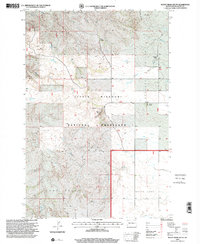
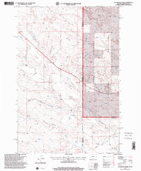
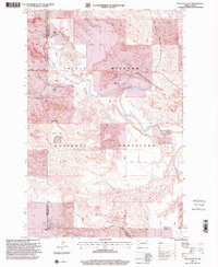
(30)- 1997 Map of Deep Creek North, 2001 Print
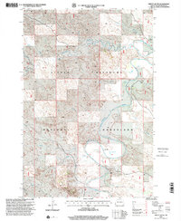
 1997 Deep Creek North2001 Print · USGSThe ranching country of the North Dakota Badlands is documented here during the late nineties, featuring the winding Little Missouri River. Genealogists can locate family landmarks such as Walser Ranch, Klewin Ranch, and the Bullion View Sch.
 - 1997 Map of Boyce Creek West, 2001 Print
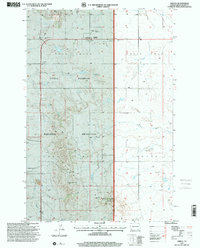
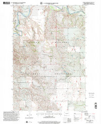
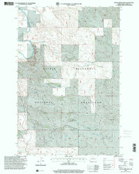 1997 Boyce Creek West2001 Print · USGSWestern North Dakota ranching country is mapped here in the late nineties, showing the expansive Little Missouri National Grassland. Researchers can trace isolated prairie life through landmarks like Oldis Ranch, Rue Ranch, and Sunshine Mound.
 - 1997 Map of Stewart Lake, 2001 Print
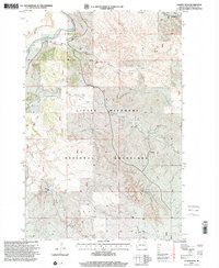
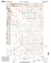 1997 Stewart Lake2001 Print · USGSThe North Dakota badlands and grasslands are documented here in the late nineties, centered on the Stewart Lake National Wildlife Refuge. Genealogists and researchers can trace the Cottage Sch, find early mines, and locate landmarks like Chalk Butte.
 - 1997 Map of Pretty Butte, 2001 Print
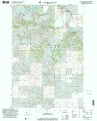
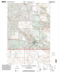
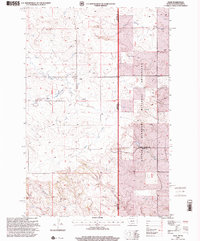
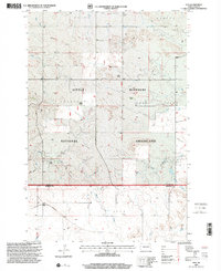
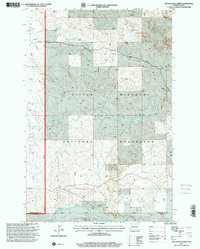
 1997 Pretty Butte2001 Print · USGSSlope County, North Dakota, is seen here during the late twentieth century as a rugged ranching landscape within the Little Missouri National Grassland. Researchers can trace remote family outposts like Brown Ranch and Williams Ranch alongside the winding Little Missouri River.
 - 1997 Map of Marmarth, 2001 Print
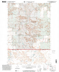
 1997 Marmarth2001 Print · USGSThe rail-and-river town of Marmarth is shown in the late nineties as it sits within the Little Missouri National Grassland. Researchers can trace the local landscape from Riverside Cem to the Rodeo Ground and the banks of the Little Missouri River.
 - 1997 Map of Marmarth SE, 2001 Print
 1997 Marmarth SE2001 Print · USGSThe North Dakota badlands near the turn of the millennium are defined here by cattle country and pioneer history. Trace the site of a famous wagon train siege at Fort Dilts State Historic Site or follow the waters of Indian Creek and Bacon Creek.
 - 1997 Map of Alpha, 2001 Print
 1997 Alpha2001 Print · USGSThe North Dakota Badlands near the turn of the millennium were a place of isolated ranches and vast grasslands. Researchers can locate legacy sites like the Randash Sch, the settlement of Alpha, and the family-held Remillong Ranch.
 - 1997 Map of Amidon, 2001 Print
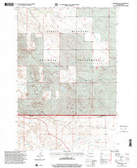
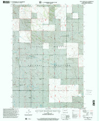
 1997 Amidon2001 Print · USGSAmidon and the surrounding Badlands are captured in the late nineties, showcasing the intersection of prairie ranching and public lands. Genealogists and local historians can locate the Lebanon Cem, the County Fairground, and the ascent to White Butte.
 - 1997 Map of Williams Lake, 2001 Print
 1997 Williams Lake2001 Print · USGSThe western rangelands of Golden Valley and Slope counties are captured here in the late nineties as part of the Little Missouri National Grassland. Researchers can trace the ranching life of the Badlands through sites like Northrup Ranch and the Horse Creek Association Headquarters.
 - 1997 Map of Rocky Ridge South, 2001 Print
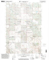
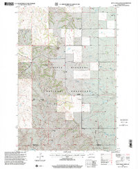
 1997 Rocky Ridge South2001 Print · USGSSlope County's high prairie and ranching traditions are preserved here during the late twentieth century. Researchers can trace land use patterns and family holdings like Erickson Ranch or locate industrial sites such as the Uranium Pit and Scoria Pit.
 - 1997 Map of Ollie, 2001 Print
 1997 Ollie2001 Print · USGSThe Montana and North Dakota border comes alive in the late nineties, documenting the rural community of Ollie and the surrounding ranchlands. Genealogists and researchers can trace local landmarks like the local Cem, the Scoria Pit, and the course of Beaver Creek.
 - 1997 Map of Rocky Ridge North, 2001 Print
 1997 Rocky Ridge North2001 Print · USGSBillings and Slope counties in the late twentieth century reveal a resilient ranching landscape within the Little Missouri National Grassland. Genealogists and researchers can trace family landmarks like Hewson Ranch or find the Rocky Ridge Schoolhouse and Smith Cem.
 - 1997 Map of Three V Crossing, 2001 Print
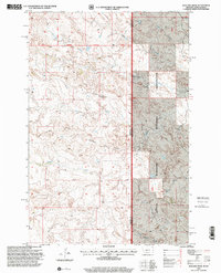
 1997 Three V Crossing2001 Print · USGSThe ranching country of western North Dakota is captured here in the late twentieth century, where the badlands meet the Little Missouri River. Trace the history of remote outposts like Three V Ranch and river landmarks such as Three V Crossing.
 - 1997 Map of Waterhole Creek, 2001 Print
 1997 Waterhole Creek2001 Print · USGSThe Montana-North Dakota state line comes into focus in the late nineties, documenting a landscape of remote ranchlands and prairie. Genealogists and historians can locate the Fertile Prairie Sch and Fertile Prairie Cem near Waterhole Creek.
 - 1997 Map of Spring Creek, 2001 Print
 1997 Spring Creek2001 Print · USGSThe high plains of western North Dakota appear in the late twentieth century as a landscape of isolated ranching and vast grasslands. Researchers can trace family-held land through outposts like Johnson Ranch and Davis Ranch along the Little Missouri River.
 - 1997 Map of Juniper Spur, 2001 Print
 1997 Juniper Spur2001 Print · USGSThe North Dakota Badlands come into focus in the late nineties, centered on the protected expanses of the Little Missouri National Grassland. Researchers can trace the rugged drainage of the Little Missouri River and locate remote landmarks like Schaefer Ranch and Hamann Road.
 - 1997 Map of Ives, 2001 Print
 1997 Ives2001 Print · USGSThe North Dakota badlands of Slope and Bowman counties are shown in the late 1990s as a landscape of remote ranches and high prairie. Researchers can trace family homesteads like Weisz Ranch and Fischer Ranch or locate the rural St Paul Cem near the railway siding at Ives.
 - 1997 Map of Bullion Butte, 2001 Print
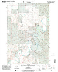
 1997 Bullion Butte2001 Print · USGSBillings and Golden Valley Counties are shown here during the late 1990s, where the river-cut badlands meet high plateau country. Researchers can locate remote family sites like Adams Ranch and Griffin Ranch or the small Connell Cem near the riverbanks.
 - 1997 Map of Daglum NW, 2001 Print
 1997 Daglum NW2001 Print · USGSWestern North Dakota ranching and prairie life are captured in the late nineties as they stood across the Stark and Billings county lines. Genealogists and historians can trace family ties at Our Lady of Lourdes Ch and its Cem, or locate old landmarks like Gaylord and Swenson Ranch.
 - 1997 Map of Daglum SW, 2001 Print
 1997 Daglum SW2001 Print · USGSWestern North Dakota in the late nineties was a landscape of remote ranching and energy extraction. Genealogists can trace family holdings like the Schaeffer Ranch or Hanson Ranch, and find historical burials at the Peaceful Valley Cem.
 - 1997 Map of Daglum SE, 2001 Print
 1997 Daglum SE2001 Print · USGSSlope County ranching and the prairie landscape of the late nineties are preserved in this detailed survey. Researchers can trace the quiet landmarks of the plains, from the Dovre Cem and Hanson Ranch to the prominent heights of Rainy Butte.
 - 1997 Map of Dry Bullion Creek, 2001 Print
 1997 Dry Bullion Creek2001 Print · USGSExperience the rugged badlands of western North Dakota in the late 1990s, where public grazing lands meet the river. Genealogists and historians can locate isolated outposts like the Howard Ranch and Van Daele Ranch or trace the Little Missouri River.
 - 1997 Map of West Fork Deep Creek, 2001 Print
 1997 West Fork Deep Creek2001 Print · USGSThe North Dakota badlands of the late nineties are laid bare in this study of the border between Slope and Bowman counties. Researchers can trace the ranching history of the Little Missouri National Grassland and find local landmarks like the Bloomgren Ranch and Slope Center.
 - 1997 Map of Boyce Creek East, 2001 Print
 1997 Boyce Creek East2001 Print · USGSSlope County's ranching country is preserved here in the late nineties, showcasing the rugged homesteads within the Little Missouri National Grassland. Genealogists can trace family-named sites like Bowman Ranch, Mound Ch, and the Janikowski Ranch.
 - 1997 Map of Badland Draw, 2001 Print
 1997 Badland Draw2001 Print · USGSThe Montana and North Dakota borderlands come into focus in the late nineties, documenting a vast expanse of public grazing land. Researchers can trace the drainages of Badland Draw and the Cannonball River, or locate landmarks like Haystack Butte and Windy Ridge.
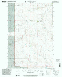
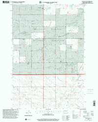
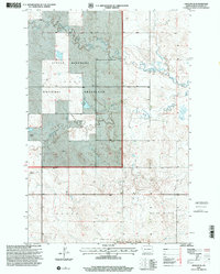
Showing maps 1-25 of 30
Top cities of Slope County
Frequently asked questions
- What are the different types of historical maps available for Slope County?
- What is the oldest map of Slope County?
- Where can I purchase historical maps of Slope County for my home or office?
- Where can I download high-res historical maps of Slope County?
- Are there historical topographic maps available for Slope County?
- Is there historical aerial imagery available for Slope County?
- Where are historical maps of Slope County sourced from?