Old Maps of Slope County, North Dakota for Genealogy
Trace your family roots with 265 historic maps of Slope County. These high-res maps reveal old neighborhoods, homesites, landmarks, and streets — helping you uncover where your ancestors lived and how the area evolved over time.
- Explore historic neighborhoods: Identify where your relatives may have lived in the 1800s or 1900s.
- Compare maps over time: Trace the changes in streets, buildings, and landmarks for multi-generational research.
- Perfect for genealogy & ancestry research: Used by family historians and researchers to map out lineage and migration.
These maps are an incredible resource for exploring your personal connection to Slope County's past.
Slope County, ND maps
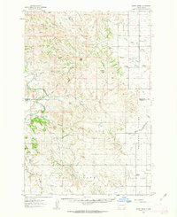
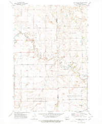
(265)- 1953 Map of Miles City, 1966 Print
 1953 Miles City1966 Print · USGSEastern Montana and the North Dakota borderlands come alive in this mid-century survey of the Yellowstone River valley. Genealogists and historians can trace the rural network of the era through sites like Fertile Prairie School, St Johns Church, and the rail lines serving Ismay and Plevna.4 unique versions available
 - 1953 Map of Dickinson, 1968 Print
 1953 Dickinson1968 Print · USGSWestern North Dakota in the fifties remains a landscape of rail-linked prairie towns and rugged badlands. Trace the local impact of the Northern Pacific railroad through Dickinson or locate early rural landmarks like Rainy Butte Church and Boys Ranch.2 unique versions available
 - 1957 Map of Dickinson
 1957 Dickinson1957 Print · USGSSouthwestern North Dakota in the mid-fifties is a landscape of coal mining and tight-knit rural school districts. Genealogists can trace family footprints through numerous country schools like Fisher School and parish churches like St Stephens.
 - 1957 Map of Miles City
 1957 Miles City1957 Print · USGSEastern Montana and the North Dakota borderlands come alive in the mid-fifties as the rail and ranching economy peaks along the Yellowstone River. Genealogists and historians can trace numerous rural landmarks like St Phillips Church, Fertile Prairie School, and the Ostendorf Ranch.
 - 1958 Map of Miles City
 1958 Miles City1958 Print · USGSEastern Montana ranching and rail life are documented here during the late fifties, centered on the confluence of the Yellowstone River and Powder River. Researchers can trace rural school locations like St Phillips Church and Chimney Creek School alongside dozens of named family ranches.
 - 1961 Map of Daglum, 1963 Print
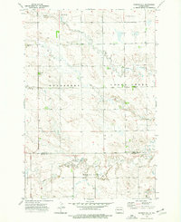
 1961 Daglum1963 Print · USGSThe western North Dakota plains near the turn of the 1960s reveal a landscape of remote schoolhouses and prairie churches. Researchers can locate vanished rural landmarks like Fisher School, the Daglum Cemetery, and Our Lady of Lourdes Ch.
 - 1961 Map of Rocky Ridge, 1963 Print
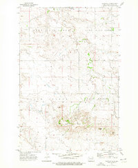
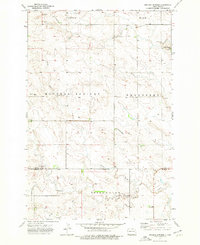
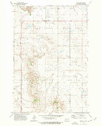
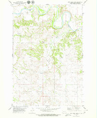
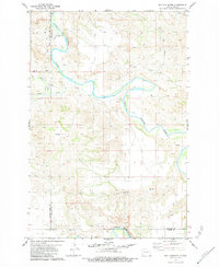
 1961 Rocky Ridge1963 Print · USGSThe North Dakota badlands of Slope and Billings Counties are captured here in the early sixties, showing a landscape of ranching and early energy extraction. Researchers can locate the Rocky Ridge Sch, White Lake Sch No 1, and the unique Burning Coal Veins near the river.
 - 1973 Map of Black Butte, 1976 Print
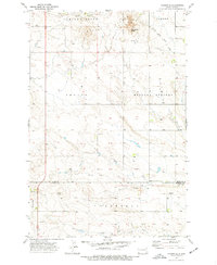
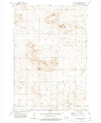
 1973 Black Butte1976 Print · USGSSlope County's high plains come into focus in the early 1970s, showcasing a landscape of prominent peaks and prairie drainages. Researchers can trace land formations like Chalky Butte and Black Butte, or follow the courses of West Sand Creek and Deep Creek.
 - 1973 Map of White Lake, 1976 Print
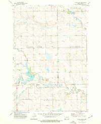
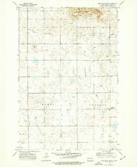
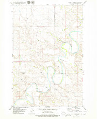
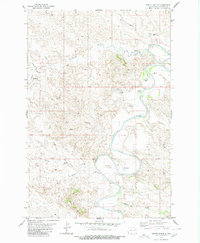
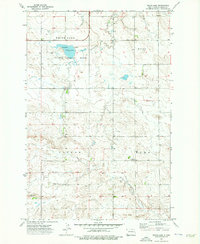 1973 White Lake1976 Print · USGSSlope County's high plains are captured here in the early seventies, centered on the vital waters of the White Lake National Wildlife Refuge. Researchers can pinpoint local landmarks like Norman Church, the Connor Sch No 1, and the headwaters of the Cannonball River.
 - 1973 Map of Warnke Hill, 1976 Print
 1973 Warnke Hill1976 Print · USGSThe northern Great Plains of southwestern North Dakota are documented here in the early 1970s, showcasing a landscape of high-prairie ranching and townships. Researchers can locate family landmarks like Pierce Cem, the Bob Denny Hills, and the settlement of Warnke.
 - 1973 Map of Mineral Springs, 1976 Print
 1973 Mineral Springs1976 Print · USGSThe rural plains of Slope and Bowman Counties are mapped here in the early seventies, centered on the local hub of Mineral Springs. Researchers can locate the Mineral Springs School and trace the meandering North Fork Cedar Creek through the Bob Denny Hills.
 - 1973 Map of Amidon SE, 1977 Print
 1973 Amidon SE1977 Print · USGSSlope and Bowman counties appear in the early seventies, a time when the prairie landscape was defined by its water sources and high buttes. Local historians can trace family ties via the Cem and the geographic markers of Chalky Buttes and Rattlesnake Butte.
 - 1973 Map of Cedar Lake, 1977 Print
 1973 Cedar Lake1977 Print · USGSThe western North Dakota plains in the early 1970s reveal a landscape of managed waterways and remote homesteads. Genealogists and historians can trace local landmarks like Cedar Lake, the small Cem, and the prairie waters of Rustan Lake.
 - 1973 Map of Stewart Lake, 1977 Print
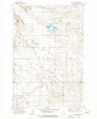 1973 Stewart Lake1977 Print · USGSThe high plains of Slope and Bowman Counties are captured in the early 1970s, showcasing a landscape of wildlife conservation and rugged prairie. Researchers can trace the boundaries of the Stewart Lake National Wildlife Refuge and locate rural landmarks like Cottage and Chalky Butte.
 - 1973 Map of Amidon, 1977 Print
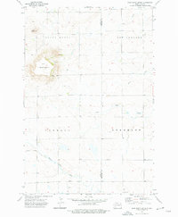
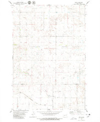
 1973 Amidon1977 Print · USGSAmidon and the high plains of Slope County appear in the early 1970s as a landscape of isolated homesteads and striking geological formations. Researchers can locate community anchors like the County Fairground and Lebanon Cem, or trace the rugged breaks around White Butte.
 - 1973 Map of New England NW, 1977 Print
 1973 New England NW1977 Print · USGSThe western North Dakota prairie in the early seventies shows a landscape of wide-open ranch land at the meeting of three counties. Genealogists and historians can trace the course of Antelope Creek past local landmarks like Brown and a solitary marked Grave.
 - 1973 Map of West Rainy Butte, 1977 Print
 1973 West Rainy Butte1977 Print · USGSSlope County rangeland and the prominent rise of West Rainy Butte are captured in this early 1970s survey. Genealogists and local historians can locate the DeSart Cem and trace the drainage of Chanta Peta Creek across the townships.
 - 1973 Map of East Rainy Butte, 1977 Print
 1973 East Rainy Butte1977 Print · USGSThe high plains of Slope and Hettinger counties are captured in the early 1970s, dominated by the landforms of East Rainy Butte and Baldy Butte. Researchers can trace the small settlement at De Sart, find Johnson Cemetery, and locate the water sources for local ranching along Chanta Peta Creek.
 - 1973 Map of New England SW, 1977 Print
 1973 New England SW1977 Print · USGSThe North Dakota prairie during the 1970s reveals a landscape shaped by the Cannonball River and the towering heights of Rainy Butte. Researchers can trace the border of Slope County, locate the Schmidt Cem, and explore the rural outskirts of New England.
 - 1979 Map of Deep Creek North
 1979 Deep Creek North1979 Print · USGSThe Little Missouri River badlands of Slope County are captured here in the late 1970s, a period of quiet ranching life on the high plains. Researchers can locate remote landmarks like the Logging Camp Ranch, Walser Crossing, and the Bullion View Sch school site.
 - 1979 Map of Three V Crossing
 1979 Three V Crossing1979 Print · USGSThe ranching country of western North Dakota is captured here in the late seventies as the river winds through the county line. Researchers can locate remote landmarks like the Three V Ranch, the river ford at Three V Crossing, and various water sources including Deer Creek.
 - 1979 Map of Ives, 1980 Print
 1979 Ives1980 Print · USGSThe borderlands of Slope and Bowman counties are shown in the late 1970s as the regional rail economy persists. Researchers can trace the path of the Chicago Milwaukee St Paul and Pacific railroad past Ives and the St Paul Cem.
 - 1979 Map of Bullion Butte, 1984 Print
 1979 Bullion Butte1984 Print · USGSThe North Dakota badlands come alive in this 1970s survey, dominated by the massive Bullion Butte and the winding Little Missouri River. Genealogists and local historians can locate the Connell Cem and trace old access routes like Pipeline Road.
 - 1980 Map of Spring Creek
 1980 Spring Creek1980 Print · USGSThe North Dakota badlands and prairie plateaus meet in the 1980s, where the Little Missouri River defines the landscape. Researchers can trace land management through numerous wells and landmarks like Davis Dam and Spring Creek.
 - 1980 Map of Pretty Butte
 1980 Pretty Butte1980 Print · USGSSlope County's rugged western plains are captured here in the early 1980s, dominated by the winding course of the Little Missouri River. Genealogists and researchers can trace local landmarks like Pretty Butte and follow the paths of Cannonball Creek and several Flowing Well sites across the prairie.
Showing maps 1-25 of 265
Top cities of Slope County
Frequently asked questions
- What are the different types of historical maps available for Slope County?
- What is the oldest map of Slope County?
- Where can I purchase historical maps of Slope County for my home or office?
- Where can I download high-res historical maps of Slope County?
- Are there historical topographic maps available for Slope County?
- Is there historical aerial imagery available for Slope County?
- Where are historical maps of Slope County sourced from?