Old Maps of Stark County, North Dakota for Hiking & Exploration
Hike through history with 217 historic maps of Stark County. Explore old trails, ghost towns, and forgotten backroads — perfect for outdoor adventurers and local explorers.
- Rediscover forgotten places: Map out old mining camps, roads, and footpaths that no longer exist on modern maps.
- Layer with modern tools: Combine with LiDAR or satellite views to plan hikes through historical terrain.
- Made for exploration: Popular among hikers, overlanders, and local history lovers.
Use these maps to find adventure and explore the hidden past of Stark County.
Stark County, ND maps
(217)- 1953 Map of Dickinson, 1968 Print
 1953 Dickinson1968 Print · USGSWestern North Dakota in the fifties remains a landscape of rail-linked prairie towns and rugged badlands. Trace the local impact of the Northern Pacific railroad through Dickinson or locate early rural landmarks like Rainy Butte Church and Boys Ranch.2 unique versions available
 - 1953 Map of Watford City, 1968 Print
 1953 Watford City1968 Print · USGSNorth Dakota's badlands and the Missouri River basin are captured here during the 1950s and 60s as the Garrison Dam changed the landscape. Researchers can trace old rail lines like the Great Northern or find rural outposts such as Grassy Butte and Halliday.3 unique versions available
 - 1957 Map of Dickinson
 1957 Dickinson1957 Print · USGSSouthwestern North Dakota in the mid-fifties is a landscape of coal mining and tight-knit rural school districts. Genealogists can trace family footprints through numerous country schools like Fisher School and parish churches like St Stephens.
 - 1957 Map of Watford City
 1957 Watford City1957 Print · USGSWestern North Dakota's landscape is captured here during the mid-fifties as the Missouri River valley undergoes massive change following the creation of Garrison Reservoir. Genealogists and historians can trace dozens of rural schools like Divide School and early settlements such as Arnegard and Grassy Butte.
 - 1959 Map of Dickinson North
 1959 Dickinson North1959 Print · USGSDickinson and the surrounding Stark County prairies are captured here during the mid-century oil boom. Researchers can trace the development of the State Teachers College and locate family history at St Patricks Cem or rural School No 9.2 unique versions available
 - 1959 Map of Dickinson South, 1960 Print
 1959 Dickinson South1960 Print · USGSSouth of Dickinson in the late fifties, the landscape was defined by the intersection of the Heart River and new aviation infrastructure. Researchers can trace the local institutional history through the St Joseph Sch and St Joseph Cem or locate industrial Clay Pits near the Northern Pacific line.2 unique versions available
 - 1959 Map of Lehigh, 1960 Print
 1959 Lehigh1960 Print · USGSStark County's coal and rail landscape is captured here in the late fifties as industrial extraction and rural education shaped the community. Genealogists and local historians can locate the town of Lehigh, the Northern Pacific line, and rural landmarks like Shipley Sch No 3 or Dobson Buttes.2 unique versions available
 - 1960 Map of White Butte NW, 1961 Print
 1960 White Butte NW1961 Print · USGSThe rural borderlands between Stark and Hettinger Counties are captured here at the start of the 1960s. Researchers can locate township divisions in Madison and Campbell or trace the early paths of Plum Creek past local landmarks like School No 1.
 - 1960 Map of Clark Butte NW, 1962 Print
 1960 Clark Butte NW1962 Print · USGSStark and Hettinger Counties at the start of the 1960s reveal a landscape of dispersed prairie homesteads and rural school districts. Genealogists and local historians can locate specific landmarks like Heart River School No. 2, Bethesda Ch, and the rising waters of Lake Tschida.
 - 1960 Map of Clark Butte NE, 1962 Print
 1960 Clark Butte NE1962 Print · USGSThe North Dakota prairie near the intersection of Grant, Morton, and Stark counties is captured here in the early sixties. Researchers can find rural landmarks such as SS Peter and Paul Ch, Heart Butte School No 2, and the newly formed Lake Tschida.
 - 1960 Map of White Butte NE, 1962 Print
 1960 White Butte NE1962 Print · USGSThe rural borderlands of Stark and Hettinger Counties are captured here in the early sixties, showing a landscape defined by the winding Heart River. Local researchers can locate the St Stephens Ch and trace the drainage of Beaver Creek across the Campbell Highland.
 - 1961 Map of Daglum, 1963 Print
 1961 Daglum1963 Print · USGSThe western North Dakota plains near the turn of the 1960s reveal a landscape of remote schoolhouses and prairie churches. Researchers can locate vanished rural landmarks like Fisher School, the Daglum Cemetery, and Our Lady of Lourdes Ch.
 - 1962 Map of Davis Buttes, 1964 Print
 1962 Davis Buttes1964 Print · USGSNorth Dakota's high plains meet Cold War defense and new infrastructure in the early sixties as a major highway is carved across the landscape. You can trace the rural layout of the day, from the Dickinson Air Force Station to the Versippi Sch and various gravel pits.2 unique versions available
 - 1962 Map of Belfield NE, 1964 Print
 1962 Belfield NE1964 Print · USGSThe high plains of Stark and Billings counties are captured here in the early sixties, showing the rail-centered community of Zenith. Researchers can trace the extractive history of the region through labeled sites like Walters Mine, Karsky Mine, and several local Scoria Pits.2 unique versions available
 - 1962 Map of Belfield SW, 1964 Print
 1962 Belfield SW1964 Print · USGSStark County's high plains and river valleys come into focus during the early sixties, showing the rural structure of the North Dakota badlands border. Researchers can trace historic local education sites like Belfield Sch No 1 and mining features such as the Scoria Pits.
 - 1962 Map of Belfield, 1964 Print
 1962 Belfield1964 Print · USGSBelfield and the surrounding plains of the Stark and Billings county line are captured here in the early sixties as new infrastructure began to reshape the region. Researchers can trace the path of the Northern Pacific railroad and locate community sites like St Stanislaus Cem and Truelson Sch.2 unique versions available
 - 1962 Map of Belfield SE, 1964 Print
 1962 Belfield SE1964 Print · USGSStark County, North Dakota, is documented here in the early sixties as a landscape of river valleys and rugged breaks. Trace the path of the Burlington Northern railroad or explore the terrain of the Little Badlands and Bull Creek.2 unique versions available
 - 1967 Map of Watford City
 1967 Watford City1967 Print · USGSWestern North Dakota is captured during a period of landscape transformation as the Missouri River valley was reshaped by the new Garrison Reservoir. Genealogists and local historians can trace the foundations of Watford City, find the Elkhorn Ranch Site, or locate rural landmarks like Ziner Butte and Grassy Butte.
 - 1973 Map of Bratburg Butte
 1973 Bratburg Butte1973 Print · USGSStark County in the early 1970s shows a landscape of winding river valleys and open ranch land. Researchers can trace the meandering Heart River, locate the isolated Pioneer Cemetery, and find the aviation outpost at Brands Airport.
 - 1973 Map of Hebron SE, 1977 Print
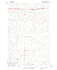 1973 Hebron SE1977 Print · USGSThe prairie landscape along the Morton and Stark county line is captured here in the early seventies, just as modern infrastructure began to cross the rural plains. You can trace the path of Heart Butte Creek, locate the Schmidt landmark, and see the early alignment of 94 near a local Gravel Pit.
 - 1973 Map of Marshall SE, 1977 Print
 1973 Marshall SE1977 Print · USGSThe North Dakota high plains of the early seventies are documented here at the boundary of two counties. Researchers can locate agricultural landmarks like Storage Bins and trace the vital water sources identified by several Spring and Well sites across the terrain.
 - 1973 Map of Hebron, 1977 Print
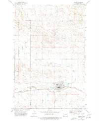 1973 Hebron1977 Print · USGSHebron and its surrounding prairies are captured in the early 1970s as the town thrived along the Burlington Northern railroad. Genealogists and researchers can locate St John Cem, St Ann Cem, and the old High School near the banks of the Knife River.
 - 1973 Map of Boyle, 1977 Print
 1973 Boyle1977 Print · USGSStark and Dunn Counties are captured in the early seventies, showing a landscape shaped by transportation and the prairie environment. Trace the infrastructure of the Burlington Northern railroad and locate water sources like the Gaging Sta along the Green River.
 - 1973 Map of Taylor, 1977 Print
 1973 Taylor1977 Print · USGSTaylor and its surrounding Stark County prairie are shown here in the early seventies as the railroad era matured. Genealogists and local historians can locate Immanuel Cem and trace the path of Beaver Cr alongside the Burlington Northern tracks.
 - 1973 Map of Willow Creek West, 1977 Print
 1973 Willow Creek West1977 Print · USGSDunn County and its neighboring borders are captured in the early 1970s, showcasing the rural water networks of the High Plains. Researchers can trace the winding Knife River and its southern Branch, or locate local landmarks like the Gravel Pit.
Showing maps 1-25 of 217
Top cities of Stark County
- Dickinson historical maps
- Belfield historical maps
- Richardton historical maps
- South Heart historical maps
- Gladstone historical maps
- Taylor historical maps
Frequently asked questions
- What are the different types of historical maps available for Stark County?
- What is the oldest map of Stark County?
- Where can I purchase historical maps of Stark County for my home or office?
- Where can I download high-res historical maps of Stark County?
- Are there historical topographic maps available for Stark County?
- Is there historical aerial imagery available for Stark County?
- Where are historical maps of Stark County sourced from?