1970s Maps of Ward County, North Dakota
Explore 10 historic maps of Ward County from the 1970s. These maps offer a rare glimpse into what life looked like during the 1970s — showing old roads, neighborhoods, homes, and landmarks that have changed or disappeared over time.
Whether you're researching your family's past, planning a metal detecting trip, or studying how Ward County's landscape evolved across the 1970s, these high-resolution maps are a powerful tool for exploring the history of this region.
- Focus on a specific era: All maps on this page are from the 1970s, giving you a focused view of this time period.
- See what’s changed: Compare century-old streets, trails, and buildings to today's modern landscape using overlays and satellite layers.
- Research with precision: Use these maps for genealogy, historical research, land use analysis, or educational projects.
- View, download, or print: Maps are fully viewable online in high resolution, and can be downloaded or printed for your own records.
Start exploring Ward County's history through authentic maps from the 1970s. This is your window into the past.
Ward County, ND maps
(10)- 1971 Map of Surrey
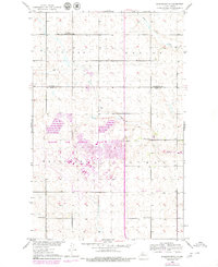
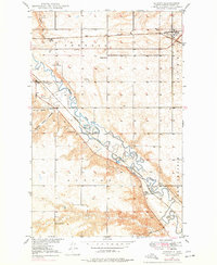 1971 Surrey1971 Print · USGSSurrey and the surrounding Ward County prairie are captured here during the early 1970s, showcasing the area's vital rail and river networks. Genealogists and local historians can locate early rural landmarks like School No 1, Logan, and the banks of the Souris River.
 - 1974 Map of Benedict SE, 1975 Print
 1974 Benedict SE1975 Print · USGSMcLean County is captured in the mid-1970s through this aerial-survey orthophotomap, documenting the agricultural grain of the North Dakota prairie. Local researchers and genealogists can trace property boundaries and farmstead locations surrounding the village of Benedict.
 - 1974 Map of Benedict NW, 1975 Print
 1974 Benedict NW1975 Print · USGSCovers Ward County, including United States, North Dakota, and other nearby areas
 - 1974 Map of Kongsberg SW, 1975 Print
 1974 Kongsberg SW1975 Print · USGSIn the mid-1970s, this McLean County landscape shows the stark reality of prairie farming and rail-side life. Genealogists and historians can trace the precise layout of Ruso and the surrounding agricultural tracts that defined this region of North Dakota.
 - 1974 Map of Kongsberg NW, 1975 Print
 1974 Kongsberg NW1975 Print · USGSCovers Ward County, including McHenry County, United States, and other nearby areas
 - 1974 Map of Benedict NE, 1975 Print
 1974 Benedict NE1975 Print · USGSCovers Ward County, including United States, North Dakota, and other nearby areas
 - 1974 Map of Benedict SW, 1975 Print
 1974 Benedict SW1975 Print · USGSCovers Ward County, including McLean County, United States, and other nearby areas
 - 1979 Map of Burlington NE, 1980 Print
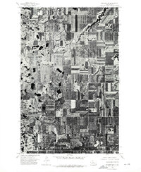
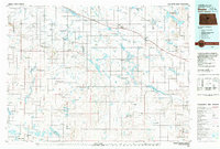
 1979 Burlington NE1980 Print · USGSUpper North Dakota prairie life and military expansion meet in this late-seventies survey of the area north of Minot. Genealogists and local historians can trace the footprint of Minot Air Force Base alongside rural landmarks like Lynch Ch and Copeland School No 1.2 unique versions available
 - 1979 Map of Drake, 1980 Print
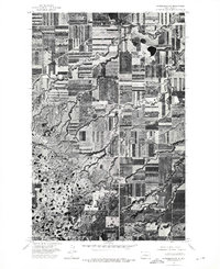
 1979 Drake1980 Print · USGSCentral North Dakota in the late seventies reveals a landscape of prairie potholes and developing water infrastructure. Trace the rail-fed growth of Drake and Anamoose or locate rural landmarks like the McClusky Canal and Lincoln Valley.
 - 1979 Map of Sawyer NE, 1980 Print
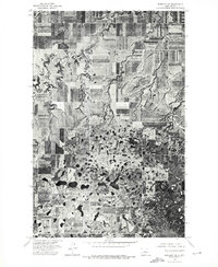
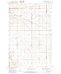 1979 Sawyer NE1980 Print · USGSWard and McHenry counties meet in this late-seventies survey of the North Dakota prairie. Genealogists and local historians can trace the precise locations of rural landmarks like Grassland School No 1, Grassland School No 2, and the Burlington Northern rail line.
End of results
Showing maps 1-10 of 10
Top cities of Ward County
- Minot historical maps
- Kenmare historical maps
- Burlington historical maps
- Surrey historical maps
- Berthold historical maps
- Sawyer historical maps
See more
Frequently asked questions
- What are the different types of historical maps available for Ward County?
- What is the oldest map of Ward County?
- Where can I purchase historical maps of Ward County for my home or office?
- Where can I download high-res historical maps of Ward County?
- Are there historical topographic maps available for Ward County?
- Is there historical aerial imagery available for Ward County?
- Where are historical maps of Ward County sourced from?