1950s Maps of Ward County, North Dakota
Explore 18 historic maps of Ward County from the 1950s. These maps offer a rare glimpse into what life looked like during the 1950s — showing old roads, neighborhoods, homes, and landmarks that have changed or disappeared over time.
Whether you're researching your family's past, planning a metal detecting trip, or studying how Ward County's landscape evolved across the 1950s, these high-resolution maps are a powerful tool for exploring the history of this region.
- Focus on a specific era: All maps on this page are from the 1950s, giving you a focused view of this time period.
- See what’s changed: Compare century-old streets, trails, and buildings to today's modern landscape using overlays and satellite layers.
- Research with precision: Use these maps for genealogy, historical research, land use analysis, or educational projects.
- View, download, or print: Maps are fully viewable online in high resolution, and can be downloaded or printed for your own records.
Start exploring Ward County's history through authentic maps from the 1950s. This is your window into the past.
Ward County, ND maps
(18)- 1950 Map of Bowbells
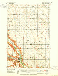
 1950 Bowbells1950 Print · USGSThe Burke County prairie meets the international border in the mid-twentieth century, centered on the vital rail junction at Bowbells. Genealogists and historians can trace rural school districts like Masek Sch and explore the early water management of the CCC Dam.2 unique versions available
 - 1950 Map of Kenmare
 1950 Kenmare1950 Print · USGSKenmare and the surrounding prairies are captured here at mid-century, dominated by the long ribbon of the Des Lacs lakes. Local researchers can trace rural life through numerous country schoolhouses and churches, including Buck Sch, Our Savior Ch, and the Kenmare Landing Field.2 unique versions available
 - 1950 Map of Deering
 1950 Deering1950 Print · USGSMid-century McHenry County centers on the rail-side town of Deering during a time of active rural school districts and prairie churches. Researchers can locate specific legacy sites like Nidarose Ch, Bethany Ch, and the Deering Cem along the Great Northern line.2 unique versions available
 - 1950 Map of Tolley
 1950 Tolley1950 Print · USGSRenville and Ward Counties are captured here mid-century, showcasing the vital rail-and-river economy of the northern plains. Local researchers can trace the locations of rural schoolhouses and family burial sites like Trinity Cem and Odd Fellows Cem near Tolley and Donnybrook.
 - 1950 Map of Des Lacs
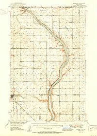
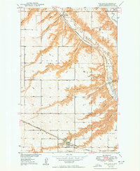 1950 Des Lacs1950 Print · USGSWard County's prairie landscape is captured here in the mid-twentieth century as the rail lines of the Great Northern and the 'Soo Line' navigated the coulee-broken plains. Trace the rural layout of Foxholm and Larsons or find family history at St Marys Cem and School No 3.3 unique versions available
 - 1950 Map of Burlington
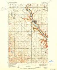
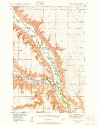 1950 Burlington1950 Print · USGSThe Souris River valley in the early postwar era shows a landscape defined by rail junctions and river management. Genealogists and historians can trace rural school locations like School No 4 and the rail corridors of the Great Northern.
 - 1950 Map of Sawyer SW
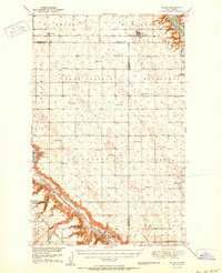
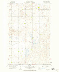
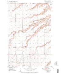 1950 Sawyer SW1950 Print · USGSMid-century Ward County shows a landscape of prairie townships and deep coulees just as the Missouri River Basin development program was underway. Genealogists and historians can locate numerous numbered rural schoolhouses, the Center Cem, and a local Lignite Mine.2 unique versions available
 - 1951 Map of Velva
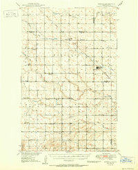
 1951 Velva1951 Print · USGSMid-century McHenry County centers on the thriving rail hub of Velva and the winding Souris River valley. Genealogists and local historians can locate numerous rural landmarks, from the North Prairie Ch to scattered schoolhouses like Roach School.
 - 1951 Map of Burlington
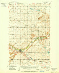
 1951 Burlington1951 Print · USGSWard County during the early 1950s shows a landscape defined by the confluence of the Souris and Des Lacs rivers and a growing rail network. Genealogists and local researchers can trace old school districts like Graham Sch and rural churches such as North Prairie Ch or the Evangelical Ch.
 - 1953 Map of Williston, 1968 Print
 1953 Williston1968 Print · USGSThe North Dakota high plains meet the waters of Sakakawea Lake in this mid-century survey of the northern borderlands. Trace the rail-and-ranch economy through sites like Anderson Sky Ranch, Sevenmile Corner, and the strip mines near Columbus.2 unique versions available
 - 1954 Map of Minot, 1964 Print
 1954 Minot1964 Print · USGSNorth Dakota's northern borderlands are captured here in the mid-fifties, showing a landscape defined by the winding Souris River and the rise of the Turtle Mountains. Genealogists can locate family-named sidings like Hurd Siding and Truro Siding alongside the vital Great Northern rail lines.3 unique versions available
 - 1954 Map of McClusky, 1968 Print
 1954 McClusky1968 Print · USGSCentral North Dakota was undergoing a profound transformation in the fifties as the newly formed Lake Sakakawea reshaped the Missouri River valley. Genealogists and historians can trace rail-town development along the Soo Line and locate historic markers like Garrison Dam or the Lewis and Clark Trail.3 unique versions available
 - 1956 Map of Blue Hill, 1958 Print
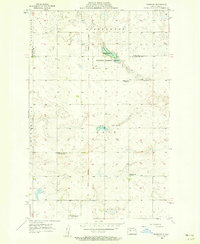
 1956 Blue Hill1958 Print · USGSCentral North Dakota's prairie landscape is captured in the mid-fifties, showing the rural junction of Ward and McLean counties. Genealogists can locate family-named landmarks and local hubs like Blue Hill Sch and Centerville Sch.2 unique versions available
 - 1956 Map of Douglas West, 1958 Print
 1956 Douglas West1958 Print · USGSThe rural landscape between Ward and McLean County comes to life in the mid-1950s, centered on the rail-linked settlement of Douglas. Researchers can trace the path of the Soo Line and locate landmark sites like School No 4 and the heights of Blue Hill.
 - 1956 Map of Roseglen, 1958 Print
 1956 Roseglen1958 Print · USGSMcLean County in the mid-fifties presents a quiet landscape of prairie townships and conservation land. Genealogists and historians can trace the rural school system and the Old Indian Boundary near Roseglen and the Hiddenwood Cem.2 unique versions available
 - 1957 Map of Williston
 1957 Williston1957 Print · USGSNorthwestern North Dakota is shown here during the mid-fifties, dominated by the sweeping plains and the Missouri River valley. Genealogists and local historians can trace the paths of the Great Northern railroad through Williston, Tioga, and Ray, or locate early industry like the coal strip mines near Lignite.
 - 1958 Map of McClusky
 1958 McClusky1958 Print · USGSCentral North Dakota was undergoing a profound change in the late fifties as the Garrison Reservoir filled behind its massive new dam. Trace the early layout of Riverdale, the Lewis and Clark Trail, and the vanishing rail stops of the Northern Pacific.
 - 1958 Map of Minot
 1958 Minot1958 Print · USGSNorthern North Dakota is shown here during the mid-fifties, dominated by the rail-driven growth of Minot and the surrounding grain-farming prairie. Genealogists can trace family connections to border towns like Westhope or explore the vast reaches of the Turtle Mountains.
End of results
Showing maps 1-18 of 18
Top cities of Ward County
- Minot historical maps
- Kenmare historical maps
- Burlington historical maps
- Surrey historical maps
- Berthold historical maps
- Sawyer historical maps
See more
Frequently asked questions
- What are the different types of historical maps available for Ward County?
- What is the oldest map of Ward County?
- Where can I purchase historical maps of Ward County for my home or office?
- Where can I download high-res historical maps of Ward County?
- Are there historical topographic maps available for Ward County?
- Is there historical aerial imagery available for Ward County?
- Where are historical maps of Ward County sourced from?