
Historical Maps of Springfield, Ohio
What stories do these 22 old maps tell about Springfield's past? From 1904 to present day, these maps reveal the evolution of streets, neighborhoods, iconic landmarks, and natural features in stunning high-res detail. Whether you're a history enthusiast, genealogist, or professional in education, environmental work, or architecture, these maps are perfect for exploration, research, and discovery.
Discover Springfield's history through maps:
- Trace Springfield's growth: Explore earlier and latest maps and editions to uncover how the region changed over time.
- Examine technical details: Each map includes its creators, publishers, scale, dimensions, and full source information.
- Layer maps with modern tools & imagery: Compare historical maps to modern-day with high-resolution satellite imagery and detailed LiDAR layers.
- Sourced from trusted archives: Carefully preserved and digitized by institutions like the United Stated Geological Survey and the US Library of Congress.
- Access in any format: View and explore in high resolution, download for offline use, or order a museum-quality print for yourself or a loved one.
Begin your journey into Springfield's history with these remarkable must-see maps.
Springfield, OH maps
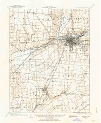
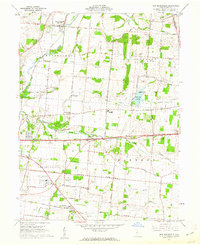
(22)- 1904 Map of Springfield, 1952 Print
 1904 Springfield1952 Print · USGSCovers Springfield, including Fairborn, Mad River, and other nearby areas
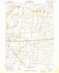
 - 1904 Map of Springfield, 1963 Print
 1904 Springfield1963 Print · USGSCovers Springfield, including Fairborn, Mad River, and other nearby areas
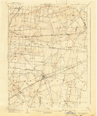
 - 1906 Map of Springfield, 1942 Print
 1906 Springfield1942 Print · USGSCovers Springfield, including Fairborn, Mad River, and other nearby areas
 - 1907 Map of South Charleston, 1943 Print
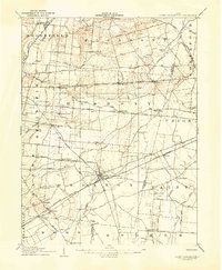 1907 South Charleston1943 Print · USGSCovers Springfield, including Harmony, South Charleston, and other nearby areas
 - 1907 Map of South Charleston, 1943 Print
 1907 South Charleston1943 Print · USGSCovers Springfield, including Harmony, South Charleston, and other nearby areas
 - 1947 Map of Columbus, 1948 Print
 1947 Columbus1948 Print · USGSCovers Springfield, including Columbus, Athens, and other nearby areas
 - 1955 Map of Springfield, 1956 Print
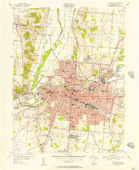 1955 Springfield1956 Print · USGSCovers Springfield, including Forest Hills, Locustgrove, and other nearby areas
 - 1961 Map of Columbus
 1961 Columbus1961 Print · USGSCovers Springfield, including Columbus, Athens, and other nearby areas
 - 1961 Map of New Moorefield, 1962 Print
 1961 New Moorefield1962 Print · USGSCovers Springfield, including Harmony, Catawba, and other nearby areas
 - 1961 Map of New Moorefield, 1969 Print
 1961 New Moorefield1969 Print · USGSCovers Springfield, including Harmony, Catawba, and other nearby areas
Showing maps 1-10 of 22
Top cities in Springfield
- Kenwood Heights historical maps
- Oakcrest historical maps
- Warder Park historical maps
- Layne historical maps
- Home Orchards historical maps
- Kingsgate Commons historical maps
See more
Top neighborhoods in Springfield
- Ridgewood historical maps
- North Hill historical maps
- Edgewood Farms historical maps
- Seans Woods historical maps
- Snyder Terrace historical maps
- South Fountain Avenue Historic District historical maps
See more
Frequently asked questions
- What are the different types of historical maps available for Springfield?
- What is the oldest map of Springfield?
- Where can I purchase historical maps of Springfield for my home or office?
- Where can I download high-res historical maps of Springfield?
- Are there historical topographic maps available for Springfield?
- Is there historical aerial imagery available for Springfield?
- Where are historical maps of Springfield sourced from?