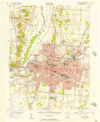
1955 Map of Springfield
USGS Topo · Published 1956About this map
The urban core and expanding industrial footprint of Springfield define this mid-1950s survey. At the center of the city, Wittenberg College stands near the massive Ferncliff Cemetery and the sprawling recreation grounds of Snyder Park. The landscape is a complex intersection of transportation and social history, where the Pennsylvania RR and Erie RR cut through neighborhoods dotted with numerous local schools, such as Haywood Jr High Sch and McGuffey Sch.
Find a feature on this map
113 named features on this map. Tap any name to fly to it.
Don’t see what you’re looking for? This feature index may not catch every label — zoom into the map to look around manually.
Map Details
Editions of this 1955 Springfield Map
This is the sole edition of this map. No revisions or reprints were ever made.
Other maps of this area

1904 · Springfield
USGS Topo · 1:62,500

1906 · Springfield
USGS Topo · 1:62,500

1907 · South Charleston
USGS Topo · 1:62,500

1914 · St. Paris
USGS Topo · 1:62,500

1914 · Mechanicsburg
USGS Topo · 1:62,500

1916 · Mechanicsburg
USGS Topo · 1:62,500

1916 · St. Paris
USGS Topo · 1:62,500

1944 · Mechanicsburg
USGS Topo · 1:62,500

1944 · St. Paris
USGS Topo · 1:62,500

1947 · Columbus
USGS Topo · 1:250,000
Featured Places
- Springfield, OH
- Forest Hills, OH
- Locustgrove, OH
- Kenwood Heights, Springfield
- Home Orchards, Springfield